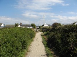
(1) Path from West Pentire
(2) Porth Joke Campsite
(3) Path by Cubert Common
Other Links >>> |
|
CIRCULAR WALK FROM WEST PENTIRE
I did this walk on 26th Augus 2007, parking at the pay and display car park in West Pentire where a days parking cost £4.
|
|
|
|
(1) Path from West Pentire |
(2) Porth Joke Campsite |
(3) Path by Cubert Common |
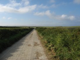
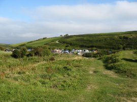
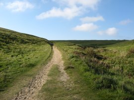
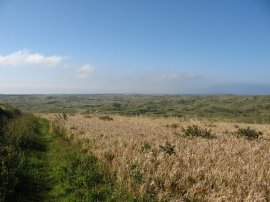
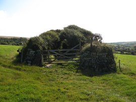
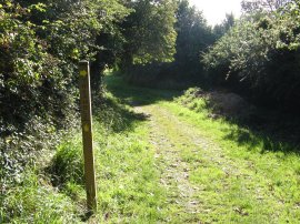
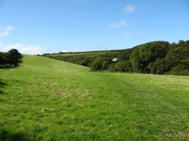
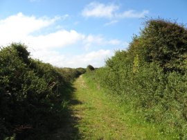
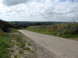
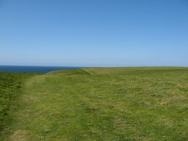
I then headed along the farm track that runs down besides the car park, photo 1. This track winds its way down hill between fields to pass the Porth Joke campsite, photo 2. Reaching a house besides the campsite the path bears right over a wooden bridge and follows a path round the sides of the campsite to join another broader track, photo 3. This is followed uphill off to the right.
 |
 |
 |
(4) Path through Holywell Golf Course |
(5) View towards Penhale Sands |
(6) Field nr Cubert |
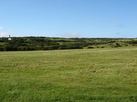
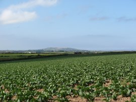
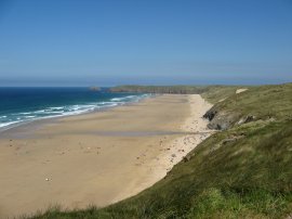
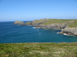
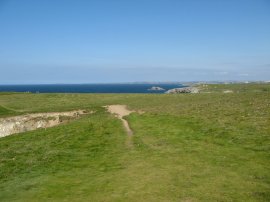
A short distance up the hill the route bears right by a small footpath marker and a little further on bears right again along a path signposted Cubert. This heads uphill with a wire fence to the left of the path before passing a track off to the left and continues uphill, now with a hedge on the left. The path levels out and passes through two wooden gates to join a sunken lane that runs through a golf course, photo 4. Leaving the golf course the path heads past a small fishing lake and up through the middle of a large, and at the time, very busy campsite. Passing through the shops and administration block of the campsite the path heads straight across a road and takes a footpath directly ahead that runs between fields. The path heads uphill for a short distance and rounding a corner the grass covered sand dunes of Penhal Sands behind Perranporth beach come into view with St Agnes Head on the horizon, photo 5. The path then starts heading gently downhill towards the sand dunes by Ellenglaze. The route passes through a metal gate and heads downhill along the left hand side of a field. Passing some farm building to reach a little lane where the route turns left. This track is followed uphill for a short distance before a footpath signposted Trebisken heads off into a field on the right. The route went past some apple trees and an attractive thatched house. The route heads alongside the right hand edge of one field and diagonally across another field with the sand dunes on the right and the town of Cubert higher up the hill on the left. The path goes across another field to join a track that runs out into the middle of a field, photo 6.
 |
 |
 |
(7) Footpath to Treamble |
(8) Field besides Penhale Sands |
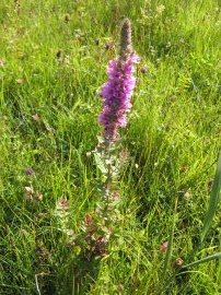
(9) Flower |
This is followed to for a short distance before I took a turning off to the right along a sunken tree covered lane signposted Treamble, photo 7. In many places this lane was completely covered by the hedgerows and was more like a green tunnel. From the lane the route heads over a plank bridge and into a small patch off woodland. Leaving the woodland the route heads across a grassy field, photo 8, close to the foot of the sand dunes. This grassy area contained a large number of flowers around the field edge. From this field the footpath joins a road by an entrance to the MOD Perranporth Army Camp.
 |
 |
 |
(10) Fields nr Stampas Farm |
(11) Path nr St Piran's Round |
(12) St Piran's Round |
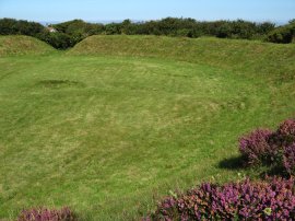
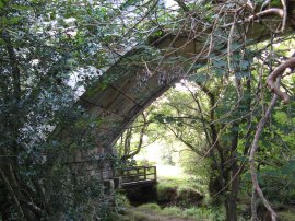
Here I turned left and headed along the road passing under the remains of an old railway bridge as the route heads gently uphill. Reaching a house, where the road bends to the left by Treworthen Farm I continued ahead along a public byway that runs down to a T junction. Here I continued ahead along a footpath that runs through a small campsite and along over fields, photo 10, towards Stampas Farm. Passing through the old farmyard I took a footpath that runs off to the left heading slightly uphill before taking a footpath that runs down through trees to cross a small stream before heading uphill towards and through the garden of what appeared to be some holiday homes. Here the footpath joins the driveway to the houses which continues for some distance to Hendravossan where I turned left to follow the driveway down to a road. Crossing the road I continued ahead on the other side along a rather overgrown path that runs besides a house and garage before climbing steadily uphill to join a broader track, photo 11 where I turned to my right. This track soon leads down to join the B3285 road by St Piran's Round, photo 12. St Piran's Round, as marked on the map, or Perran Round, as shown on the sign at the site, is apparently the best surviving example of a Plen an Gwary, or Cornish Medieval Amphitheatre.
 |
 |
 |
(13) Road towards Perrnawell |
(14) Fields nr Perranwell |
(15) Rail Viaduct by Perranwell |
Leaving St Piran's round I then had to head down the B3285 towards Rosehill for a few hundred yards before joining another footpath that ran off to the right along a track. There was a very large amount of traffic on this road and I had to make my way along it very carefully, stopping frequently to step up onto the verge to allow cars to pass. Once on the track it was much more peaceful as I headed down past a few cottages to join another road, photo 13, where I turned left and began heading downhill in the direction of Perranwell. In contrast to the busy B3285 nearby, this road was almost deserted and I was only passed by one car as I made my way along the road. Ahead of me St Agnes Head was starting to appear larger on the horizon across the fields, photo 14. I followed the road down to a footpath that left the road to the right, just before I reached the remains of an old railway line that used to run between Newquay and Chasewater. This footpath soon became a hedge lined track that ran past a number of houses before I took another footpath that headed down hill to the left. This path ran back down to the remains of the old railway line which at this point crossed over the path on a large stone viaduct, photo 15, that had carried the railway over a stream. The path crossed the stream on a wooden bridge and I then took a path to the right that led up to a broader track where I once again turned right. The day was bright and sunny and it was very pleasant walking through the quiet Cornish countryside.
 |
 |
 |
(16) Damsons |
(17) Perran Beach |
(18) Perranporth |
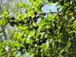
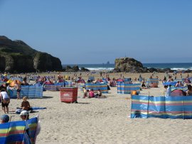
Heading along the track roughly parallel with the route of the railway line, although this was obscured by some quite dense scrubby woodland, I passed under a number of damson trees, photo 16 which lined the path. Reaching a road I continued ahead, past houses on another track that led down to the village of Bolingey. Here I turned right along the Penwartha Road and then left up Chapel Hill. At a bend in the road I continued ahead along an unsurfaced track, I followed this uphill round to the left back up to Chapel Road. This had taken me slightly off route and I then had to retrace my steps back down the hill to the bend in the track where I continued ahead along my intended route on a footpath that runs down between fields to reach Perranporth. I had originally missed the point where this footpath left the track as it was obscured by a number of parked cars. Perranporth was very busy with holiday makers in marked contrast to the quiet lanes and paths I had been passing through earlier. I made my way through the town to join the route of the South West Coast Path and followed this round to the beach which was also packed, photo 17 It was low tide and I could have walked along the beach to the far end of the beach but the route of the South West Coast Path is marked as going over the cliffs and it was this path that I choose to follow even though it was considerably harder walking than going over the sands would have been. After heading across a path of beach the path then climbed up into the sand dunes behind beach. Photo 18 was taken from the top of the dunes looking back across to Perranporth.
 |
 |
 |
(19) Perran Beach |
(20) Penhale Sands |
(21) View towards Penhale Point |
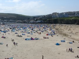
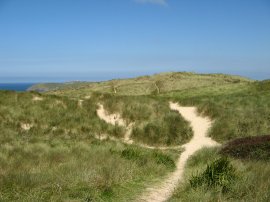
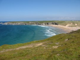
Photo 19 was taken looking in the other direction down Perran Beach towards Ligger Point. It was hard going walking over the soft sand, photo 20, and it many places the precise route through the undulating dunes of Penhale Sands was not always clearly marked. Below me on the beach there were a number of different activities taking place including a number of kite buggies heading up and down the beach. About halfway along the two mile stretch of sand that runs from Perranporth the route enters Ministry of Defence owned Land, the route of the coast path marked by a number of white poles and a number of warning signs reminding walkers not to stray from the path. The ground becomes more solid under foot as the route leaves the sand dunes and nears the end of the beach. Just before the end of the beach there was a track heading down the cliffs to the beach and I walked down this for short distance to a nice flat rock where I sat and had my lunch looking over the beach and nearby cliffs. After a very enjoyable lunch stop I headed back up to the coast path and continued round Ligger Point. Photo 21 was taken from the point looking across Hoblyn's Cove towards Penhale Point. From Ligger Point the path makes its way past the buildings of the Penhale Army Camp and on to Penhale Point.
 |
 |
 |
(22) Penhale Point |
(23) Holywell Bay |
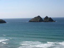
(24) Gull Rocks |
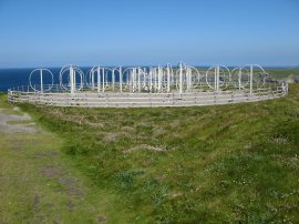
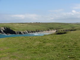
Close to the Penhale Point there was an unusual metal structure beside the path which I assume is some kind of radar or radio station, photo 22. From Penhale the path heads round Holywell Bay, photo 23 into the village of Holywell where there was a long queue of cars waiting for a parking space in the car park. I stopped and brought a drink in the shop by the beach and then continued along the coast path back to West Pentire. Once again the route crosses over a stretch of sand dunes behind the beach before reaching more solid ground further up the path. Photo 24 was taken looking over the beach at Holywell towards the Gull Rocks.
 |
 |
 |
(25) Coast Path nr Holywelll |
(26) Kelsey Point |
(27) View along the coast |
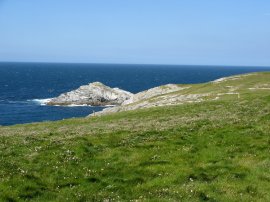
The route then heads across the top of the cliffs over open ground, photo 25, towards Kelsey Point, photo 26. where the route passes close to the site of an ancient settlement . From the headland there were views up the coast as far as Trevose Head, photo 27.
 |
 |
(28) Porth Joke |
(29) Returning to West Pentire |
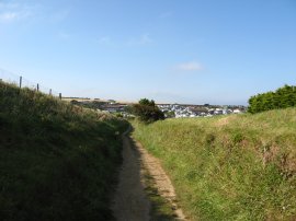
Leaving the headland the route turns to the right and heads down to the narrow beach at Porth Joke, photo 28. I headed down on to the beach and took a small footbridge across the stream at the end of the beach. From there it was a fairly short, steep climb back up to the cliff top. Here I left the route of the South West Coast Path and took a footpath that continued ahead between fields to join a track, photo 29, that ran back into the village of West Pentire, close to the car park from where I had started the walk.
Reaching the car I had walked a total of 14.7 miles. It had been varied walking, the first part over fields and down lanes, the second part returning along the coast following the route of the South West Coast Path. I had followed a number of different footpaths and all the ones I had used were well marked and free from obstructions which, along with the excellent weather, helped make the walk a pleasant experience. Going out walking a lot I do notice considerable variations in the quality of footpath signage between councils and it's always nice to find the paths well marked and easy to follow.
![]() Back to:Walk index page
Back to:Walk index page
| ©2012 Bertuchi.co.uk. Please contact me using the email button on the right if you have any questions or comments regarding the site. Any feedback and additional information about places of interest on the walks is always welcomed. All rights reserved. Please contact me if you want to use any of the images or information from the site. ENJOY YOUR WALKING |
|