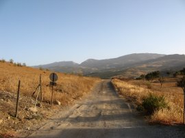
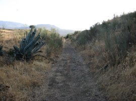
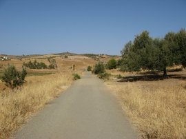
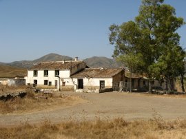
(1) Start of the walk
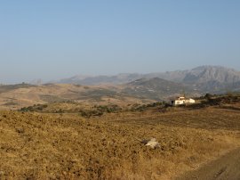
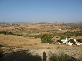
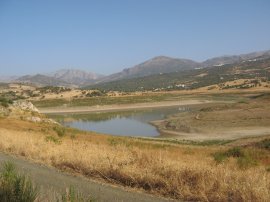
(2) Fields nr Lake Viñuela
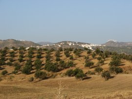
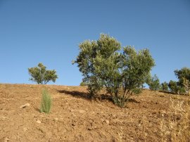
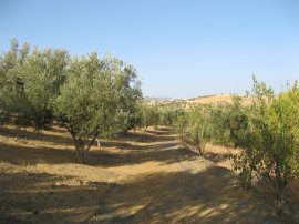
(3) Olive Grove
Other Links >>> |
|
A WALK BESIDES LAKE VIÑUELA, SPAIN
I did this walk on 11th August 2007 whilst on holiday in Spain. Lake Viñuela is a actually a reservoir, or "embalse" in Spanish, and was situated about 1/2 a mile from where we were staying, close to Puente Don Manuel. Puente Don Manuel is a village in the foothills of the Sierra Tejeda, about 50 kilometers from Malaga in La Axarquia province. A google map of the walk is at the foot of the page.
|
|
|
|
(1) Start of the walk |
(2) Fields nr Lake Viñuela |
(3) Olive Grove |
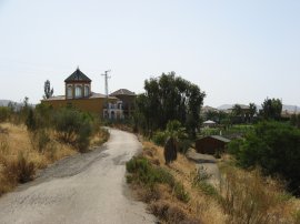
Leaving the villa I headed up to a track, photo 1, that ran past the houses. Being August the weather very was getting very warm everyday and I made an early start to catch the coolest part of the day, the sun casting quite long shadows as I started walking. I followed the track for a short distance between the dry brown fields before turning left onto another track that heads gently downhill past the abandoned white farmhouse in photo 2. Ahead of me the hills and scattered white villages, including colmar perched high on its hilltop, stretched off into the horizon. Reaching the olive grove in photo 3 I turned right.
 |
 |
 |
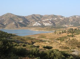
(4) Lake Viñuela |
(5) Disused Tramway |
(6) Disused Tramway |
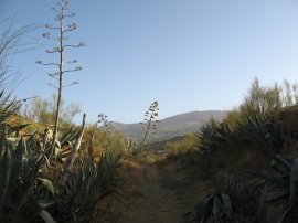
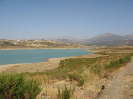
A short distance further on I got my first view of Lake Viñuela, photo 4, away to the left. I however continued ahead in the direction of Periana along a path that used to be the track bed of a tramway, photo's 5 and 6, that ran between Torre Del Mar and the village of Ventas de Zafarrayas, high in the mountains. This is a route I have not been able to find any information about, even in Spanish. In places the side of the tramway was lined with giant aloe plants, some of which had tall flower stems rising up above the path. There were also a large number of woodlice crossing the path in the shady areas, literally thousands of them.
 |
 |
 |
(7) Fields nr Lake Viñuela |
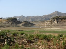
(8) View over Lake Viñuela |
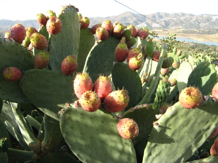
(9) Prickly Pears |
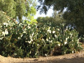
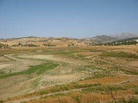
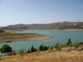
I headed along the remains of the old tramway until I reached a group of houses, close to where the tramway crosses the road that runs between Puente Don Manuel and Periana. Here I turned left besides a building that has been built over the line of the tramway and headed a few yards down to the road. Ahead of me I could now see the northern end of the lake, photo 8. In the summer of 2007 the water level in the lake was very, very low and the entire top section of the lake was completely dried up although a line around the old shore line indicated just how far the water had once risen. I headed along the road to the left, running gently uphill before taking another tarmac track that ran a bit more steeply uphill to the right although it was only a short distance to the summit of the hill before the road began heading down hill towards the lakeside. Whilst on holiday in the area I was amazed by the number of British people I encountered. On one trip to the supermarket in Viñuela three of the four cars parked outside had English number plates and as I walked down hill towards the lake I passed a couple of builders working on a property merrily chatting away in English. In places as I descended the road was lined by big stands of prickly pears acting as hedges besides the fields, photo 9.
 |
 |
 |
(10) Approaching Lake Viñuela |
(12) Northern end of Lake Viñuela |
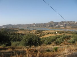
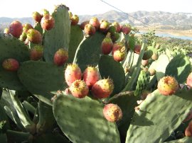
Although there is an incredible amount of building taking place throughout the area it is still predominately agricultural land with a mixture of fields and olive groves, photo 10 although at the rate things are going I am not sure how much longer this situation will last. Photo 11 shows some nicely ripe prickly pears with the lake just visible behind them. Photo 12 is another view over the dried up bed of the lake.
 |
 |
 |
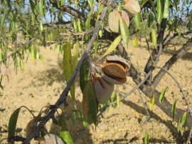
(13) Almond Tree |
(14) Olive Trees |
(15) Lake Viñuela |
As I was heading down the road I also passed a number of almond trees, photo 13. Leaving the road I headed down a path towards the unsurfaced road that ran around the edge of the lake. This path, photo 14, ended in a field a short distance away from the lake side and I had a small stretch of rather prickly ground to cross before I reached lakeside path, photo 15.
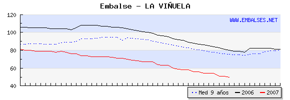 |
Lake Viñuela Water Volume |
When the Lake is full this runs quite close to the waters edge but not at the moment. The maximum capacity of the reservoir is 170 million cubic meters but as the graph below, from 16th October 2007, shows the current water volume is only 50 million cubic meters, or 29.41% of maximum capacity.
 |
 |
 |
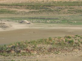
(16) Sheep and Goats at Lake Viñuela |
(18) Track besides Lake Viñuela |
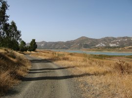
Reaching the road I turned to my right and began heading towards the top of the lake. The area is generally very quiet and peaceful and for much of my walk along the lake side the only sound I could hear were the bells jangling around the necks of a flock of goats and sheep that had been led down to the lake bed for a feed and a drink, photo 16. Photo 17 was taken looking back down towards the southern end of the lake as I neared its northern end. Here I left the lake side track and headed across the dried up lake bed towards what would be at full capacity, the far end of the lake. I then headed back up to the lake side road, photo 18 and headed back in the direction I had come.
 |
 |
 |
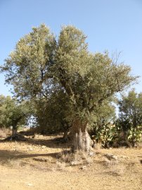
(19) Old Olive Tree |
(20) Northern end of Lake Viñuela |
(21) Track besides Lake Viñuela |
Photo 20 was taken looking back over the dried up lake bed that I had just walked over. In this area there were also a number of ancient olive trees, with broad gnarled trunks, photo 19.
(Swap photos 19 and 20)
I continued heading South besides the lake, passing the point where I had joined the lake side road earlier in the walk, photo 21. As I made my way South the amount of water visible in the lake steadily increased.
 |
 |
 |
(22) Route Waymarker |
(23) Lake Viñuela |
(24) Lake Viñuela |
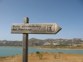
Occasionally I passed the odd way marker for the "Ruta alrededores del pantano" or route around the reservoir, photo 22. Although the lake is only a couple of miles or so in length, the walk around the edge was considerable further as the path made its way around a number of inlets along its eastern edge. Passing round the inlet in photo 23 involved a miles walk although I ended up not much further south from where I had started. At the end of the inlet was a large concrete pipe which, in wetter times, brings water to the lake from the mountains. Photo 24 is another shot taken looking back up the lake from the lakeside track, when full the water would reach almost up to the height of the road at this point.
 |
 |
 |
(25) Southern end of Lake Viñuela |
(26) Hotel La Viñuela |
(27) View towards the Cortijos Romero |
The route passes below a farmhouse and makes its way along the lakeside and a little further on I passed round the side of one more inlet, where there were a few small boats moored and views down towards the dam at the end of the valley, photo 25. I then took a track that gradually ran up away from the edge of the lake towards the Viñuela Hotel, photo 26. Here I turned sharp left to rejoin the route of the old tramway. Over to my right there were views to the urbanisation where we were staying, photo 27.
 |
 |
 |
(28) Sheep Farm |
(29) View towards La Maroma |
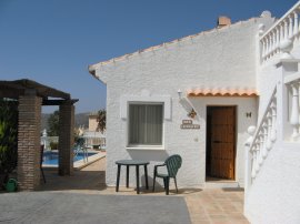
(30) Casa Mariposa |
Heading along the tramway I passed round the other side of the farmhouse I had passed below when walking besides the lake, photo 28, the lake being just below the immediate horizon at this point. The farmhouse was home to one of the flocks of sheep and goats I encountered on my walk and the area around it was rather smelly in the heat! Also on my right I now had a clear view over to La Maroma, at 2066m the tallest peak in the surrounding area, photo 29. I followed the tramway back to the spot I had joined it at the start of the day and then retraced my steps back to the house, photo 30.
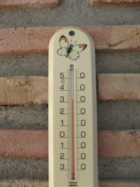 |
(31) Thermometer |
Reaching the house the shade temperature was 32c, photo 31, although to be honest the heat does not usually bother me much.
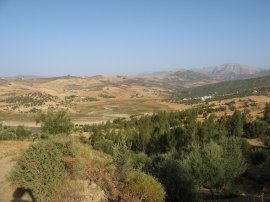
Back home, the total distance I had walked was 10.6 miles. I had only taken 1 ½ litres of water with me which was not really enough and I could have easily drunk another litre of so even though I had walked, (for me anyway), very quickly and had been out for only about 3 ½ hours. It had been very enjoyable to walk somewhere with completely different scenery and to explore a bit of the landscape around where we were staying, and it was a shame I was unable to do any more walks while we were out there apart from an hours walk on the foothills of La Maroma. Below is a google map of the area of walk and below that three pictures taken from slopes of La Maroma.
|
|
 |
 |
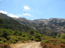 |
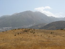
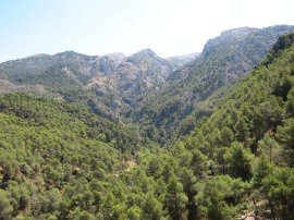
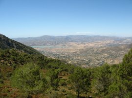
(28) Foothills of La Maroma |
(29) View towards Lake Viñuela |
(30) Foothills of La Maroma |
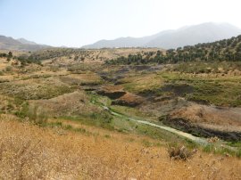
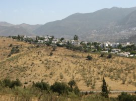
Maroma is situated in the National Park of the Sierras de Tejeda Almijara y Alhama. I drove up to the village of Alcaucín and then a further 5 kms along a dusty track to the Cortijo del Alcazar where I parked the car at the small mountain campsite. From there I walked for about an hour along the track up the mountain. A marker board at the campsite suggested the full trip to the summit, which is some distance behind the horizon in the photo's takes 5 hours. Even though I only ventured a short way up the mountain there were already very good views down across to the lake and the weather was notably fresher than down at the very bottom.
![]() Back to:Walk index page
Back to:Walk index page
| ©2012 Bertuchi.co.uk. Please contact me using the email button on the right if you have any questions or comments regarding the site. Any feedback and additional information about places of interest on the walks is always welcomed. All rights reserved. Please contact me if you want to use any of the images or information from the site. ENJOY YOUR WALKING |
|