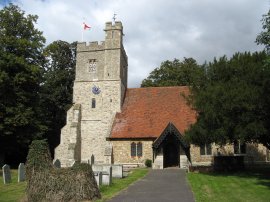
(1) Bradwell Nuclear Power Station
(2) Blackwater Estuary
(3) Bradwell Nuclear Power Station
Other Links >>> |
|
CIRCULAR WALK FROM BRADWELL
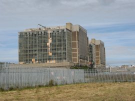
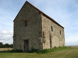
I did this walk on Sunday 2nd September 2007, around what is known as the Dengie Peninsula on the Essex Coast. I had been going to park at Bradwell Waterside but when I got there, there didn't seem to be anywhere available to park so I ended up heading back up the road for a short distance and parking in the car park beside the visitor centre at the Bradwell Nuclear Power Station, photo 1.
|
|
|
|
(1) Bradwell Nuclear Power Station |
(2) Blackwater Estuary |
(3) Bradwell Nuclear Power Station |
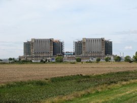
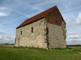
From there it was just a short walk down a marked nature trail to reach the sea wall beside the Blackwater estuary. There was a small beach besides the power station which was comprised of countless numbers of cockle shells. Opposite, across the estuary I could see Mersea Island which I had walked around earlier in the year. Bradwell, photo 3, was a Magnox Nuclear Power Station that opened in 1962 and is currently being decommissioned having closed in 2002 after a 40 year operating life.
 |
 |
 |
(4) Sea Wall at Bradwell |
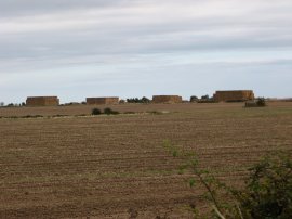
(5) Haystacks |
(6) View towards the North Sea |
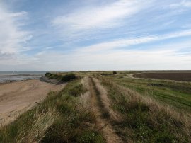
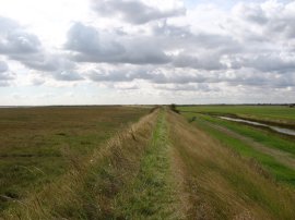
Reaching the sea wall, photo 4, I turned right and made by way east wards with the estuary on my left and farm land on my right, including four of the biggest haystacks I have seen in a field for a long time, photo 5. Though I could not see the sea ahead on the horizon its location was marked by the presence of boat sails which rose above the height of the sea wall, photo 6, although these did not come out too well in the photo.
 |
 |
 |
(7) Barges besides St Peter's mudflats |
(8) St Peter's mudflat |
(9) St Peters on the Wall Chapel |
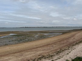
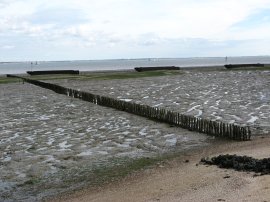
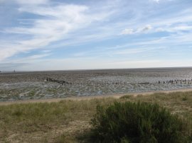
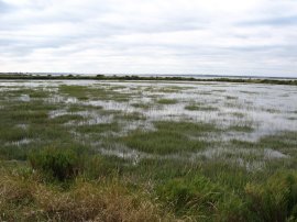
As I headed down the sea wall the Blackwater Estuary gradually widens as its heads out towards the North Sea. Parallel with a line of eleven barges, photo 7, that were beached on the mudflats the grassy sea wall I had been following became a fairly broad concrete footpath. Following the sea wall round to the south there was a thin strip of sandy beach running along the shoreline and then the very extensive mudflats of St Peter's Flat's, photo 8, heading out into the distance to meet the sea. Of course these would be covered if it was high tide which would have given the area a very different appearance. Passing a line of trees the footpath reaches the Bradwell Cocklespit Nature Reserve on the left and then the ancient church of St Peters on the Wall Chapel on the right, photo 9. The nature reserve is run jointly by Essex Wildlife Trust and the Essex Birdwatching Society and contains over 30 acres of shell bank.
 |
 |
 |
(10) St Peters on the Wall Chapel |
(11) Sea Wall by St Peters |
(12) "Small White" butterflies |
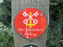
St Peters on the Wall, photo 10, was built in 654AD by St Ced on the foundations of a larger roman fort called St Othona although most of this fort has been lost to the sea. Though I could not see it signposted, St Peters church also marks the start of the St Peters Way which runs from to Chipping Ongar. From the chapel I continued along the sea wall embankment, heading South alongside the North Sea, photo 11.
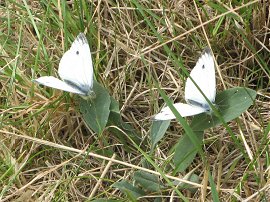
So often when I am walking I spend ages trying to take photo's of birds or insects only for them to fly off just as I am about to click the shutter. On this occasion there were are large number of the small white butterflies, photo 12, besides the path which had also I had been trying to photograph without success however eventually I got this shot lined up and for once a second butterfly actually flew into frame rather than the first one flying off.
 |
 |
 |
(13) Fields nr Bradwell on Sea |
(14) Fields nr Bradwell on Sea |
(15) Fields nr Bradwell on Sea |
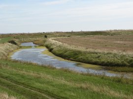
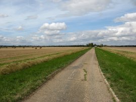
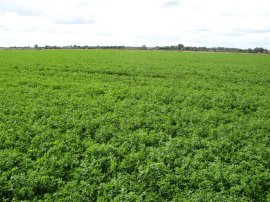
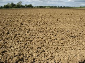
I then walked along the sea wall for about a mile further until I reached the Sandbeach Outfall. Here, at a left hand bend in the seawall, opposite another line of barges beached on mudflats I left the sea wall and headed down to join a concrete farm track, following the route of St Peters Way. A short distance further on the route bears right at a junction in the farm track and starts heading inland, photo 13. The day was fairly bright with hazy sunshine although the clouds were steadily building up and there was a very strong wind and when I turned to walk inland this was blowing directly in my face. At a bend in the track the route continues ahead over a stile into a field opposite a small farmyard. The route passes through a short field and then into another larger field, photo14, where the path follows the right hand edge of the field then taking a stile into another field (Dec 2011 - The stile has been replaced by a metal kissing gate) where the route follows the left edge of the field alongside a rather overgrown and large drainage ditch. Where the drainage ditch ends the footpath continues ahead, heading towards two small trees on the right hand side of an isolated barn. Passing the barn I had to make my way over a field of a clover like crop, photo 15, with no path visible and then across another ploughed field where the route was also more or less obscured. At the end of this field I lost all trace of the route although I could see farm buildings of Dots and Melons farm ahead where I knew the path went and I was able to make my way around the field edges to reach the farm track that runs up to the farm buildings, more or less able to follow the path as set out on the map.
 |
 |
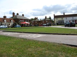 |
(16) Approaching Tillingham |
(17) St. Nicholas Church Tillingham |
(18) Tillingham |
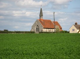
Leaving farm yard of Dots and Melons farm the route joins a road, continuing ahead along a footpath where the road turns to the left. This footpath is followed beside fields, photo 16, into the village of Tillingham. Reaching the village of Tillingham the route passes through the churchyard of Saint Nicholas Church, photo 17, and out on the village green where I stopped to have lunch, photo 18. Turning right along the road for a few yards the route then heads left along a tarmac footpath alongside playing fields.
 |
 |
 |
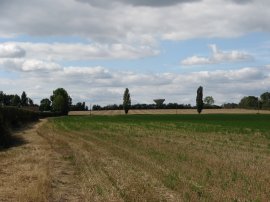
(19) Fields nr St Lawrence |
(20) Fields nr St Lawrence |
(21) St Peters Way route marker |
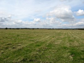
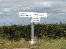
Passing Tillingham bowls club the route continues ahead between fields. Reaching a road it continues ahead towards the village of St Lawrence. Where the road turns to the right the route continues ahead into a field where it follows the left hand field edge under the power lines coming from the nuclear power plant, the footpath heading in the general direction of the water tower at St Lawrence which can be seen ahead on the horizon, photo 19. Reaching the driveway of a house the route then headed across another large open field which had been ploughed quite deeply, photo 20, and there was no footpath visible which made walking across it quite difficult on the hard and very uneven surface. Also by the house there was a rather noisy Alsatian dog running loose. Leaving the ploughed field the route heads along the right edge of another field until level with the water tower where it heads straight across the field to reach a road. The field was once again planted with a crop that had the clover like leaves although the flowers, although purple, didn't seem to be clover. Reaching the Southminster Road I turned right, leaving the route of St Peters Way, photo 21, as I started making my way down towards St Lawrence Bay.
 |
 |
 |
(22) St Lawrence church |
(23) View over the Blackwater Estuary |
(24) Junction with Saint Lawrence Hill |
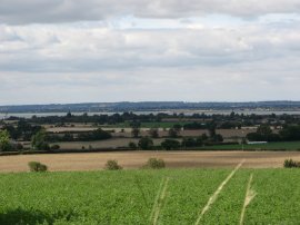
The road runs over the top of a hill and over the fields to the right, St Lawrence church could be seen, photo 22. To the left were goods views over the Blackwater Estuary, photo 23, and up towards Maldon which could be seen in the distance. At a T junction, photo 24, I turned left and headed quite steeply down the road, Saint Lawrence Hill.
 |
 |
 |
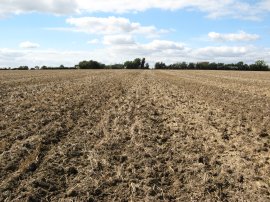
(25) Another ploughed field |
(26) Caravan Site, St Lawrence Bay |
(27) Blackwater Estuary |
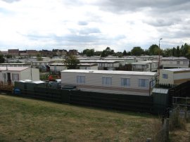
Continuing down the road for a few hundred yards I took a footpath that heads through a very overgrown gap in the hedge and across another very roughly ploughed field, photo 25, which once again made the going very difficult. Reaching Steeple Road I turned left for a very short distance and then right down Main Road towards St Lawrence Bay. Reaching St Lawrence Bay I headed through the town, past the Indian Ocean Bar, before turning right down Moorhen Avenue. At the end of the avenue I took a permissive footpath through a wooden gate on the right that led back up to the sea wall beside the Blackwater Estuary. Here I turned right to start making my way back to Blackwell whose nuclear reactors could be seen in the distance down the estuary. The path passes a couple of caravan and camping sites, photo 26, before the seawall heads out with farm land on the right. Whilst I had been out walking the tide had come in and was now lapping against the foot of the sea wall, photo 27.
 |
 |
 |
(28) Sea Buckthorn |
(29) The new Salt Marsh at High Tide |
(30) Sea Wall, nr Bradwell |
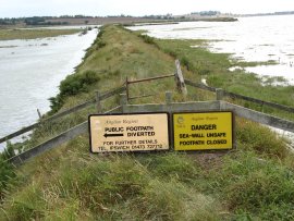
Much of the sea wall between St Lawrence Bay and Bradwell Waterside was quite overgrown and much more uneven than the stretches I had walked on at the start of the day which made the walking quite difficult and made my pace slowed down considerably. On this part of the walk I spotted a couple of Little Egrets but when ever I got my camera out they flew off out of range. There were also a number of small grasshoppers hopping about on the path but again every time I got my camera out they disappeared into the long grass either side of the path. About a mile or so down the Estuary from St Lawrence Bay the footpath diverts inland away from the original sea wall which has been breached in a couple of place. At the far end of the this diversion I found a rather muddy information board lying on the ground which gave some details of the breach. The sign said "... 199? the NRA in conjunction with MAFF regenerated ... saltmarsh behind the existing ....lands seawall to recreate within five years a natural defence which will have the following advantages. It will create a saline flood plain which will reduce the effect of storm tides. It will create a new important high level marsh that will be of great value to both overwintering and summer breeding birds."
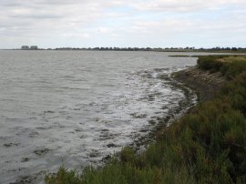
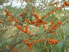
Walking along this stretch of path I passed a number of sea buckthorn bushes, their stems covered in bright orange berries, photo 28. As it was high tide the newly created saltmarsh was flooded by the tide, the remains of the old sea wall can be seen in the distance, photo 29. Photo 30 was taken where the revised route of the footpath rejoined the old sea wall, close to Bradwell Marina.
 |
(31) Bradwell Marina |
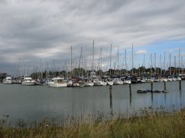
Reaching the Bradwell Marina, photo 31, the brisk wind was making a high pitched whine as it passed through the rigging of the yachts moored there. The route passes the through the marina grounds and heads down to a road before turning briefly left and then right along a footpath that leads back up to the sea wall besides another small caravan site. Ahead in the distance the two buildings of Bradwell Nuclear power station were growing ever larger as I headed down the estuary. Reaching the power station I then turned right back up the path I walked down in the morning.
Reaching the car I had walked 16.9 miles. This had been another enjoyable walk around the Essex coast in an area I had previously neglected on my walking trips. On the walk I had also noticed lots of sloes on the blackthorn bushes, it is probably the best year I can remember for them. I also passed a number of pill boxes left over from the war all around the sea wall.
![]() Back to:Walk index page
Back to:Walk index page
| ©2012 Bertuchi.co.uk. Please contact me using the email button on the right if you have any questions or comments regarding the site. Any feedback and additional information about places of interest on the walks is always welcomed. All rights reserved. Please contact me if you want to use any of the images or information from the site. ENJOY YOUR WALKING |
|