(1) Seafront, Canvey
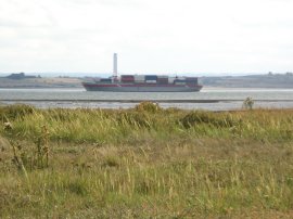
(2) View across the Thames
(3) Heading round to Thorney Bay
Other Links >>> |
|
CANVEY ISLAND
I did this walk on Sunday 23rd September 2007. I had been going to walk along the Medway Valley from Strood to Maidstone but I had got up a bit too late (again) to get a suitable train and thus drove to Canvey Island instead to continue my series of walks on the Essex coast. It was a fine day with plenty of sunshine and felt quite warm for the time of the year despite a fairly strong breeze.
|
|
|
|
(1) Seafront, Canvey |
(2) View across the Thames |
(3) Heading round to Thorney Bay |
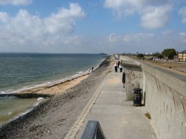
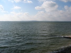
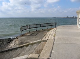
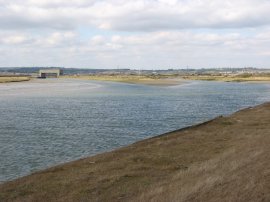
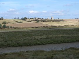
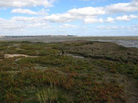
I parked in a pay and display car park on the seafront at Canvey town and then started heading along the sea wall, photo 1, upstream besides the River Thames. Looking across the Thames Estuary I could see the gently rolling hills of Kent, photo 2, and a bit further down to the left, the Isle of Grain power station. Making my way along the sea wall I soon reached Thorney Bay, photo 3 where the sea wall heads off to the right to reach a small patch of sand and shingle that had remained exposed at the high tide. Passing round the bay I soon was once again following the sea wall up besides the River Thames.
 |
 |
 |
(4) Caravan Site, Canvey Island |
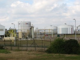
(5) Calor Gas Terminal |
(6) Sea Wall, Canvey Island |
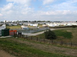
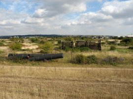
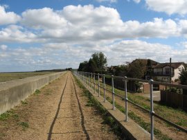
Leaving the town the route heads past a large caravan site, photo 4, and on past the Calor Gas Liquid propane gas terminal, photo 5, and the storage facilities of the Oikos Storage company. A boot fair was being held just inland although I resisted the temptation to go and have a look round. Heading up river it was possible either to walk on top of the sea wall or along its foot, photo 6, just above the water which was just below high tide level when I set out. As I made my way past the town of Canvey I alternated between walking along the bottom which gave good views of the river and along the top which gave views of Canvey. Heading past the oil storage facilities the sea wall was probably at least ten feet high with walls of sheer concrete and every so often a metal ladder ran down to the foot of the wall to allow access back to the top. The sea walls had been extensively rebuilt and improved after the floods of 1953 which claimed the lives of 58 people.
 |
 |
 |
(7) Jetties, Canvey Island |
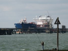
(8) The Navion Scandia, Canvey Island |
(9) Occidental Oil Refinery Jetty, Canvey Island |
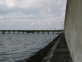
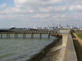
Photo 7 was taken from the top of one such ladder as I made my way back up over the sea wall. The footpath passes under a number of jetties and pipes before reaching Shellhaven Point and turning to follow the sea wall around to the right alongside Holehaven Creek beside the Lobster and Smack pub which huddles below the sea wall. A number of large boats were moored at the end of the jetties, the ship in photo 8 is the 265 mtrs long Norwegian registered crude oil tanker Navion Scandia. Heading up Holehaven Creek I passed under a huge jetty, photo 9, that headed out high over head out to the Thames Estuary.
 |
 |
 |
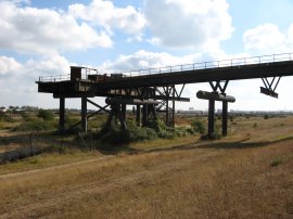
(10) Occidental Oil Refinery Jetty, Canvey Island |
(11) Site of the Occidental Oil Refinery |
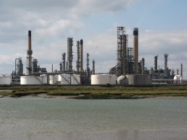
(12) Coryton Oil Refinery |
As I walked under the huge overhead jetty, photo 10, I wondered what it was for because it didn't seem to be used or have any pipes going to or from it, or to lead anywhere on its landward side. However a little further on I passed a notice board beside the Canvey Business Park and Community Wildspace which said that the area I had been walking past is part of former Occidental Oil Refinery and Storage Complex that was built in the 1970's but never used as such and I guess the jetty must be a remnant from that. The remainder of the site, photo 11, was very wild and overgrown with only the occasional lamppost rising above greenery to give any clue to the areas previous heritage. Having done some further research it seems that the oil refinery site was abandoned in 1975 when it was half finished, including having had £10 million spent on the jetty, apparently the longest in Europe. In 1988 the site was brought by Peter de Savary who intended to build houses on the area but that scheme was refused planning permission and in 1994 his firms went into receivership. Safeways then bought the site but not the jetty in 1995. Left unattended the site has become a wildlife haven with more than 1300 species of insect being recorded however the area is now once again under threat of development as part of the Thames Gateway. I continued along the grassy sea wall path with the site of the old oil storage facility on the right and the Coryton Oil Refinery, photo 12, on the other side of the creek.
 |
 |
 |
(13) Holehaven Creek |
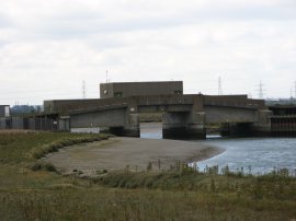
(14) Flood Barrier, East Haven Creek |
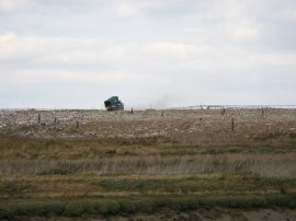
(15) Landfill site |
Not only was the Coryton refinery making a considerable amount of noise it was also very, very smelly, the wind blowing quite strongly directly across the creek from the direction of the refinery. In the creek there were several large flocks of birds picking over the mudflats that were being exposed by the slowly ebbing tide although they were a bit too distant for me to tell what they were. I continued up the creek, photo 13, to reach a flood barrier, photo 14, where East Haven Creek which splits Canvey Island from the mainland bears round to the right along with the sea wall. To my right there was a large field of cows grazing and over to the other side of the creek the refinery was now replaced by a large landfill site, photo 15.
 |
 |
 |
(16) East Haven Creek |
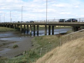
(17) A 130 Bridge, Canvey Island |
(18) View towards the Benfleet Downs |
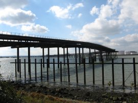
Fortunately I soon past the landfill site as I made my way down East Haven Creek although for a while I once again passed down wind of the Coryton refinery as the path followed the twists and turns of the creek, photo 16. Generally the sea wall had been broad, quite level and covered in short grass however for the mile or so leading up to A130 the path became a lot more overgrown with quite long grass as it was in area no longer being grazed by cattle. The sea wall follows the edge of the salt marsh that runs alongside the creek as it makes its way to bridge that carries the A130 onto Canvey Island, photo 17. The tide had been steadily ebbing as I walked round the island and there was no water in the creek as it passed under the bridge. I have read that before the bridges across to the island were built it had been possible to cross to the islands by stepping stones at low tide. Once under the concrete framework of the bridge the path along the embankment improved again as it begins to run alongside Benfleet creek, which soon becomes much wider than East Haven Creek had been. A short distance from the bridge the path leads back towards the A130 skirting a large expanse of salt marsh with the hills of Benfleet Downs, photo 18, away on the left, toped by a rather conspicuous water tower and in the foreground South Benfleet Station.
 |
 |
 |
(19) Approaching the B1014 |
(20) Path besides Benfleet Creek |
(21) View towards Hadleigh Castle |
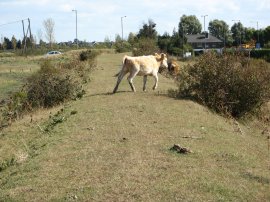
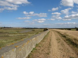
With the path close to the road it was quite noisy walking for a mile or so. Photo 19, shows one of the cows that had helped keep the sea wall paths from becoming too overgrown with long grass. The route crosses the B1014 and heads diagonally along a footpath that runs beside allotments to rejoin the sea wall besides the South Benfleet Yacht club with a small golf course on the right. This was a rather dull stretch of path, photo 20, with the flood bank running besides a large stretch of salt marsh some distance away from the actual creek and with just the golf links and houses of Canvey on the right. Despite its industrial nature I had found the stretch of path besides the oil storage tanks and jetties at the start of the walk far more interesting to walk past. As I headed alongside the creek I was able to spot the ruins of Hadleigh Castle in the distance on the other bank, photo 21, a rather better photo being displayed on the cover of my OS Explorer 175 map.
 |
 |
 |
(22) Sea Wall by Sunken Marsh |
(23) Smallgains Creek |
(24) View towards Grain Power Station |
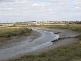
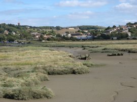
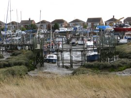
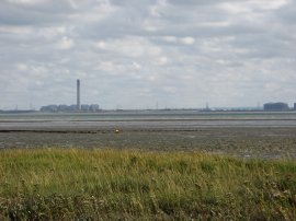
The route heads round to the houses at Sunken Marsh, photo 22, many of which were three stories tall to allow views of the creek over the sea wall. The route runs alongside Kellington Road and then heads past a large number of small cottages towards the Newlands Salt Marsh. On the right was a small fenced off hilly area which seems to be an old landfill site. The route heads round this to reach Smallgains Creek, full with a jumble of small boats and wooden jetties, photo 23. The path heads up besides the creek crossing across the top and then heading back down the other side along a path that runs past the boatyards to the Island Yacht club. Reaching the Island Yacht Club I headed across a path that runs low over the salt marsh to Canvey point, the most easterly part of the island. Photo 24 was taken looking down the Thames Estuary towards the Grain power station.
 |
 |
 |
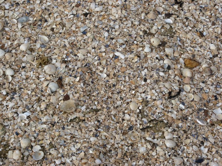
(25) Canvey point |
(27) Canvey Island FC |
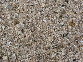
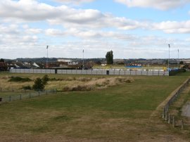
This was a rather pointless stretch of path in some respects, as it headed nowhere except into the sea, although it was very interesting to be able to walk across the salt marsh, close to the sea. At the start of the footpath a sign warned "DANGER, this path can become submerged at high tide". Close to the end of the path, photo 25, was a large bank of shingle, composed entirely of sea shells, photo 26. Ahead of me I could see the buildings of Southend on Sea which had been growing ever closing as I made my way round the island. I then retraced my steps back to the Yacht club and turned left along the sea wall to continue my walk around the island, this time back alongside the Thames estuary towards where I had parked the car. A little further on I passed the ground of Canvey Island FC, photo 27.
 |
 |
(28) Canvey seafront |
(29) Thames Estuary at Canvey |
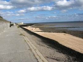
From the football ground it was not much further along the coast to where I had parked the car. It was by now low tide and a number of families where making the best of the very small patches of sand and shingle, photo 28, besides the muddy estuary and the sea front cafe was doing a steady trade. Out at sea a number of boats where making their way down the estuary, photo 29.
Reaching the car I had walked 14.8 miles. I had found parts of this walk on the landward side of the island rather dull however it had been nice to be able to walk all around the island and it had been very interesting passing the oil storage tanks and jetties and the wilderness of the never built Occidental Oil refinery with its long jetty stretching out to the Thames.
If you would like to comment on this walk you can do so here:
![]() Back to:Walk index page
Back to:Walk index page
| ©2012 Bertuchi.co.uk. Please contact me using the email button on the right if you have any questions or comments regarding the site. Any feedback and additional information about places of interest on the walks is always welcomed. All rights reserved. Please contact me if you want to use any of the images or information from the site. ENJOY YOUR WALKING |
|