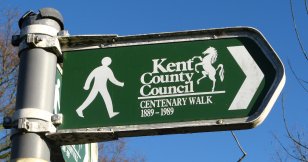
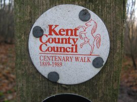
Centenary Walk Waymarker
Other Links >>> |
|
CANTERBURY CENTENARY WALK
|
|
Centenary Walk Waymarker |
I did this walk on Sunday 6th January 2008. I started the walk from a patch of parkland on the edge of Canterbury between the Great Stour River and Rheims Way. Earlier in the morning I had walked into Canterbury from Chartham along the Stour Valley Walk to reach this point and, having walked round the Centenary Walk, subsequently resumed my walk along the Stour Valley walk down to Sturry. Being a circular route the walk can be started and finished anywhere although where I started is quite suitable start as there is free car park off Whitehall Road besides the area of parkland. Although on the Ordnance Survey map the route is marked as the Canterbury Centenary Walk the signposts show the walk as the Kent County Council Centenary Walk, 1989.
 |
 |
 |
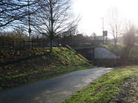
(1) Path under Rheims Way |
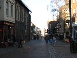
(2) St Peters Street, Canterbury |
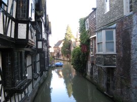
(3) Great Stour, Canterbury |
From the parkland the route heads down to take a subway under the A290 Rheims Way running alongside a branch of the Great Stour River, photo 1, before turning right to cross over the river. Just before Canterbury Castle the route turns to the left and then right up Gas Street, however due to a misplaced signpost I continued ahead at this point, heading past St Mildreds Church and on into Stour Street, on the way passing the Rupert Bear Museum, which is part of the museum of Canterbury. At the end of the road the route heads to the left up St Peters Street, photo 2, re-joining the correct route of the walk. At this point the walk also links up with the route of the North Downs Way. Heading along St Peters Street the route crosses over a branch of the Great Stour that for a short distance almost resembles a Venetian canal, photo 3.
 |
 |
 |
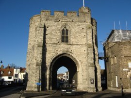
(4) Westgate, Canterbury |
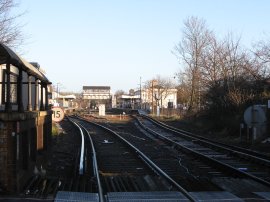
(5) Canterbury West Station |
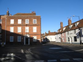
(6) London Road, Canterbury |
The route continues along St Peters Street down to the old Westgate before continuing ahead along St Dunstan's Street. The Westgate, photo 4, is a massive medieval gatehouse in Canterbury, Kent, England. Built of Kentish ragstone in about 1377, it is still extremely well-preserved and is one of the city's most distinctive landmarks. It is the last survivor of Canterbury's seven medieval gates and a much used road still passes through it. The route continues ahead and crosses over the level crossing, just down from Canterbury West Station, photo 5, before bearing left along the London Road, photo 6, by St Dunstans Church.
 |
 |
 |
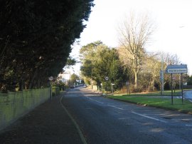
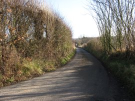
(7) Summer Hill |
(8) View back to Harbledown |
(9) Bigbury Woods |
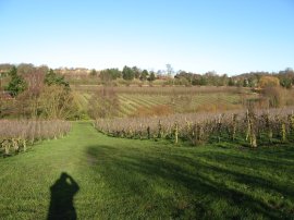
Reaching the end of London Road the route takes an underpass under the A2050 dual carriageway. Once under the dual carriageway I again strayed off the route of the Centenary Walk. I crossed over Knight Avenue and then continued following the route of the North Downs Way up Mill Lane for about a third of a mile until I realised I had wandered off course. After retracing my steps I then turned to my left along the correct path and headed up alongside the A2050 for a short distance before bearing to the left up Summer Hill, photo 7, which runs up into the village of Harbledown. Here I stopped for a little rest on a long metal bench below one of the two churches I past in the village, although both were quite obscured from the road by trees. Leaving the village the route then continues up hill to reach open countryside. Close to the top of the hill the route turns down a footpath on the left that initially runs alongside the building of Kent College school. At the foot of a short hill the route crosses a small wooden bridge, which was surrounded by a large clump of bamboo, before continuing ahead uphill again along a grassy path through the middle of an orchard. Photo 8 was taken looking back down the hill towards the bridge. Reaching a concrete path the route turns right and where the concrete track ends the route continues ahead across a muddy stretch of field before reaching a stile and turning right, rejoining the route of the North Downs Way. The route follows the North Downs Way up to a minor road where the route turns left to cross over the A2 before turning right to enter Bigbury Wood. The path then winds its way through the woodland to reach a road at Chartham Hatch where the Canterbury Centenary Walk splits up from the North Downs Way, turning left along Bigbury Road.
 |
 |
 |
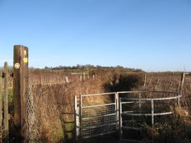
(10) Canterbury Centenary Walk Waymarker |
(11) Apple Tree, No Man's Orchard |
(12) Bigbury Woods |
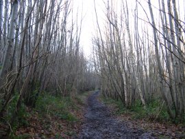
The walk is marked by a variety of differing waymarkers, photo 10, although the signage along the route is by no means complete and it would not be possible to follow the route by relying on the signs alone. The track through the woodland is generally quite broad and, looking at the leaves on the ground, the trees are mainly Sweet Chestnuts. Leaving the trees for a short distance the route passes along the edge of a grassy field and through an area known as No Man's Orchard. Entering the orchard I had noticed that the fruit trees were old, traditional apples trees of the type that I remember in the orchards from when I was younger. I stopped and took some photographs of the trees as they are now quite unusual and a little further on came across an information board which explained how 95% of the old traditional apple orchards in Kent had disappeared in the last forty years, which had been exactly what I had been thinking when I had stopped to take the photos. The orchard, covering 10 acres was planted in 1947.
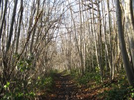
Once on Bigbury Road, just past Woodlands Farm the route takes a track on the right that runs down besides some cottages. The track is followed as it bends round to the left and as it reaches the last house the route takes a footpath that runs down the side of a long fence, all the time heading steadily downhill. Behind the fence I could hear, but not see, a large dog running up and down besides me, barking away, although once or twice its snout appeared under the fence. The path continues ahead along a footpath lined by wire mesh fences on either side before entering another patch of Bigbury Wood, photo 12, with orchards away to the right.
 |
 |
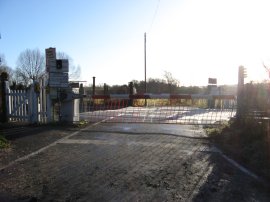 |
(13) Tonford Lane |
(14) Approaching Canterbury |
(15) Level Crossing |
Reaching Tonford Lane, photo 13, the Canterbury Centenary Walk turns to the right heading gently downhill to pass under some railway lines and continuing on down to a track by a house where the route turns left. Here I linked up with the route of the Stour Valley Walk, along a section I had walked earlier in the morning from Chilham. The two paths then shared the same route for the next couple of miles back to the end, or start, of the walk in Canterbury. The route heads along a short, muddy, stretch of track that soon becomes a surfaced hedge lined footpath, running between orchards, photo 14. At the end of the orchards the route turns right, then left, to take a subway under the A2 dual carriageway before turning right along a very minor road. This is followed for some distance, passing over a level crossing, photo 15,which had manually operated pump action gates. Eventually reaching a car park on the right hand side of the road, the route of the Canterbury Centenary Walk turns right to enter an area of parkland, close to a children's play area.
 |
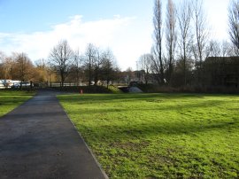 |
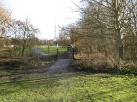
(16) Bridge over the Great Stour |
(17) Looking toward Rheims Way |
The route then crosses the Great Stour River over a wooden bridge, photo 16, to reach the place where I had started this circular walk from, photo 17.
The Canterbury Centenary Walk is listed as being 7.1 miles long and when I measured it on the map I made it about this distance however my GPS only gave a distance of 6.25 miles in length, excluding my diversion on the way to Harbledown. Finishing the Canterbury Centenary Walk, I then recommenced my walk along the Stour Valley Walk. Although nothing special, this had been an interesting diversion from the walk and would make a nice half day trip for someone staying in Canterbury who wanted to get out of the town for a while. Next time I am back in the area I will have to walk along the short section of path I missed first time around.
If you would like to comment on this walk you can do so here:
![]() Back to:Walk index page
Back to:Walk index page
| ©2012 Bertuchi.co.uk. Please contact me using the email button on the right if you have any questions or comments regarding the site. Any feedback and additional information about places of interest on the walks is always welcomed. All rights reserved. Please contact me if you want to use any of the images or information from the site. ENJOY YOUR WALKING |
|