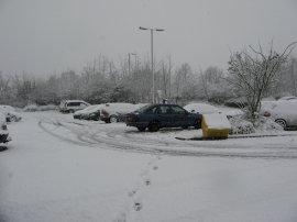
(1) My car at Dorking Station
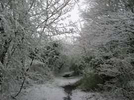
(2) Path from Calvert Road
Other Links >>> |
|
CIRCULAR WALK FROM DORKING
I did this walk on Sunday 6th April 2008. I drove down to Dorking and parked outside Dorking Station, photo 1, which has free parking on Sundays. My original plan had been to take the train to Guildford and resume my walk along the North Downs Way but because of the inclement weather my journey had been slower than planned and I had just missed the train from Dorking West to Guildford. Rather than wait the hour for the next one I decided to do a circular walk from Dorking instead. Having walked between Guildford and Dorking before I was aware it was a fairly long walk for the weather conditions, particularly as I was expecting the snow to turn to rain later and it also meant I could start walking immediately.
|
|
|
|
(1) My car at Dorking Station |
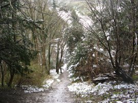
(2) Path from Calvert Road |
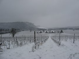
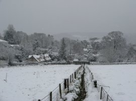
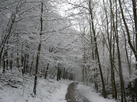
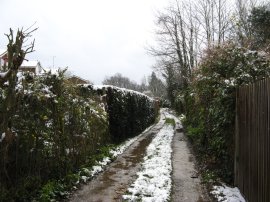
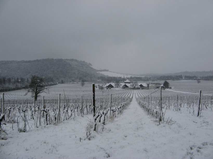
From Dorking station I headed briefly up the A24 and then crossed the road and headed up Chichester Road. At the end I followed the road round to the left into Calvert Road and where the road bends to the left again took a footpath, photo 2, that continues running ahead alongside the edge of the Denbies Vineyard. The route runs behind houses and the through a small patch of trees before turning right at a signpost marked Westhumble where the route heads slightly downhill to enter the grounds of the vineyard. Two days earlier, on Friday 4th, the temperature had reached 18c at nearby Gatwick airport and after another snow less winter in London I was shocked to see all the snow that had fallen overnight, and continued to fall as I set out over the vineyard. Denbies Vineyard is by far the largest in England, with 265 acres of planted vines, and grows a variety of different grapes, the names of some can occasionally be seen displayed at the end of the rows of vines. A short distance through the vineyard I took a path that headed slightly uphill through the snow covered vines, Away to my right there were views over to Boxhill, photo 3, covered in a dusting of Spring snow.
 |
 |
 |
(4) Crossing the North Downs Way |
(6) Bridge over the River Mole |
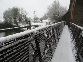
The route crossed a track and then exited the vineyard over a stile to cross over the route of the North Downs Way, photo 4. I then continued along a track which runs up to a surfaced driveway which I followed along to reach a footpath on the right that ran down between fields into the village of Westhumble, photo 5. Heading down through the village I linked up with the route of the Mole Gap Trail which I then followed along the rest of its length to Leatherhead. Just before I reached Westhumble Station I took a footpath that ran down to the left beside the railway lines behind the small Chapel of Ease. This leads into a field in the grounds of Norbury Park, a 1300 acre estate purchased by Surrey County Council in 1931 to save the area from development. The large flakes of snow that had been falling when I left Dorking had stopped and become much smaller and more icy and where being blown directly into my face as I headed over the fields which was a little unpleasant for my eyes. I can imagine if I was ever doing any serious walking in snowy weather a pair of goggles would be a good addition to my rucksack. The route runs parallel with the railway lines for a while and then crosses a wooden bridge, photo 6, over the River Mole and bears to the left, gradually heading away from the railway lines to join a surfaced track by a house.
 |
 |
 |
(7) Norbury Park House |
(8) Norbury Park |
(9) Norbury Park |
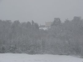
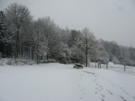
This is followed for a short distance to some farm buildings where the route turns to the left along a concrete track running between fields. A fingerpost said Leatherhead 2 ½ miles, as did a number of markers I past over the next mile or so! The route follows the track down and round to the right to cross back over the River Mole again before passing Lodge Farm. Here the route joins what was in April, a rather muddy farm track that starts ascending very gently uphill towards some trees. Away to the left I could Norbury Park House between the trees on the top of the hill, photo 7. Where the farm track turns to the right the route continues ahead, passing through a couple of kissing gates and a small picnic area, photo 8, to enter the trees photo 9.
 |
 |
 |
(10) Mole Valley nr Leatherhead |
(11) Town Bridge, Leatherhead |
(12) Leatherhead Station |
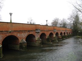
The route heads steadily uphill alongside the edge of the trees, whose branches were covered with a thick layer of snow, before joining a surfaced track that runs off to the left besides a metal fence from where there were views up the Mole Valley towards Leatherhead, photo 10. Where this track bends to the left the route takes a footpath off to the right that's heads down hill between the trees on a narrow path. Reaching a crossing track the route turns right to take a bridge under the railway lines and having passed under the railway bridge turns left along a track that leads out into a field, running parallel with the River Mole. The route passes a car park for Norbury Park and follows the river under a road bridge and continues along passing the side of a field that looked like it currant bushes in before taking a path that runs down alongside the River Mole, past the back of Leatherhead football club. The route then turns right across the red brick Town Bridge, photo 11, and heads uphill along Bridge Street towards the centre of town. Here I turned left into North Street and continued along into Station road before cutting across a park to reach Leatherhead Station itself, photo 12. At this point the GPS said I had walked 5.95 miles although I think the distance was a mile or so further than this. If the weather had been bad I had intended taking the train back to Dorking but as it was starting to brighten up a little, and the snow had stopped, I decided to walk back to Dorking instead, heading up onto the North Downs and then along to Boxhill.
 |
 |
 |
(13) St Mary and St Nicholas church |
(14) Worple Road, Leatherhead |
(15) Thames Down Link path |
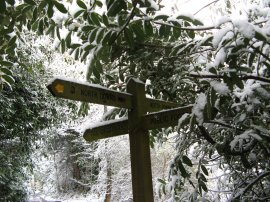
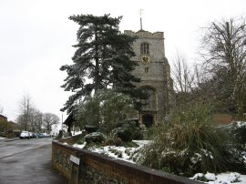
I retraced my steps back to the top of Bridge Street and then continued ahead along Church Street before turning to the left up Church Road, passing the church of St Mary and St Nicholas which has a large late medieval tower in the Perpendicular style, photo 13. At the end of the churchyard I turned right along Worple Road which is not really a road as such but an unsurfaced track, photo 14, signposted as a bridleway which runs for some distance between houses. At the end of the lane I turned right heading downhill for a few yards to join Downs Lane where I turned left. This road soon became an unsurfaced track which past by some trees which had huge clumps of Mistletoe growing on them. The route continues along to join a footpath at the end of the track that runs down to cross the rather busy A24. One over the road I continued ahead along a footpath that runs around the back of some houses with fields to the left. The route heads gently uphill through some trees before turning to the right to join a footpath that is soon once again running along the edge houses. This path is followed for some distance, climbing steadily uphill before descending very steeply to cross the driveway of Cherkley Court. Here I contniued ahead up a short flight of wooden steps before continuing along a slightly broader pathway that runs uphill to join the route of the Thames Down Link path where I stopped to eat my lunch. A bit of a thaw had set in and large clumps of snow where falling off the trees as I made my way to the right along the path, photo 15. The Thames Down Link seems to have had its way marking updated since I had walked the path back in with way markers at most of the crossing paths I went past. The surface of the path, which at this point is a public byway, had also been heavily cut up by bicycles and was rather muddy and messy to walk along which was a bit of a shame because up to this point in the walk the snow had done a great job at cleaning the mud off my boots.
 |
 |
 |
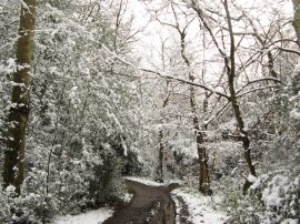
(16) Trig point, Mickleham Downs |
(17) Steps down to Headley Road |
(18) Ascending Juniper Top |
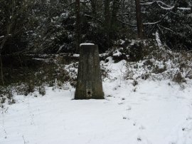
I took a brief detour of the path to visit the trig point on Mickleham Downs, photo 16, before continuing along the Thames Downs Link from where I took the next footpath off to the left, by a notice board that gave details of walks within the Boxhill Estate. I headed uphill between the trees for a short distance before the path then starts heading gently downhill; bending first round to the right before turning round to the left again and heading really steeply down hill down a long flight of step, photo 17, to cross Headley Road by the National Trust Whitehill car park. Crossing through the car park I took a footpath that headed off to the left running up to the open space of Juniper Top. In a matter of minutes the weather had changed completely and I was once again walking through a snow storm as I headed steadily uphill, photo 18.
 |
 |
 |
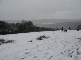
(19) Juniper Top |
(20) Path from Juniper Top |
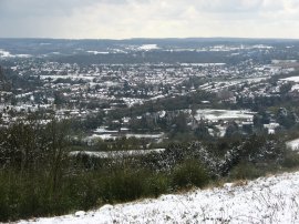
(21) View over Dorking |
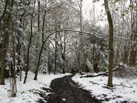
At the end of the open space, photo 19, I took a track that runs off over level ground between the trees. I continued straight along the track, photo 20, ignoring any side turnings, to join a driveway by a house that runs down to join the top of the Zig Zag road at the top of Boxhill. Crossing the road I then took a very short stretch of footpath downhill which led me on to the North Downs Way where I turned to my right to start making my way back to the car in Dorking. The weather had once again cleared up and there were even a few patches of blue sky on the horizon, photo 21.
 |
 |
 |
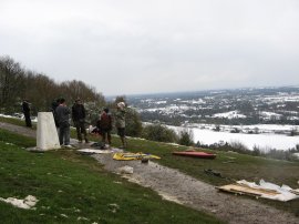
(22) Trig point, Boxhill |
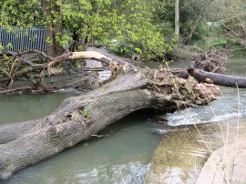
(23) Stepping Stones, River Mole |
(24) Dorking town sign |
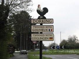
Heading along the North Downs Way I passed the trig point at the top of Boxhill, photo 22, where a number of people were still trying to toboggan down the hill although the snow had melted quite fast here on the South facing slopes compared to Juniper Top which was still covered in a decent layer of snow. I followed the rather muddy North Downs Way steeply downhill to the River Mole. The stepping stones across the river were completely obstructed by a very large fallen tree in the river, photo 23, so I made my way round to the footbridge and on down to the A24. From here it was about a half mile walk back to my start point at Dorking Station. On the way I passed the town sign in photo 24, celebrating the Dorking Chicken.
This had been one of the most strenuous walks I had done for a while but I am gradually getting my walking fitness back again and I did not feel too tired at the end. The GPS showed a distance of 11.8 miles however it had lost its signal a number of times during the day and the actual distance of the walk was probably around 13 miles. Given that it was now April this had been a very unexpected walk in the snow.
If you would like to comment on this walk you can do so here:
![]() Back to:Walk index page
Back to:Walk index page
| ©2012 Bertuchi.co.uk. Please contact me using the email button on the right if you have any questions or comments regarding the site. Any feedback and additional information about places of interest on the walks is always welcomed. All rights reserved. Please contact me if you want to use any of the images or information from the site. ENJOY YOUR WALKING |
|