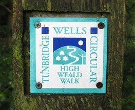
Tunbridge Wells Circular Walk
Other Links >>> |
|
THE TUNBRIDGE WELLS CIRCULAR WALK
|
|
Tunbridge Wells Circular Walk |
I did this walk on the 21st June 2008, the longest day of the year. Originally it had been planned that six of the walking group were going to do the walk together but, due to a variety of circumstances the walk was postponed and I ended up doing it on my own, (although Sara and Anne walked it the next day). At 27.5 mile long I did not have time to take too many notes during the walk and I also consciously tried to limit the number of photo's I took, (although I still ended up with over 100 at the end of the day), however hopefully the description below will give some idea of the route.
I had been going to stay the night before with Val and Chris in Tunbridge Wells to be near the start of the walk for an early start but as it had been postponed I went out to the bar instead. However despite the drink, I woke up early and on the spur of the moment made the decision to get up and do the walk anyway as planned. I had been training quite hard and also, probably more importantly, I was mentally ready to do it. Thus after sending a quick email off to the others I set off from Walthamstow, arriving at my start point in Southborough just before quarter past eight.
 |
 |
 |
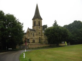
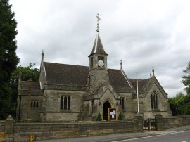
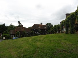
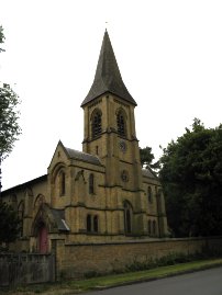
(1) St Peter's Church, Southborough |
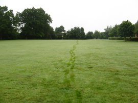
(2) Footsteps on the damp grass |
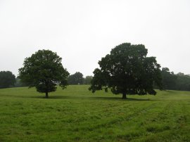
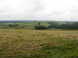
(3) Fields nr Southborough |
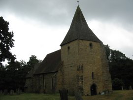
I parked my car besides St Peter's Church in Church Street, photo 1, opposite the cricket green. It was a grey and gloomy morning with a steady drizzle falling and despite being midsummer I set off wearing both my waterproof over trousers and a fleece, (the poor weather forecast had been one of the factors contributing to the postponement of the walk). Leaving the car I headed over the green to cross over the A26 London Road before taking a footpath that ran across some grassy playing fields towards Vicarage Road, my foot steps clearly visible on the damp grass, photo 2. Reaching the end of the Vicarage Road the route turns to the left down Pennington Road for a short distance before taking a footpath on the left that heads downhill over fields, photo 3, and through small patches of trees to eventually reach a small stream where the route turns to the right, running parallel with some railway lines. Reaching a driveway the route turns to the left to pass under the railway before heading past a farm and out over fields and into a patch of young woodland. Here the route heads down to a minor road, turns to the left past some houses before heading to the right along a field edge and down through a fairly overgrown path just inside the trees to reach a short stretch of lane. The tall greenery meant my top half was quite soaked as I reached a lane that leads down to the A21.
 |
 |
 |
(4) Entrance to Somerhill |
(5) Apples |
(6) St Peter's Old Church, Pembury |
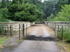
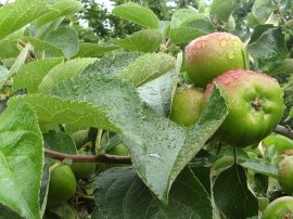
Having passed under the A21 the Tunbridge Wells Circular walk turns to the right to join a driveway, photo 4, that runs into the grounds of the schools at Somerhill, a Jacobean mansion set in 150 acres of beautiful parkland. The route heads along the driveway for a while before bearing to the left over the parkland, continuing ahead to pass in front of the main school building. After passing through the car park the path then turns to the right and heads along a very unusual narrow sunken stone lined stretch of path that appeared almost like a small moat running below the school. Eventually this leads out into more open ground by fields before a short stretch of orchard, the ripening apples covered with raindrops, photo 5. Leaving the orchard the path heads besides a field, over a stream in a small patch of trees and across another field to join the B2017 Five Oak green Road. Here the route turns right, passing a pub that has been converted to an Indian restaurant, that would have been very tempting to stop at had it not been so early in the day, before taking another footpath off to the right that starts running uphill besides fields. The route heads past the stables at Knowles bank, joining a driveway which runs up Dislingbury Road. I was starting to feel quite warm in my waterproof trousers as I ascended steadily uphill and thus I stopped for a short break to remove them, having looked at map and hoping to have avoided the worst of damp grass. The route heads to the left along Dislingbury Road for a short distance before turning to the right down Pembury Hall Road. A short distance further on the route takes a footpath to the left that runs through trees into the grounds of Kent College. After passing some tennis courts the route bears to the left to pass by St Peter's Old Church, photo 6.
 |
 |
 |
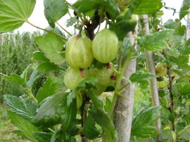
(7) Gooseberries |
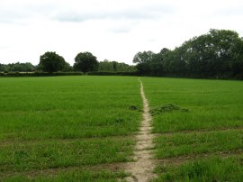
(8) Approaching Penshurst |
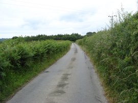
(9) High Woods Lane |
From the churchyard the route heads down Old Church Road, past a water treatment works an on towards the A228. Just before the main road is reached the Tunbridge Wells Circular turns to the left along Redwings Lane however I continued ahead to reach the A228 before taking a footbridge on the left that leads round over the road. Fortunately though I soon realised I was off course and I only had to retrace my steps for a short distance to resume the correct path. (This was the only time all day that I went slightly off course). The route leaves Redwings Lane almost immediately, passing by an area of Raspberries before once again taking a footbridge over the A228. Having successfully crossed over the A228 at the correct point the route passes by a small farm shop at Downingbury where there were a number of different fruit bushes growing including the Gooseberries in photo 7. Leaving the farm complex the Tunbridge Wells Circular crosses over the Maidstone Road and joins a farm track that runs through a section of orchards. The route heads past the farm buildings at Pippins and on through the orchards to enter into Snipe Wood where the walk links up with the route of the High Weald Landscape Trail. Leaving the trees the route joins a track that runs past house up to join the Romford Road. Here I turned to my left before joining a footpath on the right that leaves the Romford Road opposite a T junction to join another footpath that heads over fields to reach the A21 again. Here the route turns sharp right to head along Hastings Road, close to the outskirts of Pembury. Immediately before the houses start on the left hand side of the road the route then takes a footpath on the left that heads alongside a field edge down to a footbridge over the A21.
Once over the road the path passes through a narrow section of trees on the top of a ridge from where there were good views looking towards the South. Leaving the trees the route begins heading downhill over a couple of grassy fields, heading for the group of trees in the centre of photo 8. This was a largely trackless stretch of path although the direction of the route was never in doubt. The grass however, which got progressively longer as I headed down hill, was still very wet from the earlier rain and by the time I reached the bottom of the hill my legs were well and truly soaked. Reaching the bottom of the valley I made my way over a rather marshy path of ground before starting to head uphill again where the route joins a farm track. This eventually become a tarmac road, High Woods Lane, photo 9, that heads past the buildings of Little Bayhall. From the farm the route heads along the lane which runs close to the top of a high ridge. The earlier drizzle had stopped and there were even a few glimpses of the sun as I made my way along road. This quiet stretch of road is followed for just over a mile and the pleasant easy walking meant I was able to up the pace a bit, as well as allowing my clothes to dry off.
 |
 |
 |
(10) Bayham Road |
(11) The Green, Frant |
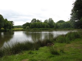
(12) Pond besides Whitehill Woods |
As the road passes through High Woods, the route leaves the lane along a footpath that heads off to the left through the trees then alongside a field to the Hawkenbury Road. Here the route turns to the left for a short distance before taking a path that runs off to the right that at first runs along the driveway to Tuttys Farm before heading on besides fields to join a path that runs parallel to some railway lines. This path is followed up to Benhall Mill Road where the route turns to the right crossing over the railway. As I walked along the road I noticed a large number of tiny frogs hopping across the road surface, many of which proved very difficult to avoid. Just after a bend in the road the route joins a footpath on the left that runs down besides the club house of the Nevill Golf Course and on besides a fairway to reach the B2169 Bayham Road where photo 10 was taken. The Tunbridge Wells Circular heads across the road and along the driveway to Brickhouse Farm. Past the farm the route then heads alongside fields before passing through Chase Wood. Leaving the trees the path then passes along the edge of a couple of more fields to reach the churchyard of Frant Church. As I had been approaching Frant I could hear the sounds coming from a fete being held in the village including, "Ladies and Gentlemen and particularly children, the puppet show is just about to start". From the churchyard I headed through the Lych Gate, which has a weather vane built into the ceiling, before heading down Frant High Street to the Green, photo 11, where I stopped at a convenient bench to eat my lunch. The GPS said I had walked 13.9 miles which meant I was just over halfway round, some 5 and half hours after I had set off. Leaving Frant the route crosses over the A267 and takes a footpath on the left that heads down between houses, through some trees and across a patch of open ground to join a path that runs for some distance along the edge of Whitehill Woods. Reaching the end of a picturesque pond, photo 12, the path turns to the left for a short distance before turning to the right to cross over the middle of a large grass covered field running above a larger lake with the grounds of Eridge Park on the far side.
 |
 |
 |
(13) Holy Trinity Church, Eridge Green |
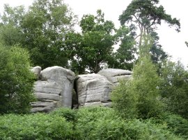
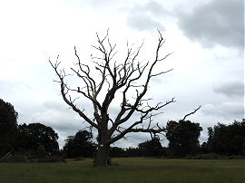
(14) Eridge Rocks |
(15) Spa Valley Railway |
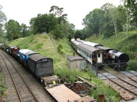
Having crossed over the field the path passes through Forge Wood, steadily curving round to the right as the route heads towards the A26 at Eridge Green. Turing right the route heads up to the Holy Trinity Church before turning to the left down Warren Farm Lane. The path then leaves the lane and enters into an area of woodland as the path passes Eridge Rocks, photo 14. Leaving the trees the route crosses back over Warren Farm Lane and heads out across a field before heading over the middle of a very large open field. Reaching the end of the field the route turns to the right, then follows the field edge round to the left to head down to Eridge Road. Here the route turns to the right before taking a lane off to the left that runs up past Pinstraw farm. Here the route joins a grassy covered hedge lined track that makes its way round to Forge Farm. Just past the farm the path starts to runs parallel with track of the Spa Valley Railway for a while with Harrison's Rocks rising up across a meadow on the right. I had been feeling quite tired for a while and felt myself really slowing down on this part of the walk. However whilst I meandering along besides Harrison's Rocks I got a phone call from Chris who said he would meet me in Groombridge in 20 or so minutes which gave me an incentive to get back into gear. Leaving the railway line, the route heads through the trees by Aytton's Wood and along the track that leads to the Harrisons Rocks car park. Just before the road at Birchden is reached the Tunbridge Wells Circular joins a footpath on the left that heads down besides a field to a bridge over the Spa Valley Railway lines from where photo 15 was taken.
 |
 |
 |
(16) The Green, Groombridge |
(17) Penshurst Place |
(18) Approaching Leggs' Lane |
The path then heads between houses before turning right along Corseley Road, leaving the shared route of the High Weald Landscape trail which heads to the left at this point. At the end of the road the Tunbridge Wells Circular crosses station road, heads through a small car park and enters into the grounds of Groombridge Place where I spotted Chris waiting for me. Reaching the house the route turns to the left, then right to pass a pond, before heading out to the left over a field to the road at Groombridge Hill. Here we stopped and had a little rest on a bench outside the Crown pub, overlooking the triangular village green, photo 16. I had been going to stock up with water and snacks at Groombridge but Chris had very kindly brought all I needed and after a short while I set off on my way. From the pub the path heads up Groombridge Hill for a short distance before taking a footpath on the left that heads steeply uphill through trees to reach fields. The route then crosses over fields towards the Ashurst Road before bearing to the right and joining the road at its junction with Fordcombe Road. Heading straight across the road the route then heads out over more fields towards the grounds of Ashurst Place. To my right I could just see the water tower in Langton Green rising above the trees. Having passed Ashworth Place the route heads over the driveway to Shirley Hall and continues over a field, photo 18, to reach Leggs' Lane. Here the route heads to the right for a short distance before taking a footpath on the left. This runs besides a couple of fields, crosses over the driveway to Danemore Park and then continues along the edge of another field before the path enters into the trees of Avery Wood. The path initially starts descending through the wood before linking up with the route of the Wealdway, which I had walked just two weeks earlier, turning to the right to head uphill along a fairly narrow path to reach the road at Bullingstone. Here I turned to the right before taking a path that heads off from the road to the left that runs over fields and then along a rather overgrown section of path between houses to join a road in the village of Speldhurst. Here the route turns to the right, following the road, Speldhurst Hill, round past the church, photo 5 and then turning and following the road downhill to the right. The Wealdway leaves the road along a driveway that runs down past a pet food shop and what once must have been a mill with a very old and decaying waterwheel besides the building. The route then heads uphill along a rather overgrown path to reach another minor road by the driveway of a house.
 |
 |
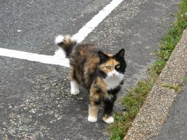
(19) Friendly Cat |
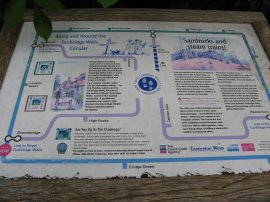
(20) Circular Walk information board |
I had been making good progress since I had left Groombridge but stopped and had a little rest at this point ready for the final stretch of path back to the start at Southborough. Break over, I then turned to the right for a short distance along the road before taking a footpath off to the left that runs between fields towards the edge of Southborough, crossing over the road, Bentham Hill, on the way. The path passes through a number of backstreets including Manor Road and Crundwell Road, where the pretty cat in photo 19 came running up to see me. The walk then takes a footpath down to a pond by Holden Corner before crossing over the road and taking a track that runs up to Victoria Road at Modest Corner. Here the route continues ahead before leaving the road and taking a footpath that winds its way through the trees of Southborough Common back to where I had parked my car by St Peter's Church.
 |
 |
(21) St Peter's Church, Southborough |
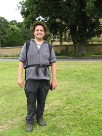
(22) Myself at the end of the walk |
The time on the church clock, photo 21, was 6:50 so I had completed the route in 10 hours and 35 minutes. I had rung Anne as I was approaching Modest Corner and she was waiting for me with Zuka when I arrived back at the car and kindly took my photo, 22.
Reaching the car my GPS said I had walked just over 26.2 miles which was a mile or so less than the published distance for the walk. I was really pleased to have made the effort to do the walk, and apart from the short spell near Groombridge was able to keep up a reasonable pace. In the end the walk required just as much mental effort as physical effort to complete. It was nice of Chris to come and meet me at Groombridge and I also appreciated the calls I had from him, Anne and Sara during the day. Even though it was the middle of June I ended up wearing my fleece all day as the weather was quite cool, which actually was probably an advantage for such a long walk.
I have put all the photo's I took on flickr and they can be viewed here: My Tunbridge Wells Circular Photos
If you would like to comment on this walk you can do so here:
![]() Back to:Walk index page
Back to:Walk index page
| ©2012 Bertuchi.co.uk. Please contact me using the email button on the right if you have any questions or comments regarding the site. Any feedback and additional information about places of interest on the walks is always welcomed. All rights reserved. Please contact me if you want to use any of the images or information from the site. ENJOY YOUR WALKING |
|