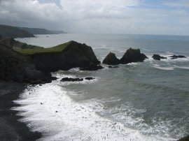
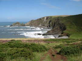
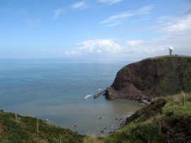
(1) Screda Point
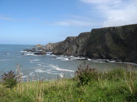
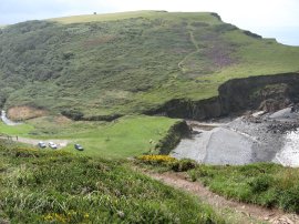
(2) View towards Broad Beach
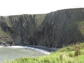
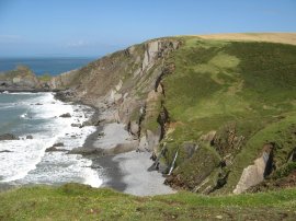
(3) Warren Cliff
Other Links >>> |
|
NORTH DEVON
A circular walk from Hartland Quay
This is a short circular walk, heading along the South West Coast Path from Hartland Quay to the lighthouse at Hartland Point before returning along a route that runs just inland from the coast. I did this walk on 7th August 2008 while on holiday in North Devon.
|
|
|
|
(1) Screda Point |
(2) View towards Broad Beach |
(3) Warren Cliff |
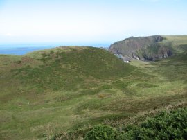
I parked in the car park just above Hartland Quay, where there was a charge of £3 to park although a little further up the route, by the church in Stoke, there is a small free car park. The weather we had been having while on holiday had been very poor but on this day it finally brightened up a little. Although it was grey in the village of Hartland where I was staying, and despite driving through quite a heavy shower on the three mile trip to the coast, I could see a large patch of clear sky on the horizon and the weather steadily improved throughout the day. Photo's 1 and 2 were taken seconds apart with the dark grey clouds behind me down the coast and clear blue skies ahead. Looking inland, as in photo 4, there were also clouds but these too soon moved much further inland. From the car park I joined the route of the South West Coast Path and headed uphill to join a footpath that runs over the top of strangely folded rocks of Warren Cliff, photo 3.
 |
 |
 |
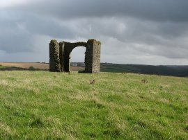
(4) Ruined tower above Warren Cliff |
(5) View from Dyers Lookout |
(6) Blackpool Mill |
On top of the cliff were the ruined remains of an old tower, photo 4. Later in the walk I saw this had a direct line of sight down a valley from Hartland Abbey and wonder if it was anything associated with Abbey, perhaps a folly of some kind. Maybe someone will know! This was a very steep and undulating walk and the flat grassland above Warren Cliff soon came to an end at Dyers Lookout, photo 5, as the path started descending down to cross a stream above a small beach. Here path heads inland for a short distance to take a bridge over the stream before heading down a track, past an isolated house near the beach which was for rent as holiday accommodation and then ascending steeply uphill. Photo 6 was taken looking back down the beach from where I had just walked.
 |
 |
 |
(7) Blegberry Beach |
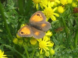
(8) Gatekeeper Butterfly |
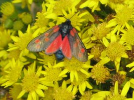
(9) Cinnabar Moth |
Almost as soon as the cliff top is reached the path then starts heading back downhill again, this time to cross another small stream that falls as a waterfall, which just about can be seen in photo 7, down to the beach. Passing the waterfall the route then starts another ascent back to the cliff top above Blegberry Cliff. On top of the hill there were a umber of butterflies and moths about which was pleasing to see including the Gatekeeper Butterfly and Cinnabar Moth in photos 8 and 9.
 |
 |
 |
(10) Smoothlands |
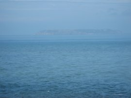
(11) A rather hazy view of Lundy Island |
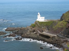
(12) Hartland Lighthouse |
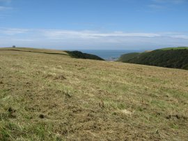
After a short stretch of fairly level walking above Blegberry Cliffs the path descends down to an area marked on the map as Smoothlands, photo 10, the path running just inland from the cliff edge. Another ascent and descent takes the path to another valley where once again the route heads inland for a short distance to take a wooden bridge over a small stream before turning to the left and heading back down towards the sea, passing another isolated dwelling. The stream here also falls the final few feet to the sea down a small waterfall. Then it is uphill again to a more level section of path that runs alongside fields to Hartland Point. As I walked along away to my left across the Bristol Channel I could see the island of Lundy, photo 11, although it remained rather shrouded by haze. I passed a memorial to those who lost their lives on the hospital ship Glenart Castle which was torpedoed some 20 miles offshore on 28th February 1918, and soon the lighthouse, photo 12, nestled below Hartland Point came into view.
 |
 |
 |
(13) Barley Bay |
(14) Path nr Blagdon Farm |
(15) Blegberry |
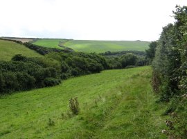
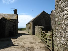
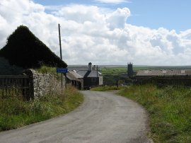
From the viewpoint at Hartland Point I followed the coast path round the top of Barley Bay, photo 13, towards the car park for Hartland Point. Ahead of me I could see the air traffic control radar dome at Hartland. Reaching the car park I turned inland heading along the entrance road to the car park before continuing ahead where the road turns to the left. In the car park there was a small cafe displaying a very enticing menu however having only walked for just over three miles I did not really need to stop. I passed a farm building and continued down a track to the buildings of Blagdon Farm and along a hedge lined track that headed gently downhill between fields, photo 14. At a junction in the path I joined a bridleway signposted by a wooden finger post in the hedge, which I missed at first, heading towards Blegberry. This ran besides a small stream for a short distance before heading up an old farm track that run between fields to eventually join a paved road. The path through the farmland was a pleasant contrast to the earlier walk along the coast path. I turned right onto the road but soon had to turn back and retrace my steps as a farmer on a quad bike was herding a large flock of sheep down the road to a nearby field. The sheep out the way I then resumed my journey along the road to the buildings of Blegberry, photo 15. I also managed to get a signal on my mobile phone, where we were staying in Hartland it had no reception, and thus I received a number of text messages in quick succession as I walked along having finally got in range of a transmitter.
 |
 |
 |
(16) View back to Blegberry |
(17) Road towards Stoke |
(18) St. Nectan's Church, Stoke |
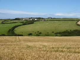
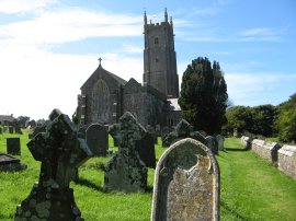
From Blegberry I turned to my left to take another path that run over fields, descending downhill to cross a small valley. I had stopped to chat to a couple I met at Blegberry who warned me that the path was quite muddy however it did not seem to bad, although the wet ground was a bit slippery in places. Photo 16 was taken looking back the way I had come towards the buildings at Blegberry. Reaching a minor road, photo 17, I continued ahead as the road made its way past a couple of houses before descending down to cross the Abbey River from where there were views up to Hartland Abbey although a large white marquee was obscuring most of the front of the building. Once past the abbey the road then ascends quite steeply uphill towards the parish church of St. Nectan in the village of Stoke, photo 18. The church has been described as "the Cathedral" of North Devon with its commanding 128ft tower being the highest in North Devon. I took a footpath that ran through the churchyard and then joined a footpath that ran behind a hedge alongside the road. At the end of the houses the footpath ran along the edge of a field back down to the car park by Hartland Quay.
 |
 |
(19) Hartlake Memorial |
(20) Hartland Cottage |
Photo 19 was taken looking back down to the coast in the direction of the ruined tower I had passed earlier on the cliff top.
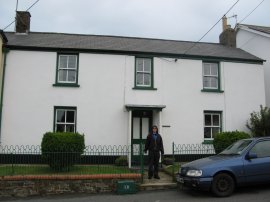
Reaching the car I had walked just under 7 miles, although with all the ups and downs on the first part of the walk it did feel a bit further than this. After all my walks around the South East this year it had been really pleasant to be out in some different scenery. It had also been pleasant to actually see the sun and after returning to the holiday cottage, photo 20, we drove over to the beach at Sandymouth for the afternoon!
If you would like to comment on this walk you can do so here:
![]() Back to:Walk index page
Back to:Walk index page
| ©2012 Bertuchi.co.uk. Please contact me using the email button on the right if you have any questions or comments regarding the site. Any feedback and additional information about places of interest on the walks is always welcomed. All rights reserved. Please contact me if you want to use any of the images or information from the site. ENJOY YOUR WALKING |
|