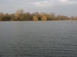
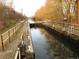
(1) Seventy Acres Lake
(2) Field nr Hooks Marsh
(3) Field nr Hooks Marsh
Other Links >>> |
|
LEA VALLEY CIRCULAR
I did this walk on Monday 29th December 2008. It was nice to get out after all the Christmas festivities and I had received a new 50l rucksack which I was very keen to try out. I have been using a 25l Berghaus rucksack for years, which is still in perfect condition and is exceedingly comfortable to wear, however at times it is just a bit too small. 50l is probably overkill for a day sack however it should have more than enough space for all my requirements on slightly longer journeys.
|
|
|
|
(1) Seventy Acres Lake |
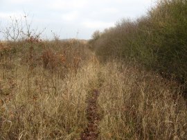
(2) Field nr Hooks Marsh |
(3) Field nr Hooks Marsh |
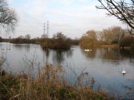
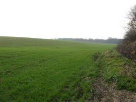
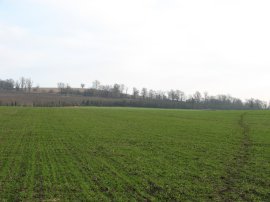
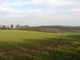
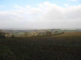
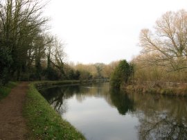
I parked at the Hooks Marsh Car Park in the Lea Valley, over looking Seventy Acres Lake, one of the many old gravel pits in the area, photo 1. From there I headed a short distance back up the narrow Fishers Green Lane before taking a footpath that runs off to the right over a field. I followed the path first along the field edge, photo 2, then over the field, photo 3, and up to the B149. Fortunately the mud was just dry enough not to stick to my boots. At the top of the field I turned to my right for a short distance towards the entrance to Cornmill Meadows before turning to my right and crossing over the rather busy road.
 |
 |
 |
(4) Hill nr Monkhams Hall |
(5) "View" over London |
(6) Trig Point, Monkhams Hall |
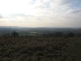
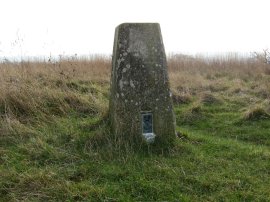
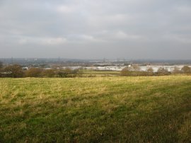
Once over the road I began heading uphill along a footpath that heads off to the right of a house up towards the top of a small hill, close to Monkhams Hall, photo 4. It was a chilly day, although I was well wrapped up with two base layers and two fleeces, and there were only very hazy views out across the countryside towards central London, photo 5. On top of the hill was an old trig point, photo 6.
 |
 |
 |
(7) View towards Galleyhill Wood |
(8) Galleyhill Woods |
(9) View from Galleyhill Wood |
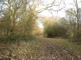
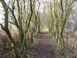
I headed across the top of the hill and continued ahead downhill over a couple of fields to join a green lane that heads towards Galleyhill Wood which can be seen on the horizon in photo 7. Reaching a tarmac stretch of path by Aimes Green I turned to my left and began heading up a broad bridleway that runs through the trees, photo 8, towards the top of Galley Hill. Once at the top of the hill, the width of woodland narrows until it was only a small strip on either side of the path as it makes its way towards Long Green. The path is following the top of a small ridge and there were occasional breaks in the trees that allowed views over the surrounding countryside, photo 9.
 |
 |
 |
(11) Coal Post, Galley Hill |
(12) Nazeing Golf Course |
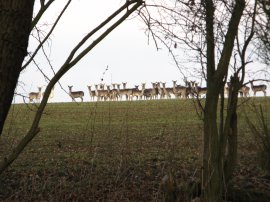
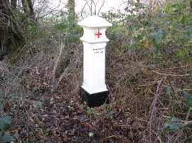
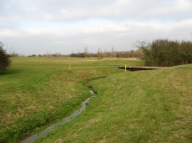
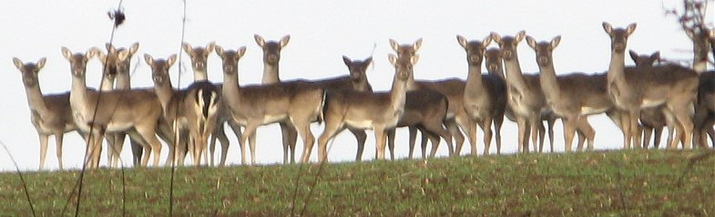
In one of the gaps between the trees I spotted a herd of deer in a field on the horizon, photo 10, one of several herds I spotted during this part of the walk. The deer are something that I have missed this year, having walked predominantly in Kent, where they seem far less abundant than in Essex. The footpath continues ahead until the end of the trees where the route turns to the left heading downhill along a rather muddy byway. At the top of the hill, just before the route turns to the left, there was a coal post, photo 11, in the brambles besides the path. These were erected after the 1851 and 1861 London Coal and Wine Continuance Acts were passed which enabled the City of London to set up boundary markers to demarcate the area within which they had the right to levy a duty on coal and wine brought into the metropolitan area. The byway heads down to join Bumble Green Lane at Long Green and continues ahead to reach a mini roundabout. I headed straight across the road and up Middle Street for a few yards before taking a footpath that runs off to the right, along a narrow stretch of path besides the edge of a small industrial unit with a drainage ditch on the right. This soon leads out to cross a couple of small paddocks and then crosses a stile into the grounds of Nazeing Golf Course, photo 12. Here I briefly linked up with the route of the Stour Valley Walk which I had walked several years ago. Up to this point it had been a very enjoyable walk however for a while the quality went downhill. I never like walking across golf courses and the route of the paths at Nazeing are not always that obvious. From the stile the footpath heads across a fairway, where I had to stop as a foursome was in progress in front of me, before turning to the left and following the hedge line down to a small brook. Here the path turns to the right following the edge of the brook and again I had to stop while some golfers teed off, I think on the eight green. The route continues ahead, now on a track which is followed round to the left and then back round to the right to cross over the small tree lined Nazeing Brook. On my map a footpath was marked running diagonally off to the left although I could see no trace of this so I continued ahead, heading slightly uphill, following the route of the Stour Valley Walk. A hundred or so yards further on another footpath was marked off to the left on the map but again I could see no way markers on the ground. There was however a golf cart track so I followed this off to the left anyway. This ran through rough ground for a short distance before coming out on to another fairway where there were no footpath indicators and I again had to stop to allow a couple of golfers to play their shots. I could however see a stile exiting the golf course diagonally to my right and once the golfers were out of the way I headed across to this.
 |
 |
 |
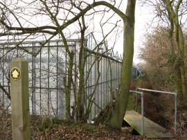
(13) Overgrown Field nr Nazeing Golf Course |
(14) Footpath nr Nazeing |
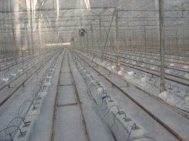
(15) View inside one of the large greenhouses |
Although there was a new footpath post and marker besides the stile, once out of the golf course I entered a very overgrown and almost impassable stretch of path, photo 13, completely overgrown by very sharp blackthorn bushes. Fortunately this stretch of path did not continue for too long and I eventually reached a crossing path where my route turned to the left through slightly more open ground, although there was no path at all evident on the ground through the tall grass and scrubby bushes. I was however on the right route and when I reached the edge of the field I was more or less level with the footpath that continued on down the side of a large greenhouse, photo 14. Reaching the end of the greenhouse the route crosses a farm track and continues ahead besides a house and then along the edge of a field besides a caravan park to reach Hoe Lane. I crossed over Hoe Lane and continued across another short field to a driveway. The footpath headed straight across the driveway and headed up besides a line of tall of fir trees where I was joined for a while by two barking dogs that had come from the neighbouring garden. A little further on the route passed another large greenhouse, photo 15, headed through a hedge and began ascending up another small hill.
 |
 |
 |
(16) View across the Lea Valley |
(17) Boating lake nr Broxbourne |
(18) Boating lake nr Broxbourne |
From the top of this hill there were good views out over the Lea Valley, photo 16, although once again it was still quite hazy. Here I turned to my left and followed the path along the top of the field down to some houses where I turned right onto a tarmac footpath running between wooden fences. The path turns to the left almost immediately and joins a road, Banes Down. From here I turned right along Maplecroft Lane and started heading downhill to reach Peck's Hill. I headed straight across this road and down the driveway of another nursery, continuing ahead on a narrow footpath to join Nursery Lane and enter the grounds of the Lea Valley park. Here the route turns to the left and then takes a footpath off to the right that runs down to pass between two large boating lakes in the floor of the Lea valley, photos 17 and 18.
 |
 |
 |
(19) Path between the boating lakes |
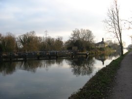
(20) Carthagena Lock, River Lea |
(21) River Lea nr Broxbourne |
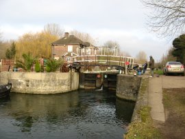
The route crosses between the lakes on the narrow tree lined path in photo 19, crosses over a bridge where the two lakes are linked and continues ahead to pass through a small section of trees and on to the banks of the River Lea Navigation, just above the Carthagena Lock, photo 20. From here I turned to my left heading down river, photo 21, towards Broxbourne and Cheshunt along a stretch of path I have walked many times in the past, including when I did the Lea Valley Walk.
 |
 |
 |
(22) King's Weir, River Lea |
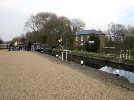
(23) Aqueduct Lock, River Lea |
(24) Path below Aqueduct Lock |
I headed down the river passing by the Broxbourne Lido and on down past the King's Weir, photo 22, and Aqueduct Lock, photo 23. This is a long straight section of the River Lea with a well surfaced path, photo 24, and I was able to make good time as I walked along. A considerable amount of work has taken place over recent years in the area, improving the path in places as well as installing distance markers and the occasional information board; this time I spotted one about water voles which I don't think I had seen before.
 |
 |
 |
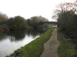
(25) Cheshunt Lock, River Lea |
(26) Bridge across the River Lea |
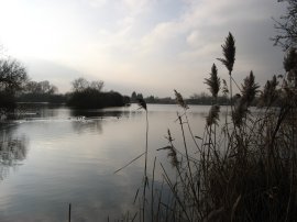
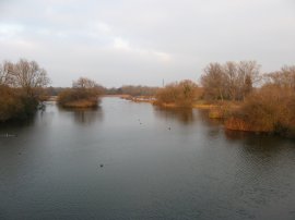
(27) Seventy Acres Lake |
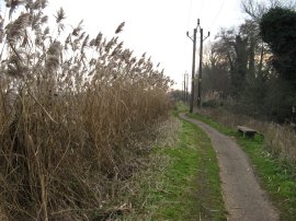
I continued on past Cheshunt Lock, photo 25, and a short distance further on reached the bridge by Turnershill Marsh, photo 26, that I took across the river to join the path that led back up to my parking place. This was another narrow stretch of path that headed between the Seventy Acres Lake on the left, photo 27, and the Hooks Marsh Lake on the right.
 |
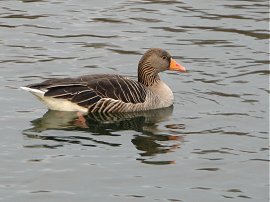 |
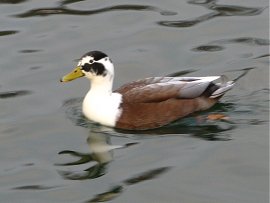
(28) Duck |
(29) Greylag Goose |
Reaching the car I had walked 9.5 miles. This had been a walk of three distinct stages, firstly passing over the hills above the Lea Valley, a second less pleasant section heading between the hills and the Lea Valley and finally a few miles walk along the river Lea back to the car. All in all it was quite an enjoyable walk, my new rucksack felt fine, and I did enjoy devising my own circular route, something that I miss when walking the recreational trails which are what I have mainly walked through 2008. Back at the car park I tried taking some photo's of the various geese and ducks that were there although the light was fading fast and it was hard to get any decent shots.
If you would like to comment on this walk you can do so here:
![]() Back to:Walk index page
Back to:Walk index page
| ©2012 Bertuchi.co.uk. Please contact me using the email button on the right if you have any questions or comments regarding the site. Any feedback and additional information about places of interest on the walks is always welcomed. All rights reserved. Please contact me if you want to use any of the images or information from the site. ENJOY YOUR WALKING |
|