Beeches Way
Other Links >>> |
|
BEECHES WAY
Cookham to West Drayton
|
|
Beeches Way |
I did this walk way back in April 2009, I say way back as this was one path I never had time to write up when I walked it and it was almost three years later when I created this page. However despite the time gap I thought it would be nice to subsequently put up some of the photos from the walk, as even if there is not much actual description of the route, it does give a flavour of the trail and having taken an average of five photos a mile there are plenty of reminders of the route.
 |
 |
 |
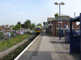
(1) Cookham Station |
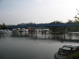
(2) Cookham Bridge |
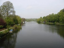
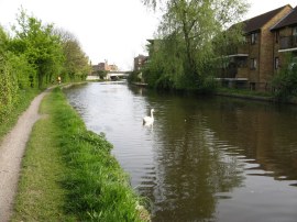
(3) River Thames at Cookham |
I took the train over to Cookham which is the nearest station, photo 1, to the start of the walk. From the station I headed down Station Hill before joining a set of footpaths that headed between fields and across meadows to reach the River Thames. I then joined the Thames Path for a short distance as I made my way down to Cookham Bridge, photo 2, before heading up to cross the bridge over the river, photo 3.
 |
 |
 |
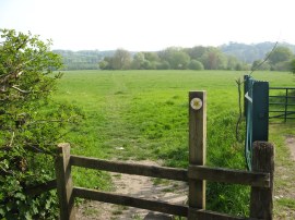
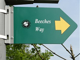
(4) The start point of the Beeches Way |
(5) Beeches Way sign |
(6) Driveway leading to Hedsor Hill |
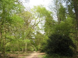
Once over the river I had just a short walk up Ferry Lane to reach the start point of the Beeches Way which starts by a stile that leads into a grassy meadow, photo 4. As I was walking over this meadow I saw my first swallows of the year flying low over the grass. Reaching a house the route turns to the left up the driveway although I initially headed uphill along the steps in photo 6 to the road at Hedsor Hill before having to turn around and retrace my steps back downhill.
 |
 |
 |
(7) Sheepcote Woods |
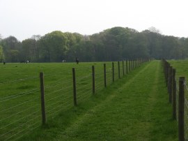
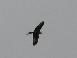
(8) Path from Woodburn Common Road |
(9) Red Kite |
Back on course the Beeches Way joins a path that heads up through Woolmans Wood to join Branch Lane and then continues ahead along Widmoor Broad Lane. The route then joins a track on the right, Coach Alley which is followed up to Sheepcote Lane. Here the map showed the route heading to the left along the road before turning to the right down Woodburn Common Road however a number of permissive paths had been opened in the woodland besides the roads which the route now takes, photo 7, round to Hales Cottage. Here the route crosses the road and heads on a fence lined track running between fields, photo 8, which is followed down to Bristles Wood. As I was walking along this stretch of footpath there were a number of Red Kites flying about overhead, photo 9, always a pleasant sight to see.
 |
 |
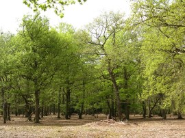 |
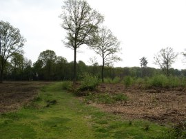
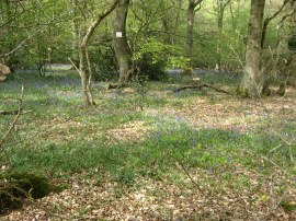
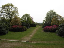
(10) Littleworth Common |
(11) Dorney Wood |
(12) Burnham Beeches |
Reaching a road the route continues ahead over Littleworth Common, photo 10 before crossing Common Lane and heading down besides Twelve Acre Wood. Another fence lined path over a field is then crossed before the route enters Dorney Wood, photo 11. Crossing Park Lane the beeches Way then enters the Burnham Beeches Nature Reserve, photo 12, the route following a number of paths through the quite extensive woodland where the trees were all resplendent in their fresh green leaves.
 |
 |
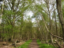 |
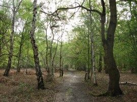
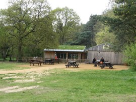
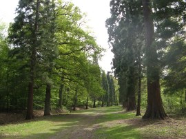
(13) Cafe, Burnham Beeches Nature Reserve |
(14) Brockhurst Wood |
(15) Stoke Common |
Reaching a small cafe in the nature reserve, photo 13, I stopped and had a mug of tea and also ate some of my pack lunch. I then followed the Beeches Way along the Lord Mayors Drive into Burnham Beeches where there is a stretch of road walking through the village, the route heading along Beeches Road before turning to the right along the A355 Beaconsfield Road. Reaching Victoria Road the route heads to the left, following the road round into Parsonage Lane which the route soon leaves along a path or track on the left which leads into Farnham Common and Brockhurst Wood, photo 14, where there were still a number of Bluebells out in flower under the trees. The path wanders around the edge of the woods before heading to the right to cross over Duffield Lane and join a path that heads across to Stoke Common, photo 15, which is a very attractive area of lowland heath. The heath is actively managed to prevent it reverting to scrub and was one of the highlights of the walk.
 |
 |
 |
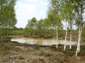
(16) Stoke Common |
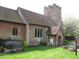
(17) St. James Church, Fulmer |
(18) Black Park Country Park |
The Beeches Way makes its way over the common, photo 16, to Stoke Common Road which is then followed into Windmill Road which leads into the village of Fulmer. Just past the church, photo 17, the route joins a path that initially runs along a field edge then across the middle of another field before heading uphill to the right past some very grand houses. Here the route joins Fulmer Rise which heads past more grand houses tucked away behind trees down to Fulmer Common Road. Here the route heads left before so turning to the right along Black Park Road. After heading along this road for a while the route joins a footpath on the left that heads into the woodland of the Black Park Country Park, photo 18. The whole route is also shared by the Shakespeares Way although the only proper way marks I saw for that path was where this footpath enters the park.
 |
 |
 |
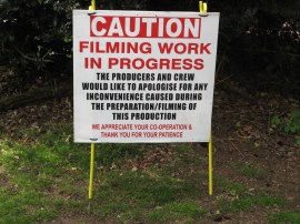
(19) Caution Filming, a slightly different warning |
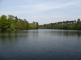
(20) Blackpark Lake |
(21) Sailing Boat, Blackpark Lake |
The park is close to the Pinewood Studios and in several areas there were signs warning of filming, photo 19, and apologising for any inconvenience caused although there was no filming in sight when I went by, the only evidence of filming being tracks laid along the ground, I presume to aid the movement of the camera's. I remember looking up what filming was taking place when I got back from the walk but have no recollection of that now. The path makes its way through the park and around the side of Blackpark Lake, photo 20, where there were a number of very fine model sailing boats out on the water, photo 21.
 |
 |
 |
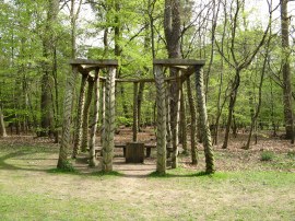
(22) Black Park Country Park |
(23) Langley Park Country Park |
(24) Langley Park Country Park |
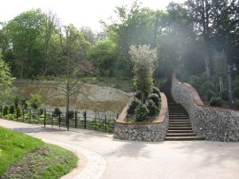
Leaving the lake the route passes a visitors centre and then joins a broad path that is followed down to the very busy A412 Uxbridge Road. Just before the road was reached there was a wooden pergola and bench, photo 22, where I stopped for a short snack break. Having spent some time waiting to safely cross the road the route then enters into the grounds of Langley Park Country Park. The path heads through an area of semi formal gardens, photo 23 where there were a good variety of different coloured rhododendrons out in flower. The park is on a slight hill and there were views across to Windsor Castle although these were rather obscured by haze. The exact course of the route was not entirely clear however the route makes its way down to join an impressive tree lined avenue, photo 24, running parallel with Billet Lane.
 |
 |
 |
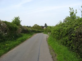
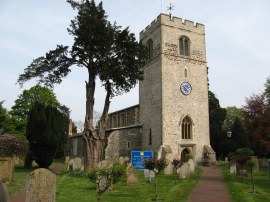
(25) Love Green Lane |
(26) St Peters Church, Iver |
(27) Crossing over the M25 nr Iver |
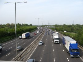
The path heads down this avenue to reach a driveway where the route heads to the left down to Billet Lane which the route crosses before continuing ahead along Bellswood Lane. Reaching the end of this lane the route crosses Wood Lane and joins a track, continuing ahead between fields, which is followed down to Love Green. Here the route heads briefly to the right along Swallow Street before heading to the left up Love Green Lane, photo 25. Reaching the end of this road the Beeches Way heads to the right along Bangors Road South before turning left up Coppins Lane. At the end of the lane the route joins a footpath that heads past the overgrown and ruined buildings of Coppins Farm before heading off to the right to join Swan Road which leads to the village of Iver. Here the route heads along Thorney Lane North, passing St Peters Church, photo 26, before bearing to the left down Victoria crescent which leads to a footbridge over the M25, photo 27.
 |
 |
 |
(28) Slough Arm, Grand Union Canal |
(29) Colne Brook Aqueduct |
(30) River Fray |
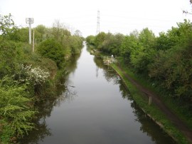
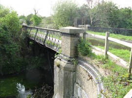
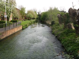
Once over the motorway the route heads along a surfaced track that runs alongside a rather smelly sewage works to a rickety bridge over the Slough Arm of the Grand Union Canal, photo 28. Crossing the bridge the route then heads to the left along the towpath, soon crossing the aqueduct over Colne Brook, photo 29. The path then crosses over the River Colne before leaving the canal bank along a fairly broad tree lined path. This heads along to Trout Road, the route bearing to the right then following the road round to the left where it crosses over the River Fray, photo 30, before continuing on past a new housing development to reach the Grand Union Canal at West Drayton.
 |
 |
(31) Grand Union Canal, West Drayton |
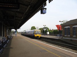
(32) West Drayton station |
Here I headed to the right along the towpath, photo 31, up to the Yiewsley High Street road bridge which marks the end point of the Beeches Way. From here it was just a short walk down the road to West Drayton station, photo 32, from where I began my journey home having walked a total distance of 17.9 miles for the day.
Up until the Beeches Way left the Langley Park Country Park this had been a very enjoyable walk through some fine countryside, particularly the heathlands which are not that common in this part of the world. However from then on the scenic merit of the route declined considerably and to me it would make sense to end the route at Iver, or perhaps follow the Colne Valley Link Route to Langley station, rather than continue on all the way to West Drayton.
If you would like to comment on this walk you can do so here:
![]() Back to:Walk index page
Back to:Walk index page
| ©2012 Bertuchi.co.uk. Please contact me using the email button on the right if you have any questions or comments regarding the site. Any feedback and additional information about places of interest on the walks is always welcomed. All rights reserved. Please contact me if you want to use any of the images or information from the site. ENJOY YOUR WALKING |
|