
(1) Anne and Zuka
(2) St Augustine's Abbey
(3) View back to Canterbury
Other Links >>> |
|
ELHAM VALLEY WAY
I did this walk on Saturday 27th June 2009. I had an early start from Walthamstow, leaving home at 6:30, to drive down to the seafront at Hythe where I met up with Anne and her Labrador Zuka. From there we drove over to Canterbury, where a days parking cost a rather extortionate £7, for the start of the Elham Valley Way. This was another walk I had been meaning to walk for a long time and it was nice to be actually setting off. After a quick stop while I brought a cup of coffee for an early morning boost and Anne bought some chocolate supplies it was off down the path back to Hythe.
|
|
|
|
(1) Anne and Zuka |
(2) St Augustine's Abbey |
(3) View back to Canterbury |
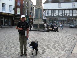
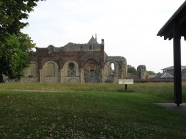
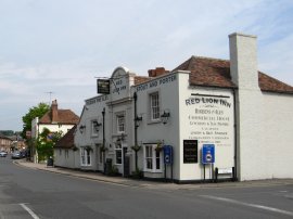
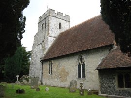
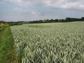
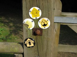
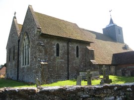
The official start of the walk is outside the entrance to Canterbury where photo 1 of Anne and Zuka was taken. The first few miles of the Elham Valley Way follows the same course as the North Downs Way out of the town, and also for a mile of so, the route of the Stour Valley Walk, so it was familiar territory as we made our way along Burgate, over the A28 Lower Bridge Street into Bridge Street before heading round into Longport where the path passes the ruins of St Augustine's Abbey, photo 2. From Longport the route heads past the prison before turning to the right down Spring Lane from where a further right turn leads into Pilgrims Way. This runs along a path behind houses before rejoining the road as the route follows the Pilgrims Way round to the right as it crosses over some railway lines. The route then continues along the road heading out through the suburban fringes of Canterbury to eventually pass through a farm yard and then enter open country. The path had been heading gently uphill and just before the farm yard there were good views back down to Canterbury, photo 3.
 |
 |
 |
(4) Heading towards Hode Lane |
(5) Bifrons Park |
(6) Bridge High Street |
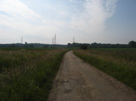
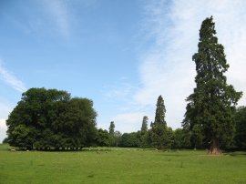
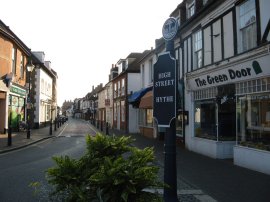
The route heads along a farm track, photo 4, that eventually joins Hode Lane. The lane is then followed down to Bifrons Hill which the route joins for a short distance before taking a driveway that leads into the grounds of Bifrons Park with impressive Lime and Wellingtonia trees, photo 5. Turning to the, left the route runs between fields before passing under the A2 dual carriageway to join the residential Conyngham Lane in the village of Bridge. Reaching Bridge High Street, photo 6, the Elham Valley Way heads to the left passing through the village although I have to admit I did not notice the bridge over the now almost permanently dry river Nailbourne which gave the settlement its name.
 |
 |
 |
(7) Bourne House |
(8) Galleyhill Woods |
(9) Waymarks |
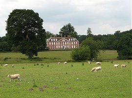
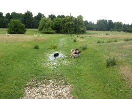
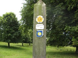
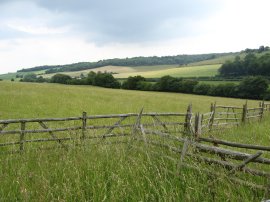
Just past St Peter's Church the route turns to the right up Bourne Park Road before joining a footpath on the left that runs over an area of grassland before rejoining the road again. Heading along the road we passed the entrance to Bourne House which is considered to be the finest Queen Anne building in Kent. Leaving the road the route heads by the Bourne Park Lake, where Zuka stopped for a cooling paddle, before continuing across open pasture towards the village of Bishopsbourne. The grass was being grazed by a large number of sheep and there were also fine views across to Bourne House, photo 7. The open parkland provided an almost timeless landscape with hardly any intrusions from the 21st Century visible. On the way to Bishopsbourne the route crossed over the water course of the river Nailbourne which comprised of just a few puddles, although still very useful for washing off sheep droppings, photo 8. The Elham Valley Way is generally well waymarked throughout and there were only a few stretches on the entire walk where it proved necessary to check the map for the right route. Accompanying the early stage of the walk there were also waymarks for the La Via Francigena, photo 9, which marks what was once the major medieval pilgrimage route to Rome from the north.
 |
 |
 |
(10) St Giles Church, Kingston |
(11) Anne and Zuka |
(12) Covert Lane |
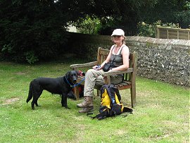
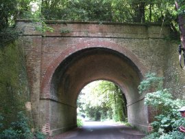
Leaving the pasture the route passes through the churchyard of St Mary's Church, Bishopsbourne before heading along the Street. Where the road bends round to the left the route continues ahead along a driveway running through the grounds of Charlton Park before joining a footpath that runs between fields and parkland towards the village of Kingston. To the right of the path there were occasional views over to another fine country house, Charlton Mansion. Reaching Kingston the route turns to the left along another road called the Street before turning to the right up Church Lane. On the Street we passed a bank of wild strawberries which Zuka had great fun eating, expertly picking the ripe berries from the plants. Reaching St Giles Church, photo 10, we stopped for our first proper break of the day, photo 11, before continuing along a short stretch of footpath and across a field to join Covert Lane where the route passes through a large brick arch under the disused railway line that once ran between Canterbury and Folkestone which closed in 1947, photo 12.
 |
 |
 |
(13) View from Railway Hill |
(14) Descending by Jumping Downs |
(15) View South along the Elham Valley |
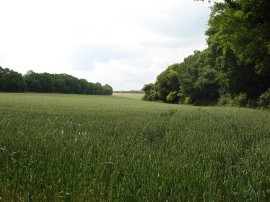
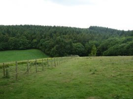
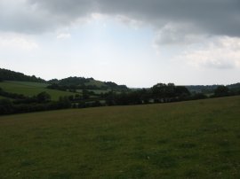
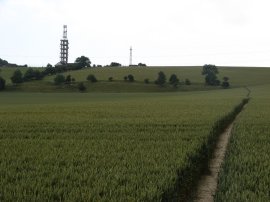
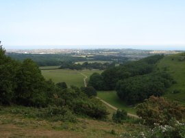
Just past a pumping station the Elham Valley Way leaves Covert Lane and joins a broad well surfaced track that heads through a small section of trees, and then between fields to Hearts Delight Farm. From the farm the route heads uphill to join the road at Railway Hill. From the road there were good views across the fields in the direction we would soon be travelling, photo 13. Where the road bends to the left the route turns to the right along another tree lined track that leads out to open fields. The route then heads diagonally to the left across a field before heading quite steeply downhill by Jumping Downs, photo 14. At the foot of the hill we turned left along a quiet road that makes its way gently back uphill through Covert Wood and although it was one of the longer stretches of road walking all walk, we were not passed by a single vehicle. Shortly after the road leaves the trees the route leaves the road, joining a track on the left that bends round an isolated house before turning to the right and heading across fields. Reaching Baldock Downs, the route descends through a patch of woodland before once again joining fields that lead down to aptly named Valley Road at the bottom of the Elham valley. Looking along the valley to the South, photo 15, we caught our first glimpse of the radio mast on top of Tolsford Hill which we would eventually pass several hours later.
 |
 |
 |
(16) View North along the Elham Valley |
(17) Approaching Wingmore |
(18) The Square, Elham |
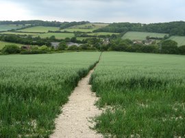
Photo 16 was taken looking North up the valley from the same spot as the previous photo. The route turns briefly to the right along the road before heading uphill along a track on the other side of the valley. This old hollow lane leads back up to the fields on top of the downs where we stopped for our lunch break, close to the edge of Thomas Acre Wood. Having climbed back up to the top of the downs the route then turns to the right and heads back down to the valley floor again. The route heads across a field and then passes through a short stretch of the wood. It was a very warm summers day with only an intermittent breeze to keep the temperature down however the hot weather had caused a number of large storm clouds to form. Generally these kept a few miles away from us but as we were walking through the trees we got caught by the edge of one of the clouds and it started to rain. We had a short break while Anne put on her waterproof jacket, ( I hadn't brought my jacket, although I did have a spare shirt I could change into if required), before heading over one last field, photo 17, to join Ox Road in the hamlet of Wingmore. Fortunately there was only a very short burst of heavy rain which was actually quite refreshing and in a matter of minutes the rain stopped and luckily it remained dry where we were for the rest of the day. The clouds however did stay very close to us and we were accompanied by intermittent rumbles of thunder for quite some time as we headed steadily towards the coast. Back at the road in the valley bottom we turned to the left and then, by Wingmore Court Farm, took a footpath on the left that runs parallel with the road over the Hall Downs. The route crosses a road at North Elham and then follows a path round the edge of a field lined by a row of tall trees which follows the course of the River Nailbourne. At the end of this long field the route turns right along Duck Street in the village of Elham which leads up to The Square, photo 18, opposite the St Mary's Church.
 |
 |
 |
(19) View back towards Elham |
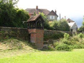
(20) St Ethelburga's Well |
(21) Heading up Tolsford Hill |
Leaving the Square we headed left along Pound Lane and then left down Vicarage Lane. Just past the last houses on the right, the route joins a footpath on the left, once again running between fields along the Elham Valley, close to the course of the River Nailbourne. The path then follows a fairly straight route alongside the fields, photo 19, towards the village of Lyminge. The route crosses two minor road and just after second also crosses over the Nailborne. Although the channel was full of plants there was just enough water present for Zuka to have a refreshing paddle. Eventually the route reaches Lyminge, joining North Lyminge Lane. Crossing over the Canterbury Road, the route heads along a footpath between houses and then over a green to reach St Ethelburga's Well, photo 20, which houses a spring that may be the main source of the River Nailbourne. I had brought some crisps from a small shop besides the Canterbury Road and we stopped and had a quick snack break on a bench besides the well however soon set off again as the dark thundery clouds started approaching particularly close. The route joins Leaving the green the route joins Well Lane before turning left down Rectory Lane. At the end of the lane the Elham Valley joins a path running between fields towards Broad Street. The route crosses over a paddock and the road and then enters into the grounds of Etchinghill Golf Club. Here the route turns to the right before taking a path on the left that follows a hedge line over the golf course to reach the Canterbury Road. We both missed the path to the left at first and continued ahead for a short distance, the only time all day that we went slightly off route. Having crossed the Canterbury Road the route starts heading up over a field towards the top of Tolsford Hill, photo 21.
 |
 |
 |
(22) View back towards Lyminge |
(23) Route markers |
(24) View towards the Channel |
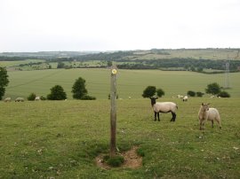
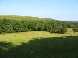
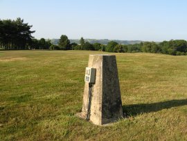
I had been feeling quite tired as we approached Lyminge but the rest had done me good and I felt much more energetic as we left the field and headed over the sheep grazed grassland to reach the radio mast at the top of the hill. This was an area I knew well as the route of the Elham Valley Way joins up with the routes of the Saxon Shore Way and North Downs Way at this point, photo 23, both paths that I have walked in the last couple of years. Crossing over the top of the hill from the mast we then got our first views of the channel, photo 24, although our final destination at Hythe remained hidden behind Summerhouse Hill.
 |
 |
 |
(25) Tree Fungus |
(26) Path nr Coombe Farm |
(27) Church of St Nicholas, Newington |
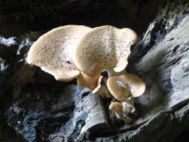
The path heads over a grassy area lined by Hawthorn Trees, before heading through scrubby woodland of an army training base. The route turns left, heading downhill through trees, where we spotted the impressive fungus in photo 25, before heading across a road and down the driveway to Coombe Farm. Here the route turns to the left to head over a field, photo 26, towards a disused railway bridge. Here the Elham Valley Way leaves the route of the other two paths, turning to the right to join a tree lined path that follows the course of the old railway line. Reaching a patch of open ground there is a choice of routes, one heading up to join the old railway trackbed, the other heading across the open ground and through a small corner of Ashley Wood. We took the latter route and on leaving the trees joined a path that ran alongside the edge of wood and then out across open field to join the Newington Road in the village of Newington. Here we turned to the right, heading down to the Church of St Nicholas, photo 27, where the route heads to the left along a side road before joining a footpath that curves round to the right to join the A20 Ashford Road.
 |
 |
(28) Trig Point, Sene Valley Golf Course |
(29) The end of the walk |
We followed the road under the entry and exit slip roads for the Channel Tunnel Rail Link, as well as the track itself, before turning to the right to join a footpath that carries the Elham Valley Way over the M20 motorway. The route then turns right and then left to join a track that runs under the Folkestone to Ashford rail lines. This tarmac track is followed gently downhill through trees where it crosses over the Seabrook stream before heading slightly more steeply uphill towards more open ground besides the Dibgate Army Camp. Here the route turns to the right before heading over a field to enter Sene Wood. Leaving the trees the route turns to the right once again by Sene Farm and heads out over the Sene Vally Golf Course, photo 28. The stormy clouds that had accompanied us for most of the day had finally been left behind and the golf course was bathed in the bright early evening sunshine. Leaving the golf course the Elham Valley Way headed steeply downhill along a rather roughly surfaced sunken lane which heads down to join Sene Park Road on the outskirts of Hythe At the end of Sene Park the route turns right onto Cliff Road and then takes the next left down Cannongate Road. Leaving Cannongate Road the route heads over a few yards of footpath to join another road which is followed down to join Station Road at its junction with Blackhouse Hill from where it was just a short walk downhill through the streets Hythe to the official end of the path at the junction of Station Road and Hythe High street, photo 29, which my GPS made exactly 22 miles from the start point outside Canterbury Cathedral. Sadly my photo of Anne and Zuka at the end of the walk didn't come out too good.
 |
 |
(30) Royal Military Canal, Hythe |
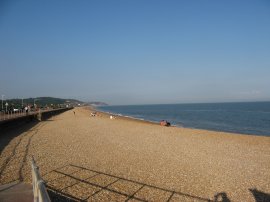
(31) Marine Parade, Hythe |
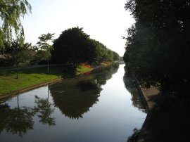
From the end of the path it was then a half mile walk along East Street and down Twiss Road, where we crossed over the Royal Military Canal, photo 30, back to our parking place at the end of Marine Parade on Hythe seafront, photo 31. Reaching the car we had walked a total of 22.9 miles.
Although it was a long day the time had gone very quickly with Anne chatting away, and having walked at a fairly steady pace I felt less tired than after many shorter walks, something I was particularly pleased with as it had been a month since I had done my last walk. As mentioned earlier we had been lucky with the weather which had been just about perfect for walking in.
Back in 1997 Kent County Council produced a very good guidebook for the Elham Valley Way which details the walk from Hythe to Canterbury and is well worth getting hold of, although I think the way we walked it was a far better option, getting the built up area of Canterbury out of the way at the start and having a nice downhill section at the end of the day.
If you would like to comment on this walk you can do so here:
![]() Back to:Walk index page
Back to:Walk index page
| ©2012 Bertuchi.co.uk. Please contact me using the email button on the right if you have any questions or comments regarding the site. Any feedback and additional information about places of interest on the walks is always welcomed. All rights reserved. Please contact me if you want to use any of the images or information from the site. ENJOY YOUR WALKING |
|