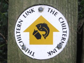
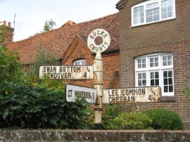
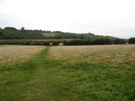
(1) Chiltern Link Waymarker
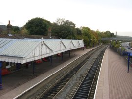
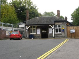
(2) Wendover Station
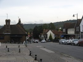
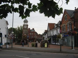
(3) Wendover High Street
Other Links >>> |
|
THE CHILTERN LINK
|
|
|
|
(1) Chiltern Link Waymarker |
(2) Wendover Station |
(3) Wendover High Street |
I did this walk along the Chiltern Link, photo 1, on Friday 9th October 2009. First I drove over to Amersham from where I then got the train to Wendover Station, photo 2, which marks the start point of the walk. The Chiltern Link path is a comparatively short route, linking the Ridgeway from Wendover with the Chess Valley Walk, which starts at Chesham. Leaving the station I headed down the station approach road and turned left onto Pound Street before crossing over South Street and continuing into the High Street, photo 3, from where I could see the wooded slopes of the Chiltern Hills rising above the town. The day before I had walked the final stage of the Royal Military Canal Path in East Sussex in warm, bright sunshine but the weather had turned overnight and for this walk it was a grey, damp day with a stiff breeze blowing which kept me feeling quite chilly for much of the day. So chilly in fact I thought about popping into one of the second hand shops I passed on the High Street to buy a cheap jumper however I was sure that once I started climbing up through the hills I would warm up sufficiently.
 |
 |
 |
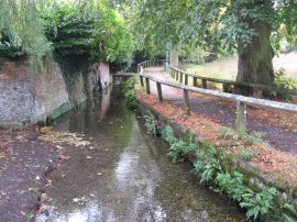
(4) Footpath from Wendover High Street |
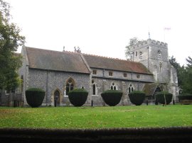
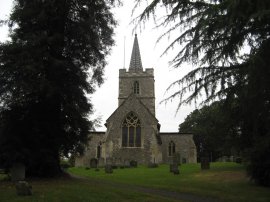
(5) St Marys Church, Wendover |
(6) View from Hogtrough Lane |
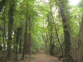
Leaving the High Street, the Chiltern Link joins a footpath on the right that runs alongside a shallow stream, photo 4. While the Chiltern Link path is not signed at this point the route is following the Ridgeway National Trail which is way marked. The footpath is followed across Chapel Lane and into Heron Path, passing a sizeable pond before joining Church Lane, opposite the St Mary's Church, photo 5. The route then turns to the left along the road, passing a school, to reach Hale Road. Here the Chiltern Link continues straight ahead, heading gently uphill along Hogtrough Lane towards Boswells Farm as the views out over the Chilterns gradually open up, photo 6. Just past the farm buildings the Chiltern Link enters Barn Wood where the Ridgeway National Trail heads off to the left. There a number of different paths in the woodland, the Chiltern Link following one that initially heads up the left hand side of a sunken lane before continuing ahead as the lane bends to the right. This was the only point of the walk where I was a little unsure if I was on the right route. However I was on the correct course and followed the path which climbs up through the trees to Concord House where the route enters a field and turns sharp left along the field edge.
 |
 |
 |
(7) Fields nr Kingsash |
(8) Fields approaching The Lee |
(9) The Lee Old Church |
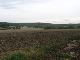
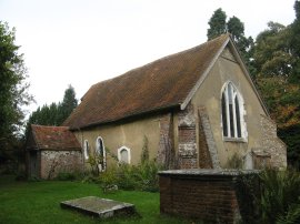
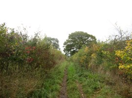
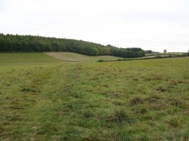
The route then follows the field edge as it bends round to the right before crossing into another field and following the path along the right hand field edge down to Chesham Lane by King's Ash Farm. The route heads straight across the road and skirts round a couple of houses and crosses a small paddock before once again heading out into more open fields, photo 7.The route heads along the side of a large field, crossing over the route of the Chiltern Way, before turning briefly to the left and then right again to head alongside another couple of fields. At one point the route passes through a small clump of trees where I stopped and had my first short break of the day, the trees forming a decent shelter from the wind. Leaving the fields the path then heads across a grassy area and over the driveway of a house. Here the route is marked on my map as continuing ahead through a paddock to the road but I turned to my right to head into a rather unusual churchyard containing two churches, the second one nearer the road hidden from the first by a clump of trees and being quite unexpected when it came into view. The first of these churches is Lee Old Church, photo 9.
 |
 |
 |
(10) Wooden Grave Markers, Lee Old Church |
(11) Church of St. John the Baptist, The Lee |
(12) The Lee Village Green |
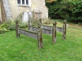
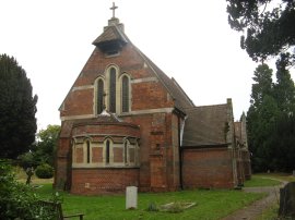
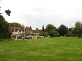
Outside the Old Church which dates from around 1220 were three unusual wooden grave markers, photo 10. The new church, which is dedicated to St. John the Baptist, photo 11, was completed in 1869 and was built adjacent to the ancient chapel when the Old Church became too small for the increasing population. The Old Church has been preserved by The Lee Old Church Trust and the Grade 1 listed building is still in use today. One of the joys of going out walking is coming across such unexpected finds and I was further impressed when having turned to my right along the road for a short distance and came to the open space of The Lee Village Green, photo 12, an almost picture perfect setting even in the rather gloomy weather.
 |
 |
 |
(13) Road sign, The Lee |
(14) Woodland nr Lee Common |
(15) Herberts Hole |
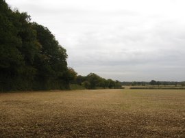
The route heads down the left hand side of the village green, although I detoured off route slightly to take a photo of an old metal road sign, photo 13, which showed I was now roughly half way between Wendover and Chesham. At the end of the green the route turns briefly to the right by a pub before turning to the left down a tree lined track that runs past houses and out of the village. Reaching a bend in the track I followed a metal Chiltern Link signpost on down the track and it was only when I reached some more houses by Lee Clump that I realised I had gone off route. At the time I wondered how this had happened however when I retraced my steps back to the bend in the track I realised that the metal sign, which I had subconsciously followed until I reached the houses which I knew I should not be passing, had been turned round to point in the wrong direction. The real route continues ahead along a broad track which heads downhill through a narrow patch of woodland, photo 14, to join a road at Ballinger Bottom. The Chiltern Link heads across the road and joins another track that soon forks to the right heading past some houses where once again there was a metal Chiltern Link sign that had been turned round to point in the wrong direction, the correct route of the path heading off to the right through the trees past the back gardens of the houses at Ballinger Bottom. Leaving the trees the path heads along the right hand edge of a rather overgrown field before turning to the right and following another field edge path over the top of the hill. Having passed alongside two fields the route approaches an isolated cottage where it turns briefly left along a broader track, and then right once again soon joining a rather narrow stretch of path that heads quite steeply down hill first alongside the garden of the house, and then a field, to reach a road at Herberts Hole. Here the route turns to the right and joins a path, also known as Herberts Hole, photo 15, that heads off to the left from the nearby T junction. This track is followed for quite some distance, heading downhill along the bottom of a shallow valley to eventually reach Drydell Lane.
 |
 |
 |
(16) Red Kite |
(17) Approaching Pednor Road |
(18) St Mary's Church, Chesham |
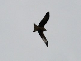
As I was walking down the path I came across two Red Kites lazily soaring up and down above the fields, at one point one was following me almost directly overhead. While they were a splendid site unfortunately they proved very hard to photograph against the dull grey sky and photo 16 is the best I took. At Drydell Lane the route turns to the right before taking the footpath on the left which continues in a generally Eastern direction over fields, photo 17, towards Pednor Road. Although still hidden from view I was now approaching the outskirts of Chesham and once over the Pednor Road the route headed across one more field and then climbed uphill, passing by a small section of trees to enter in Lowndes Park. Here the Chiltern Link turns to the right, running along the edge of the trees to reach Bury Lane. The route then passes through a tall metal gateway to join a path running past the St Mary's Church, photo 18. The path bends round to join Church Street where the route turns to the left to cross over St Mary's Way before turning left again along Chesham High Street.
 |
 |
 |
(19) Chesham Station |
(20) Chesham Clock Tower |
(21) Heading towards Beech Wood |
The Chiltern Link leaves the High Street heading to the right along Station Approach which soon leads to Chesham Station, photo 19, which marks the end of the Chiltern Link Path. Reaching the station I had walked 8.6 miles, which includes my unintentional detour by Lee Clump so the true distance of the route is probably nearer 8 miles. Having had a quick look round I then set off back to the car in Amersham. Chesham Station marks the start of the Chess Valley walk and I followed this route for a short distance along a footpath that runs parallel with the High Street before heading down to Red Lion Street where I turned to the right for a short distance. I crossed the road opposite Chesham Clock Tower, photo 20, which is at the end of the High Street before heading up Germain Street. Here I crossed over the River Chess and continued ahead into Fullers Hill before heading round the back of Fullers Close to join a footpath that heads uphill over a couple of fields, photo 21, and into a band of trees at Beech Wood. Leaving the trees the footpath joins a path that runs between the back of some houses and a school playing field before turning the left along Mayhall Lane to join the main A416 Amersham Road. I had to follow this rather busy and noisy road along the edge of Chesham Bois Common before turning to the right into the relative peace of Copperkins Lane. A short distance down the lane I joined a footpath on the right that ran between houses, crossing over Devonshire Avenue and Hervines Road where the path enters Hervines Park. I then headed alongside the edge of the park before turning to the left down Longfield Drive which leads down to Rectory Hill from where it was just a short walk under the railway lines and along a short stretch path beside Parsonage Wood that leads down to Amersham Station where this walk ended.
Arriving back at the car, which I had parked in the multi story car park besides Amersham Station, I had walked a total distance of 12.3 miles. It had been a pleasant walk crossing over the Chilterns, which is an area I intend doing a bit more walking in over the coming year, although it would have been more enjoyable on a less windy and grey day.
If you would like to comment on this walk you can do so here:
![]() Back to:Walk index page
Back to:Walk index page
| ©2012 Bertuchi.co.uk. Please contact me using the email button on the right if you have any questions or comments regarding the site. Any feedback and additional information about places of interest on the walks is always welcomed. All rights reserved. Please contact me if you want to use any of the images or information from the site. ENJOY YOUR WALKING |
|