Thames Path Extension
Other Links >>> |
|
THAMES PATH SOUTH EAST EXTENSION
The Thames Barrier to Crayford Ness
|
|
Thames Path Extension |
I did this walk on Sunday 30th October 2011, immediately after finishing the last stage of my walk along the Thames Path National Trail which ends at the Thames Barrier where this route starts. The Thames Path extension runs down alongside the side of the Thames as far as Crayford Ness where it ends close to the entrance to Dartford Creek. I was accompanied by Sara, Val and Chris and Denise walked with us to Woolwich.
 |
 |
 |
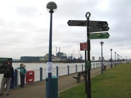
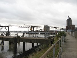
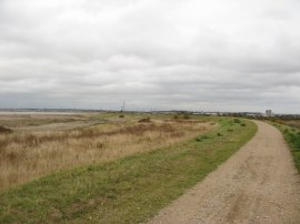
(1) The start of the walk |
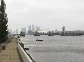
(2) View back towards the Thames Barrier |
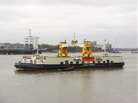
(3) Woolwich Ferry |
The first few yards of the path, photo 1, follow the route of the Green Chain Walk as it heads away from the river, climbing up a flight of steps and then following a tarmac pathway that threads it way through a small strip of gardens for a third of a mile up to the A206 Woolwich Road. Here the route heads to the left along the busy road up to a roundabout where the route joins Ruston Road which is the second road on the left. The route follows Ruston Road round to the left and then heads to the right for a few yards along Harlinger Street before once again heading to the left along a small stretch of road which is followed back to the waterfront. From this point there were good views up the river back towards the Thames Barrier and further on to Docklands, photo 2. This stretch of path is then followed along the waterfront to the Woolwich Ferry Approach road and there was one of the ferries, photo 3, moored up besides the path.
 |
 |
 |
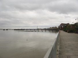
(4) View down river from Woolwich |
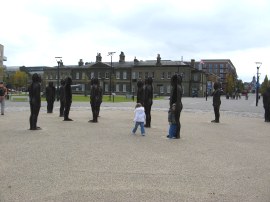
(5) Assembly, Woolwich Arsenal |
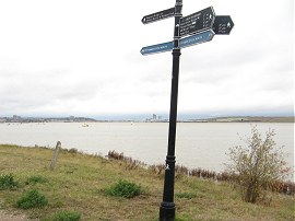
(6) Route Waymark |
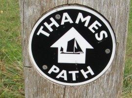
The path crosses the ferry approach road and skirts round the ferry buildings before heading round to Glass Yard which runs alongside the rivers edge behind a sports centre. Here the route passes the south entrance to the Woolwich Foot Tunnel although this was closed when we went by, as it had been the previous December when I had last walked here despite the original completion date for the works having been back in June. The path is then able to be followed along the waterfront, photo 4, all the way down to Erith. Leaving Woolwich the path heads past the buildings of the Woolwich Arsenal which was Britain's principal ordnance manufacturing facility from the early 18th century until the mid-20th century. Some of these buildings now house Firepower which is the Royal Artillery Museum and many of the rest have been converted into residential accommodation. As well as a good selection of cannons on display there is also a sculpture by Peter Burke comprising 16 hollow cast iron figures, photo 5, named Assembly. While the Thames Path proper had been way marked with the Acorn National trail symbol the extension path is marked by a circular disc with a sailing vessel on the directional arrow, photo 6.
 |
 |
 |
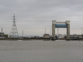
(7) Barking Flood Barrier |
(8) Approaching Thamesmead |
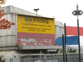
(9) Thames Barrier warning sign |
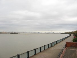
Leaving the buildings of Royal Arsenal West behind the route joins an unpaved section of path, probably the first such stretch of path besides the river since Barnes. This is followed round past Tripcock Ness as the path begins heading down towards Thamesmead. On the opposite bank was the tall structure housing the flood barrier at the mouth of Barking Creek, photo 7. In 1878 Tripcock Ness was the site of the sinking of the Princess Alice after a collision with another vessel that resulted in the loss of over 650 lives, a tragedy almost impossible to imagine now. As we approached Thamesmead we joined another paved section of path running alongside the river, photo 8, where we stopped for our lunch break. On one of the buildings behind the path was a big sign, photo 9, warning boats they were entering the Thames Barrier Control Zone.
 |
 |
 |
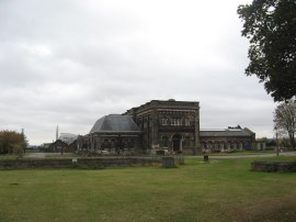
(10) Crossness Pumping Station |
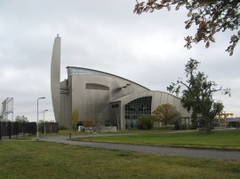
(11) Crossness Sludge Incinerator |
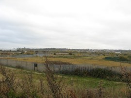
(12) Erith marshes |
Walking alongside the residential buildings that line the broad waterfront path in Thamesmead we passed the start point of stage 1 of the Green Chain walk and headed on round Cross Ness and past a golf driving range to reach the buildings of the Crossness Sewage Works and pumping station, photo 10. These were constructed between 1859 and 1865 as part of Sir Joseph Bazalgette's redevelopment of the London sewerage system and mark the eastern end of the Southern Outfall Sewer. The route then heads along a concrete lined section of path running past the extremely smelly sewage works and at the far end of the site reaches the shiny metal building of the Crossness Sludge Incinerator, photo 11.The tide was coming in as we were heading down river and on the muddy foreshore there were several flocks of teal and other wading birds looking for food. The path then heads alongside a small undeveloped area of Erith marshes, photo 12, before reaching another industrial area.
 |
 |
 |
(13) Industrial Area nr Erith |
(14) Riverfront at Erith |
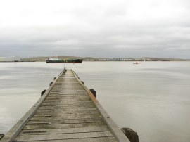
(15) Erith Causeway |
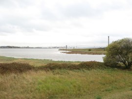
Here we headed past modern warehouses and older industrial sites and jetties besides the river, photo 13, including the tall towers at the ADM oil works which dominate the skyline by Erith. The route then heads along the waterfront besides more housing and the Riverside Gardens, photo 14, along to the small wooden Erith Causeway, photo 15, the narrow wooden structure heading out unfenced and at unguarded out into the river.
 |
 |
 |
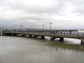
(16) Erith Pier |
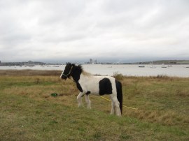
(17) Path by Crayford Marshes |
(18) Pony grazing besides the river |
Here the route has to head inland the short distance up to Erith High Street which is followed for just a few yards before the route heads down a passageway on the left besides a pub that soon rejoins the river. Here we linked up with the route of the London Loop which shares its route with that of the Thames Path Extension from this point onwards and a short distance further on we passed the Erith Deep Water Pier, photo 16. Not far past the pier the waterfront path ends and the route has to leave the river, heading up James Watt Way at the back of a Morrisons Supermarket and the continuing ahead up Appold Street to Manor Road. Here we headed to the left, past some houses, and then through a rather dingy industrial estate. Where the buildings end the route then heads to the left, following the access road round to Erith Yacht Club. Here we joined a path running along the top of the flood bank, photo 17, as it gradually curves back round to the waters edge with Crayford marshes away to the right.
 |
 |
 |
(19) The end point of the Thames Path extension |
(20) Mouth of the River Darent |
(21) Darent Flood Barrier |
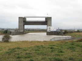
Here we had a short snack stop before following the path round to Crayford Ness, photo 19, which marks the end point of the Thames Path Extension path, close to the mouth of the river Darent, photo 20. The river marks the boundary between Greater London and Kent and ahead in the distance we could see the Queen Elizabeth Bridge rising across the river Thames. Reaching this point we had walked 10.44 miles along the path which is slightly more than the distance shown on the metal mileage posts. Crayford Ness is, however, rather in the middle of nowhere and we still had a further mile or so to walk to get back to the cars. As I mentioned several years ago when I was walking the London Loop, this would be the ideal place for a bridge over the river Darent as currently it is a walk of several miles to get back to the waters edge on the other side of the river. From Crayford Ness we followed the flood bank path as it headed up along side the river Darent and Dartford Creek, passing the Darent Flood Barrier, photo 21, which forms part of the same set of flood defences as the Thames Barrier and the barrier at Barking Creek.
 |
 |
 |
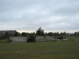
(22) Howbury Moat |
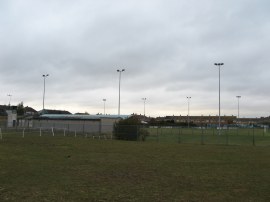
(23) Slade Green FC |
(24) Slade Green Station |
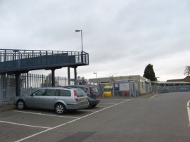
It was almost high tide by this time and the creek was full of water as we headed along the path at first running alongside some more industrial units before leaving the flood bank and joining a bridleway that headed up to Moat Lane. As we were walking here we met a man out walking his dogs who said he had seen a seal in the creek when he had been down there and a quick internet search does reveal that they are sometimes seen there. The path passes Howbury Farm where there are the remains of a small moated site, photo 22, which originally surrounded the Howbury Manor house and a little further on the path passes the Small Glen, home of Slade Green FC, photo 23. From the football ground it was just a short distance further up Moat Lane and into Forest Road and Slade Green Station, photo 24, where we had parked the cars.
As usual I have uploaded the route of the walk which can be accessed here: Thames Path Extension.
Reaching the car we had walked 18.2 miles in total from Greenwich, having completed both the final section of the Thames Path and the Thames Path South East Extension. The weather had been dull and overcast but it had remained dry and relatively mild. The Thames Path Extension is not a classic walk but it was still pleasant enough to be strolling down the ever widening river Thames.
If you would like to comment on this walk you can do so here:
![]() Back to:Walk index page
Back to:Walk index page
| ©2012 Bertuchi.co.uk. Please contact me using the email button on the right if you have any questions or comments regarding the site. Any feedback and additional information about places of interest on the walks is always welcomed. All rights reserved. Please contact me if you want to use any of the images or information from the site. ENJOY YOUR WALKING |
|