Swale Heritage Trail
Other Links >>> |
|
THE SWALE HERITAGE TRAIL
Sittingbourne to Goodnestone
|
|
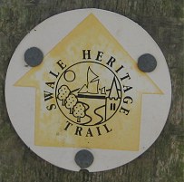
Swale Heritage Trail |
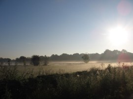
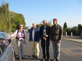
I did this walk on Sunday 16th October 2011. I drove over to Sittingbourne and parked up in Church Road outside Sittingbourne FC's Bourne Park Stadium which is at the start of the Swale Heritage Trail. I was then joined there by Sara, Derek, Dave and Tommy who had met up earlier at Graveney which is close to the end of the trail, before driving over to Sittingbourne. It was another unseasonably mild day, with almost no breeze and not a cloud in the sky, the temperature eventually getting up to a pleasant 18c which was excellent for a mid October day. In the morning when I had left home there was a low mist hanging over the lower reaches of Epping Forest which made even Leyton look quite attractive, photo 1.
 |
 |
 |
(1) Epping Forest by Hollow Ponds |
(2) The start of the Swale Heritage Trail |
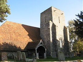
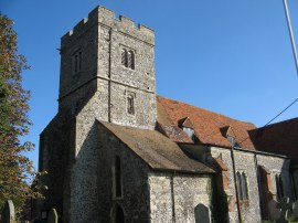
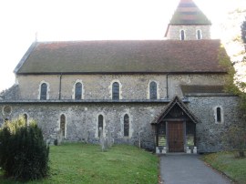
(3) Murston Old Church |
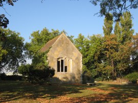
Once were were all assembled at the start of the path, photo 2, we set off along Church Road from where the Swale Heritage Trail soon heads past the remains Murston Old Church, photo 3, before joining a rather litter strewn section of path that is followed round to the right with the football stadium and its adjacent car parks on the right and a large warehouse to the left. The original Murston church was pulled down and relocated towards the end of the 19th century and all that remains of the old church is part of the centre chancel. According to one website it was intended this building should serve as the gateway for a Swale Heritage Trail but this never materialised.
 |
 |
 |
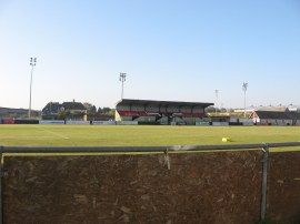
(4) Bourne Park Stadium |
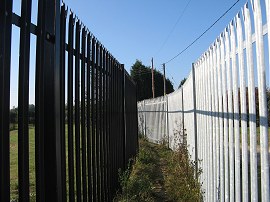
(5) Fenced path heading up to Murston |
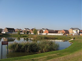
(6) New housing at Murston |
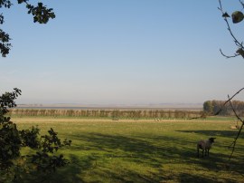
At one point a small gap in the fencing around the stadium allowed a view into the Bourne Park ground, photo 4, which as well as being the home of Sittingbourne FC is also, for the 2011- 2012 season, the home of Maidstone United, the team I support and a place I have been to many times in the past. Following the path round the back of the ground the footpath heads along a narrow path between two tall metal fences, photo 5, up to the houses on the edge of Murston, an area where a considerable number of new houses had been built since my map was printed, photo 6.
 |
 |
 |
(7) St Giles church, Tonge |
(8) View down to the Swale Estuary |
(9) Blacketts Road |
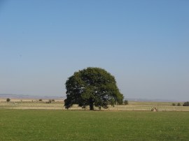
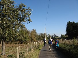
As we reached these houses we spotted the first small, and rather faded way mark for the Swale Heritage Trail fixed to a wooden post. The route heads to the left to join Meeres Court Lane before continuing on past an attractive pond to reach Great Easthill Way. Where this bends to the right the route continues ahead along the edge of field before heading to the right along a track that leads up to Lomas Road where the route heads to the left. Reaching the end of this road the Swale Heritage Trail then heads to the left down Church Road, passing St Giles church, photo 7. As we headed further along this road views opened up over the Isle of Sheppey, photo 8, and back to the Kingsferry Bridge although these were rather obscured in the hazy sunshine. Reaching a road junction we then branched right into Blacketts Road, photo 9, which headed alongside a number of apple orchards, the trees full of ripe fruit.
 |
 |
 |
(10) Heading towards Conyer Creek |
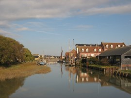
(11) Conyer Creek |
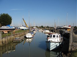
(12) Swale Marina |
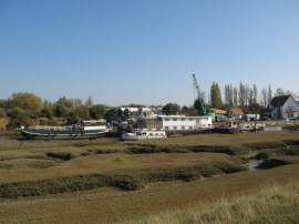
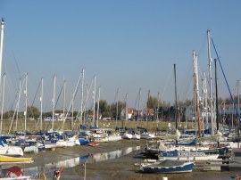
Reaching the end of this road the route heads to the right, then left, between farm buildings before turning to the right along a path that is followed to the flood wall lining the banks of Conyer Creek. Here we briefly linked up with the route of the Saxon Shore Way as the path winds its way round the edge of the creek, photo 11, up to the Swale Marina, photo 12, where we met up with Maria who had taken the train over to Teynham station before walking down to meet us. We followed the path round the edge of the marina amd reaching Conyer we headed along Conyer Road before joining an enclosed footpath on the right that ran between houses and then cuts across a field to rejoin Conyer Road.
 |
 |
 |
(13) St Marys Church, Teynham, |
(14) Luddenham Road |
(15) Path leading to the Uplees Road |
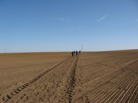
We then followed the hedge lined road to the right as it ran between fields and orchards, following the road round to the right at a road junction. A short distance up from the road junction we joined a footpath on the left which headed over a rather rickety stile and into a small paddock which the route heads diagonally across up to St Marys church, photo 13. We stopped for our lunch break in the churchyard on a bench looking out across Teynham Level, the weather warm enough for Tommy and Dave to seek out a patch of shade to sit in. After lunch we headed down a path running through the middle of an orchard down to Teynham Street where we headed to our right. Where this stretch of road bends to the left we continued ahead along a path running between orchards before rejoining the same road at the end of its dog leg round the orchards we had headed straight across. We then followed the road up to some farm buildings at Deerton Street before joining another footpath on the left that followed a fairly straight course between more fields and orchards to the Luddenham Road, photo 14. Just before we reached the road Dave found a geocache placed in the hedge besides the field; it was interesting to note how such a large box could be so well concealed just a few feet away from the footpath and how caches are often partly visible but remain hidden unless you are actively looking for them. At the road we headed to the left before following the road round to the right, passing the now closed Mounted Rifleman pub, as we began heading over to Luddenham. Although there is a fair amount of road walking involved with the Swale Heritage Trail most of these are very quiet lanes and we were passed by very few vehicles. Leaving the road we joined a footpath that headed down along the edge of a field and through a couple of kissing gates up to the farm buildings at Luddenham Court. There was also a church here although it was hidden from view behind a band of tall trees. Heading past the buildings we then joined another field edge path on the right that heads over to Cherry Drive. Crossing this road we joined a farm track heading across a very large and open ploughed field. Where the track ends the path continues over the field, photo 15, heading uphill at first before descending down to join the Uplees Road on the outskirts of Oare. We were all thankful that the weather had been so dry the field was full of dusty earth rather than damp mud which would have probably made the crossing rather unpleasant.
 |
 |
 |
(16) Oare Creek |
(17) St Mary Magdalene Church, Faversham |
(18) Faversham Creek |
Heading through Oare we very briefly linked up with the Saxon Shore Way again at the head of Oare Creek, photo 16, before continuing ahead along Oare Road towards Faversham along the dullest section of the route. We made a brief detour into the churchyard of St Mary Magdalene Church , photo 17, where Tommy located another geocache before following the road, now called Davington Hill, down into Faversham. We turned left into Dark Hill and followed this round to West Street. If you look closely at the GPS route through Faversham you will see a rather odd loop as when we reached West Street we headed off course, continuing down the street to North Lane instead of turning to the left down Flood Lane. Reaching the end of West Street we realised our error and headed down North Lane to rejoin the correct route at the junction with Bridge Road. However this had meant we had missed a section of the path so while the others had a rest on a bench myself and Sara quickly headed the wrong way up the path to the junction of West Street and Flood Lane before retracing our steps back they way we should have originally walked to rejoin the others - hope that doesn't seem to obsessive. As it was West Street had been a very pleasant road to walk down and the proper path round the head of Faversham Creek not that particularly exciting although we would have missed the good views down the creek from Bridge Street, photo 18.
 |
 |
 |
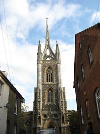
(19) St Mary of Charity Church, Faversham |
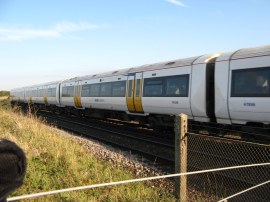
(20) Waiting at the rail crossing |
(21) The small Hop field |
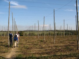
All reunited, except for Maria, who had left us to head home, and back on course, we continued along North Lane, the road running around the side of the buildings of the Shepherd Neame brewery which dominate much of the centre of town. Crossing a road we headed up the narrow Church Street up to the grounds of St Mary of Charity church with its tall and intricate stone spire, photo 19. The Swale Heritage Trail heads to the left through the churchyard and along a footpath before joining another footpath and cycle track on the right. This is followed by a playing field up to some houses. Crossing Abbey Fields road the route then joins a footpath running along the back of houses with fields to the left. Eventually the houses end and the path reached open fields which are followed up to some railway lines where we had to wait for a train to pass before crossing, photo 20. A short distance from the railway the route passed through a small area that had been planted with hops, photo 21, although these had now been harvested.
 |
 |
 |
(22) Fields nr Goodnestone |
(23) St Bartholomew's Church, Goodnestone |
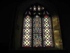
(24) Window, St Bartholomew's Church |
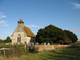
The route then continued over more fields, some of which had been set out with poly tunnels and a very intricate drip feed irrigation system for soft fruit, photo 22, as the route makes its way over to St Bartholomew's Church at Goodnestone where Tommy and Dave located one more geocache. We had a quick look round the small church, which is Grade I listed building and now under the care of the Churches Conservation Trust, before heading down to join a track which leads up to Head Hill Road which marks the end point of the Swale Heritage Trail. After taking a group photo at the end, photo 25, we then retraced our steps back up towards the church before joining a footpath on the right which headed down across a field to cross back over the railway lines. We then headed along a footpath over the middle of another large field which led up to our parking place by the Graveney Village Hall.
 |
(25) The end of the trail |
As usual I have uploaded the route of the walk which can be accessed here: Swale Heritage Trail.
All in all we had walked 13.6 miles although the actual length of the Swale Heritage Trail was probably nearer 12.5 miles in length after taking into account the extra walking we did in Faversham and the final stretch of path back to the cars. Despite the stretches of road walking this had been an enjoyable walk through pleasant countryside, this view no doubt helped by the excellent weather we enjoyed.
If you would like to comment on this walk you can do so here:
![]() Back to:Walk index page
Back to:Walk index page
| ©2012 Bertuchi.co.uk. Please contact me using the email button on the right if you have any questions or comments regarding the site. Any feedback and additional information about places of interest on the walks is always welcomed. All rights reserved. Please contact me if you want to use any of the images or information from the site. ENJOY YOUR WALKING |
|