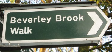
Beverley Brook Walk
Other Links >>> |
|
THE BEVERLEY BROOK WALK
New Malden to Putney
|
|
Beverley Brook Walk |
I did this walk on Sunday 13th November 2011. I had been intending to walk another stage of the Grand Union Canal path but I had been to a party the night before and wasn't up in time to reach Aylesbury and then do the walk I had wanted. However it was another glorious bright sunny day and far too good to be staying in so I made my way over to New Malden to walk the Beverley Brook Walk instead. The walk runs for 6 and a half miles to the River Thames nr Putney with a 0.8 mile link from New Malden Station to the start of the walk by the A3 although I'm not sure why this link route isn't just included as part of the path itself.
 |
 |
 |
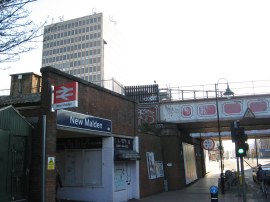
(1) New Malden Station |
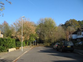
(2) Cambridge Avenue, New Malden |
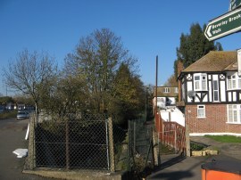
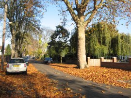
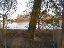
(3) The start point of the walk |
From New Malden Station, photo 1, I headed a short distance to my right down Coombe Road, stopping off at the petrol station to get a bottle of drink, before heading to the right down Cambridge Avenue where I saw my first way mark for the route. Reaching the end of this quiet residential road, photo 2, the route continues ahead along a broad tree lined path running between the fairways of a golf course. Where this ends the path joins a short stretch of road that leads up to the A3 before taking an underpass, signed "To the Beverley Brook Walk". This heads under the road to where the walk proper begins, photo 3. Here the route heads along a short stretch of footpath that is followed to Westcoombe Avenue with Beverley Brook running alongside.
 |
 |
 |
(4) Westcoombe Avenue, New Malden |
(5) Path approaching Wimbledon Common |
(6) Path in Wimbledon Common |
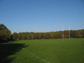
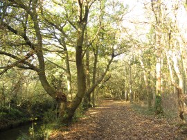
Along the road were large numbers of fallen leaves, photo 4, giving some clue to the time of the year which was not entirely evident from the weather. Reaching the end of Westcoombe Avenue the route heads to the left along the A238 Coombe Lane, passing a parade of shops, before heading to the right down Beverley Avenue. Reaching the end of houses I headed to the left along a footpath that heads back down towards the Brook. At first there is a fence besides the right of the path however this soon ends as the route heads across the bottom of a couple of playing fields, one of which was being used for a rugby match. Reaching the end of the playing fields, photo 5, the route heads into a patch of woodland lining the brook, photo 6, at the western edge of Wimbledon Common. At the entrance to the woodland was a notice board, giving details of the walk. I passed several of these during the walk and it was only later that I realised they contained differing information. This stretch of woodland path is followed alongside the brook for about a mile up to another area of playing fields.
 |
 |
 |
(7) Beverley Brook in Richmond Park |
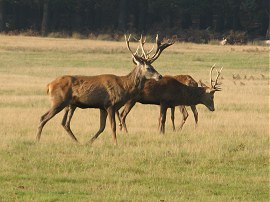
(8) Deer, Richmond Park |
(9) Walk Way Mark |
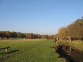
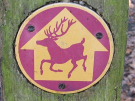
Here the route links up with that of the Capital Ring for a short distance as the path heads alongside the playing fields before heading to the left across a bridge over Beverley Brook and then onwards across a small area of open ground to reach the A3. Last time I had reached this point I had to take a footbridge over the busy road but since then a pedestrian crossing, with a special section for horses, has been installed with leads directly to the Robin Hoods Gate entrance into Richmond Park. Having said that in the time it took for the lights to change to cross over each carriageway it may well still have been quicker to head up and over the footbridge. Once over the road I headed into Richmond Park and then headed sharp right along a path running along the bottom edge of the park which soon leads back to Beverley Brook which is now running along a channel besides the open parkland, photo 7. The path then follows the brook on a fairly straight course for some distance through the park. I was taking the walk fairly easy and although I had only walked a few miles I stopped for my lunch break on a bench looking out over the park, enjoying the bright warm sunshine and open views although I did slightly regret I was not out in Buckinghamshire on the Grand Union Canal path. In the park there were lots of stags with fine sets of antlers, photo 8, and I made a short detour away from brook to take a have a slightly closer look. There had been a couple of reports in the papers recently of stags attacking bystanders and almost everyone was keeping a sensible distance from the herd apart from one woman with a very small child who foolishly headed right up towards them, showing no commonsense whatsoever. As well as the metal signs for the walk there were also the occasional way marks for the route attached to posts here and there depicting a red stag with antlers which I thought was quite apt, photo 9.
 |
 |
 |
(10) Level Crossing, Vine Road |
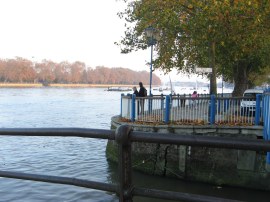
(11) Path by Barn Elms Playing Fields |
(12) Reaching the Thames |
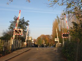
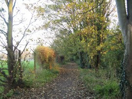
Reaching a wooden footbridge the route crosses over the brook, which then curves away to the left, and continues ahead close to the road up to the Roehampton Gate where the Beverley Brook Walk leaves Richmond Park. It took an inordinately long time to cross over the entrance road into the park where the route joins an enclosed section of path running to the left along the outside of the park wall. This soon leads to a bridge over the brook where the route joins a footpath on the right that runs alongside the brook at Palewell Common with playing fields to the left. Continuing ahead the route heads alongside a pitch and putt green and then heads through a small area of allotments up to the Hertford Avenue. This followed to the right up to the A205 Upper Richmond Road where the route heads to the right. Reaching Priests Bridge the route bears to the left, following the road round as it curves round to cross over Beverley Brook and then head back up to the Upper Richmond Road. This road is then followed a short distance further before heading to the left down Vine Road. This road, with houses on the left and woodland on the right is followed down to cross over two sets of level crossings in quick succession, photo 10, from where Barnes Station can be seen a short distance away on the right. Reaching the end of the road the route continues ahead for a couple of yards before heading to the left along a footpath running just inside the trees of Barnes Common. This path soon crosses over Mill Hill Road and continues ahead besides some houses on the left before heading sharp right along a surfaced path running across the common. As this path approaches Mill Hill Road again the route joins another path that bears left which leads down to Rocks Lane. Here the route crosses the road and heads slightly to the right to run along the edge of some tennis courts and then alongside the edge of a rather overgrown and seemingly abandoned cemetery. The route then continues along the edge of a playing field before heading to the left along a path that leads back up to the brook. Crossing a footbridge the route heads to the right along a tree lined footpath running alongside the brook with the Barn Elms playing fields to the right, photo 11. This stretch of path leads down to the end of the walk at the banks of the river Thames although when I walked the route the final few yards were closed due to building works and a short diversion round the edge of the playing fields has been put in place. This diversion reaching the river, photo 12, a few yards up from the normal spot. At this point I had walked 7.8 miles from New Malden Station.
 |
 |
 |
(13) The mouth of Beverley Brook |
(14) Putney Bridge |
(15) View upstream from Putney Bridge |
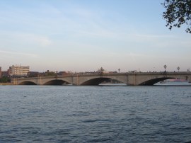
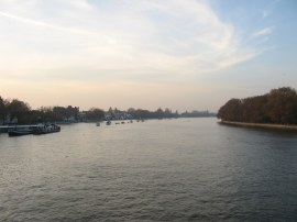
I then headed to my right downstream, soon crossing over the mouth of Beverley Brook where it enters the Thames, photo 13. Continuing on I headed along the Embankment, the road leading past a large number of rowing and sailing clubs lining the river up to Putney Bridge, photo 14. There were quite a number of sailing boats out on the river which were making very slow progress downstream in the face of a strong incoming tide and adverse wind direction and I stood and watched these for a while slowly tacking down river trying to keep as close to the bank as possible where I guess there was more shelter and a weaker current. I then headed over Putney Bridge, photo 15 and made my way over to Putney Bridge Station where I began my journey home.
As usual I have uploaded the route of the walk which can be accessed here: Beverley Brook Walk.
Reaching the tube station I had walked the grand total of 8.7 miles! Not a great distance but it had been a good walk on a glorious day and Richmond Park really is one of those places I should visit more often. Although the Beverley Brook Walk is way marked there were a number of junctions where signage was missing and I needed to check my map to ensure I stayed on course. There is also a PDF file of the walk that, in Nov 2011 anyway, can be downloaded from the Merton Council Website Beverley Brook Walk PDF.
If you would like to comment on this walk you can do so here:
![]() Back to:Walk index page
Back to:Walk index page
| ©2012 Bertuchi.co.uk. Please contact me using the email button on the right if you have any questions or comments regarding the site. Any feedback and additional information about places of interest on the walks is always welcomed. All rights reserved. Please contact me if you want to use any of the images or information from the site. ENJOY YOUR WALKING |
|