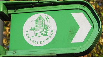
Len Valley Walk
Other Links >>> |
|
LEN VALLEY WALK
Maidstone to Lenham
|
|
Len Valley Walk |
I walked this path on Sunday 20th Nov 2011. There was thick fog for most of the journey down to Kent but this had finally lifted by the time I got to Lenham Station. There I met up with Val, Chris and Sara before driving over to Maidstone where we met up with Dave, Tommy and Maria. We only had sketchy details of the route as the Len Valley Walk is not marked on the Ordnance Survey Explorer Map and there was only limited information regarding the walk on the Internet that we could find. Maidstone Borough Council published a booklet in 1999 for the route although I could not find a copy of this either. The walk is way marked though, and apart from the initial stage out of Maidstone Town Centre, where we followed our own route, we were able to follow the path without much difficulty.
 |
 |
 |
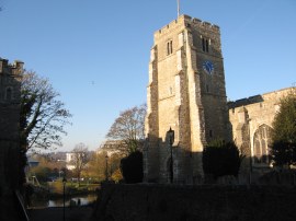
(1) All Saints Church, Maidstone |
(2) Archbishop's Palace, Maidstone |
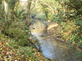
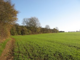
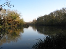
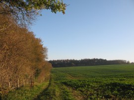
(3) River Len by Wat Tyler Road |
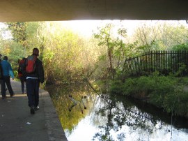
We parked up at a car park in College Road from where it was just a short walk past All Saints Church, photo 1, over to the Archbishop's Palace. This is where the River Len enters the River Medway and the end of the river seemed a good place to start the walk. From the Archbishop's Palace, photo 2, where there was a walk way mark on a pole in the palace grounds, we set off along Palace Avenue which runs alongside the course of the river Len before bending round into Lower Stone Street and then turning to the left along Romney Place. From there we followed the footpath running along the edge of the Sainsburys car park, parallel with Wat Tyler Road. This is followed down to a small, and rather slippery, wooden bridge over the River Len and the Len Valley Nature Reserve which is a quiet and rather neglected green space close to the town centre. Heading to the right we followed a path running under the Wat Tyler Road and along the banks of the river, photo 3, up to Square Hill Road.
 |
 |
 |
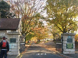
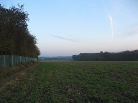
(4) The entrance to Mote Park |
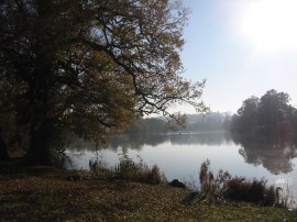
(5) Mote Park lake |
(6) River Len by Spot Lane |
We then headed to the right again along the road before heading to the left up Blythe Road. At the end of this residential street a short stretch of footpath leads up to Mote Avenue and the entrance to Mote Park, photo 4, where we linked up with the route of the Len Valley Walk. This had taken a more direct route from the Archbishops Palace, probably running along Knightrider Street into Wat Tyler Way and then heading along Mote Road into Mote Avenue but this way misses out the stretch of path alongside the nature reserve which I had wanted to see as well as the patch of river on Palace Avenue. We then headed into Mote Park, following the road ahead along a tree lined avenue that leads to the lake, photo 5. Continuing on we made use of some public toilets and also used the opportunity to take off a few layers of clothes, half of us warm enough to wear T shirts on what was becoming another incredibly mild, still November day. Reaching the end of the lake we headed to the right past the old Cheshire home before heading down to join a broad, surface path that is followed to Willington Street and the end of Mote Park, crossing over the River Len on the way. Crossing the road the route continues ahead for a few yards along Deringwood Drive before joining what seemed like the remains of an old closed road, Spot Lane, on the left which runs alongside the Len, photo 6.
 |
 |
 |
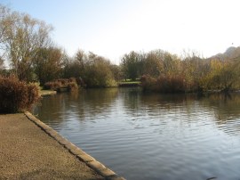
(7) Pond besides Mallards Way |
(8) Reaching open countryside |
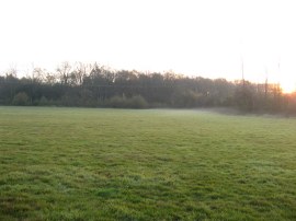
(9) View over to the North Downs |
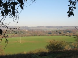
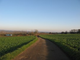
This is followed to its junction with Mallards Way, which the route crosses continuing ahead alongside a small pond, photo 7. At the end of the pond the route heads to the right, where in somewhat typical fashion for much of the path there was no signage, before heading uphill past a playing field where a junior football game was taking place, to join a road. Here we headed to the left, crossing over a mini roundabout by the Orchard Spot pub before joining a footpath which heads up some steps with houses on the right and trees to the left. Reaching the end of this stretch of path the route reaches a large open field, photo 8, where the Len Valley Walk heads to the left along the field edge. Having headed uphill there were good views across Bearsted and the Len valley over to the North Downs, photo 9.
 |
 |
 |
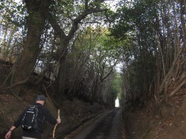
(10) Path by Green Hill |
(11) Heading along the Caring Road |
(12) Old Mill Pond, Nr Leeds Kent |
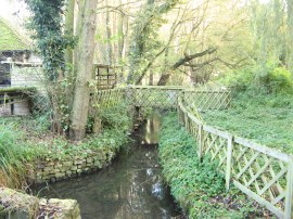
Reaching a road, Green Hill, the route heads straight across, joining a driveway that runs past a few houses and some barns before joining a field edge path that heads steeply downhill to cross a small stream, photo 10. The path then heads diagonally to the left, uphill across the next field before heading to the right along a field planted with raspberry canes. The route then heads to the left along the edge of a scrubby area of ground to reach Caring Road, photo 11. Here we headed to the right, following the quiet lane past a number of fine houses up to its junction with Caring Lane. Once again the signage had disappeared although we correctly deduced that the route headed to the left at the junction. A short distance down the road we joined a footpath on the right, where there was a Len Valley Walk way mark. This path heads round to a big field where the route heads uphill to the right. Reaching the top of this field the path then heads to the left a few yards along the field edge before crossing over a stile and heading to the left along a narrow fence lined stretch of path running between fields. This heads down to some trees and joins a driveway running close past a house and on to Old Mill Road. Here the route continues ahead over the road,first however we detoured slightly off route to view the Old Mill Pond, photo 12, and Maria left us to walk over to Hollingbourne station for her train home. The mill that had once stood here was still a paper mill in 1847 but had been converted to a corn mill by 1852 In 1908, the mill was being used to grind cocoa beans however the mill had probably ceased work by 1922 and was idle by 1928. It was eventually demolished in 1955.
 |
 |
 |
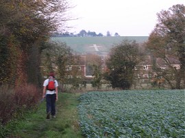
(13) Field leaving Old Mill Road |
(14) A large mushroom |
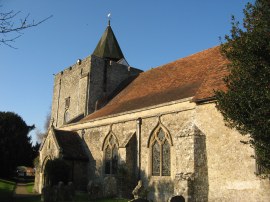
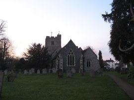
(15) St Nicholas's Church, Leeds, Kent |
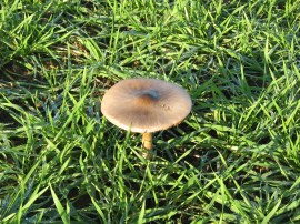
Back on course, we joined another footpath running over another large open field, photo 13, where there were a number of large mushrooms also growing, photo 14. Reaching the end of the field the route bears to the left and crosses another area of scrubby ground to join a surface track which the route follows to the right for a short distance before joining on the left. This head across a field up to the main road in Leeds, besides the primary school. Crossing the road we headed into the churchyard of St Nicholas's Church, photo 15, where we stopped for our lunch break. We could only find one broken and unusable bench in the rather overgrown churchyard however myself, Dave and Tommy sat in the sun against the church wall, enjoying the warm sunshine while the others sat on a bench outside the front of the church.
 |
 |
 |
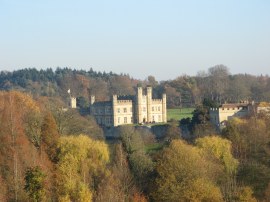
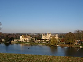
(16) Leeds Castle |
(17) Leeds Castle |
(18) Woodland Path nr Leeds Castle |
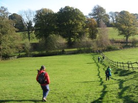
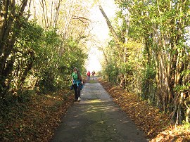
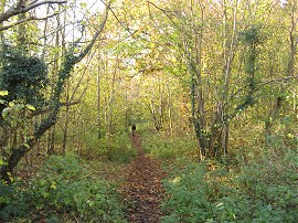
Lunch over we headed through the churchyard and followed the route across another field to a road and then continued ahead into the grounds of Leeds Castle, photo 16. A fairly straight stretch of path headed through the grounds, passing the village cricket pitch, and also the spot where I had broken my thumb many years ago falling off a toboggan. Reaching a driveway running through the park the route heads through a gate towards the Great Water before following a series of yellow topped poles on the right which guide the path along the public right of way, close to the waters edge from where there were good views over to Leeds Castle, photo 17, and its associated buildings. This lake and the moat around the castle were formed by the waters of the River Len. The path then enters a patch of woodland,photo 18, where the route once again crosses the river, which is followed up to the Broomfield Road.
 |
 |
 |
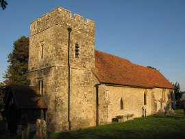
(19) St Margaret's church, Broomfield |
(20) Path heading towards Chegworth Court |
(21) Farm track nr Chegworth Court |
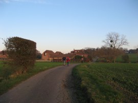
Here we headed to the right for a short distance before heading left up to St Margaret's church, Broomfield, photo 19. Passing through the churchyard the route continues ahead along a path that runs over to Chegworth Court. This path heads alongside field edges, photo 20, and passes through a couple of patches of woodland where at one point we had an abortive attempt to find a geocache which was probably extra well hidden under the carpet of fallen autumn leaves; however time was pressing, so we had to head on. Reaching the road by Chegworth Court we went off course as I had guessed, wrongly, that the route headed to the left along the road before joining a footpath on the right that is followed down to Water Lane Farm. We soon realised this was not the correct route though and were able to head off to our right, round the back of some rather grotty to barns to rejoin the correct route of the path. This, as Sara had correctly realised, had headed straight across the road and between the buildings of Chegworth Court. Back on course, we joined a farm track, photo 21, that led down to the byway, Water Lane.
 |
 |
 |
(22) River Len at Pollhill |
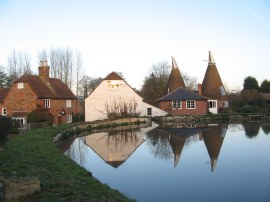
(23) Fairbourne Mill |
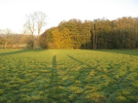
(24) Fields approaching Runham Lane |
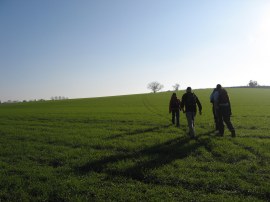
Here we turned to the left, eventually following the lane down to Water Lane Farm. On the way we did have a successful geocache find, this one attached to a plastic rose hidden in a tree which was quite inventive. At Water Lane Farm the route continued ahead over a very damp and muddy stretch of path which is followed round to the right. This runs between fields before the route joins a footpath on the left that heads over to the houses at Pollhill. Here we once again crossed over the River Len, photo 22, which was by now looking considerably smaller. The route then heads through a gate on the right, running around the back of a house to reach a road where we once again headed to our right. The M20 motorway was quite close to the path at this point and the noise coming from it quite intrusive, at what had once been a very peaceful location. (I had had a school friend who lived on the lane, back before the motorway was built). Reaching the end of the lane we headed to the right once more, along Fairbourne Lane, crossing over the River Len again, before joining a footpath on the left that headed diagonally across a field. This field had been sub-divided into a number of separate paddocks which meant a succession of stiles to cross. Crossing back over Fairbourne Lane we continued over another field to reach a road by Fairbourne Mill, photo 23. Here the route heads between the old mill buildings as the path winds its way across a number of fields to Runham Lane. The sun was getting low on the horizon at this point and we were casting long shadows across the fields, photo 24.
 |
 |
 |
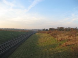
(25) Runham Lane |
(26) Channel Tunnel Rail Lines |
(27) Approaching Boldrewood Farm |
At Runham Lane we headed to the left, soon heading gently uphill along the sunken lane, photo 25, to cross bridges over both the M20 motorway and the Channel Tunnel Rail Link, photo 26. Reaching the end of Runham Lane we headed right along the slightly busier Sandway Road before joining a driveway on the left which curves round to the building of Boldrewood Farm, photo 27. There were a couple of fine clumps of mistletoe high up in the trees by the farm and some we spotted growing on some shrubs about head height.
 |
 |
 |
(28) Mist just starting to form |
(29) Path besides the railway lines |
(30) Approaching Lenham |
The route continues along on a track which is followed up to Ham Lane where we headed to the left for a few yards before joining another footpath heading over fields that leads to the Headcorn Road. In one of the fields a patch of mist was just beginning to form, hanging low above the grass, photo 28. The Headcorn Road is followed up to the railway lines on the outskirts of Lenham, and very close to the station where we had parked. Val and Chris finished the walk at this point however the Len Valley Walk does a big dog leg to get into the centre of Lenham and myself, Sara, Dave and Tommy continued on. Heading to the right we joined a field edge footpath, photo 29, that runs alongside the railway lines. Just before this large, long field ends we linked up with the route of the Stour Valley Walk , heading to the left to cross over the railway lines. The path then heads alongside a couple of more fields with the Lenham Cross, photo 30, visible ahead on the North Downs.
 |
 |
 |
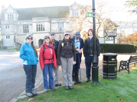
(31) St Mary's Church, Lenham |
(32) The end of the path |
(33) Lenham Station |
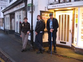
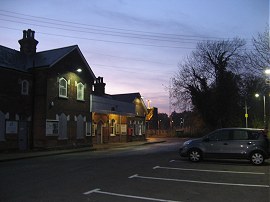
The path then bends round to reach the churchyard of St Mary's Church in Lenham. Just outside the churchyard, onthe Old Ashford Road, we saw the last signpost for the Len Valley Walk where we stopped for our end of walk photograph, photo 32, having walked 13.1 miles from Maidstone.Tommy brought us all a muffin from the village shop and we then headed the final mile back to the cars at Lenham Station, photo 33. By now it was getting quite dark and we were treated to a red sunset on the horizon.
 |
 |
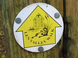
(34) Len Valley Walk Way Marker |
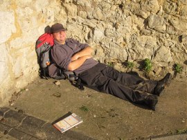
(35) A 50l rucksack has its uses |
Back at the cars we had walked 14.0 miles, for once mine and Dave's GPS' in complete agreement. This had been a much more enjoyable walk than I was expecting with good views and a few little hills on the way. We were able to correctly follow the entire route apart from the start at Maidstone which was our choice to go to the Len Valley Nature Reserve and the short stretch we went wrong by Chegworth Court. It made it more of an adventure having to piece together the correct direction of the route where signage was missing and it was quite satisfying to head down an unmarked stretch and come across a Len Valley Walk sign at the other end.
As well as uploading the GPS route below I have also uploaded the .GPX file from the walk which can be downloaded here: Len Valley GPX file. Right-click the link and choose "Save Link As..." to save the document to your computer
As usual I have uploaded the route of the walk which can be accessed here: Len Valley Walk route.
If you would like to comment on this walk you can do so here:
![]() Back to:Walk index page
Back to:Walk index page
| ©2012 Bertuchi.co.uk. Please contact me using the email button on the right if you have any questions or comments regarding the site. Any feedback and additional information about places of interest on the walks is always welcomed. All rights reserved. Please contact me if you want to use any of the images or information from the site. ENJOY YOUR WALKING |
|