Brent River Park Walk
Other Links >>> |
|
BRENT RIVER PARK WALK
Hanger Lane to Brentford
|
|
Brent River Park Walk |
I did this walk with Denise on 27th December 2011. From Walthamstow we took the tube over to Hanger Lane station which is the nearest station to the start of the path. It was a dull, grey day although quite mild without too much of a breeze and stayed dry.
 |
 |
 |
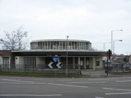
(1) Hanger Lane station |
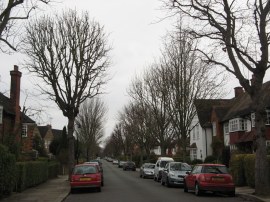
(2) Meadvale Road, W5 |
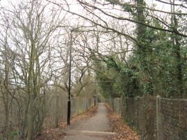
(3) Path by Ealing Golf Course |
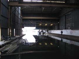
From Hanger Lane station, photo 1, we crossed under the A40 and headed a few yards down the North Circular before heading to the left into the much quieter suburban Brunswick Road. We followed this road for about 3/4 miles before we saw the first sign for the Brent River Park Walk, one arm pointing ahead and the other heading down a short stretch of footpath on the right. This footpath soon bends round to run alongside allotments to reach Lynwood Road which I think must mark the actual start point of the path. However we continued ahead, turning right into Nevill Road and then following the signposts left into Meadvale Road, photo 2. This road is followed for another 0.3 of a mile before the route heads to the right into Pitshanger Park, somewhat earlier than indicated on the map. The path then heads through the park which I somehow missed taking a photo of, running alongside the River Brent for a short distance. Reaching some tennis courts the route heads to the right along an enclosed footpath, photo 3, running between the grounds of Ealing Golf Course.
 |
 |
 |
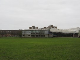
(4) Gurnell Leisure Centre |
(5) Path besides the Ruislip Road East |
(6) Path besides the Ruislip Road East |
Just before a footbridge over the River Brent is reached the route heads to the left along another similar footpath before bearing to the right along a path running past allotments which leads up to Argyle Road. Here the Brent River Park Walk heads to the right, past the junction with Ruislip Road East before crossing the road and joining a path running along the edge of playing fields with the Gurnell Leisure Centre, photo 4, away to the left. This heads down to the River Brent and the route then follows the river as it bends back round to the sports centre in an area very popular with Parakeets. We then headed to our right through an area of scrubby ground to join a footpath running between the Ruislip Road East and the River Brent. This heads under some railway lines, photo's 5, and continues on for some distance, photo 6, before the path rejoins the road by Greenford Bridge where the route of the Brent River Park Walk links up with the Capital Ring, the two routes running together for the remainder of the walk.
 |
 |
 |
(7) River Brent, Brent Valley Park |
(8) Brent Valley Golf Course |
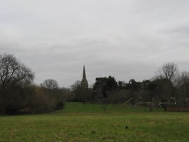
(9) Brent Lodge Park |
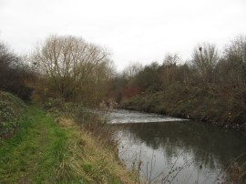
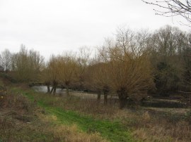
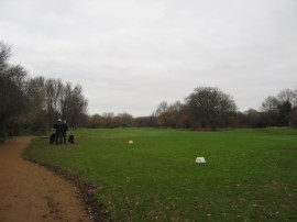
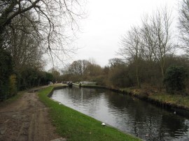
At Greenford Bridge the route crosses the road and joins a footpath running along the edge of the River Brent in the Brent Valley Park, photo 7, the more open nature of the river channel and willow trees lining the banks giving the area a surprisingly rural feel. This stretch of path is followed for some distance as the route makes its way along to the Brent Valley Golf Course, photo 8. The path sticks quite close to the river as it winds its way through the golf course, crossing over the river a couple of times, before entering the next area of green space, Brent Lodge Park, photo 9. The route follows the river as it meanders through the park with the spire of St Mary's church in Hanwell prominent on a hill away to the left.
 |
 |
 |
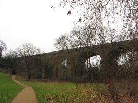
(10) Fingerpost, Brent Lodge Park |
(11) Wharncliffe Viaduct |
(12) Hanwell Bridge |
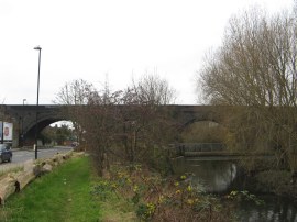
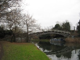
The route passes a rare distance marker for the Brent River Park Walk, photo 10 as the route heads alongside the large brick built Wharncliffe Viaduct, photo 11. The viaduct, built in 1836-7, was constructed for the opening of the Great Western Railway and was the first major structural design by Isambard Kingdom Brunel. Passing under the viaduct the route crosses back over the river and heads alongside Brent Meadow to the Hanwell Bridge, photo 12.
 |
 |
 |
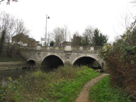
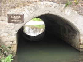
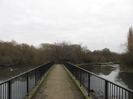
(13) Hanwell Bridge |
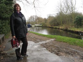
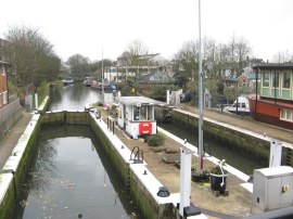
(14) Denise, Hanwell Locks |
(15) Hanwell Locks |
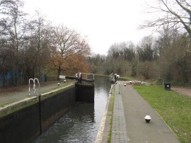
The Hanwell Bridge, which carries the A4020 Uxbridge Road across the river Brent, has two main arches and a smaller one for pedestrians. This was flooded and a plaque on the other side of the bridge states "When path is flooded please cross Uxbridge Road at nearby traffic lights", photo 13. However the middle arch of the bridge was so silted up it was possible to use this to cross under the road, rather than the intended arch avoiding a trip up to the road. The route then follows the river through an area of trees as it heads down to join the Grand Union Canal. The walk joins the canal between the first and second locks of the Hanwell Flight, photo 15, and then heads to the left along the canal bank for the remainder of its length to Brentford.
 |
 |
 |
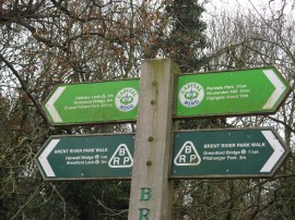
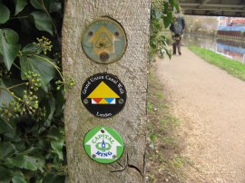
(16) Walk Way Markers |
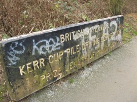
(17) Prize length of Piling 1959 |
(18) Weir nr Osterley Lock |
The Brent River Park Walk is now not only sharing its route with the Capital Ring but also the Grand Union Canal walk and a short distance further on was a marker post featuring waymarks for all three paths, photo 16. On the way to the Osterley Lock the path passes a memorial to the "British Waterways Kerr Cup Pile Driving Competition" recording the "Prize length of Piling 1959", photo 17. It was interesting to see how dirty the memorial had got over the last five years since I walked the Capital Ring. Just before Osterley Lock is reached the path heads over a weir, photo 18.
 |
 |
 |
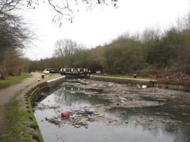
(19) Osterley Lock |
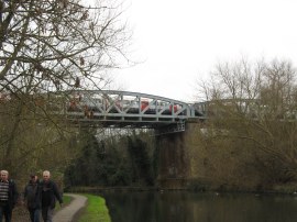
(20) Tube Bridge over the Canal |
(21) Gallows Bridge |
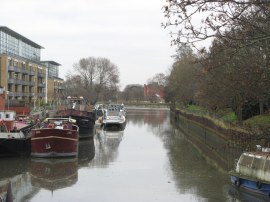
There was a large area of litter floating on the canal by the gates to Osterley Lock, photo 19. I had never seen such a large accumulation of rubbish on the surface of the canal and can only assume it had been flushed out from some place it had been accumulating for some time. As well as a large number of footballs and plastic debris it also contained a wooden post with the way marks for the route. A few hundred yards below the lock the route passes under the M4 and further on the route passes under a metal bridge supported on tall brick pillars which carries the Piccadilly line tube service over the canal, photo 20, before crossing over the canal over a graceful cast iron bridge that had been built in 1820, photo 21.
 |
 |
 |
(22) Clitheroes Lock |
(23) GlaxoSmithKline headquarters |
(24) Rail Bridge nr Brentford |
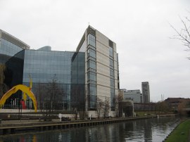
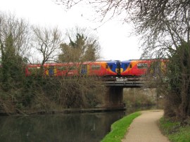
Next up the route passes Clitheroes Lock, photo 22, and soon reaches the landscaped grounds round the GlaxoSmithKline headquarters, photo 23. The path is now on the outskirts of Brentford and soon heads under the A4 road and then another set of railway lines, photo 24. Besides the canal towpath were a series of information boards detailing the history of the canal and it users.
 |
 |
 |
(25) Old Warehouse nr Brentford Lock |
(26) Grand Union Canal, Brentford |
(27) Brentford Gauging locks |
Much of the area alongside the canal in Brentford has been extensively redeveloped although there is still one area where the route passes under the remains of a wharf building that juts out over the footpath and canal and now makes an ideal roost for pigeons, photo 25. The path heads by the Brentford visitor moorings, photo 26, which were busy with boats before heading round a corner to reach the Brentford Gauging locks, photo 27.
 |
 |
 |
(28) Fingerpost, Brentofrd High Street |
(29) Thames Lock |
(30) View to the Thames |
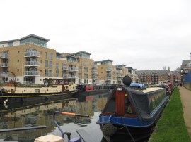
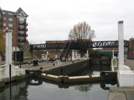
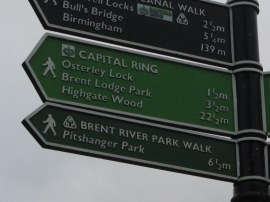
From the locks it was just a few yards up to Brentford High Street which marks the end point of the Brent River Park Walk. There a fingerpost, photo 28, gave a distance of 6.5 miles to Pitshanger Park although the distance we had walked from where we had seen the first sign for the route in Brunswick Road was 7.3 miles. From the High Street we headed down alongside the Grand Union Canal to the Thames Lock, photo 29, the entrance channel leading to the Thames, photo 30, containing considerably more water than when I had walked this stage of the Grand Union Canal earlier in the year.
From the lock we headed up Dock Road to Brentford High Street where we stopped for a short snack break before taking a bus up to Boston Manor tube station to take the tube home having walked a total of 8.82 miles for the day which is the most Denise has walked for a number of years. One of the features of this walk was the large number of birds we got to see. As well as numerous Parakeets we also spotted a Green Woodpecker very close to us in Pitshanger Park as well as Long Tailed Tits, a flock of Chaffinches and Tufted ducks on the canal to name just a few. While the walk is way marked there were one of two areas, particularly by the exit from Pitshanger Park which could have done with a few more way marks to make navigation a bit more straight forward.
As usual I have uploaded the route of the Brent River Park Walk which can be accessed here: route.
If you would like to comment on this walk you can do so here:
![]() Back to:Walk index page
Back to:Walk index page
| ©2012 Bertuchi.co.uk. Please contact me using the email button on the right if you have any questions or comments regarding the site. Any feedback and additional information about places of interest on the walks is always welcomed. All rights reserved. Please contact me if you want to use any of the images or information from the site. ENJOY YOUR WALKING |
|