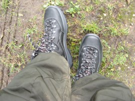
(1) My new boots
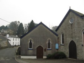
(2) St Neot, Cornwall
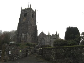
(3) St Neot Church
Other Links >>> |
|
TWO VALLEYS WALK
Circular walk from St Neot
I did this walk on Sunday 29th January 2012. I parked in the small car park opposite the village hall in the village of St Neot which marks the start point of the Two Valleys walk. This is a circular walk of just under 6 miles on the edge of Bodmin Moor in Cornwall. The weather forecast for the day had been dreadful but luckily it started better than expected with none of the predicted rain. It was very cold though, only 2 or 3 degrees, however also very still which helped cut down on wind chill; quite unusual for Cornwall where there usually seems to be a breeze blowing.
|
|
|
|
(1) My new boots |
(2) St Neot, Cornwall |
(3) St Neot Church |
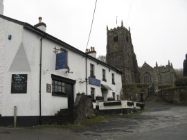
For this walk I used by new Berghaus Explorer Ridge boots, photo 1, which I had brought earlier in the week to replace my old Scarpa ZG65's which are beginning to fall apart, even if they are not quite dead yet. It will be interesting to see how well these boots last, given the price I paid, anything over 1000 miles and I will be happy. They certainly weren't looking as clean as by the end of the walk. From the car park I headed to the right down the road, photo 2, crossing the bridge over the St Neot or Loveny River before joining a lane on the left besides the London Inn. Next door to the pub was the large Church of St Neot, photo 3, where my aunt was married back on FA cup final day 1974. My mum was able to remember the exact date, May 4th, however my abiding memory of that day is being upset at missing the match on television!
 |
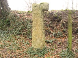
 |
 |
(4) Lane leading out of St Neot |
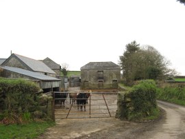
(5) Passing a small farmyard |
(6) Wooden Way marker |
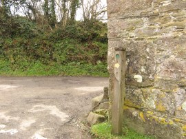
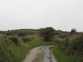
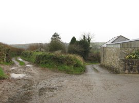
There is a fair amount of road walking on the Two Valleys Walk and the lane I joined besides the London Inn is followed for about a mile and a half as it heads steadily uphill out of the village, photo 4, passing a few isolated farms and houses, photo 5, as it makes its way up towards open moorland. Despite the length of road walking I was only passed by one car on the entire stretch. Besides one of the farms along the road I spotted some snowdrops in flower and also the odd daffodil, signs of the previously mild weather. The route of the Two Valleys Walk is partially waymarked with wooden poles with a yellow direction arrow and a circular green spot on them, photo 6, although these are not sufficient to navigate the route without a map. I did this walk in a clockwise direction however looking at the posts that mark the route it has been way marked in an anti clockwise direction with the markings on one side of the posts only.
 |
 |
 |
(7) Approaching the end of the lane |
(8) Path across Berry Down |
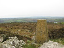
(9) Trig Point S5609, Berry Down |
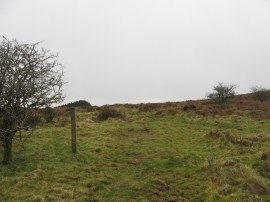
Eventually a T junction is reached where the route continues straight across along a stretch of enclosed bridleway which soon leads out onto the moor at Berry Down. The route follows the bridleway across the moor, photo 8, however I made a short, but rather time consuming, side trip up to the trig point on top of the down, photo 9. There was only a vague path to follow up to the top from this side of the down and I was very wary of the gaps between some of the granite rocks on the flank which were obscured by greenery as the last thing I wanted to do was put my foot down a hole and hurt my ankle, particularly as I was still getting the feel of my new boots on the uneven surfaces.
 |
 |
 |
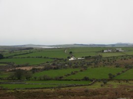
(10) View towards Colliford Lake |
(11) Heading down to Bowden Wood |
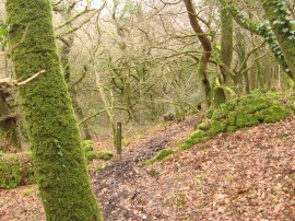
(12) Path in Bowden Woods |
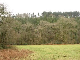
The little side trip up Berry Down added 0.4 mile to the length of the walk however the climb up was well worth it as even though it was not far it gave far better views over the surrounding countryside than those available from the path, off to Colliford Lake, photo 10, and far further over the rest of Cornwall. Rejoining the route of the Two Valleys walk from where I had left it I then headed off to my right across the moor. As the path I was following was a bridleway it was fairly well churned up and muddy due to the horses hooves and my new boots were soon not looking new any more. All to soon this stretch of moorland walking ends and a road is reached where the route heads downhill to the right along a lane lined by tall hedges where every bare surface seemed to be covered by bright green moss. Shortly after the lane passes a side road on the left the Two Valley Walk joins a footpath on the left that heads steeply downhill through a small patch of trees before crossing a stile and heading over the corner of a small paddock. Passing through a gate the path then heads diagonally across the next field, photo 11, and along the edge of another field as the route starts heading down to the wooded floor of a steep sided valley. Crossing another stile the route heads down through the trees of Bowden Wood, photo 12, to join a path that runs parallel to the Bowden Stream; the stream running in its channel some distance below the level of the path. This was a particularly nice stretch of path and a complete contrast to the moorland crossed a short distance earlier.
 |
 |
 |
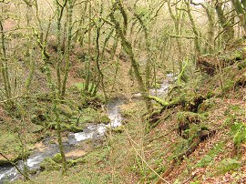
(13) Bowden Stream |
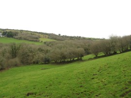
(14) Field nr Trenant |
(15) River Fowey |
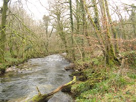
Continuing downhill through the moss covered trees alongside the stream, photo 13, the route joins a broader forestry track which is followed down to a more open area where there had been some recent logging activity which had left the track in a very muddy state. Reaching a road at Trenant the route continues ahead before joining a short stretch of farm track which leads into a field. Here the route heads along the left hand edge of the field, parallel with the stream. At the end of the field the route then follows the field edge as it first heads round to the right and then left again to reach a small path running along the edge of the River Fowey, photo 15. Here the route heads to the right on another very pleasant section of path heading through trees, the path running besides the waters edge. The path was quite uneven though and did not seem to be that used.
 |
 |
 |
(16) Field nr Treverbyn |
(17) Cross at Wenmouth Cross |
(18) Farm track by Higher Newton farm |
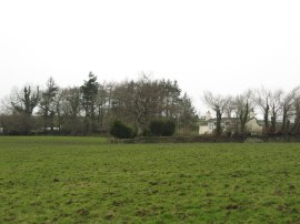
It had started spitting with rain while I was on Berry Down and as I was walking alongside the River Fowey I had to stop to put on my waterproof coat and the rain cover on the rucksack and as I progressed the rain became steadily heavier and heavier. Leaving the river, a rather slippery set of wooden steps then carries the path up to a track where the route heads to the left, gradually bending away from the river. Just before the track reaches a road the Two Valleys Walk joins a footpath on the right which continues ahead for a few yards before bending round to the right to head steeply uphill across an open field. Crossing over a stile the route then continues ahead over another field, photo 16, heading towards a wall just to the left of a house at the small hamlet of Treverbyn. It was tough walking across this field which had been turned into a quagmire by a herd of cattle whose hooves had sunk deep into the ground making the surface very uneven and muddy, the mud completely covering my new boots. This field leads up to a road by a T junction where I continued ahead, the route once again heading gently uphill along a quiet country lane. Reaching the end of this lane the route heads to the left along a more level stretch of road. This road is followed to a junction where the route bears right for a short distance further, heading up to a crossroads at Wenmouth Cross. Here the route bears to the right by an old Cornish cross, photo 17, the road signposted to Colliford Lake.This lane is followed gently uphill for a short distance before the Two Valley Way joins another minor road on the left. This is followed past a small settlement of houses before the road bends to the left, heading back down towards St Neot in the bottom of the valley. Reaching Higher Newton farm the route then bears to the left along a farm track, photo 18.
 |
 |
(19) Back Lane, St Neot |
(20) London Inn pub, St Neot |
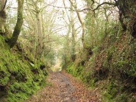
This was pretty damp and muddy at first before the path heads into a sunken lane, photo 19, that heads more steeply down into St Neot. Reaching the end of this lane the route links up with the outward leg of the path, just above the London Inn pub, photo 20.
Arriving back at the car I had walked just 6.03 miles though it felt as if I had walked further. Partly because the off road sections where so muddy and often uneven and also because there were actually some hills to go up. My total ascent, while not great, was almost as much as my last two 15 mile walks in Essex combined. I really do need to do a bit more hill walking to get my fitness back. This had been quite a short walk and I had been intending to walk a bit further up on the moors out on the other side of the village but as it was raining so heavily I decided to call it a day and head for home.
As usual I have uploaded the route for the Two Valleys Walk which can be accessed here: Two Valleys Walk route.
If you would like to comment on this walk you can do so here:
![]() Back to:Walk index page
Back to:Walk index page
| ©2012 Bertuchi.co.uk. Please contact me using the email button on the right if you have any questions or comments regarding the site. Any feedback and additional information about places of interest on the walks is always welcomed. All rights reserved. Please contact me if you want to use any of the images or information from the site. ENJOY YOUR WALKING |
|