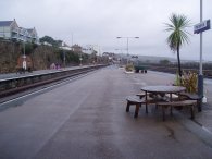
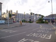
(1) Penzance Station
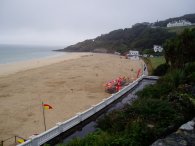
(2) Porthminster Beach, St Ives
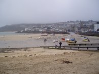
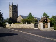
(3) St Ives
ST IVES TO PENZANCE
I did this walk on the 21st August 2006. Despite it being the middle of summer the weather was more akin to late Autumn with very low cloud and intermittent drizzle although later in the day it did gradually brighten up. I had spotted details of this walk in a Guardian newspaper magazine article listing what they described as Britains 50 best walks and having come down to collect my daughter from my parents this was the ideal time to do it. I drove down to Penzance from where I took the train to St Ives for the start of the walk. The journey took 24 minutes, including a change at St Erth. I had parked at the sea front car park in Penzance where parking was £4 for the day however walking to the station I noticed their car park was only £2 for the day.
|
|
|
|
(1) Penzance Station |
(2) Porthminster Beach, St Ives |
(3) St Ives |
It was raining when I left Penzance station, photo 1, and it was still gloomy when I arrived in St Ives at the small station which overlooks Porthminster Beach, photo 2. I had a little wander round St Ives, photo 3, before making my way round to Portmeor beach and the start of the walk.
 |
 |
 |
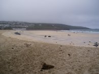
(4) Porthmeor Beach |
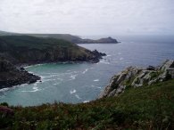
(5) South West Coast Path nr St Ives |
(6) South West Coast Path nr St Ives |
The first 11 miles of the walk from Porthmeor Beach, photo 4, are along the South West Coast Path down to Bosigran Castle. From there the route leaves the coast path and heads overland to Penzance on the South Coast of the Cornish Peninsular.
As I was climbing up from Porthmeor Beach I came across a man sitting on the path who began describing at length how he had been been living in a cave close by for the last few years and all the experiences he had had. Interesting to listen too however I feel he could have probably talked all day and I had a long way to go so after a while I headed on. Because of the times of the trains it had been nearly 11 o'clock when I had got to St Ives and I did not want to be too late arriving back at Penzance!
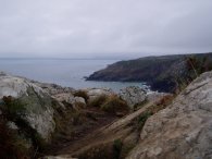
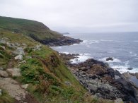
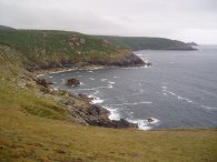
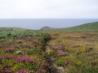
After leaving St Ives the path runs along the coast passing a number of small coves and headlands, photo's 5 and 6. The whole section of coast path from St Ives to Bosigran castle is fairly remote is also quite strenuous walking over high cliffs with several descents and ascents over small valleys en route. One of the first decisions I had to make was do I wear my waterproofs. While it was quite damp at the start it was also relatively warm and I decided I would probably get just as damp wearing them so in the end they remained in my bag.
 |
 |
 |
(7) Trevega Cliff |
(8) Granite Footbridge |
(9) The Carracks |
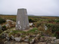
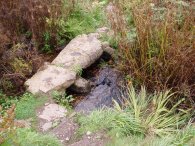
Photo 7 is of the trig point at Trevega Cliff where I had my first break. Continuing on, the path crossed a littel stone footbridge, photo 8 as it makes its way towards the rocks of the Carracks, photo 9.
 |
 |
 |
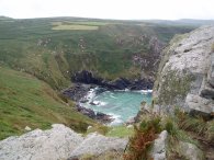
(10) Economy Cove |
(11) Carn Porth |
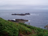
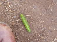
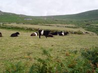
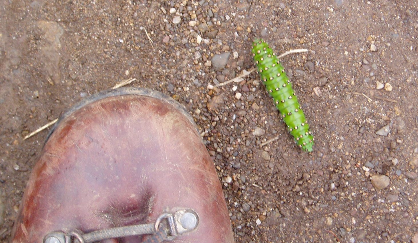
All the time there were good views along the coast in both directions, photo 10. As I was walking along the path not far from Carn Porth, photo 11, I spotted a large green Emperor Moth caterpillar, photo 12, crossing the path in front of me. Later on I also spotted a slow worm sliding across the path before disappearing into the undergrowth leaving just the tip of its tail in view. This was the first time I had ever seen a slow worm while out walking though it was too deeply hidden in the undergrowth to get a photo.
 |
 |
 |
(13) Mine adit nr Zennor |
(14) Pendour Cove |
(15) View towards Gurnard's Head |
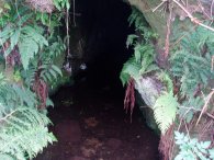
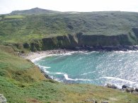
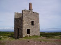
At Gala Rocks the path heads down to the shore line before climbing back up hill again to make its way round to Zennor Head. This area had once been part of a thriving Cornish mining industry and there were numerous reminders of the past activity to be seen from the path. On the route close to Zennor Head the path passed an old mine adit, photo 13, which disappeared off into blackness, its floor covered in a few inches of water. Intriguing, but probably extremely dangerous to explore. Once I reached Zennor Head itself I stopped for lunch, looking down across Pendour Cove, photo 14, from the top of the headland. Behind me a small plaque attached t the rock stated that " Zennor Headland given to the National Trust Dec 1953 in proud and happy memory of the friends whose love has sustained me - AB" which got me thinking who AB might have been although so far I have been unable to find out. After an enjoyable lunchbreak, and much needed rest, I continued my walk on down the coast from Zennor Head. The path drops steeply down some steps to cross a small stream above Pendour Cove before heading towards Gurnard's Head which can be seen in the distance in photo 15.
 |
 |
 |
(16) Porthmeor Cove |
(17) Bosigran Cliff |
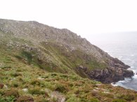
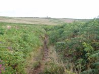
It was around this point that the weather finally started to brighten up and the clouds finally lifted from the coast. The path passes more mine workings at Treen Cove and then climbs up to Gurnard's Head which for a long way had been the most prominent spot on the horizon. While there I watched a group of people climb down the headland to rocks at the water egde which seemed a rather foolhardy thing to do. There was quite a swell in the sea and it would have only needed one slightly larger wave to come past to have washed them off. From Gurnard's Head the path continues on to Porthmeor Cove, photo 16, before finally heading across to the headland in photo 17 which marks the site of Bosigran Castle. Here the route of this walk leaves the South West Coast Path and begins its route across country to Penzance.
The path heads for the low point between the two hills on the horizon in photo 18, crossing a road close to the old mine building that can be seen in the larger version of photo 18, before staring to head uphill between Carn Galver on the left and Watch Croft on the right.
 |
 |
 |
(19) View towards Bosigran Castle |
(20) Path across the moorland |
(21) Old mine building |
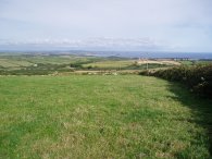
Photo 19 was taken looking back from the col between Carn Galver and Watch Croft towards Bosigran Castle. The path then heads across ooorland towards another old mine building that can just be made out on the horizon in photo 20. Though this was gentle easy walking across reasonably level ground I was starting to feel quite tired after the long walk along the coast and the soles of my feet in particular were feeling a little sore. As the path reaches the old mine building, photo 21, there were the first views of the sea on the South Coast.
 |
 |
 |
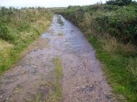
(22) Waterlogged path |
(24) Stone Cross |
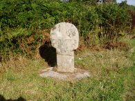
Leaving the old mine building the path heads onto a track that then becomes a minor road. The first part of the track was awash with water, photo 22, which was coming from a pipe in the hedgerow. At the first road junction the route takes a footpath off to the left that runs downhill between fields. In the distance there were views of St Michael's mount, photo 23, although Penzance itself remained hidden fom view. The footpath then joins another small road for a short distance, passing an old Cornish stone cross on the roadside, photo 24, near Madron Well.
 |
 |
 |
(25) Madron |
(26) Madron Church |
(27) Penzance |
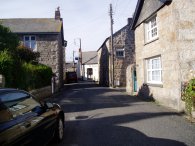
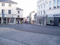
Another short stretch of footpath lead to the village of Madron, photo 25. Passing Madron church, photo 26, the path once again heads downhill across fields towards Penzance, joining a farm track by Rose Hill Farm that leads down to the A30 on the outskirts of the town. Crossing the A30 there is a stretch of about a mile of road walking into the centre of the town, photo 27, from where it was just a short walk back to the station, photo 28 where i had parked and the end of the walk.
 |
(28) Penzance Station |
This had been another highly enjoyable walk. The section along the South West Coast Path being particualrly dramatic followed by a pleasant walk across moorland and fields to Penzance. My feet were however feeling very tired by the time I reached the car, not helped by the fact that several miles of the route towards the end was on tarmac.
The GPS made this walk 16.8 miles as opposed to the length of 14.9 mentioned in the Guardian however I probably added some of the extra mileage wandering round St Ives at the start. Including breaks the walk took eight hours to complete and it was 7:00pm when I got back to the car.
![]() Back to:Walking index page
Back to:Walking index page
| ©2008 Bertuchi.co.uk. Please contact me if you have any questions or comments regarding the site. Additional information about places of interest on the walks is always welcomed. All rights reserved. Please contact me if you want to use any of the images or information from the site. Thank you. |
|