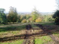
(1) The Stubbles
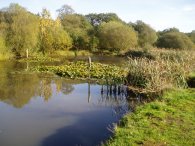
(2) Strawberry Hill Pond
EPPING FOREST CIRCULAR
|
|
|
|
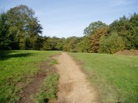
(1) The Stubbles |
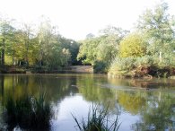
(2) Strawberry Hill Pond |
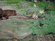
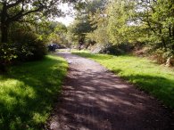
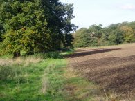
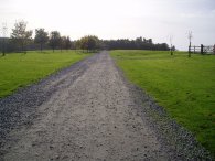
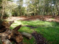
I did this walk on the 29th October 2006 after seeing it featured in the November 2006 issue of Country Walking Magazine. The walk starts at a small car park off Nursery Road in Loughton where there is parking space for about 10 or 12 cars. From the car park the path heads very gently uphill across the open glade of the Stubbles, photo 1, to join a bridle path that runs past Strawberry Hill pond, photo 2. Turning right along the bridle path the path continues along to another pond and parking area and crosses the Earls Path Road. Just over the road I came across a delightful moss covered tree trunk with toadstools growing on it, photo 3. (Click the green text below the photo to see a larger version).
 |
 |
 |
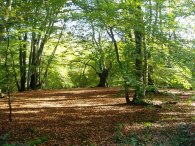
(4) Green Ride, Epping Forest |
(5) Green Ride, Epping Forest |
(6) Ambresbury Banks |
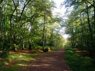
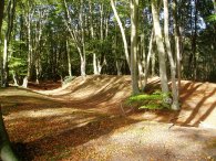
As seems to have been the case with most of my walks just recently it was another bright, sunny and warm day, even though the weather forecast had predicted rain yesterday, and once again my fleece and jacket remained packed in my rucksack. The route of the path continues along the Green Ride, photo's 5 and 6, through the centre of Epping Forest, on the way joining up with the route of the Epping Forest Centenary Walk which I had walked back in May 2006. The path winds its way up and down through the trees, crossing the roads of Golding's Hill and Coppice Row. A little further on the path passes by the earth embankments known as the Ambresbury Banks, photo 6, which are remains of an iron age rectangular, lowland plateau fort.
 |
 |
 |
(7) Cricket Pitch, Bell Common |
(8) View towards Hertfordshire |
(9) Approaching Griffin's Wood |
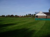
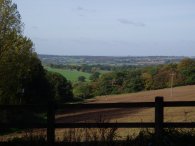
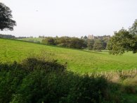
Approaching Bell Common the path leaves the Green Ride and takes a path off to the left that leads a brief distance through trees towards a small cricket ground and pavilion, photo 7. The path passes in front of the pavilion building to a driveway that runs down to the B1393 Epping High Road. Crossing the road when the traffic allows the path heads left along the pavement until just past the last house where a footpath heads off to the right that leads down to a path that runs alongside the M25. To the right there were quite extensive views across the Hertfordshire countryside, photo 8. This path turns over a stile and follows the side of a field, photo 9, as it runs down towards Griffin's Wood.
 |
 |
 |
(10) Copped Hall Park |
(11) Copped Hall Park |
(12) View towards Hertfordshire |
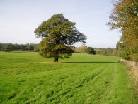
To the left of the path there were views across to Copped Hall House, photo 10. At the edge of Griffin Wood the path turns left to pass through a stile and into the grounds of Copped Hall Park. The grounds of the hall have, since 1992, formed part of buffer land around the edge of Epping Forest owned by the Corporation of London. Copped Hall Park was originally a medieval hunting park and the landscape is dotted with fine parkland trees small woods and hedges with magnificent views. At least that is what the sign at the entrance to the park says! The path runs along the side of the field in photo 11 with more views across the Hertfordshire Countryside, photo 12. At the end of the field the path moves onto a surfaced track which leads round to Copped Hall House itself.
 |
 |
 |
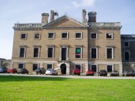
(13) Copped Hall House |
(14) Path nr Copped Hall House |
(15) Track in Warren Wood |
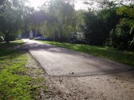
Copped Hall House, photo 13, was destroyed by a fire in 1917 but is now gradually being renovated and restored by the Copped Hall Trust having been saved from further development in 1995. The route continues along the driveway past the front of the house, photo 14, and makes its way down to take a bridge back over the M25 and into Warren Wood. Over the bridge the path continues along the track until just before a set of white gates is reached, photo 15, where the route heads down a signposted footpath that runs off to the right through some rhododendron bushes. This path heads gently downhill, running parallel with the road at Crown Hill.
 |
 |
 |
(16) Path at Crown Hill |
(17) Path near Crown Hill |
(18) Holly Berries |
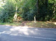
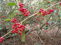
It was at this stage of the walk that I went slightly off course. The route then takes a path to the left that leads across Crown Hill however I missed this turn off and end up walking a bit too far down hill and when I cut across to the road I had to walk back up hill for a few yards until I found the track on the other side, which runs to the left of the first house, that I needed to take. Where I should l have come out is marked by the white post in the middle of photo 16. The route then skirts the side of a house and takes a path, photo 17 that runs just inside the edge of the forest for about three quarters of a mile up to Woodridden Hill. There were quite a few holly trees in this part of the forest and they all seem to have a very good crop of berries this year, photo 18.
 |
 |
 |
(19) Toadstools |
(20) Forest Way Signpost |
(21) View over North London |
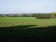
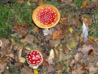
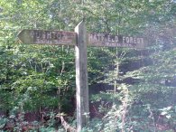
Just before I crossed the road at Woodridden Hill, (which took some time as it was very busy) I came across the toadstools in photo 19, one of a large number of different types of mushrooms and toadstools I spotted while walking through the forest. Just over the road the route of this walk joins up with the route of the Forest Way which was marked by the signpost in photo 20. The Forest way runs from Hatfield Forest to Epping Forest at Loughton, according to the signpost, a distance of 22.5 miles, although it has been a number of years since I have walked it. A little further along there was a break in the trees which gave extensive views over the Northern suburbs of London, photo 21.
 |
 |
 |
(23) Beech trees, Epping Forest |
(24) Fairmead Pond |
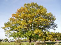
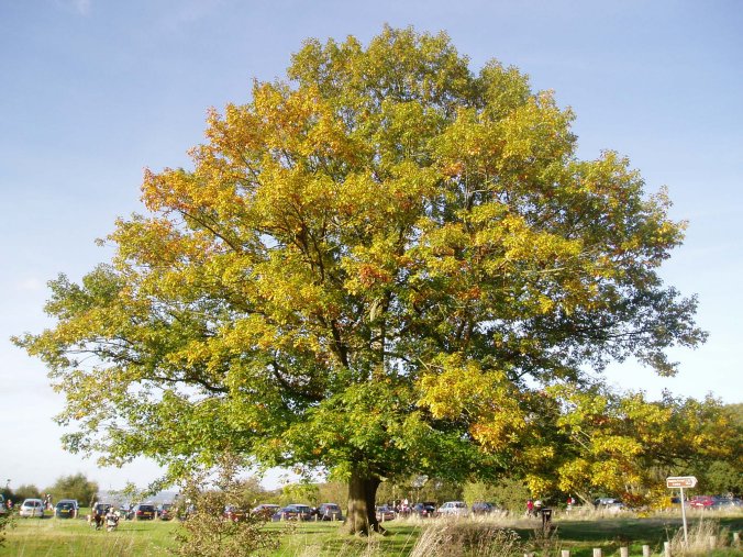
The path continues on and crosses Claypit Hill before making its way towards High Beech where I had a quick stop at the Kings Oak pub, opposite the oak tree in photo 22. I then followed a track that headed east, close to the Epping Forest Conservation centre which soon re-joins the Centenary Walk. Follow the path to the right, up and down a number of short, but quite steep hills, and on to the next road. Cross this road and continue along the route of the Centenary Way for a short distance further before taking a smaller path that runs off to the left towards a car park. Passing this car park head along the road for a short distance before taking a path that once again runs off to the left, past the small Fairmead Pond in photo 24. From here the path continues down to the main A104 Epping New Road. Cross the road carefully and continue ahead past a small car park, ignoring paths off to the left and right. Follow this path through the forest until it reaches a T junction where this route turns left for the short walk back to Strawberry Pond. Once back at the pond a right turn leads back through the trees to the Stubbbles and back to the car park. Just after crossing the A104 I had been passed by two horse riders and close to Strawberry Pond I caught up with them again as one of the horse had had a shoe come lose and its hoof was bleeding quite heavily. The rider was able to remove the shoe completely but the horse did not want to put its hoof on the ground.
In Country Walking the walk is described as 10.5 miles however my GPS made the distance for the walk only 9.6 miles. The GPS did however lose is signal a number of times under the trees so this may account for some of the lower figure.
Once again I had problems with my feet, this time because of a vein on top of my foot which became very painful while I walked, I think I must have laced my boots too tightly at first which had squashed it as my foot warmed up.
![]() Back to:Walking index page
Back to:Walking index page
| ©2008 Bertuchi.co.uk. Please contact me if you have any questions or comments regarding the site. Additional information about places of interest on the walks is always welcomed. All rights reserved. Please contact me if you want to use any of the images or information from the site. Thank you. |
|