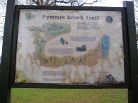
Pymmes Brook Trail Marker
PYMMES BROOK TRAIL
Cockfosters to Picketts Lock
|
|
Pymmes Brook Trail Marker |
I walked the Pymmes Brook Trail on 31st January 2006.The path runs for just under 10 miles across North London from Cockfosters underground station to Picketts Lock on the River Lea.
 |
 |
 |
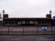
(1) Cockfosters Underground Station |
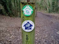
(2) Route markers |
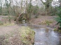
(3) Pymmes Brook |
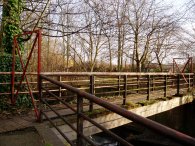
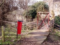
The path crosses the main road outside Cockfosters Underground station, photo1, heads down into Chalk Lane, past the church, and along into Games road, passing a number of nice houses on the way. In Games Road the path leads into the edges of Monken Hadley Common. This first part of the route is shared with the London Loop, photo 2. A short walk through the Common leads to Pymmes Brook itself which is crossed by the little bridge in photo 3.
 |
 |
 |
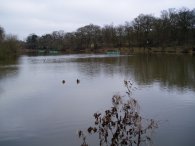
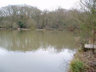
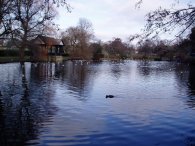
(4) Beech Hill Lake |
(5) Beech Hill Lake |
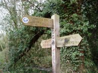
(6) Finger Post, Monken Hadley Common |
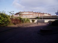
Just off the route of the path is Beech Hill Lake, photos 5 and 6, from which the brook flows. Walking along this stretch reminded me of when I had last been here in the summer walking the London Loop. That day the Piccadily line had only been running as far as Arnos Grove due to the London Bombings from where I had had a very lengthy bus journey home. Now everything was normal and the events of summer seemd a long way off. A wooden finger post, photo 6, marks the point where the Pymmes Brook trail leaves Monken Hadley Common and the route of the London Loop Path.
 |
 |
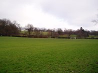 |
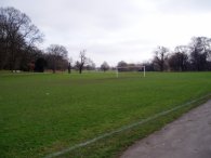
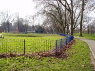
(7) Victoria Recreation Ground |
(8) Oak Hill Park |
(9) Oak Hill Park |
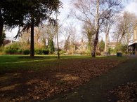
The route of the trail leaves the brook and detours through the Victoria Recreation Ground, photo 7, before a considerable stretch of road walking, first along Crescent Road, then Brookfield Road and finally Cat Hill leads to the appropriatly named Brookside where the route of Pymmes Brook is finally rejoined in Oak Hill Park, photo 8. Photo 9 was also taken in Oak Hill Park looking towards the Oak Hill Theological College although this did not come out in the photo.
 |
 |
 |
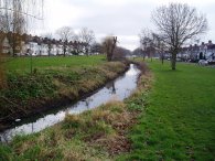
(10) Pymmes Brook, Oak Hill |
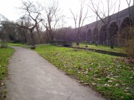
(11) Arnos Park |
(12) Arnos Park |
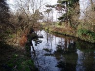
Leaving the park the path passes through a narrow strip of green space alongside the brook flanked by houses on either side, photo 10. This part of the walk reminded me of the end of stage 14 of the London Loop, nr Harold Wood, althought the houses and general atmosphere of the area are somewhat different. Crossing Osdige Lane the path heads into what a sign somewhat optimistically described as the Brunswick Park Waterfall walk, not that I saw any evidence of waterfalls as I passed by. Crossing Waterfall Lane the path passes under the route of the Piccadily line and heads into Arnos Park with the route of the underground line running along a small viaduct alongside, photo 11.
 |
 |
 |
(13) Display Board, Arnos Park |
(14) Broomfield Park |
(15) New River, Palmers Green |
The Pymmes Brook trail is well signposted throughout and in a number of places there were also more detailed information boards although like the one in photo 13, which is in Arnos Park, they were almost all covered in graffitti. From Arnos Park the path passes on into Broomfield Park, photo 14.
As ever the routes of the path is rather organic and once again this had a few variations to the route as shown on the OS map. Through Broomfield Park I took the route of the Pymmes Brook trail as shown on the ordnance survey map, passing through the park to Aldermans Hill, then passing Palmers Green Rail station and turning right into Green Lanes and then left into Oakthorpe Road. On the ground the route of the path as signposted has changed slightly and now leaves Broomfield Park along Broomfield Lane which then runs into Oakthorpe Road. In Oakthorpe Road the path crosses the route of the New River, photo 15 before heading down to meet the North Circular Road. Once again the route of the path as shown on the map compared to the directions signposted on the ground varied. The ordnance survey map shows the route of the path continuing alongside the north circular whereas the path was signposted directly across it and then along an alley whcih crosses the brook before leading up to Princes Avenue. This time I took the way marked route which seemed preferable to following the mapped route besides the North Circular.
 |
 |
 |
(16) Pymmes Brook, Tile Kiln Lane |
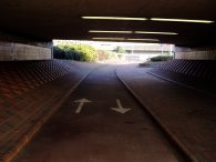
(17) A10 / A406 Underpass |
(18) A10 / A406 Underpass |
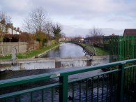
The two routes of the path rejoin in Tile Kiln Lane and the path enters the Tile Kiln open space, a small stretch of scrubland alongside Pymmes Brook bounded by the North Circular Road and the A10. While the Pymmes Brook appears quite peaceful in photo 16 in reality there was the thunder of the traffic going along the North Circular just the other side of the embankment and the A10 immeadiatly behind me as I took the photo. The path passs under the A10 and over the North Circular road, photos 17 and 18 and makes it way along a service road and onto Silver Street.
 |
 |
 |
(19) Millfield Arts Centre grounds |
(20) Bridge, Pymmes Brook Trail |
(21) Bridge, Pymmes Brook Trail |
In Silver Street the route of the path turns into the grounds of the Millfields Arts Centre, photo 19, amongst the forthcoming attractions, Chas n Dave. Following the way marks round the arts centre building the path leads to a small bridge over the Pymmes Brook, photos 20 and 21. This was blocked at both ends by the red metal structures that can be seen in the photo's. I really have no idea what they are there for and I was unsure if they were meant to close the bridge. There was still a Pymmes Brook trail marker attached to a post besides the bridge which can just be made out at the side of photo 21 so the way marks had not been removed and I could see no alternative signage. Eventually I decided to go across the bridge which did not prove too difficult. On one side I climbed over the edge and on the other I was able to squeeze through. I still can't make up my mind whether I was missing something here or not though.
 |
 |
 |
(22) Squirrel, Pymmes Park |
(23) Pymmes Park |
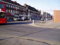
(24) Fore Street, Edmonton |
The path crosses Tanners End Lane and runs between some houses and goes into Pymmes Park. I was eating a a bag of crisps that I had brought from a newsagents just outside the park which attracted the attentions of the local squirrel population which came running up looking for a handout. The last time I had come across squirrels that were so tame was at Centre Parcs where I opened a window to put out an apple core for one and it came running straight in the chalet, and there was me trying to open the window quietly so as not to scare it off. After crossing Pymmes park, photo 23, named along with the brook after William Pymme who had been a local landowner between 1307 and 1327 the trail goes onto to Fore Street and up to the junction with Plevna Road, photo 24, where the path turns off round the back of Edmonton Leisure centre to reach Salmon's Brook.
 |
 |
 |
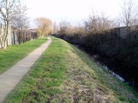
(25) Salmon's Brook, Edmonton |
(26) Salmon's Brook, Edmonton |
(27) Tottenham Park Cemetery |
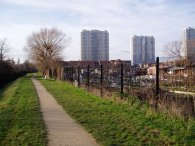
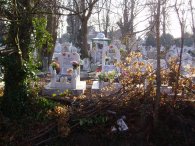
Salmon's Brook, photo 25, passes alongside house and then a stretch of alltoments as the tower blocks of Edmonton slowly recede, photo26. As Salmon's Brook reaches Montague Lane it passes along the side of Tottenham Park Cemetery, photo 27, a small and tightly packed cemetery which I had never spotted before despite the many times I had driven up the road. Most of the graves I could see were quite lavish and had what seemed to me Turkish names on the. A supposition aided by the considerable number of graves that featured the Turkish flag on their headstone.
 |
 |
 |
(28) Horse Sculpture |
(29) Picketts Lock |
(30) Picketts Lock |
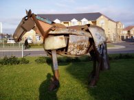
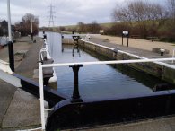
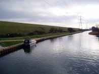
From Salmon's Brook it was a bit of a trod along Monague Road, past the impressive metal sculpture of a horse, photo 28, and on to Picketts Lock Lane for the final stretch of walking to Picketts Lock itself, photo's 29 and 30, where the route of the path joins the Lea Valley Walk
Just before the Picketts Lock centre there was a Pymmes Brook way marker pointing towards the cinema complex. Although signs also continue to the Picketts Lock itself theres no route board at the end of the walk.The area around the lock has recently been landscaped and I'm pretty certain there was a board there once describing the trail which has now been removed so maybe the end has been moved to the cinema and sports complex which is more convenient destination for the local transport links.
Even if you do venture to the lock, which is recommended as it makes a nice end to the walk, you would have to return towards the cinema to get a bus. Unless of course you continue on along the Lea Valley walk!
The Pymmes Brook trail was welll way marked throughout and there was generally a sign of some sort whenever necessary although some of these, particularly in the park sections were quite far apart. The path through Monken Hadley Common was a little muddy but the rest of the walk was along tarmac or compacted gravel / clay and being through London there were numerous options to shorten the walk.
The GPS made the length of the Pymmes Brook trail 9.84 miles long. I however also walked the rest of the way home down the River Lea and through Walthamstow which made a total length of 14.3 miles.
![]() Back to:Walking index page
Back to:Walking index page