(1) Hartington
(2) Fields Nr Hartington
PEAK DISTRICT
Circular from Hartington
|
|
|
(1) Hartington |
(2) Fields Nr Hartington |
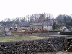
I walked this circular walk from Hartington on Saturday 18th March 2006.
I had had an easy drive up from London earlier in the morning with Paul from work and was in my walking boots and ready to start walking by 11:30. It was a bitterly cold day with a very strong wind which added to the wind chill but regardless of the weather it was great to be out of London and walking in some proper countryside.
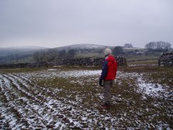
From Hartington Youth Hostel we passed over the main road through the village and took up a road that led past the church in photo 1. Just past a bend in the road we took a path off to the left that heads in a Northerly direction across fields above Bank Top Farm, photo 2.
 |
 |
(3) Fields Nr Hartington |
(4) Fields Nr Hartington |
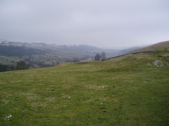
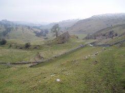
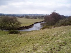
The path leads across fields below Carder Low, along the side of the valley formed by the River Dove.
 |
 |
(5) Fields Nr Hartington |
(6) Sheen Hill |
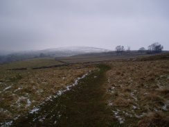
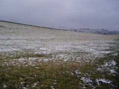
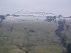
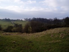
As we climbed gradually higher the dusting of snow on the ground also gradually increased, photo 5. Looking across the valley towards Sheen Hill in photo 6 the snow level can quite clearly be seen. Despite the strong wind and cold temperature it was above freezing point and the snow was melting fast and unlike the previous weekend when I had been out in Hertfordshire and the ground was frozen, here the ground was damp and boggy.
 |
 |
(7) Pilsbury Castle |
(8) Pilsbury Castle |
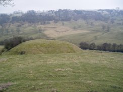
At a junction in the path we turned left on a path that took us downhill, across a road above Pilsbury, and on to the Motte and Bailey's of Pilsbury Castle, photos 7 & 8. Pilsbury Castle was built some time just after the Norman conquest. Although little concrete information seems to be known about it origins or purpose it undoubtly holds a commanding position over the valley of the River Dove.
 |
 |
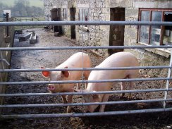
(9) Pigs at Meadow Farm |
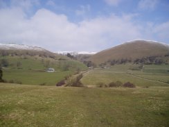
(10) View towards High Wheeldon and Aldery Cliff |
From Pilsbury castle the path continued to head downhill and followed the River Dove to Crowdecote. In Crowdecote we turned right up the road then left onto a smaller road and left once again onto a track that runs past Meadow Farm. Going past one of the farm buildings a couple of pigs came running up to the gate of their pen to have a look at us, photo 9. We continued along the track across fields to a Green Lane which runs across the valley where we turned left to cross over the River Dove at Beggars Bridge to begin the ascent up to Longnor on the other side of the valley.
 |
 |
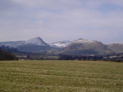
(11) View towards Parkhouse Hill |
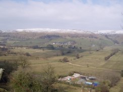
(12) A dusting of snow |
As we climbed the steep track up to Longnor there were good views to the North of Parkhouse Hill, photo 11 and back over the Dove valley that we had just walked across, photo 12.
 |
 |
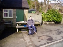
(13) Lunch in Longnor! |
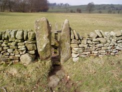
(14) Stone stile |
In Longnor we stopped and ate our sandwiches on a bench outside the Cheshire Cheese pub, photo 13, before taking a path that headed down past a farm yard. At Folds End the path splits into two and we took the lower path that headed in a Southerly direction across a field towards the River Manifold. A feature of this walk was the small stone stiles between the fields. Some of these were very narrow to squeeze through, most also had a little wooden gate on one side, photo 14.
 |
 |
(15) Fields besides the River Manifold |
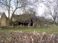
(16) Ruined Farmhouse |
The ground on this stretch was particulalrly boggy and churned up which made our progress rather slow as we headed over the fields alongside the River Manifold, photo 15. The route of the path continued to head in a Southerly direction, sometimes close to the river, at other times further away, for some distance, past the farms at Lower Boothlow and Ridge End and on to the road near Brund Mill. On the way we passed the ruined farmhouse in photo 16.
 |
 |
(17) River Manifold |
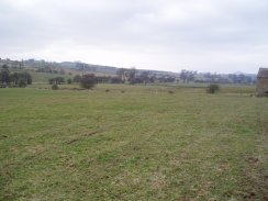
(18) Fields East of Sheen |
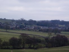
From Brund Mill the path leaves the River Manifold, photo 17. We then followed the road uphill to Brund itself where we took a hedged track that lead off to the left in an Easterly direction towards the village of Sheen. Once Sheen is reached we turned left onto the road and then right again almost immeadiatly down a path which was entered overa small stile tucked away in the corner of a field close to the road. It really is a small stile and at first we complelty walked past this and went down a driveway to a house instead. The path then heads in a South Easterly direction downhill across fields to cross a small stream before starting rise slightly uphill again to where photo 18 was taken, looking back towards Sheen on the skyline..
 |
 |
(19) Hartington |
(20) Footpath sign |
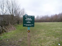
The path then descends down hill back into the Dove valley to a bridge over the River Dove and back into Hartington, photo 19. At the end of the path in Hartington there was an attractive footpath sign, photo 20, that had been erected by the Peak and Northern Footpaths Society. This was one of a number we came across over the three days we had in the Peak District. More details of the work of the Peak and Northern Footpaths Society can be found at their website Peak and Northern Footpaths Society
The GPS made this walk 10.5 miles long. Despite the poor conditions underfoot for much of the walk it was pleasant to be out in the Peak District with the snow capped hills all about.
![]() Back to:Walking index page
Back to:Walking index page