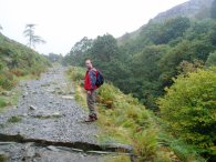
(1) Church Beck, Coniston
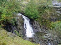
(2) Waterfall, Church Beck
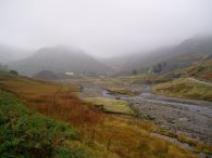
(3) Coniston Copper Mines
OLD MAN OF CONISTON
I went up the Old Man of Coniston on 7th October 2005. Unfortunatly the Lakes were covered by a layer of thick cloud which remained all day. While not particularly rainy the weather meant that we had almost no views at all while out walking, in fact often we could only see a few yards ahead. This also caused a few navigational problems on what should have been a very straight forward walk.
|
|
|
|
(1) Church Beck, Coniston |
(2) Waterfall, Church Beck |
(3) Coniston Copper Mines |
I had been hoping to stay at one of the Coniston Youth Hostels but these were either full or closed so we had ended up spending the previous night over in Ambleside so the day started with a short drive over to Coniston. I had been walking in the Lake District many times in the past and had never before experienced such difficulty finding somewhere to stay in a Youth Hostel which were almost all full up, even though early October can't exactly be peak season. Despite all my walking in the Lake District this was the first time I had been over to the Coniston area.
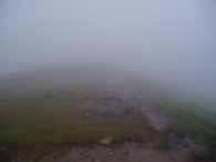
We were able to park off road just outside the centre of the village, (the car park in the centre wanted something like £7 for a days parking), and from there it was just a short walk through the village to the start of the track up the mountain alongside Church Beck, photos 1 and 2. This soon led up towards the old miners cottages and mine workings by Levers Water Beck, photo 3, although the path starts heading uphill to the left sometime before these are reached.
 |
 |
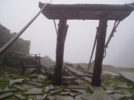 |
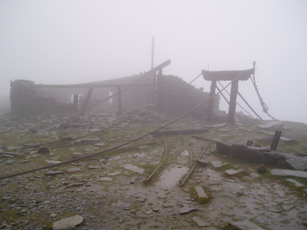
(4) Mine workings, Coniston |
(6) Mine workings, Coniston |
As soon as we left the valley floor we ascended into the clouds that were to accompnay us all day and all views disappeared. It was a relatively steep climb up and on the way we encountered another area of abandoned mine workings higher up the mountain, photos 4 to 6. The area looked quite eerie in the mist. Photo 5 is one of my favourites of the year and clicking on the text underneath it links to a larger version.
 |
 |
 |
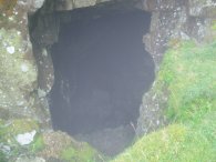
(7) Mine cave |
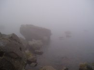
(8) Low Water Tarn |
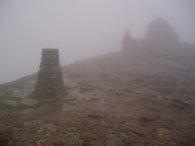
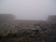
(9) Old Man of Coniston summit |
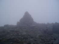
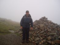
Wandering around the mine workings we came across the large cave seen in photo 7 before continuing up the mountain. By all accounts Low Water Tarn, photo 8, is one of the most beautiful in the Lakes however it was completly hidden in the mists. After a short rest it took about a further 30 minutes to reach the summit of the Old Man of Coniston at 803m in height. Photo 9 shows Paul, the summit cairn and trig point.
 |
 |
 |
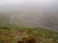
(10) "View" from Coniston |
(11) Swirl How summit cairn |
(12) Cairn, Swirl Hause |
Photo 10 was taken looking along the ridge towards Swirl How. The entire ridge walk between the Old Man of Coniston and Swirl How was completly covered in dense cloud and we could only see a few yards in any direction and could have been walking absolutly anywhere. At both Great How Crags and Swirl How we went slightly off route for a while. A combination of compass and GPS soon put us right on each occassion but meant retracing our steps. Photo 11 shows the summit cairn of Swirl How at a height of 802m.
From Swirl How we were going to walk across the Prison Band to Wetherlam however because of the poor weather conditions we decided to call it a day and started heading back down to Coniston once we reached Swirl Hause. Photo 12 is of me by the cairn at Swirl Hause.
 |
 |
 |
(13) Levers Water Resevoir |
(14) Levers Water Resevoir |
(15) Coniston Copper Mines |
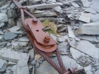
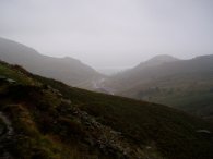
From Swirl Hause it was a relatively straight forward walk down to the Coniston fells and on down into the village itself. On the way we passed the Levers Water resevoir, photo's 13 and 14. The cloud base was marginally higher than in the morning and as we descended we got the occasional view of the remains of the mine workings in the valley below, photos 15 and 16, including an odd concrete fronted structure that still seemed to be in use.
 |
 |
 |
(16) View towards Coniston |
(17) Old mine carts |
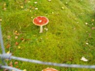
(18) Toadstool |
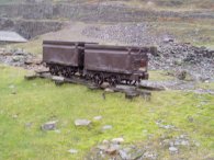
At the bottom of the valley by the old mine cottages there was what seemed to be a small museum. This was closed but it had a couple of old mine carts, photo 17, on display outside. We also passed a couple of large bright red toadstools growing in some moss, photo 18. From there we followed the left hand bank of Church Beck back into Coniston by which time my feet were starting to feel quite tired. After a quick change of shoes at the car we wandered over to the Black Bull, a pub with a micro brewery attached, and had a very refreshing pint of their Bluebird Bitter. I don't normally drink bitter but this was one of the most enjoyable pints I can remember having and would have gladly stayed for several more had I not been driving.
The GPS made this walk 8.5 miles long.
![]() Back to:Walking index page
Back to:Walking index page