(1) Downgate Pub, Hungerford
(2) Hungerford Port Down
(3) View towards the Downs
Other Links >>> |
|
HUNGERFORD CIRCULAR
I did this walk on Friday 27th April 2012. Over the weekend I was walking another section of the Kennet and Avon canal with Val, Chris and Sara and I set off early to fit an extra walk in on the Friday. I had a good journey up from Walthamstow to Hungerford in terms of traffic, although my car appeared to have problems with the bearings in the gear box and was making a rather bad sound by the time I arrived at the hotel where we were staying. Due to this I didn't walk on the Sunday as originally planned in order to get home in good time if the car broke down completely, which fortunately it didn't although it is now currently off the road.
|
|
|
|
(1) Downgate Pub, Hungerford |
(2) Hungerford Port Down |
(3) View towards the Downs |
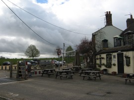
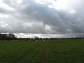
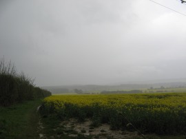
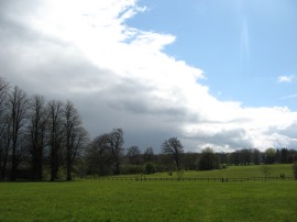
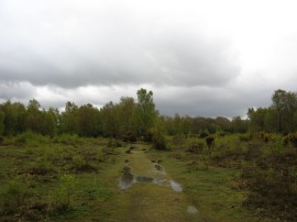
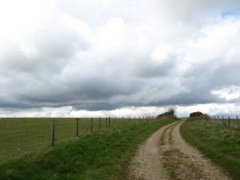
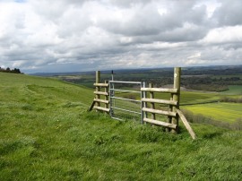
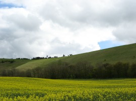
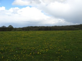
From the car park of the Three Swans hotel in the centre of Hungerford I headed a short distance along Station Road before turning to the left along Park Street which I followed up to Hungerford Port Down. Here I headed through the Down gate by the Downgate Pub, photo 1, and joined a footpath that headed diagonally to the right across the common lands of the down. The path went by a large herd of cows, photo 2, most of which were sitting down, before crossing a road and continuing diagonally across the grass to the far corner of the down. Ahead of me I could see the Berkshire Downs rapidly disappearing under a downpour and I stopped to put on my waterproof coat, wrap up my camera and put the waterproof cover on the rucksack. Leaving the common the path then heads alongside the edge of a couple of long fields which were planted oil seed rape which was just about in full bloom although the views ahead were now obscured by the heavy rain I was now walking through, photo 3. Luckily though this shower did not last for too long and after about 10 or 15 minutes the rain had subsided and blue skies where once again appearing over the downs.
 |
 |
 |
(4) The flooded path |
(5) The clearing sky |
(6) A rather isolated footpath sign |
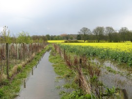
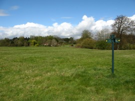
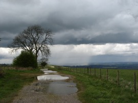
The footpath then continued ahead along a fenced lined section of path between the fields where I encountered a large area of flooding which at one point came over the top of my boot giving me one wet foot, photo 4. The flooding was caused by a blocked culvert under the path which then diverted the excess water along the path. At this point I was wondering what was going to happen next on this trip, my car was ill, I had got caught in torrential rain almost as soon as I started out and now my foot where wet however from this point the day did improve considerably all round. I then headed across the middle of another waterlogged field up to Inglewood Road where I headed a few yards down the road to the left. Just before the first house on the right I then joined another footpath on the right that winds its was for some distance between and across a variety of paddocks. As I was walking there was a very clear demarcation on the sky between the rain clouds and clear sky, photo 5. The route follows a reasonably straight course through the paddcocks, photo 6, crossing a couple of driveways until reaching a third driveway by a fine brick house the footpath continues ahead through a small patch of woodland. By now I was walking in full sunshine, the air feeling warm and filled with the sound of birdsong.
 |
 |
 |
(7) Muntjac deer |
(8) The giant walking boot |
(9) Inkpen Common |
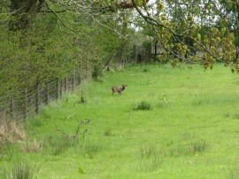
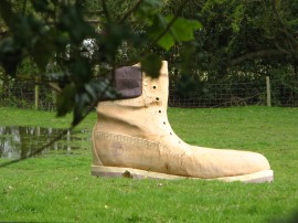
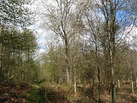
The route then continues through three more paddocks, where I spotted a Muntjac deer, photo 7, before heading slightly down hill to cross across a small boggy area of ground before heading up across the middle of the next paddock to reach a gate leading into a driveway. Heading through the gate I headed to the left along the hedge lined driveway which I followed down to a road junction where my route immediately joined another footpath that heads of to the right. This path then heads gently uphill towards a line of houses on top of a ridge where my route then continued ahead over Kintbury Road and alongside the edge of another field. Reaching a house the route bears first left and then right along a short stretch of path that follows a tall wooden fence round to reach a track besides some trees. Here I headed to the left to cross a bridge over a small stream before continuing along the track which soon becomes a driveway running past houses which is followed up to a road. In one of the garden was a giant replica of a Timberland walking boot, photo 8, which seemed a rather unusual item to have lying around. Crossing the Great Common Road I then continued ahead to join a track running across Inkpen Common. As I was approaching the common it once again stared raining although nowhere near as heavily as earlier on. I followed a broad, and rather waterlogged path, photo 9, over to the far side of the common where I headed to my right along another similar path, following a line of electricity pylons.
 |
 |
 |
(10) Cottage by Prossers Farm |
(11) Heading up towards the downs |
(12) Heading up the downs |
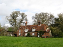
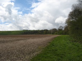
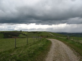
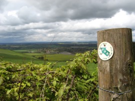
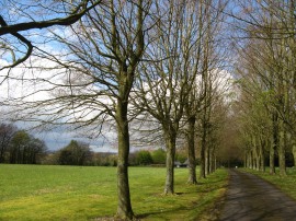
Crossing over the common I deviated slightly from my intended route following a path that headed off to the right back to Great Common Road. Here I turned to the left up to the Crown and Garter pub before joining a byway on the left that soon had me back on my original planned route. This byway leads to a surfaced road which runs by an attractive cottage, photo 10, with a very large old oak tree besides the road. Reaching the end of this lane I then headed to the right along another minor road. Where this road bends sharp right I joined the second footpath on the left which begins heading gently uphill towards the downs, the path running along the edge of a large open field, photo 11. Most of the walk up to this point had been quite sheltered but heading alongside the edge of this field I was exposed to a fairly stiff breeze blowing over the downs. Reaching the end of the field the route heads through a small patch of scrubby woodland up to a road. Continuing ahead over the road another footpath leads through some more trees up to join the grass covered flanks of the downs, photo 12. I stopped for a short lunch break on a stile before making my way up to the top of the hill.
 |
 |
 |
(13) Walbury Hill |
(14) Rain in the distance |
(15) View down to Hungerford |
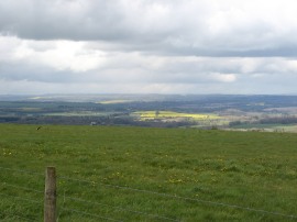
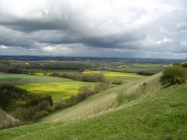
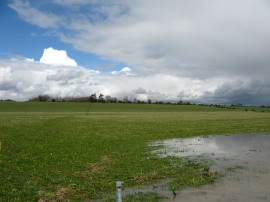
Here I joined a byway running along the top of the ridge where I headed to the right, now following the route of the Wayfarers Way which I had walked with Anne back in December 2009. Needless to say this had me wondering about Anne and how she is getting on and also remembering Zuka running about after the pheasants which seemed to be everywhere the last time we walked this stretch of path. As I followed the track across the top of Walbury Hill, photo 13, which is the highest point in Berkshire, I could see a heavy band of rain running off to the right over the paths I had recently walked, photo 14. I could also make out the two large fields of oilseed rape I had walked alongside through a similar shower at the start of the walk, photo 15.
 |
 |
 |
(16) Path along the Downs |
(17) Test Way signpost |
(18) Coombe Gibbet |
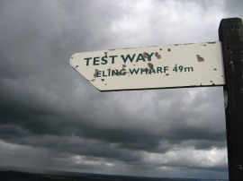
I continued on along the broad byway, photo 16, as it makes its way over to a road and the small car park where we had parked for the start of the walk along the Wayfarers Way before crossing the road and continuing on along the byway where I joined up with the start of the Test Way, photo 17. This stretch of path soon leads up to Coombe Gibbet on Gallows Down, photo 18. The Gibbet is built on top of a long barrow known as the Inkpen long barrow and was erected in 1676 for the purpose of gibbeting the bodies of George Broomham and Dorothy Newman although the current structure is a replica.
 |
 |
 |
(19) Path along the Downs |
(20) Now on the Mid Wilts Way |
(21) The islolated gate |
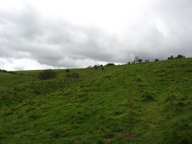
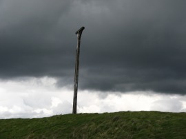
The byway which starts of quite broad and well surfaced gradually became narrower and rather muddy, rutted and waterlogged, photo 19, which considerably slowed down my walking pace as I struggled to keep my footing on the slippery ground. Continuing on along the top of the ridge I crossed over into Wiltshire where I linked up with the route of the Mid Wilts Way, photo 20. This heads to the right through a gate, joining a vague footpath that heads across an area of grassland before heading through an isolated gate, with no fence either side, photo 21, which at least does give a good indication of the route off the downs.
 |
 |
 |
(22) Berkshire Downs nr Ham |
(23) View back to the Downs |
(24) Ham, Berkshire |
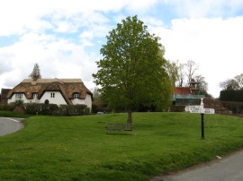
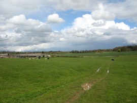
This then leads to a narrow, grass covered path that begins heading steeply down the side of the hill, photo 22. This path was lined with lots of Cowslips growing in the grass. Reaching the bottom of the hill the I joined a track running along the top edge of a field. At the end of the field the path heads to the right, gently downhill along the field edge. Here the route soon bears to the left through the hedge and joins a path running diagonally across the next field which was in a slightly different place to the location as marked on the map. This path is followed for some distance down to a join a broad farm track at the end of the field. Before joining this path though I headed down the side of the field in the hope of avoiding the thick clinging mud on the path through the field but eventually had to join the official route of the path. At the farm track I then headed to left following the track to a road. Here I then headed to the right, down towards the village of Ham, photo 24.
 |
 |
 |
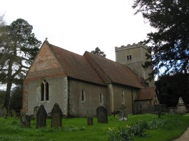
(25) All Saints' Church, Ham |
(26) The large garden pond |
(27) Heading up towards Mount Prosperous |
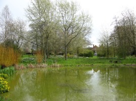
I followed the road down into Ham, with its attractive thatched cottages before joining a minor road on the left which heads up to what a sign described as an Ancient Church, photo 25, although from the outside much of the building looked pretty modern, maybe I didn't see it from its best side. Back tracking slightly I then joined a footpath on the right that headed across a small meadow being grazed by sheep. Reaching the end of the meadow I turned to the right along a track which soon leads up to a road where I continued ahead into the field opposite. I went a bit off course here, initially following a prominent track that wasn't the footpath, which itself was slight to the left of how it is marked on my map. However I soon figured out the correct route, crossing a stile and heading round the edge of a large garden and pond, photo 26, before crossing back out into the fields and heading to the left along a farm track that leads gently downhill to a small band of trees. Here I crossed a small stream and almost immediately joined a footpath that heads diagonally to the right across the next two large open fields, photo 27, the path heading gently uphill to a line of trees on the horizon. (Having now looked at an aerial photo of the area I think the prominent path may be an alternative footpath to the official route to take walkers round the outside of the garden rather than along the course as marked on the map which has the path running through the garden. I did stop and speak briefly to a lady while passing through the garden though who did not question why I was there, jusy asked if I knew where I was going. This reminds me she also had a rather yappy dog who jumped up at me and she said "well at least your not wearing your best clothes", or words to that effect however my Paramo trousers are probably the most expensive pair of trousers I own!).
 |
 |
 |
(28) The tree lined driveway |
(29) A fine crop of Dandelions |
(30) Anvilles Copse |
Anyway reaching the top of the hill, marked as Mount Prosperous on the map the route crosses over a track and heads through a black metal gate to join a footpath running down the side of tree lined driveway, photo 28. At the end of the driveway I continued ahead along a permissive footpath that bends round to the right, running along the edge of a field with a fine house away to the right, the permissive footpath in place to take walkers away from the statutory path that runs much closer to the house. This path soon heads round to the left to run through a narrow strip of woodland. This leads to a larger area of woodland where I joined a footpath on the right that headed out along the edge of a large open field with a large number of dandelions in flower, photo 29. Just past the house I had crossed back into Berkshire, although the county border was not visible in anyway apart from the change of name on the footpath way marks. A short distance along the field the route crosses over into the next field, before continuing ahead on the other side of the fence. In the middle of this field was a small wooden obelisk although there was no description of what it was for. A short distance further on I reached a crossing path where I headed to the left which immediately took me back into the field I had recently left. This path is marked on the map as part of one of the Berkshire Circular Routes and headed out over the field of dandelions towards an area of woodland. Leaving the field the route headed over a stile, which made another useful dry seat for a snack stop, into the woods, photo 30.
 |
 |
 |
(31) Field by Anvilles Farm |
(32) Path from Anvilles Farm |
(33) Hungerford Station |
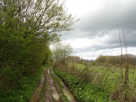
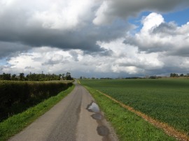
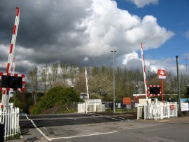
This was a particularly damp and muddy section of path and my boots which had been quite clean up to this point were soon covered in mud. Leaving the trees I then headed to the right along a farm track which ran through a field being grazed by some cattle, photo 31, when I went through. At the end of the field I crossed over the gate and headed to the left along a farm track that heads past a large barn to join a footpath running along a paved section of track, photo 32 that continues straight ahead between fields towards Hungerford. Eventually this long driveway reached Inkpen Road where I continued ahead as I made my way back to Hungerford Port Down. This road was quite quiet although there were a couple of sharp bends in it and not much of a verge to walk on so I did need to be very aware of any traffic coming along the road. Just past a T junction on the left I was able to join a path running parallel with the road along the top edge of the common land. I followed this path beside the road along to a tall hedge by the Inkpen Gate where I headed to the left along a path that runs across the middle of the down back to the Downgate Pub. I then retraced my steps back to Station Road, continuing on past the station, photo 33, where the level crossing gates came down just after I finished takign my photo and proceeded to stay shut for ages; I subsequently found out there was trouble on the line. In the end I wandered down to the station and used the bridge between the platforms to cross over the line.
 |
 |
(34) Kennet and Avon Canal, Hungerford |
(35) Hungerford Bridge |
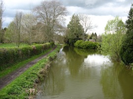
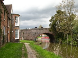
From the station I continued on the short distance down to the Kennet and Avon Canal, photo 34, before heading to my left up to Hungerford Bridge, photo 35. I then headed up the High Street back to the hotel having walked a total distance of 15.3 miles.
Val, Chris and Sara were sitting in the lounge having a cup of tea when I arrived which made a pleasant end to the walk. This was a great area to go walking in with a large number of rights of way to follow. I also enjoyed the opportunity to be out walking my own route rather than following a pre-determined path. I know I do this on the return legs of my circular walks along the recreational trails but it was pleasant to have complete freedom to go where I wanted with no real pre planned route. It had been nice to climb up to the downs and link up with my walk along the wayfarers way and walk along the ridge with the far reaching views over the area I would be walking tomorrow along the Kennet and Avon Canal. Probably the most enjoyable walk of the year so far.
As usual I have uploaded the route of the walk which can be accessed here: Hungerford Circular Walk route.
If you would like to comment on this walk you can do so here:
![]() Back to:Walk index page
Back to:Walk index page
| ©2012 Bertuchi.co.uk. Please contact me using the email button on the right if you have any questions or comments regarding the site. Any feedback and additional information about places of interest on the walks is always welcomed. All rights reserved. Please contact me if you want to use any of the images or information from the site. ENJOY YOUR WALKING |
|