Dollis Valley Greenwalk
Other Links >>> |
|
DOLLIS VALLEY GREENWALK
Mill Hill to Hampstead
|
|
Dollis Valley Greenwalk |
I did this walk on Sunday 20th May 2012. I had originally been intending to do this walk later in the year but I was still car less and, with a late start, needed a relatively local walk to do. The Dollis Valley Greenwalk which runs for just over 10 miles between the Moat Mount Open Space in Mill Hill over to the Hampstead Heath Extension fitted the bill. Despite being near the end of May it was a dull, grey day with a fairly steady breeze and I wore two T shirts and a fleece all day.
 |
 |
 |
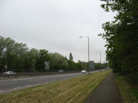
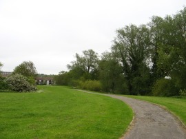
(1) A1 Barnet Way |
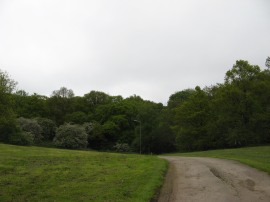
(2) Moat Mount Open Space |
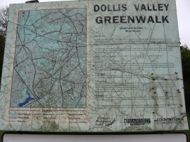
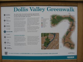
(3) Greenwalk Information Board |
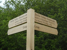
From home I headed over to Edgware station before taking the 292 bus up to the A1 Barnet Way, photo 1. From the bus stop it was then about a half mile walk up to the Moat Mount Open Space, photo 2, and the start of the walk. The way marking on the route had recently been upgraded when I walked the path and all the signage was in pristine condition; although doubtless they won't stay that way for long. As well as the new way marking there was also an old information board by the car park at the start of the walk, photo 3. This rather generously gives the mileage for the route as 14 miles which is considerably greater than the actual length of the Greenwalk. Further on along the walk I passed a couple of new information boards that stated the more accurate 10 mile distance of the route.
 |
 |
 |
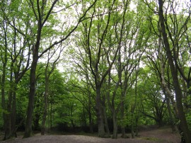
(4) Nut Wood |
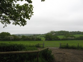
(5) Moat Mount Open Space |
(6) Totteridge Fields Nature Reserve |
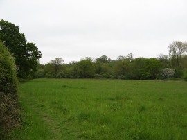
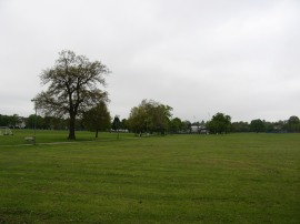
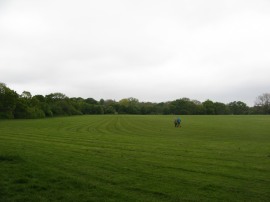
From the entrance to Moat Mount the path heads into the trees of Nut Wood, photo 4, joining a path on the left that heads gently up through the trees before turning to the right along a footpath that runs in a narrow area of trees with fields on either side. This is followed up to a junction of paths where there were good views over the surrounding countryside, photo 5, which looked remarkably rural given the location. Here the route heads to the left before turning to the right along an enclosed field edge path which is followed up to Hendon Wood Lane. Here the route heads to the right, following the road as it bends round to the right. Just past the entrance to the Old Cholmeleians sports ground the Dollis Valley Greenwalk joins a footpath on the left that heads alongside the edge of the Totteridge Fields Nature Reserve, photo 6.
 |
 |
 |
(7) Field on the way to Barnet |
(8) One of the new walk signposts |
(9) Approaching Barnet |
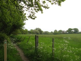
The path heads down alongside a couple of the meadows before heading through a gap in the hedge and cutting across the edge of a large cricket pitch to once again go through a small gap in the hedge. Here the route joins an enclosed footpath running between fields, photo 7. At one point this got quite narrow and for a short stretch was very muddy which I crossed very carefully as I did not want to spent the rest of the day wandering around the more built up areas with boots and trousers covered in mud. This path is followed round to the right to join a path running along the bottom edge of a number of fields with the infant Dollis Brook running behind a thick hedge on the left. Eventually a wooden signpost, photo 8, directs the path to the left over a small concrete bridge across the brook, the route then heading to the right along the opposite bank of the brook. The path is now approaching the outskirts of Barnet and the route is soon running along a tarmac footpath surrounded by mown grass with housing away to the left of the path, photo 9.
 |
 |
 |
(10) Barnet Playing Fields |
(11) The meandering Dollis Brook |
(12) Brook Farm Open space |
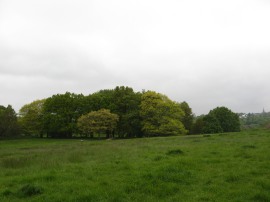
This path heads up to Barnet Lane which the route heads across before passing through a car park by a table tennis centre and out into Barnet Playing Fields, photo 10. Besides the road here was another of the old Greenwalk Information Boards, numbered 2. The route heads along the bottom of the playing fields as the London Loop, which had been sharing the path since the start of the walk at Moat Mount, heads off up to the left towards the Barnet Football ground which is located at the top end of the playing fields. Reaching the far side of the playing fields the Greenwalk head round to the right, following the Dollis Brook, photo 11, as it runs between Totteridge and Whetstone through the Brook Farm Open space, photo 12. For much of this length of the walk there were two parallel paths, one a cycle route and one a footpath. Reaching the end of the open space the route crosses Totteridge Lane from where it is just a 70 yard walk up to the Totteridge and Whetstone Tube station on the Northern Line. This had been running close to the path along the edge of the Brook Farm Open space for quite some time.
 |
 |
 |
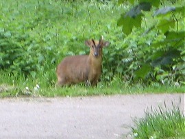
(13) Male Muntjac Deer |
(14) Greenwalk Information Board |
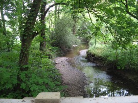
(15) Dollis Brook |
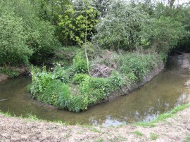
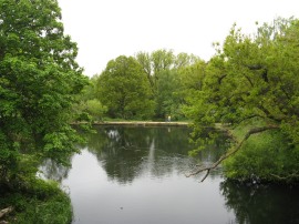
Besides the road there was a new information board for the walk which showed the walk split into seven sub stages. Once over the road the Greenwalk continues ahead through Whetstone Stray, another stretch of undeveloped land running alongside the Dollis Brook. The path meanders its way alongside the river and as I was approaching Laurel Way I was surprised to see a Muntjac Deer standing on the path, photo 13. This was quite brave and I was able to get quite close before it eventually ran off. Crossing over the road the path continues ahead along the short distance up to Tillingham Way, the path running alongside a playing field where a Sunday football match was taking place. Reaching Tillingham Way the route briefly splits into two, heading either right or left along the road and I chose the right had branch, as this was how the path was marked on my map. This leads up to Southover where I headed to the left, past houses that almost all seemed to have a Mercedes of some type parked outside them. The road crosses a bridge over a tributary of the brook and the Greenwalk heads to the left to rejoin the parkland running alongside the river. This stretch of path is followed up to Argyle Road where the Greenwalk enters the Riverside Walk Open Space. At the entrance to the park there was another of the new walk information boards, photo 14, although this was the last one that I saw on the walk. Perhaps the remaining three as detailed on the board are still to be installed. The path threads its way alongside a play area and crosses Fursby Road before heading through a narrower stretch of trees with the path running along an embankment above the brook by Oakdene Park. The route crosses over to the opposite bank before soon crossing back again over a newly renovated bridge from where there was a reasonably decent views down the brook, photo 15, which for most of its length remains stubbornly obscured from view.
 |
 |
 |
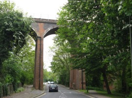
(16) Dollis Brook Viaduct |
(17) Hendon Lane Road Bridge and Weir |
(18) A1 Great North Way Bridge Bridge |
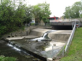
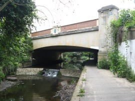
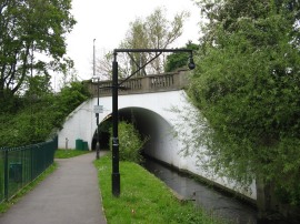
Eventually the path reaches Dollis Road where the route continues ahead, passing under the tall brick built Dollis Brook Viaduct, photo 16, which carries the Northern Line spur up to Mill Hill East Station. The viaduct is nearly 60 feet high and is the highest point on the London Underground above ground level. Shortly after the road starts bending round to the right the Greenwalk joins a path running through the Windsor Open Space with the amount of open space besides the brook growing ever narrower as the path makes its way in towards the centre of London. The route crosses Waverley Grove before taking a narrow underpass under the Hendon Lane, photo 17, where the brook flows down over a small weir. Only a few yards further on the Greenwalk then heads under the A1 Great North Way Bridge, photo 18.
 |
 |
 |
(19) Path under the North Circular |
(20) Henleys Corner |
(21) Path leading to Big Wood |
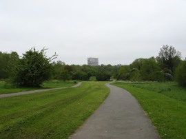
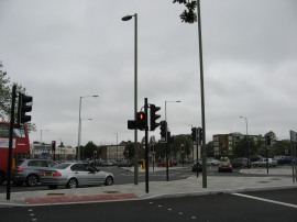
Once under this bridge, a section of tree lined path carries the route round to a small play area at the point where the Dollis Brook joins Mutton Brook to form the River Brent. Here the Greenway joins a path following Mutton Brook under the North Circular Road, photo 19, linking up briefly with the route of the Capital Ring. The path then continues ahead with an area of trees to the right and open ground between the path and road to the left, the sound of the nearby traffic being rather intrusive. This path is followed up to Henleys Corner, photo 21, where the route crosses over the Finchley Road I made a slight detour to a nearby shop for a quick snack. Back on the path the route then takes a small bridge over Mutton Brook and follows the Brookside Walk round to briefly join Addison Way. A short distance down the road the Greenwalk takes a footpath on the right that heads up into Little Wood. This small patch of woodland used to belong to the Bishop of London until 1933 and was declared a local nature reserve in 1999. Leaving the trees the path then heads along Denman Drive before continuing ahead along a footpath, photo 21, into Big Wood.
 |
 |
 |
(22) Housing on Big Wood Road |
(23) St Jude's Church, Hampstead Garden Suburb |
(24) The end of the walk |
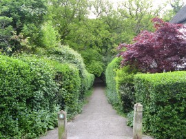
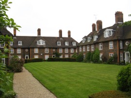
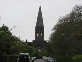
Passing through Big Wood the route continues straight ahead along Big Wood Road and on into Meadway Close. On Big Wood Road where a number of housing blocks built as part of the Hampstead Garden Suburb development in the early 20th century, photo 22. There were also views up to St Jude's Church, designed by Edwin Landseer Lutyens, with its 178ft tall spire rising above the surrounding housing, photo 23. At the end of Meadway Close the Greenwalk heads through a short stretch of footpath running between houses which leads out onto the Hampstead Heath Extension, photo 24. This marks the end point of the Dollis Valley Greenwalk although there were no signs or notice boards to indicate this; perhaps they will be installed later. Reaching this point the GPS said I had walked 10.4 miles from the start of the walk at Moat Mount Open Space.
 |
 |
 |
(25) Hampstead Heath Extension |
(26) Sandy Heath, Hampstead |
(27) Viaduct Pond |
I then set about making my way down to Gospel Oak station, some 3 miles away across Hampstead Heath, for the train back to Walthamstow. First I headed across a number of large open grass areas on the Hampstead Heath Extension, photo 25, before joining a tree lined path that runs besides some small ponds that heads up to Wildwood Road. Crossing the road I continued ahead through the trees of Sandy Heath, photo 26, heading slightly further to the right than I had intended too, up to Spaniards Lane. Crossing the road I then joined a broad path that made its way downhill across the heath. Not long after this path joining I spotted a crow harassing a rabbit although eventually the rabbit leapt on the crow and it gave up which was one of the strangest things I have seen while out walking in London.
 |
 |
(28) Parliament Hill |
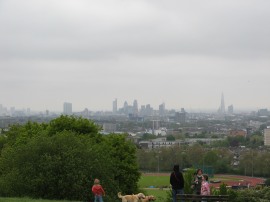
(29) View from Parliament Hill |
A little further on the path crosses a bridge over viaduct pond, pond 27 and continues on downhill before I joined another of the many paths that cross the heath which headed up towards Parliament Hill, photo 28. From the top of the hill there were far reaching, if rather hazy, views over the ever changing London skyline, now with the Shard adding an extra point of interest. From Parliament Hill I then headed more steeply down to the Hampstead Lido where I headed along Gordon House Road for the short walk up to Gospel Oak Station.
Reaching the station I had walked a total distance of 13.9 miles. This had been a better walk than I was expecting and I was glad I had not waited until winter to do it, even if the weather did have a rather wintery feel to it. The start of he walk was through proper countryside and the Dollis Brook provided a green ribbon to walk through for most of the remainder of the path. The only minor problem was I tweaked my right knee running for the train and this continued to cause me a bit of discomfort for time when walking the coast to coast path the following week.
As usual I have uploaded the route of the Dollis Valley Greenwalk which can be accessed here: route.
If you would like to comment on this walk you can do so here:
![]() Back to:Walk index page
Back to:Walk index page
| ©2012 Bertuchi.co.uk. Please contact me using the email button on the right if you have any questions or comments regarding the site. Any feedback and additional information about places of interest on the walks is always welcomed. All rights reserved. Please contact me if you want to use any of the images or information from the site. ENJOY YOUR WALKING |
|