Chelmsford Centenary Walk
Other Links >>> |
|
CHELMSFORD CENENARY WALK
A circular walk from Galleywood
|
|
Chelmsford Centenary Walk |
I did this walk on Tuesday 31st July 2012. As usual I drove over from Walthamstow and parked up in a car park at Galleywood Common which is on the route of the Centenary Circle. It was a grey and fairly cool drizzly morning although from the weather forecast I was hopeful that the weather was going to brighten up later. I was using a fairly old version of the Ordnance Survey Explorer map for the area and in a couple of places, including that from my start point, the route of the Centenary Circle has been amended slightly and this walk description is based on the route as shown on my map rather than the most up to date course.
 |
 |
 |
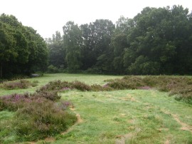
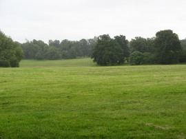
(1) Galleywood Common |
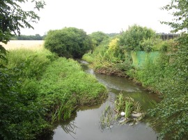
(2) Path besides Galleywood Brook |
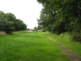
(3) Path nr Baddow Park |
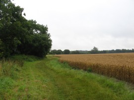
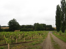
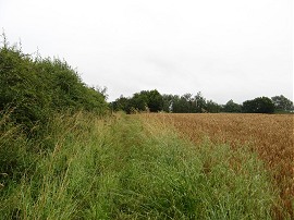
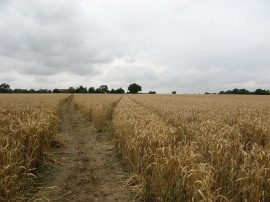
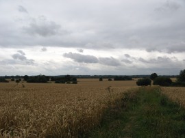
From my parking spot I headed down a surfaced path running alongside Galleywood Common, photo 1, which led down to Stock Road. Crossing the road I continued ahead along Pond's Road, heading gently downhill between the houses of Galleywood before the route briefly bears left into Lower Green. I then joined a footpath on the right that heads out into a paddock and then across some fields. Reaching a hedge the route heads to the left, running alongside the edge of a large open field planted with a crop of almost ripe Barley, photo 2. This spot also marked the point where the original route of the Centenary Circle and the revised route, which had deviated at my parking spot, reunited and it was not much further down this stretch of path till I saw my first way marker for the walk. The path then continues along the edge of the field with the tiny Galleywood Brook running in the hedge to the left. The path passes through a narrow band of trees and a little further on skirts round the edge of a slightly larger area of wood that juts out into the field before following a farm track that runs between two fields up to the buildings at Baddow Park. Here the route heads to the left along another track with a small vineyard to the left of the path, photo 3.
 |
 |
 |
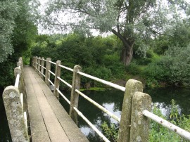
(4) Path heading down from Vicarage Lane |
(5) Tall damp grass lining the path |
(6) Geese at Mascalls Farm |
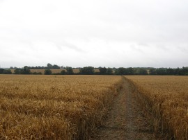
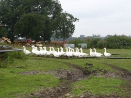
This track is followed down to Brook Lane where the route heads briefly to the right before heading to the left down Vicarage Lane. Here the Centenary Circle soon joins a footpath on the right which crosses the middle of a large field, photo 4, where ahead of me I saw a hare run down the path, the first one I had seen for quite some time. Reaching the end of this field the route crosses a wooden footbridge over a small brook before heading up alongside the edge of the next couple of fields. I had put my waterproof over trousers on at the start of the walk although the weather was a little bit warm to be wearing over trousers and I was starting to feel rather hot and sticky at this point however there was a lot of tall damp greenery overhanging the path, photo 5, not helped by me going slightly off course, and I would have been completely soaked without them. Reaching West Hanningfield Road the route heads to the left before joining a footpath on the right that runs through the farmyard of Mascalls Farm where there were a large number of cows in pens on either side of the path. The path continues on into a field by a pond, where there was a large flock of white geese, photo 6, before heading to the left to join a footpath that runs past another pond.
 |
 |
 |
(7) Maltings Road, Great Baddow |
(8) St. Andrew's Church, Sandon |
(9) Bridge over the River Chelmer |
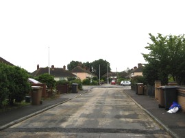
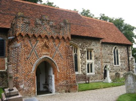
Leaving this area the footpath heads across the middle of another large field, heads over a brook, and across another couple of fields back up to West Hanningfield Road on the outskirts of Great Baddow. The route heads to the right before joining a footpath on the left which winds it way through a housing estate to Maltings Road, photo 7, then continues on to join another footpath that heads between houses to reach Church Street. Yet again the route heads briefly to the right along the road before joining a path on the right called The Bringey which is followed up to a school. Here the route heads right along a path that runs besides an area of open space and under the A1114 before continuing on to reach Molrams Lane. There now follows a stretch of road walking as the route heads down Woodhill Road to the village of Sandon, passing by the St. Andrew's Church, photo 8. I stopped to take of my waterproof over trousers at this point, I was getting to warm for comfort, and found that my legs were pretty wet anyway although my trousers did soon dry off. Just past the church the Centenary Circle continues on down Brick Kiln Road which heads up to the rather busy A1060 Maldon Road. Here the route heads to the left for a few yards before joining a footpath on the right which heads diagonally across a field to join Sandford Mill Lane. Here I headed to the right, following the lane gently downhill past some attractive cottages to reach a narrow bridge over the River Chelmer, photo 9.
 |
 |
 |
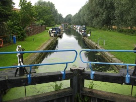
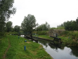
(10) Sandford Mill Lock |
(11) Chelmer and Blackwater Navigation |
(12) Chelmer and Blackwater Navigation |
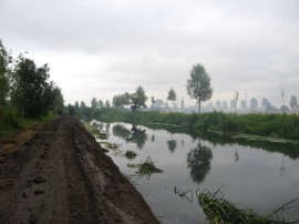
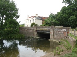
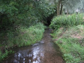
Over the river the route continues ahead before turning to the right along Brook End Road South which is followed as it curves round to the left to reach a bridge across the Chelmer and Blackwater Navigation by the Sandford Mill Lock, photo 10. Here the route heads to the right along the towpath besides the river bank. This should have been a really pleasant stretch of the walk however shortly after the river had passed under the rather noisy A12 I reached an area where there were extensive forestry works taking place along the bank of the river. These had created a rather muddy, desolate and in places smoky environment to walk through, photo 11. Eventually the section of forestry works ended and the path did continue along a more pleasant section of river bank, photo 12, although the busy A12 was never far away.
 |
 |
 |
(13) Cuton Lock |
(14) The A130 Colchester Road |
(15) Road by Braganza Way |
Shortly after passing the Cuton Lock, photo 13, the Centenary Circle leaves the towpath and joins a footpath on the left. This heads along the edge of a field and through an underpass back under the A12 before joining a footpath running along the edge of an area of comparatively new housing. This stretch of path is followed up to a footpath on the right which the route follows through a band of trees, with industrial units hidden on either side of path which leads up to the very busy A130 Colchester Road, photo 14. After negotiating the traffic the Centenary Circle heads along White Hart Lane before joining a footpath on the right that winds its way through a large, newish housing estate which did not exist back when my map was printed and thus was something of a surprise. Here I went slightly off route, as reaching a roundabout, photo 15, I followed a footpath that continues ahead, running along the edge of a park before joining a field edge path with the new housing away to the left. However looking at a newer map the Circle is shown as heading to the left along Braganza Way up towards Old Lodge Farm before bearing to the right to link up with the path I was on. I think my route was better though as I cannot see the reason of continuing on through the modern housing when there is a field edge alternative running on a parallel route a short distance away.
 |
 |
 |
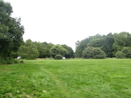
(16) View back to the new housing estate |
(17) Path behind New Hall School |
(18) Trig point S3872 |
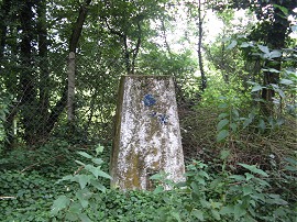
Reaching an old isolated oak tree the footpath bears to the right across a field to join a path running alongside a brick wall, some of which was rather lopsided in places, that encloses the grounds of New Hall School with views back over to the new housing estate across the fields on the right, photo 16. Reaching a road, Generals Lane, the route heads to the left, passing a rather incongruous set of traffic lights. The lane heads past an entrance to the school, the route continuing on passing a house before joining a footpath on the right which heads across the middle of a small field. I stopped here for a snack stop before continuing on along a field edge path which runs along the edge of a number of large fields with the grounds of the school to my left, photo 17, the Centenary Circle effectively doing a dog leg round three sides of the school. Reaching the fifth field the route heads diagonally to the right across the field to the far corner to join a broad, hedge lined green lane with a golf course away to the right. Part of the way down this path I passed a trig point with flush bracket S3872, photo 18.
 |
 |
 |
(19) River Chelmer nr Broomfield |
(20) Broomfield |
(21) Path nr Stacey's Farm |
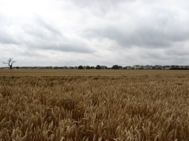
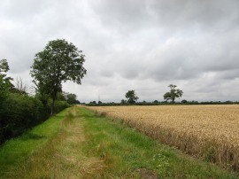
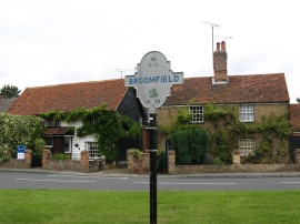
This path leads back down to the A130 where I had rather a wait for a gap in the traffic to cross the road. Once over the road the path continues on between hedges before turning to the left along Back Lane. Just after the second house on the right the route then joins a footpath on the right that heads down over fields to reach a bridge over the River Chelmer, photo 19. At first I went a little too far down Back Lane as there was a van parked on the verge right by the footpath sign so I missed it as I went past. The path crosses the bridge over the river, in a very attractive setting by an old mil, before joining a short enclosed stretch of footpath on the left which soon leads out to a path running over a field to an area of playing fields by the village of Broomfield, photo 20, where I stopped on a bench besides the playing field for my lunch break. I then followed the footpath up to the B1008 Main Road where the route heads to the right before taking a footpath on the left which runs alongside houses along an enclosed stretch of path which gradually makes its way out of the village. This leads to a path running across the middle of a large field that was planted with wheat when I went by which is followed up to the buildings of Stacey's Farm, photo 21. The path then heads to the right, round the edge of the farm buildings where it links up with the route of the Saffron Trail, before joining a straight section of path heading across a field with the trees of Bushy Wood visible ahead in the distance. Reaching a field boundary the route heads left and then follows the field edge round to the right. At the end of this field the path bears half right across the corner of a field before bearing to the left along a field edge path that winds its way over to the Chignal Road.
 |
 |
 |
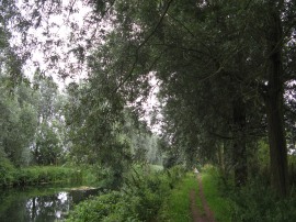
(22) Path nr Brickbarns Farm |
(23) River Can |
(24) Path through the Writtle Belt |
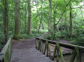
Here the route heads to the right for just a yard or two before joining another footpath on the left that heads out along the edge of a field. Reaching a corner in the hedge the footpath then heads to the left across the middle of the field which had recently been ploughed leaving the earth really soft and uneven to walk across. The path then continues on a fairly southerly course alongside a field to Mashbury Road, opposite a black barn. Here the Centenary Circle heads to the right before joining another footpath on the left that runs down past the farm buildings, the exact route was slightly unclear here, to join a footpath that bears to the right across the middle of a field, photo 22, which heads downhill towards a small brook where the route bears to the left along the bottom edge of the field. The route then heads alongside the brook before doing a rather bizarre dog leg across the field on the left, heading up towards some houses before curving back round to the bottom edge of the field and the brook again. The path then crosses a small bridge over the brook and then heads to the left along a footpath that eventually makes its way along the edge of fields to the A1060 Roxwell Road. Here the route heads to the right, passing a petrol station with a handy store, before heading down to the left along Lawford Lane. This heads down to cross a bridge over the River Can, photo 23, before following a broad hedge lined track, a continuation of Lawford Lane, down towards Writtle. Reaching houses Lawford Lane heads round to the right and at the end of the road the route heads to the left along St John's Road. The Centenary Circle then continues ahead across Bridge Street and down Lodge Road before bearing left into Paradise Road which is followed down to an underpass under the A414 dual carriageway before continuing ahead up the access road leading to Hyland Park. Before the park entrance is reached the footpath is signed as running through the middle of a belt of trees known at the Writtle Belt running parallel with the driveway. I followed this rather enclosed and dingy stretch of path, photo 24, until I was level with the car park where I took advantage of the toilets and then had a short snack break.
 |
 |
 |
(25) Hyland Park |
(26) River Wid |
(27) Site of Galleywood Racecourse |
While I was eating in started raining, although not quite heavily enough for me to need to put my coat on. From the car park the signed route of the footpath continued on through the belt of trees however I walked along the edge of the trees and the parkland, photo 25, which was brighter and gave far better views, although the thick trees did come in handy as shelter from a particularly heavy band of rain that passed over. Reaching Lower Belt at the bottom end of the park did rejoin the path through the trees although one disadvantage of this path was that in places it was really quite muddy, having been used by bicycles which had cut up the surface and at one point I actually slipped over, the first time I can recall this happening in years; luckily no damage was done and I avoided the worst of mud. This stretch of path is followed up to the corner of the park with the A12 road. From the map it appeared the path then headed to the left, along the inside edge of the park before heading to the right to join the road although after having walked along the edge of the park to the point on the map where the path was shown I couldn't find any route out to the road from this point and it could well be that the route exits the park in the corner and then heads alongside the road up to the crossing point. I however continued ahead to another entrance into the park nr Hyland house before heading back down the road it the opposite direction which was shorter than retracing my steps back the other way. The A12 is a busy dual carriageway although I was relatively lucky and did not have to wait too long to safely cross over the road. Once over the road the route heads down a gravel track that runs past some houses, under some railway lines and out between fields as the route descends down to cross over the River Wid, photo 26. The track then start heading steadily back uphill passing a long row of houses, before crossing Goat Hall Lane and continuing ahead up Bekeswell Lane. This runs past a few isolated houses and up to the edge of Galleywood Common by the site of what used to be the Galleywood Racecourse, photo 27 which was the scene of the Chelmsford Races for at least 176 years from 1759 to 1935, the racecourse finally closing in 1939.
 |
(28) Back at Galleywood Common |
From there I continued on up to cross the Margaretting Road before continuing on along a track past some stables. Shortly after these I joined a footpath on the left which headed through the narrow band of trees besides the track and over a small open area back to the place where I had parked at Galleywood Common, photo 28, completing the Chelmsford Centenary Circle.
Back at the car I had walked 21.3 miles in total. This was not a particularly scenic walk, and the rather grey weather did not help, although it was better than I was expecting, and there was a certain satisfaction in achieving a walk of this length and I did not feel particularly tired at the end.
As usual I have uploaded the route of the Chelmsford Centenary Walk which can be accessed here: route.
![]() Back to:Walk index page
Back to:Walk index page
| ©2012 Bertuchi.co.uk. Please contact me using the email button on the right if you have any questions or comments regarding the site. Any feedback and additional information about places of interest on the walks is always welcomed. All rights reserved. Please contact me if you want to use any of the images or information from the site. ENJOY YOUR WALKING |
|