
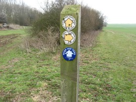
(1) East Common Road, Redbourn
(2) Footpath nr Redbourn
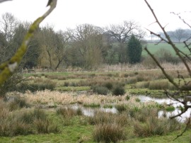
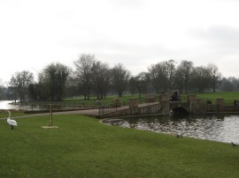
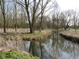
(3) River Ver nr Redbourn
Other Links >>> |
|
VER-COLNE VALLEY WALK
Redbourn to Watford
I did this walk on Sunday 11th March 2012. I drove over to Watford where I met up with Greg before driving up to Redbourn for the start of the walk.
The Ver-Colne Valley walk, which runs between Redbourn and Watford, is marked on Ordnance Survey Explorer Maps 182 and 173 however was not way marked on the ground. Recently though a Ver Valley Trail has been extensively way marked between the source of the River Ver at Kensworth Lynch and its confluence with the River Colne by Bricket Wood and we followed the markers for this walk up until the we reached the River Colne; the route of this walk being almost identical to that of the Ver-Colne Valley walk as marked on the maps. To add a slight bit of further confusion there were also a few much older way markers on the first part of the walk down from Redbourn for the Ver Valley Walk although I have been unable to determine how this relates to the other two trails.
|
|
|
|
(1) East Common Road, Redbourn |
(2) Footpath nr Redbourn |
(3) River Ver nr Redbourn |
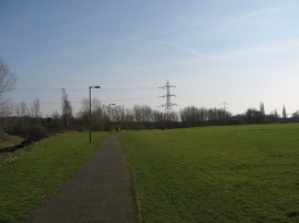
We parked up in a small car park on the Common at Redbourn and then set off down East Common Road, photo 1, before heading to the left along Chequer Lane. Despite having walked this stretch of path before when doing the Hertfordshire Way we went slightly off course here, heading briefly to the right down the Nicky Line path before joining a footpath on the left that heads across the B487 and out over a field. Reaching the boundary of the field we headed to our left to rejoin the correct route at the bottom of the next field. Photo 2 shows the start of this path and also one of the blue markers for the Ver Valley Trail. We then followed a field edge path and then a hedge lined track that made its way down to the A5183. The path heads by a house and crosses the road to join a path running along the edge of a field with the river Ver running through a patch of marshy ground away to the left, photo 3.
 |
 |
 |
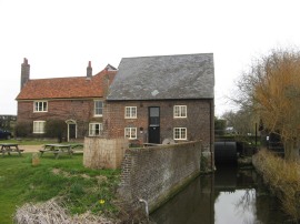
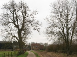
(4) Redbournbury Mill |
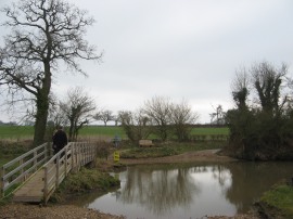
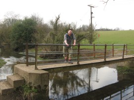
(5) Footbridge over the River Ver |
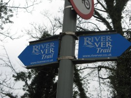
(6) Sign post for the River Ver Trail |
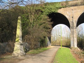
This stretch of path is followed over to Redbournbury Mill, photo 4. The restored mill is open every Sunday afternoon and has a small bakery attached which is open on Saturdays although both were shut when we went by. Turning to the left the path heads along a lane that leads towards a farm before bearing half left to head across a bridge over the river. A farm track then leads round the edge of the farm buildings before crossing a footbridge over another channel of the river Ver by a large ford, photo 5. Once across the river the route heads to the right along a track which soon leads out to another field edge path. As at many of the junctions we past there was a metal sign for the River Ver Trail, photo 6, clearly a route that has had a fair bit of money spent on it.
 |
 |
 |
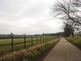
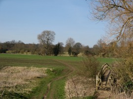
(7) Path by Shafford Farm |
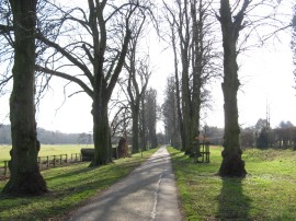
(8) Path through the Gorhambury Estate |
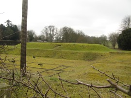
(9) St Albans Roman Theatre. |
This path eventually leads to an enclosed track and out onto a surface track by Shafford Farm, photo 7. The Ver-Colne trail then heads between the farm buildings and past another old mill before curving round back to the A5183 Redbourn Road. On the map the route of the Ver-Colne Walk is then shown as heading down alongside the main road as far as St Albans however continuing straight ahead across the road there is a permissive path through the Gorhambury Estate. This permissive path is the route taken by the Hertfordshire Way and was the route we followed into St Albans. It may not have been technically the correct route but was a far more pleasant alternative than a long slog down beside the busy road. Once over the road the route heads along a path that heads through a plantation of trees before crossing over the river Ver to join a farm track. We followed this across the river valley up to a crossing track where we headed to the left along a surfaced track which also acts as the driveway to Maynes Farm. This pleasant section of tree lined path, photo 8, is followed down to the A4147 Hemel Hempstead Road with St Albans cathedral coming into view ahead. Just before the road is reached the route heads through some white gates besides the old St Albans Roman Theatre. There is a small hut to collect the entrance fee to view the theatre although we contented ourselves with the view from over the hedge, photo 9.
 |
 |
 |
(10) Lake, Verulamium Park |
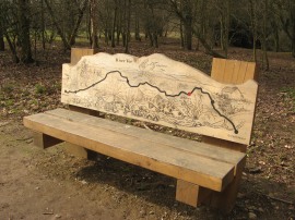
(11) River Ver Trail Bench |
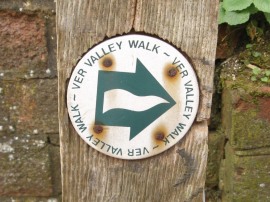
(12) Ver Valley Walk |
Continuing on we headed over the road and on a short distance down St Michaels Road before turning to the right in front of the Verulamium museum. The route heads past St Michaels Church and through the car park into Verulamium park where there were some handy free toilets. The Ver-Colne Valley Walk then turns to the left behind the museum buildings to head down to some ornamental lakes. The first lake was being used model boat enthusiasts with some quite impressive boats, including some remote controlled sail boats. The route now heads to the right alongside the edge of the lake, photo 10, before bearing half right as the route follows the River Ver alongside the edge of the park out to Holywell Hill, the trail finally diverging from that of the Hertfordshire Way. Close to the end of the lake was a carved wooden bench, photo 11, which had the route of the Ver-Colne Trail carved on the back of the seat with a red dot marking our current location. Crossing Holywell Hill, from where we could see St Albans Abbey station away to the right, we joined a narrow path, at first running between houses that crosses over the river and then heads by some allotments up to Cottonmill Lane. As well as the way markers for the River Ver Trail we also spotted a few of the old way marks for the Ver Valley Walk, photo 12, as we headed on downstream.
 |
 |
 |
(13) Footbridge nr the A404 |
(14) Cattle in the River |
(15) River Ver Meadows |
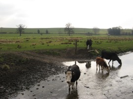
The path continues on alongside the river where it passes under an old railway bridge which now carries the Alban Way, a footpath and cycle route that follows the old rail line between St Albans and Hatfield. A short distance past the rail bridge the route heads to the right, crossing a field before heading up between houses to rejoin Cottonmill Lane. Here we headed to our left the route heading for some distance along the suburban street. Reaching the junction with Butterfield Lane the route heads to the left to cross back over the River Ver. The path then heads past some buildings before joining a footpath on the right that leads down to a field edge path running alongside the river. This path is followed down towards the A404 with the footpath crossing a footbridge over the river, photo 13, just before the road is reached. Shortly after passing under the road the route crosses another bridge back over the river where there were some cows enjoying a drink in the river, photo 14. The footpath then continues on alongside the river as it curves its way round the edge of a large area of pasture, photo 15. We followed the river more closely than the route marked on the map before heading up to the left to join a short section of enclosed path running across the top of some allotments.
 |
 |
 |
(16) Old gravel pit nr Frogmore |
(17) 1992 Sand and Gravel Association award |
(18) Confluence of the Rivers Ver and Colne |
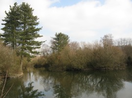
This soon leads to a track where the route heads to the right up to the A5183 Park Street at Frogmore. After a quick stop for Greg to get some snacks we headed to the left down the road. Crossing the road, a narrow path heads down the right hand side of the river and out into an area of old gravel workings with scattered ponds and areas of woodland, photo 16. Here we went slightly off course, following the way marked route of the Ver River Trail which continues ahead past a small car park and then over an open area of ground to reach the M25, rather than that of the Ver-Colne Valley Walk as marked on the map. Here we headed to the left and joined the river as it headed through a culvert under the motorway and out into the grounds of Moor Mill, where there was a Public House, hotel and conference centre. Reaching the end of a drive we crossed over Smug Oak Lane, where we rejoined the route of the walk as marked on the map. We then joined a footpath that led by another car park to the start of a mile long tree lined path running alongside the river known as the Riverside Way. Close to Smug Oak Lane was a plaque, photo 17, commemorating a 1992 Sand and Gravel Association award for restoration of the riverside. This was the second one of these plaques I have seen recently, the other one on stage 1 of my walk along the St Peters Way out in deepest Essex. About halfway down the Riverside Way we had a quick lunch stop at a handy picnic bench before continuing on to the end of the path by Drop Lane. We then headed to the left down the road for a short distance before joining a field edge path that follows the river Ver up to its junction with the River Colne, photo 18, which marks the end point of the River Ver Trail, a walk I will doubtless do some day even if I have already now walked much of its length.
 |
 |
 |
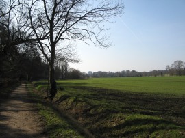
(19) Fields approaching Watford |
(20) River Colne Valley |
(21) Driveway from Munden House |
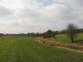
The Ver-Colne Valley Walk however continues on, soon crossing a bridge over the river and joining a path that heads diagonally across a field to join a hedge lined farm track, the path now running some distance away from the river Colne. This section of path was followed for just over a mile as the trail starts making its way towards Watford with a couple of tower blocks gradually becoming visible on the horizon, photo 19. Eventually we reached a crossing track where we headed to the right, briefly linking up with the route of the Hertfordshire Way once again. A bridge carries the route over a dry channel and the path then heads across the flat floor of the river valley, photo 20, to reach another footbridge that crosses over the River Colne along what was a very scenic section of path. Once over the river we left the Hertfordshire Way and joined a path that heads uphill to the left to reach a driveway running through the grounds of Munden House, photo 21.
 |
 |
 |
(22) Radlett Road playing fields |
(23) Coal Post, Watford |
(24) Lower High Street, Watford |
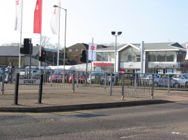
This driveway is followed as it curves round to the left before heading on to take a bridge over the M1 motorway before one final tree lined section of the driveway lead down to the busy A41 road. We had now reached the outskirts of Watford and once over the road joined a paved section of path running through the Colne Valley Linear Park with houses lining the route to the right. This ends at Mill Lane which the Ver-Colne Valley Walk crosses before continuing ahead alongside the Radlett Road. A short distance further the route is able to leave the road to join a path running around the edge of a recreation ground with the river Colne running besides the path on the left. The route then follows the curves of the river as it winds its way towards the centre of Watford, crossing Colonial Way, where the path is lined by allotments on the right and then Link Road where the path skirts round the Radlett Road playing fields, photo 22. Here we left the tarmac path for a while and joined a lower track running besides the river which we were able follow up to the mainline rail bridge before rejoining the surface path. This heads under a large brick arch and past a coal post, photo 23. This was one of the taller stone coal posts erected besides railways although this post is not quite in its original location. The route then continues along a tree lined path besides the river with a playing field on the right before heading through underpasses under the A411 and then Water Lane. Here we reached the car park of a large Tescos where the route is marked as bearing off to the right to reach the Lower High Sreet however we continued ahead, following the river past the front of the store and up to Waterfields Way which marked the end of the path for us. At this point we had walked 15.2 miles from Redbourn.
 |
(25) One that didn't get away! |
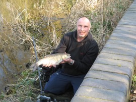
This was less than we had thought we were walking so we decided to continue walking a little bit further, following Waterfields Way down the Lower High Street and then heading to the left towards Eastbury road. Just before we reached this road, and having spent ages waiting for a gap in the traffic to cross over, we were able to join a footpath on the right that headed through a metal gate into the grounds of Oxhey Park. We then headed under the railway lines along a path that once again ran alongside the River Colne. We had been wondering if there were any fish in the river and just before we reached the end of the park by Wiggenhall Road we got our answer as there was a man on the riverbank with a fish he had caught, photo 25.
From the road we then made our way over to Greg's house to collect his car for the trip back up to Redbourn having walked a total distance of 16.9 miles. This an unusual path as the only reference to it under the Ver-Colne Valley Walk name appears to be on the OS maps. As mentioned above there were also some old Ver Valley Walk waymarks on the uipper part of the path and the River Ver has its own new trail; which I will have to walk sometime up to its source.
It was nice to have some company for this walk, the time definitely passed quicker, and it also allowed the path to be completed in one go. It was another pleasant mild day with a lot of sunshine and I ended up with both my fleeces in the rucksack and my face feeling quite warm in the sun.
As usual I have uploaded the route of the Ver-Colne Valley Walk which can be accessed here: route.
If you would like to comment on this walk you can do so here:
![]() Back to:Walk index page
Back to:Walk index page
| ©2012 Bertuchi.co.uk. Please contact me using the email button on the right if you have any questions or comments regarding the site. Any feedback and additional information about places of interest on the walks is always welcomed. All rights reserved. Please contact me if you want to use any of the images or information from the site. ENJOY YOUR WALKING |
|