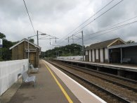
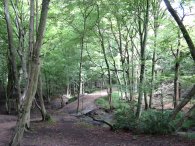
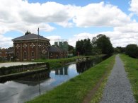
(1) Cuffley Station
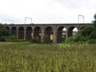
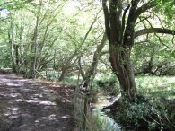
(2) Rail Viaduct nr Cuffley
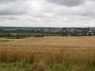
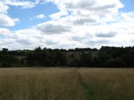
(3) View towards Cuffley
Other Links >>> |
|
THE HERTFORDSHIRE WAY - DAY 19
Cuffley to Rye House
I did this walk on the 29 July taking the train back up to Cuffley Station from Finsbury Park.
|
|
|
|
(1) Cuffley Station |
(2) Rail Viaduct nr Cuffley |
(3) View towards Cuffley |
From Cuffley Station, photo 1, I turned left down Station Road before taking the footpath that runs through the car park of the Community Hall which leads down to fields, retracing my steps from the last time I walked along the Hertfordshire Way. As I headed over the grassy fields, the cows that had blocked my way the last time I had passed through were fortunately no longer present. Passing through a kissing gate I turned right, then left, to follow a field edge around a field planted with Broad Beans. This led to the spot where the Hertfordshire Way had passed under the railway lines when I had walked from South Mimms and where I turned now left to continue along route 10A of Hertfordshire Way, though I had already walked part of the path as part of the Hertfordshire Chain Walk. The path takes a gravel track that ran through the field of Broad Beans and at the end of field, reaching some trees the route turns to the left joining a broader farm track that runs from under the railway viaduct, photo 2. This heads downhill with trees to the right before crossing a small stream over a metal, almost cattle grid like, bridge. The route then heads steadily uphill between fields. Just past the top of the hill the Hertfordshire Way turns left along another track that runs gently uphill to the buildings of Burnt Farm where the track becomes a tarmac lane. This lane runs steadily uphill with occasional views over to Cuffley through the hedges on the left, photo 3.
 |
 |
 |
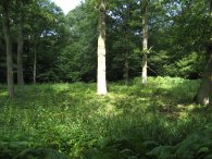
(4) Field, nr Goffs Oak |
(5) Path towards Hammond Street |
(6) Greenhouses |
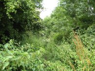
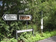
Close to the top of the hill the route leaves the Theobalds Park Estate through a double white gate and turns right along Silver Street before turning left down the driveway of Poindon Farm along a footpath sign posted Goffs Oak. Reaching a cottage the route bears left over as stile into a field and then over another stile to join a hedge lined track. This runs on to reach some houses and the road in Goffs Oak. Here the route turns right along Cuffley Hill and then left down Newgate Street Road. The route continues along Newgate Street Road for a short distance before leaving the route of the Hertfordshire Chain Walk and taking Crouch Lane off to the right. The route follows Crouch Lane round to the left and then after a long straight, at a right hand bend, continues over a stile into a very scrubby field, photo 4, where the route heads diagonally off to the right although it was not really possible to see any trace of a path in the field and I had to spend a few minutes figuring exactly where I should be heading. The route then heads over another field following a hedge on the right hand side before heading down into a scrubby patch of woodland to cross over small stream. The route then heads up a hill crossing another field diagonally to the right before heading over a stile by a gate and heading more to the left up another field to enter into another patch of scrubby woodland where the path was very overgrown with tall nettles. On several occasions during this stretch of the walk I spotted Muntjac Deer watching me but every time I got my camera out to take a photo they ran away. Of all stages of the Hertfordshire Way that I have walked this had been by far the most unclear stretch to follow.
Reaching the road the route turns right for a short distance before turning left up Smiths Lane. Reaching a bend in the lane the route turns left along Bread
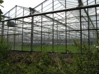
and Cheese Lane. At a bend in this lane the route continues ahead along a footpath signposted Hammond Street 0.7 Kilometres. This path was also very overgrown in places, photo 5. To the right of the path there were a number of large green houses, photo 6, although it was not possible to see what they contained. This footpath eventually becomes a tarmac track which runs past Tanfield Farm and at a junction the track turns left and heads downhill to join yet another overgrown path to reach a small stream.
 |
 |
 |
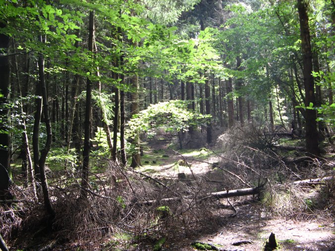
(7) Wormley Wood |
(8) Coal Post, Broxbourne Woods |
(9) Wormley Brook |
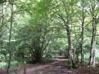
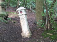
Here the route turns briefly left, then right to enter into the woodland of Wormley Wood, photo 7, part of Broxbourne Woods National Nature Reserve. The next few miles of the walk through the woodland were some of the most enjoyable of the entire path. The route meanders its way through the forest passing an old coal post, photo 8, one of 250 that used to circle London, before heading down to cross Wormley Brook, photo 9. Once over the brook the route heads uphill and, just past a sign post describing Broxbourne Wood, the Hertfordshire Way leave the main path and takes a small path to the right.
 |
 |
 |
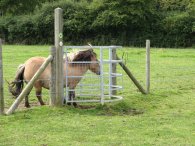
(10) White Stubbs Lane |
(11) Shetland Pony |
(12) Path towards Cowheath Wood |
The path continues into Bencroft Wood before turning left and heading up to join the main path through the wood once again where the route turns right to run down to reach a road. Here the route turns left up West End Road, soon reaching White Stubbs Lane, photo 10. The route heads straight across White Stubbs Lane and goes through a kissing gate into a field The route passes through a couple of more kissing gates and down past Pembridge Farm where one of the gates was slightly blocked by a Shetland pony ,photo 11, which seemed to be hoping to go through. Leaving the farm gate the route crosses a road and heads through another kissing gate to join a footpath. The route crosses through a couple of kissing gates by a stable and then heads down over a field, photo 12, into more woodland.
 |
 |
 |
(14) Spital Brook |
(15) Site of the Moated Enclosure |
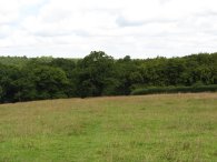
While the route takes a number of twists and turns through the woodland it is always well signposted with Hertfordshire Way markers at every junction where the route changes path. Progressing through this part of the woodland the route enters a stretch of pine trees, photo 13, which made a change to the broad leaved woodland earlier. Reaching a driveway the route turns left, heading downhill past a house before continuing on along a bridleway. At the foot of the hill the route turns right into the Danemead nature reserve, the path running alongside Spital Brook, photo 14. Crossing Spital Brook the route then heads into Hoddesdonpark Wood. After I had crossed Spital Brook I did not pay close enough attention to the map or way markers and headed off in the wrong direction for 0.35 of a mile, something I seem to find quite easy to do in woodland! Realising I had gone wrong I thus had to retrace my steps to take the correct path which continues alongside Spital Brook just inside the edge of the woodland. In Hoddesdonpark Wood there are the remains of medieval moated enclosure, photo 15, and a small notice board gives details of its probable history.
Just the past the moated site the Hertfordshire Way turns left up a broad track and at a cross roads it then turns right along another similar track through the woodland. As seems to have been the case throughout the summer it had been raining very heavily overnight and even though it was the end of July many of the woodland paths were very wet and muddy. It seems ironic that only this time a year ago people were worrying about hose pipe bans and drought.
 |
 |
 |
(16) Approaching the A10 nr Hoddesdon |
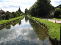
(17) New River path |
(18) Mallard Duckling |
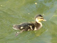
Reaching a track the route turns right along a drive way that leads to a very attractive timber clad house where the route finally leaves the woodland. Passing between the house and its associated buildings the route heads through a kissing gate into a field, photo 16, to head down to a track running parallel to the rather noisy A10. Ignoring a tunnel that runs under the road, eventually the route reaches Cock Lane where it turns left to cross over the A10. A little further down the lane the footpath then turns along a track that runs off to the right, not far past a small car park. To the left of this track a large number of new houses were in the process of being built. Continuing ahead the route passes the Crabtree Plantation and the route makes its way behind houses along a broad stretch of open space that leads into Allard Way. Reaching the end of Allard way the route then turns right up Baas Hill before taking a footpath off to the left just past a small car park, the route once again running parallel to the rather noisy A10. After a few hundred yards, by a gap in the bank to the left of the path, the route turns left and heads downhill beside Cozens field to enter a small patch of woodland. Leaving the woodland the path continues along a hedge lined lane with school playing fields to the left and some tarmac playing courts to the right. At the bottom of the hill the route links up with the route of the New River Path on Cozens Lane West. The route turns left along Broxbourne High Road and then when it reaches the New River it turns right to join the new river footpath, photo 17. On this stretch of path the were a number of small ducklings, photos 18 and 19; The "river" side walking providing a pleasant contrast to the earlier wooded stretches of this stage of the route.
 |
 |
 |
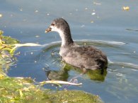
(19) Baby Moorhen |
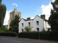
(20) Broxbourne Church |
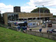
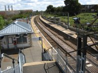
(21) Broxbourne Station |
The New River Path is then followed all the way to the church at Broxbourne where the route heads down Mill Lane to pass the remains of an old mill. Heading down besides a car park the route continues along a footpath and under Station Road to reach Broxbourne Station where the New River path is rejoined on the left and stage 10a of the Hertfordshire Way ends. The GPS made it 11.1 miles to Broxbourne Station considerably less than the 12 miles total given in the Hertfordshire Way Guide book, particularly when taking the 0.7 extra I did in Hoddesdonpark Woods when I went off the path.
 |
 |
(22) Broxbourne Pumping Station |
(23) Rye House Station |
From Broxbourne Station I continued along the New River Path following the start of section 10b of the Hertfordshire Way. This I followed all the way to Rye House Station where I ended my walk for the day. The total distance I had walked was 13.0 miles, which made a total distance along the Hertfordshire Way of 12.3 miles.
I had a very long wait for a train at Rye house as there was only one train an hour and the ticket back to Walthamstow cost £10 which seemed very excessive although there did not seem to be an alternative option at the ticket machine. In retrospect I should have brought a single to Tottenham Hale and then a tube ticket to Walthamstow rather than a combined train and tube ticket. Still this had been an enjoyable and varied days walk and I was particularly impressed by the Broxbourne Woods National Nature Reserve. On one of the notice boards there were details of an 11 mile long trail through around the woodland which I would like to walk at some point, perhaps when the days are a little shorter.
![]() Back to:Walk index page
Back to:Walk index page
| ©2012 Bertuchi.co.uk. Please contact me using the email button on the right if you have any questions or comments regarding the site. Any feedback and additional information about places of interest on the walks is always welcomed. All rights reserved. Please contact me if you want to use any of the images or information from the site. ENJOY YOUR WALKING |
|