Other Links >>> |
|
THE HERTFORDSHIRE WAY - DAY 18
South Mimms to Cuffley
I did this walk on Saturday 14th July. I parked in Blanche Lane, South Mimms, opposite South Mimms church from where it was just 0.2 of a mile to rejoin the route of the HertfordshireWay in Blackhorse Lane.
 |
 |
 |
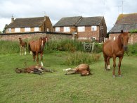
(1) Ponies, South Mimms |
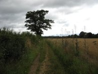
(2) Path towards the A1M |
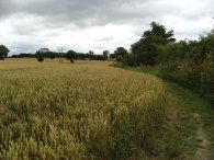
(3) Fields by Warrengate Farm |
From Blackhorse Lane the route takes a short driveway in between two houses to join a footpath signposted Swanland Road 1 mile. Entering the field two young foals which were peacefully resting on the grass as their parents stood guard. After crossing two small fields, the first of which was occupied by a number of young foals which were peacefully resting on the grass as their parents stood guard, photo 1, the route joins a farm track that runs down between fields, photo 2, to reach the A1M where the route turns left besides the motorway for a while distance before taking an underpass underneath the busy and rather noisy road.
Having the crossed the A1M the Hertfordshire Way then takes a tarmac track up to the old A1, heading straight across to take a little bridge over Mimmshall Brook besides a ford before continuing along a farm track running between fields with a small stream to the left. Reaching the buildings of Warrengate farm the route crosses the stream over a flat metal bridge and turns right along the bank of the stream with open fields to the left, photo 3.
 |
 |
 |
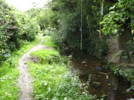
(4) Stream nr Warrnegate Farm |
(5) Potters Bar Golf Course |
(6) Quakers Lane, Potters Bar |
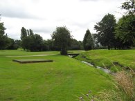
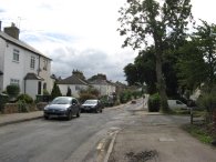
Reaching an industrial area on the left the route takes a more enclosed path still running besides the stream, photo 4, which heads down to the edge of the industrial estate. Here the route crosses a road and heads down a small path besides the building of Therapy Equipment Ltd, still heading alongside the stream. Reaching another road the route turns left to run parallel with some railway lines for a short distance before turning right to take a gravel covered track under the railway lines and into the grounds of Potters Bar Golf Course. The route then turns to the right to run back down alongside the railway lines for a short distance before turning left under a raised pipe to follow a watercourse through the grounds of the golf course, photo 5. Leaving the watercourse the route turns to the right and heads uphill along a tree lined gully towards a white painted house. Leaving the golf course the route heads along behind the houses into a road called Manorway which is followed down to Church Road where the route turns left heading uphill through the outskirts of Potters Bar. Reaching Mount Grace school I turned right and headed along Quakers Lane, photo 6.
 |
 |
 |
(7) Fields nr Potters Bar |
(8) Northaw Church |
(9) Footpath nr Vineyards Road |
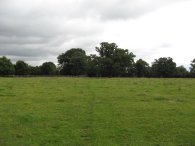
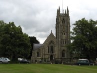
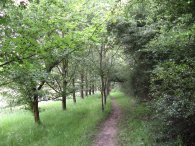
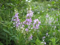
At the top of Quakers Lane the route heads across a main road and through an old cast iron kissing gate into a series of fields which, by the evidence on the ground, had been grazed by cattle, photo 7. Leaving the end of the third field the route runs down the side of a patch of woodland before making its way through more open ground besides fields and round the edge of Northaw Place. Eventually the route reaches a road where it heads across the top of Well Road and turns left to head down Judges Hill. This was a fairly busy stretch of road but it had a pavement to walk along. Reaching the Sun Pub the route turns left down Vineyards Road, past the very attractive Northaw Church, photo 8. As Vineyards Road start to turn to the left, by a gap in the houses, the Hertfordshire Way takes a kissing gate off to the right signposted Cuffley 1 ¼ miles. Here the path soon starts heading gently downhill along a tree lined path with fields on either side, photo 9. To the left there were good views across a small valley with a line of impressive houses along the opposite ridge.
 |
 |
 |
(11) Cows at the kissing gate |
(12) Cuffley station |
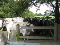
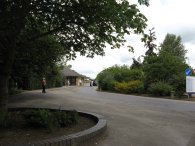
Reaching the valley floor the route levels out and runs into a more open farm track running along the edge of a gently sloping field. This stretch of path looked very familiar and I suddenly realised that I had walked along here last year when I was walking the Hertfordshire Chain Walk which had joined in from the left at the start of the farm track. Reaching Northaw Road East the route turns left to reach the outskirts of Cuffley. At the end of some playing fields on the right hand side of the road the route turns right and heads down a broad tree lined track. Passing under the railway lines the route leaves the route of the Hertfordshire Chain Walk and turns immediately to the left along the side of a field parallel with the railway lines. The path follows the field edge round to the right before taking a kissing gate off to the left into a grassy field. The way into this field was blocked by a large number of cows which took some persuading before they moved out of the way and allowed me to pass, photo 11. The route then heads into another field and over a car park to reach station road from where Cuffley station was just a few yards down the road to the left, photo 12.
 |
 |
 |
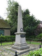
(13) Robinson Memorial, Cuffley |
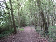
(14) Footpath nr Cuffley |
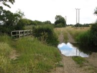
(15) Ford by Mimmshall Brook |
Reaching Cuffley station I had walked 7.2 miles so that was exactly 7.0 miles along the Hertfordshire Way. I had now completed the original circuit of the Hertfordshire Way and just have the two new stages running between Cuffley and Hertford via Broxbourne introduced in the second edition of the guidebook to complete the whole walk.
From the station I headed uphill along Station Road, passing Tolmers Lane where I had turned off when I started my walk around the Hertfordshire Way back in January. At the end of Station Road I turned right and headed steeply uphill along Plough Hill which continues on into East Ridgeway. On the East Ridgeway I past a memorial to commemorate the shooting down of the first German airship over British soil at Cuffley on September 3rd, 1916 by Captain William Robinson who was awarded the Victoria Cross three days later, photo 13. It was a bit of a co-incidence seeing the memorial because only the previous day my father had asked me if I had seen it while passing through Cuffley. From the East Ridgeway the road runs into the Ridgeway, site of the houses I had spotted earlier on in the walk while walking down from Northaw. Here I linked up with the route of the Hertfordshire Chain walk once again and took a footpath off to the left that descends steadily besides woodland, photo 14, all the way down to the bottom of the valley to rejoin the route I was on earlier. From this point I followed the route of the Hertfordshire Way back to South Mimms, there not really being any other viable options to make a more circular walk apart from the little loop I had done round Cuffley. Photo 15 was taken as I crossed over Mimmshall Brook, close to the start of the stage.
Reaching the car I had walked a total of 13.9 miles. Given the location so close to the edge of Greater London this was a surprisingly pleasant walk with a number of very attractive sections of path. Recently I have been walking quite slowly but I was determined to walk a faster pace today and although the route was just 0.3 mile shorter than Wednesdays walk I completed the distance more than an hour quicker, (which meant I had plenty of time to get home and cut the lawn!). Generally though walking for me is about being out in the countryside and enjoying the sights and sounds rather than for getting from A to B as quickly as possible.
![]() Back to:Walk index page
Back to:Walk index page
| ©2012 Bertuchi.co.uk. Please contact me using the email button on the right if you have any questions or comments regarding the site. Any feedback and additional information about places of interest on the walks is always welcomed. All rights reserved. Please contact me if you want to use any of the images or information from the site. ENJOY YOUR WALKING |