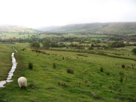
(1) River Noe
(2) View up to Hollins Cross
(3) View over Edale
Other Links >>> |
|
A CIRCULAR WALK FROM EDALE
I did this walk on Monday 22nd October 2012. I had been up in Manchester for my mother in laws birthday and was able to take the opportunity to have a quick walk in the Peak District. Apart from the walk up to Hollins Cross these were all paths I had walked before however it had been some time since I had last been up in this part of the world and it was nice to be out in some different scenery. Unfortunately the weather did rather spoil the walk with low clouds sitting on the hill tops all day and I ended up cutting the walk short when I reached the Pennine Way.
|
|
|
|
(1) River Noe |
(2) View up to Hollins Cross |
(3) View over Edale |
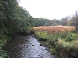
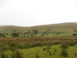
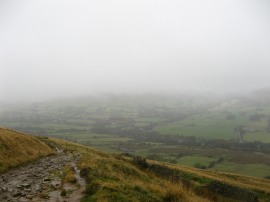
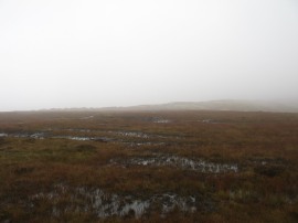
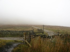
I parked in the main car park at the bottom of Edale which cost £5 for the day. From their I headed along the road for a short distance before joining a footpath on my right which headed up towards Hollins Cross. This path follows a farm track over the River Noe, photo 1, and starts heading uphill past Peter Barn. Just before the farm buildings are reached a signed footpath heads off to the right which I then followed up to Hollins Cross,photo 2, steadily heading up into the base of the clouds as the views down into the Edale Valley gradually disappeared, photo 3.
 |
 |
 |
(4) Hollins Cross |
(5) Path leading to Mam Tor |
(6) Mam Tor |
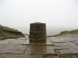
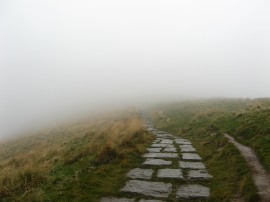
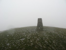
Once on top of the ridge at Hollins Cross, photo 4, I headed to my right along a path paved with flagstones, photo 5, which leads up to the trig point on top of Mam Tor, photo 6. It was very damp and windy on top of the ridge although surprisingly mild and I was warm enough not to need to wear my fleece.
 |
 |
 |
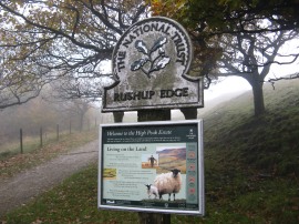
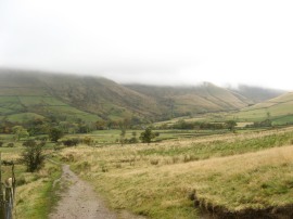
(7) Rushup Edge |
(8) Path along Rushup Edge |
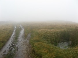
(9) Heading over to Brown Knoll |
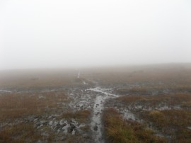
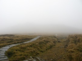
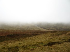
From Mam Tor I followed the path down to cross over the road which leads down to Edale and then continued on along the footpath which runs over the top of Rushup Edge, photo 7. I plodded on through the mist following this fairly straight section of path, photo 8, for about 2.4 kms before I joined a footpath on the right which headed off across the open moorland towards Brown Knoll. The first few yards of this path were well surfaced but I soon joined a more minor path that headed off on the left across the heather. This path was very boggy and muddy, photo 9, and it was slow going as I made my way around the bogs with the surrounding landscape hidden in the mist.
 |
 |
 |
(10) Brown Knoll |
(11) Path nr Brown Knoll |
(12) Path heading towards Kinder Low |
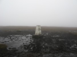
Eventually I reached the trig point on Brown Knoll, photo 10, before continuing on along the path, photo 11, which soon heads downhill towards a wall where I joined a much better quality path, in place surfaced with flagstones, photo 12, which I followed off to the right towards Kinder Low
 |
 |
 |
(13) Reaching the Pennine Way |
(14) Path heading to Kinder Low |
(15) Dropping down below the clouds |
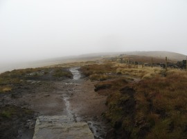
This path heads slightly downhill and I dropped down below the base of the clouds for the first time since I had reached Hollins Cross. After a short distance this path links up with the route of the Pennine Way, photo 13. My originally intention had been to head up to the trig point on Kinder Low before cutting across to the path running along the edge of Kinder Scout which I would then follow round to either Grinds brook Ollerbrook Clough. However the clouds were showing no sign of lifting, photo 14, and I could see no point in continuing to walk in the damp, windy conditions with next to no visibility so when I reached the Pennine Way I decided to follow this lowland route back to Edale instead, photo 15.
 |
 |
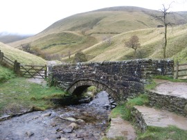 |
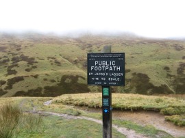
(16) Cairn at Jacobs Ladder |
(17) Sign by Jacobs Ladder |
(18) Small stone bridge |
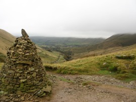
Thus I headed off to my right along a path that descends back down to the Edale Valley. It was far more pleasant as I headed down towards the large cairn, photo 16, at the top of Jacob's Ladder, photo 17, where I stopped for a quick lunch break. I was wearing my Berghaus boots which weren't that suitable for the steep stony path down into the valley as I could feel every rocky lump through the thin soles of the boots. At the bottom of Jacob's Ladder I crossed over a small stone bridge, photo 18, and joined a level farm track which eventually heads down to reach a minor road.
 |
 |
 |
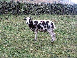
(19) Looking back up the valley |
(20) A spotted sheep |
(21) Heading down into Edale |
The Pennine Way follows this for a while before joining a footpath on the left by the camping barn at Upper Booth which heads out between fields for the last mile or so walk into Edale. The last few fields were being grazed by sheep including a number of very spotted examples, photo 20, and had a narrow flagstone path laid across them which I don't think was there last time I had walked across them although that was many, many years ago, photo 21. There were good views across the valley with the autumn leaves on the trees although the surrounding hills were still shrouded in cloud.
 |
 |
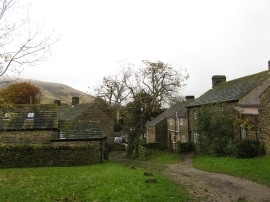
(22) Edale |
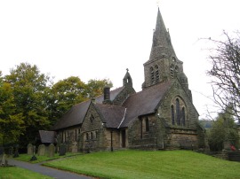
(23) Holy and Undivided Trinity Church, Edale |
Once back in the village, photo 22, I then just had a short walk down the road, passing the church as I made my way back to the car park.
Reaching the car I had walked 10.2 miles. It had been nice to be out, and I had enjoyed making my way over the mist hidden moorland to Brown Knoll however the walk would have been far more enjoyable if the cloud base had just been a little higher.
As usual I have uploaded the route of the walk which can be accessed here: route.
![]() Back to:Walk index page
Back to:Walk index page
| ©2012 Bertuchi.co.uk. Please contact me using the email button on the right if you have any questions or comments regarding the site. Any feedback and additional information about places of interest on the walks is always welcomed. All rights reserved. Please contact me if you want to use any of the images or information from the site. ENJOY YOUR WALKING |
|