(1) Ferry Square, West Lynn
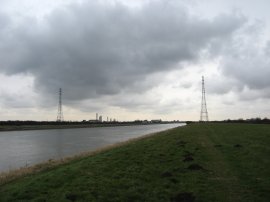
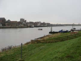
(2) River Great Ouse, Kings Lynn
(3) View down the River Great Ouse
Other Links >>> |
|
CLENCHWARTON PARISH WALK
Circular walk from West Lynn
I did this walk on Friday 8th February 2013 during a visit to see my friend Anna. I drove the short distance over to West Lynn where I parked up in Ferry Square. I had decided to do this walk at quite short notice had a fairly late start and was travelling light without my big rucksack, my load made even lighter because I soon discovered I had left my can of drink behind! I also had no food or waterproofs and not even a map that covered the whole walk with me, well there is a first for everything! Not a recommended get up for a walk but as purely a one off it made an interesting change.
|
|
|
|
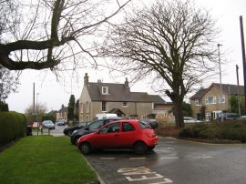
(1) Ferry Square, West Lynn |
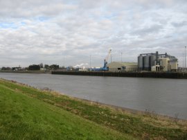
(2) River Great Ouse, Kings Lynn |
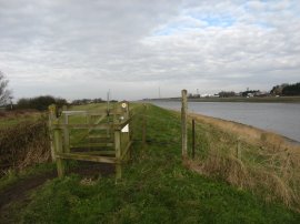
(3) View down the River Great Ouse |
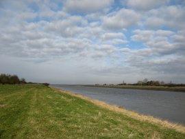
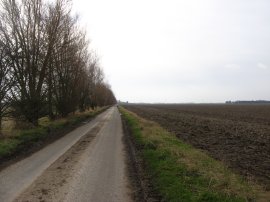
In Ferry Square, photo 1, there were the remains of a weathered fingerpost, without a finger, with Parish Walk written down the side of the post. The square also marks the start of the Peter Scott Walk and there was a small information board for that walk too on the grass besides where I had parked. From the square the route heads a few yards between houses along River Walk before climbing up onto the grass covered flood bank running alongside the River Great Ouse, opposite the grain silos by Kings Lynn docks, photo 2. For the next couple of miles the route follows the flood bank down alongside the river as it makes its way out into the Wash, photo 3.
 |
 |
 |
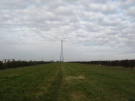
(4) Heading towards the pylon |
(5) View down the River Great Ouse |
(6) Marsh besides the Wash |
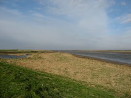
Looking directly ahead there was a very tall pylon, photo 4, some one and half miles away, which carries the electricity cables across the river and grew steadily larger as I headed down the path. Eventually the route reaches a sewage works and the passes under the electricity pylon before continuing on towards the Wash, photo 5. On the way I passed a very large flock of geese on the mud lining the banks of the river at what must have been quite near low tide. Eventually the flood bank begins to curve of round to the left as the path reaches the marshy ground around the fringes of the Wash, photo 6.
 |
 |
 |
(7) Path heading towards Ongar Hill |
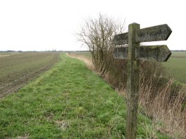
(8) Walk Finger Post |
(9) Road from Ongar Hill |
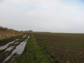
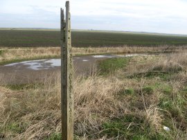
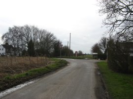
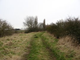
Soon the path leaves the flood bank, and the route of the Peter Scott Walk, to join a field edge path running just inland alongside the New Flood Bank, photo 7, as the route heads over towards Ongar Hill. The weather had started quite bright with occasional patches of sunshine although it soon clouded over during this part of the walk. Reaching Ongar Hill, where there was another of the damaged walk finger posts, photo 8, the Clenchwarton Parish Walk starts to head inland along a minor road. This road, photo 9, follows a relatively straight course for quite some distance across the flat fields. One of the features of this walk was the large amount of road walking involved, mainly due to the lack of footpaths in the area. I don't know, but speculated whether this was due to the fact that the land was comparatively new having been reclaimed from the sea and thus there weren't the historic traditional rights of way in existence over the land.
 |
 |
 |
(10) Wooden Crates |
(11) Junction with Rhoon Road |
(12) View across Rhoon Marsh |
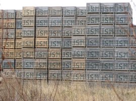
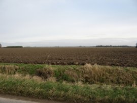
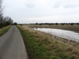
At several points besides the road were tall stacks of wooden crates all with their own initials, photo 10. Eventually the route reaches the T junction at the end of the road, photo 11, where the route heads to the left along Rhoon Road. From the road there were far reaching views across the pancake flat surrounding countryside, photo 12. The tall electricity pylons remained in view and acted as a good guide of my progress around the route.
 |
 |
 |
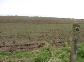
(13) Walk Finger Post |
(14) Into the mud |
(15) Track leading to Hall Lane |
Rhoon Road is followed down to Northgate Way where the Clenchwarton Parish Walk heads to the left for a few yards before joining an unsurfaced track on the left that runs past some houses, just before Northgate Way bends round to the left, This stretch of path soon leads out into fields where there was a walk finger post complete with fingers, photo 13, the only complete one I saw on the entire walk. It was nice to finally be off the tarmac but the footpath soon headed out across the middle of a very muddy field, photo 14. With all the recent rain and snow this was completely water logged almost impossible to walk across and I thus headed half left to reach a thin line of grass that ran along the top of a drainage ditch which meant I was able to avoid most of the mud. The path over the field is followed down to a green, hedge lined lane, photo 15 where the route heads to the left.
 |
 |
 |
(16) Clockcase Lane |
(17) Back at the River Great Ouse |
(18) The Lynn Ferry |
This track is followed down to Hall Road where there commenced another stretch of road walking, although once again this was a very quiet minor road with hardly any traffic. This road becomes Clockcase Lane, photo 16, as the Clenchwarton Parish Walk makes its way over the flat fields back towards the River Great Ouse. As I was walking along the road a Barn Owl flew past and settled on a fence post a little way down the field which was a very pleasant sight to see. Eventually the road reaches the flood bank where a short stretch of footpath leads up through the hedge and onto the top of the flood bank where I linked up with the outward route of the walk from West Lynn, close to the sewage works and tall electricity pylons, photo 17. Reaching this point I had walked a distance of 9.65 miles. The weather was clouding over rapidly and for the last mile or so back up along the river to West Lynn I was walking in a sleet shower which made my legs quite damp although I did have my thermals on under my walking trousers which prevented me getting too cold. As I approached West Lynn I saw the small Lynn Ferry making its way there and back across the river, photo 18.
Reaching the car I had walked 11.2 miles. This was far from a classic walk and for the length of the path had a considerable amount of road walking, although none of this was on major roads. It was nice to be out though and this is still a part of the world I have done very little walking on so it did make a change and the walk down the Ouse towards the Wash was quite pleasant. Hopefully I'll get the opportunity to revisit the area at some point and walk the Peter Scott Walk.
As usual I have uploaded the route of the walk which can be accessed here: route.
![]() Back to:Walk index page
Back to:Walk index page
| ©2012 Bertuchi.co.uk. Please contact me using the email button on the right if you have any questions or comments regarding the site. Any feedback and additional information about places of interest on the walks is always welcomed. All rights reserved. Please contact me if you want to use any of the images or information from the site. ENJOY YOUR WALKING |
|