The Dog Rose Ramble
Other Links >>> |
|
THE DOG ROSE RAMBLE
|
|
The Dog Rose Ramble |
I did this walk on Sunday 31st October 2010. I had been intending to do another stage of the Harcamlow Way but had been invited out to Sunday lunch at the neighbours so needed a shorter, more local walk and the Dog Rose Ramble, which had been on my list of "to do" walks for some time, fitted the bill perfectly. The clocks had gone back overnight giving me an extra hour too, and despite the roadworks on the North Circular I was over in Northolt ready to start the walk by 8:30. The Dog Rose Ramble is a circular walk and I parked the car in Ealing Road, Northolt, from where it was just a short walk down the road to link up with the route which I walked in an anti clockwise direction.
 |
 |
 |
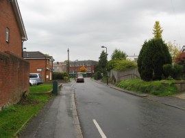
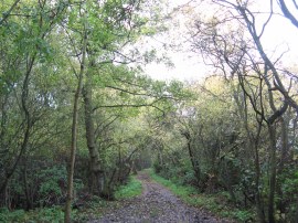
(1) Church Road, Northolt |
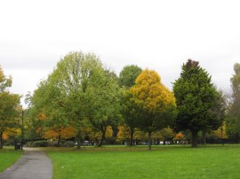
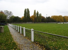
(2) Islip Manor Park |
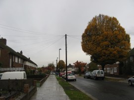
(3) Islip Manor Road |
From my parking spot, the route heads up Church Road, photo 1, crosses over Mandeville Road and continues ahead through some metal gates to join a broad tarmac path that heads into Islip Manor Park. Reaching the park, photo 2, the route turns to the left following the edge of the park, then follows the path as it heads round to the right. Shortly after crossing an open area the route heads down another broad path at the far side of the park which leads out of the park to Islip Manor Road, photo 3.
 |
 |
 |
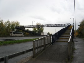
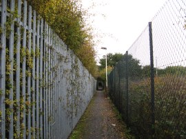
(4) Footbridge over the A40 |
(5) Path from the A40 footbridge |
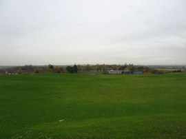
(6) Lime Trees Golf Club |
The route then turns left along the road heading down to reach the A40 where a footbridge, photo 4, carries the ramble across the road. Leaving the road the route joins a narrow tarmac footpath running between two tall fences, photo 5, which winds it way towards another minor road. Just before this road is reached the route bears to the right along a narrow muddy track running through a small band of trees. At the end of these trees the route heads up a small slope to reach a more open grassy area. Although covered with grass, the ground underfoot was soft and muddy and it looked as if it had been recently landscaped. To my right I could see Northolt Aerodrome and through the rain to the left a golden minaret provided a bright point in the otherwise gloomy, damp vistas. There was no clear indication of the exact route across this area but I headed across the middle of the grassy hills, photo 6, before joining a path that runs just to the right of a derelict and graffiti covered golf club house that is towards the right hand side of photo 6. The area is, or perhaps was, part of the Lime Trees Golf Club which given the state of the ground appears to be in the process of being redeveloped. From the club house, the path heads through a short stretch of scrub land to reach a grassy area which the path heads alongside to reach West End Road where there was a reassuring Dog Rose Ramble path sign.
 |
 |
 |
(7) Sharvel Lane |
(8) Woodland nr Westways Farm |
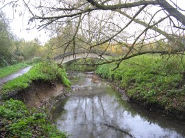
(9) Golden Bridge |
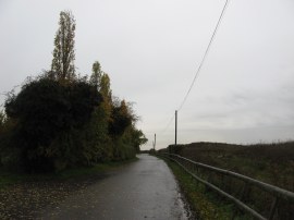
Crossing the road the route continues ahead along Sharvel Lane, photo 7. The route passes a plant yard and a stables and the Downs Barn Moated site, the moat once surrounding a manor house which was demolished in 1388. A little further on the lane passes the large brick building of the West London shooting school and much of the land to the left of the lane is occupied by shooting ranges and although these cannot be seen a number of signs attached to trees warned of shooting taking place. As the route progresses along the lane the tarmac ends and the route gradually becomes narrower and lined with hedges. Where the main track bends to the left the Dog Rose Ramble continues ahead along a bridleway running just inside the edge of a patch of woodland, photo 8. The route runs through the trees, bending round the buildings of Westways Farm on a very muddy section of path before crossing over Golden Bridge, photo 9, to reach Charville Lane where the route links up with that of the Hillingdon Trail.
 |
 |
 |
(10) Path from Charville Lane |
(11) Pond, Michael Frost Park, Yeading |
(12) AFC Hayes, Farm Park |
The route heads to the left along the road for a very short distance before route passing through a set of green metal gates on the left to join a footpath. Just after the gates the Dog Rose ramble heads to the left at a fork in the path, crossing over an open area, photo 10, to enter an area of woodland. Despite the weather forecast of light drizzle it had been raining quite heavily all morning and the ground was very wet and muddy underfoot. The whole area appeared very rural and could have been deep in the countryside rather than being surrounded on all sides by suburban London. Just after passing a pond, photo 11, the route heads half left continuing through the trees on the main path through the woodland. Reaching the end of this stretch of path the route heads left to run alongside the ground of AFC Hayes, photo 12, formerly Brook House FC, who in 2010 where playing in division one central of the Southern League.
 |
 |
 |
(13) Yeading Nature Reserve |
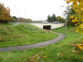
(14) The A312 Underpass |
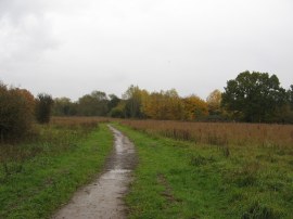
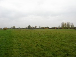
(15) Brookside Open Space |
Leaving the football ground the path bends round to the right to reach Kingshill Avenue. Bearing half left across the road the route heads through another set of green metal gates into the grounds of the London Wildlife Trusts Yeading nature reserve, photo 13. As I headed across the open grassland of the reserve I could see a steady stream of planes that had taken off from Heathrow disappearing into the clouds. The actual route of the Dog Rose Ramble heads alongside the bushes on the right of the open space that mark the course of Yeading Brook. I had been heading a bit far over to the left so I cut across the grass to join the path which runs along the edge of the trees. This is followed round to a cycle path at the end of the Greenway which the route follows across a concrete bridge that crosses over the brook. Once over the bridge the route heads to the left, once again running alongside the greenery that lines Yeading Brook with open ground on the right. This stretch of path is followed to Yeading Lane where the route crosses back over the brook, the path at first continuing alongside the brook before bearing to the left over the grass to reach an underpass that carries the route under the A312, photo 14. The underpass made a good dry place to have a look at my map before heading out over another patch of open grass running alongside the brook, photo 15. Despite how it is marked on the map, the route follows the left hand hedge line of this open space for some distance before leaving the open area on a grassy track running between trees and bushes.
 |
 |
 |
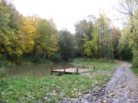
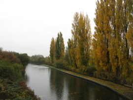
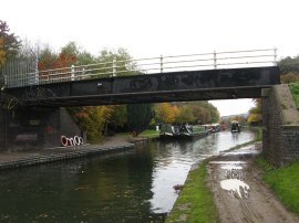
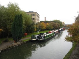
(16) Grand Union Canal nr Hayes |
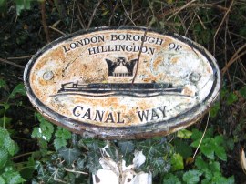
(17) London Borough Boundary Marker |
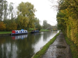
(18) Grand Union Canal nr Hayes |
The route follows this path as it bends round to the right to reach a tarmac path where the route heads to the left to soon reach a footbridge over the Grand Union Canal, photo 16. Here the Dog Rose Ramble splits from the route of the Hillingdon Trail, heading to the left along the canal path, a route I had last walked back on a very hot day in June 2005. A short distance down the canal the path passes a couple of small metal plaques, photo 17, marking the boundary between the boroughs of Hillingdon and Ealing. The path alongside the canal was quite muddy in places, photo 18, with the surface broken up by the tracks of numerous bicycle tires, and by the end of the walk my trousers looked as if I had been walking over ploughed fields which was not what I had been expecting from an urban walk.
 |
 |
 |
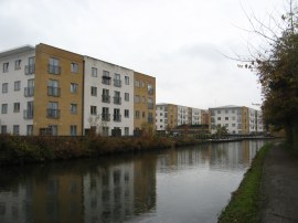
(19) Grand Union Village, Northolt |
(20) Abandoned Factory |
(21) Footbridge where the route leaves the canal |
Heading along the canal the route passes the entrance to Willowtree Marina and to my right I could hear the sound of football matches being played behind the trees that line the canal bank. Nearby I had spotted a number of interesting ducks on the water including a mandarin duck with a group of Mallards however my camera batteries where running low and did not have enough power left for the zoom to work which was a shame, my spare batteries that I always carry being in my other rucksack. My usual rucksack had been "borrowed" by my daughter for the weekend who had neglected to take out most of the stuff I keep in it beforehand. The path heads by an area where a large number of new flats, known as Grand Union Village, photo 19, had been built besides the canal on the site of an old industrial estate. A little further on the canal headed past an abandoned factory complex, photo 20, doubtless which will be converted to more housing in the not too distance future as the old industrial heritage of the canal side gradually disappears. Another feature I noticed while I was walking alongside the canal was a considerable number of coconuts floating in the water which I presume must originate from some religious ceremony. The canal passes underneath a couple of roads and I stopped under second one of these, where Kensington Road crosses the canal, for a short snack break, where the once shiny murals on the opposite bank looked rather grimy under a coating of dirt and cobwebs. Heading back out into the rain the path soon passes under the A40 where the stench of damp pigeon droppings was rather overwhelming. Just past the A40 the path reaches the bridge where the route of the Dog Rose Ramble leaves the Grand Union Canal, photo 21.
 |
 |
 |
(22) Dawoodi Bohra Mosque, Northolt |
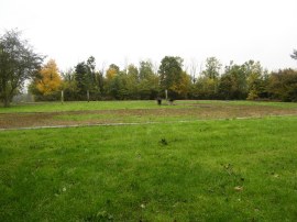
(23) Northolt and Greenford Country Park |
(24) Site of the Northolt Manor House |
The bridge is located besides the Dawoodi Bohra Mosque, photo 22, and I wondered if it had been the golden minaret from this building that I had seen earlier in my walk from the Lime Trees Golf Club. The route crosses over the bridge, joining a fenced lined tarmac track which is followed to reach Rodwell Road. Crossing the road the route then enters the Northolt and Greenford Country Park, continuing ahead along a gravel track, photo 23, that heads gently uphill. At the top of the hill follow the track round to the left as it runs past the site of the Northolt Manor House, photo 24, where the original room structure has been marked out on the ground.
 |
 |
 |
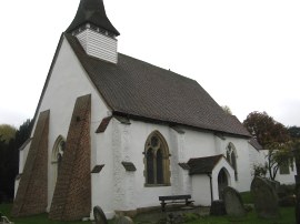
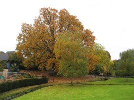
(25) St Mary's church, Northolt |
(26) Oak tree by St Mary's church |
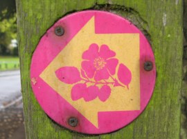
(27) Dog Rose Ramble Way Marker |
The route then heads to the right into the grounds of the whitewashed St Mary's church, photo 25, before heading downhill to the left through the churchyard along a track that leads back to the road where I started my walk by a tall oak tree surrounded by a square metal bench, photo 26. Attached to a finger post at the junction with Church Road where a couple of Dog Rose Ramble Way Markers, photo 27. Seeing these at the start of the walk I though the route might be signed all the way round but I only actually spotted a few other way markers and most of these were of the plastic sticker type and it would not be possible to follow the walk without some guide.
Back at the car I had walked 8.33 miles, about 8 of which had been on the walk itself and I was glad I had made the effort to go out on such a grey day.
As usual I have uploaded the route of the walk which can be accessed here: Dog Rose Ramble route.
If you would like to comment on this walk you can do so here:
![]() Back to:Walk index page
Back to:Walk index page
| ©2012 Bertuchi.co.uk. Please contact me using the email button on the right if you have any questions or comments regarding the site. Any feedback and additional information about places of interest on the walks is always welcomed. All rights reserved. Please contact me if you want to use any of the images or information from the site. ENJOY YOUR WALKING |
|