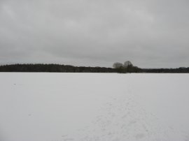
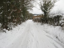
(1) View back to Chorley Road
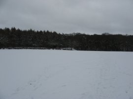
(2) Entrance to the Hellfire Caves
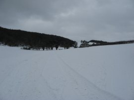
(3) West Wycombe Hill
Other Links >>> |
|
WEST WYCOMBE CIRCULAR
I did this walk on Sunday 10th January 2010. I had wanted to continue my walk along the Harcamlow Way however to reach my start point would have meant a long trip on minor roads which due to weather would probably have still been fairly impassable in my car. The journey to West Wycombe however was motorway almost all the way, thus much easier to get to, and the run also gave me an opportunity to properly recharge the car battery which had been flat the day before. Unfortunately it was a very grey gloomy day however there was not much wind and the temperature was only just below freezing. With two base layers and two fleeces I was as warm as toast, in fact a little too warm at times as I made my way up and down the hills and valleys of the area.
|
|
|
|
(1) View back to Chorley Road |
(2) Entrance to the Hellfire Caves |
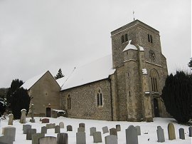
(3) West Wycombe Hill |
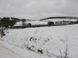
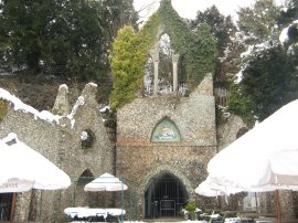
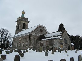
I parked on the roadside in Chorley Road below West Wycombe Hill, the nearby free car park being inaccessible due to the snow and ice on the rather steep entrance. From there I made my way up Church Lane, passing the entrance to the Hell-Fire Caves, photo 2. These caves were extended by Sir Francis Dashwood between 17481752 although the precise reason for their construction is unclear. From the cave entrance I continued up Church Lane, following the icy road round to the left before joining a footpath on the right that ran down along a field edge to reach the A4010 Bradenham Road from where I took photo 3, looking back towards West Wycombe Hill
 |
 |
 |
(4) Lee's Wood |
(5) Field nr Naphill |
(6) Field nr Naphill |
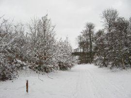
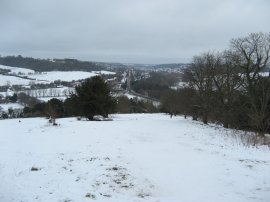
Crossing over the road I joined a footpath that headed diagonally over a small field before passing under some railway lines. Once under the railway the footpath began heading generally uphill along field edge paths and through one small thicket of trees to eventually reach an isolated house. Here my route joined a snow covered lane for a short distance before joining a path on the right which led uphill through a patch of woodland, photo 4. The woodland path gradually narrowed and eventually the path left the trees to cross over one more field to reach Naphill Common which runs along the top of the ridge. Here I turned to the left, following one of the many snow covered paths that snake their way through the trees. Overhead there were a number of red kites flying around which are a pleasant sight to see. Leaving the common I joined a fence lined footpath that runs between houses to Naphill Main Road. Crossing the road I joined a footpath through a small section of field before crossing over a stile into a much larger open field, photo 5. The field was covered in a thick layer of almost unspoilt powdery snow, an impressive sight but rather difficult to walk over with every footstep sinking deep into the snow. Luckily I had brought my gaiters which prevented too much snow actually getting into my boots and I soon noticed when became loose. I had been making very slow progress on the walk; as well as the deep snow, where the paths were well used the snow had been compacted and was very slippery and uneven which also made for slow walking and reaching the end of the field I stopped for a while to select a revised, and somewhat shorter, route than I had originally planned. Having picked a route I then joined a footpath on the left that headed diagonally over another field to enter another patch of woodland, photo 6
 |
 |
 |
(7) Footpath nr Flowers Bottom |
(8) Snow nr Lacey Green, Jan 2010 |
(9) Lacey Green Parish Church |
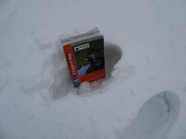
I made my way through the woodland along a path that led out to Clappins Lane which I then followed down to Speen Road. I had been having problems with my camera saying low battery however when I changed them for the spare set I had in my rucksack I found they had even less power left than the ones already in my camera so it was back to the original pair and a more conservative approach to taking photos'! I turned to the left along Speen Road before continuing ahead along a driveway when the bends round to the right. Here I joined a footpath on the left that ascended gently uphill along the bottom of a small valley, photo 7. I followed this footpath across a number of fields to eventually reach Flowers Bottom Lane on the outskirts of Speen, the footpath joining the road through a gate that was covered by branches so low down that I had to almost get down on my hands and knees to pass underneath. I then joined another footpath on the other side of the road that headed steeply uphill towards a small group of houses. Heading past a garage I turned right along a lane for a short distance before joining a footpath on the left that ran across the fairly level fields on the top of the hill. The snow was particularly deep here, each footstep sinking seven or eight inches deep as measured by my map, photo 8. Crossing a stile I turned to my left following a field edge footpath that leads to the playing fields and cricket pitch at Lacey green before joining the main road through the village close to the parish church, photo 9.
 |
 |
 |
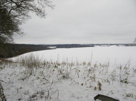
(10) View from Lacey Green |
(11) Smalldean Lane |
(12) St Botolph's Church, Bradenham |
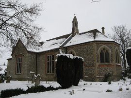
From the churchyard I headed up Church Lane, where there were fine icicles hanging from the roofs of the houses, before joining a footpath on the left by some stables. This path headed alongside a field before crossing a farm track to join a narrow path that runs downhill alongside the edge of the trees to the left of photo 10. As I was walking down the path I stopped for a short lunch break, for once actually drinking my flask of tea, before continuing on to reach Smalldean Lane, photo 11. Opposite where the footpath joins the lane there was an Audi sportscar trying unsuccessfully to get up the snow covered lane. Eventually the driver gave up trying to progress further and reversed back down the way he had come. I followed the car down the road for a short distance before joining a footpath on the right that headed up into Bradenham Wood. The path snaked its way through the National Trust owned woodland, steadily ascending uphill towards the RAF buildings where I joined a broader track that began heading downhill through the trees. Reaching the edge of the woodland I went slightly off course for a short distance before finding the correct path that made its way over to the village of Bradenham, turning to the right along a hedge lined tack and then left alongside an area of open ground. The footpath joins Bradenham Woods Lane besides the old Youth Hostel although this was closed several years ago. Turning to my right, I headed down the road passing St Botolph's Church, photo 12, and the snow covered cricket pitch as I made my way towards the A4010 Wycombe Road.
 |
 |
 |
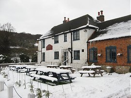
(13) Red Lion, Bradenham |
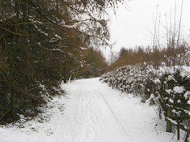
(14) Path nr Nobles Farm |
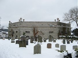
(15) The Mausoleum on West Wycombe Hill |
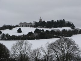
Reaching the road I headed past the Red Lion pub, photo 13, before crossing over the main road to join a footpath that heads under some railway lines and then begins heading steadily uphill, first beside a field and then through woodland, towards Nobles Farm which is situated on the top of another ridge. Here I turned to my left along a broad and level track, photo 14, that ran through trees towards West Wycombe Hill. As I was walking along this stretch of path there was small snow shower although fortunately this did not last too long. Leaving the trees I then headed over an open area of ground, which I think in better weather is used as a car park, to enter the ground of St. Lawrence church. Behind the church is a large mausoleum, photo 15, which belongs to the Dashwood Family who used to own the surrounding land before it was sold, first the Royal Society for the Encouragement of Arts, Manufactures and Commerce and then, in 1934 to the National Trust who are the current owners of West Wycombe village and hill.
 |
 |
 |
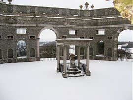
(16) The Mausoleum on West Wycombe Hill |
(17) Church of St. Lawrence, West Wycombe |
(18) View from West Wycombe Hill |
From the mausoleum I made my way back past the church, photo 17, to join a path that ran round the outside edge of the churchyard to reach the front of the mausoleum. Here I began making my way down West Wycombe hill from where there were good views ahead towards High Wycombe, photo 18. It was a rather slippery descent down to Church Lane from where it was just a short walk back to the car.
By the time I reached the car I had been out walking for over 5 hours and I was glad that had taken the decision earlier in the day to shorten my proposed route. I had only walked just over 11 miles in that time and had really been surprised how much the snow had slowed my walking pace down. Here is a link to the route of the walk: West Wycombe Circular.
If you would like to comment on this walk you can do so here:
![]() Back to:Walk index page
Back to:Walk index page
| ©2012 Bertuchi.co.uk. Please contact me using the email button on the right if you have any questions or comments regarding the site. Any feedback and additional information about places of interest on the walks is always welcomed. All rights reserved. Please contact me if you want to use any of the images or information from the site. ENJOY YOUR WALKING |
|