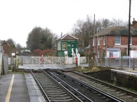
(1) Chartham Station
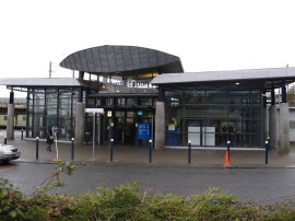
(2) Ashford Station
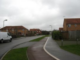
(3) Gordon Close, Ashford
Other Links >>> |
|
STOUR VALLEY WALK Part 2
Ashford to Chartham
I did this walk on Thursday 27th December 2007. I drove down to Chartham and took the train to Ashford to resume my journey along the Stour Valley Walk. Chartham is an attractive little village and I was able to park in a small free car park by the village hall, right besides the route of the Stour Valley Walk which was just a short distance away from the station. The journey from Chartham to Ashford took 17 minutes and a single ticket cost £4.40. Because it was Christmas time the traffic on the roads had been very light on the way down to Chartham and it had only taken me an hour and quarter to get there from London which was far shorter than I had been expecting which meant I had quite a wait at the station for the one train an hour that was running to Ashford.
|
|
|
|
(1) Chartham Station |
(2) Ashford Station |
(3) Gordon Close, Ashford |
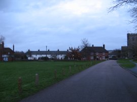
Chartham station, photo 1, is a small unmanned station although the level crossing gates were operated by hand rather than automatically and three times while I was waiting at the station a man came out of the green signal box to open and shut the gates. Last time I had not followed the correct route of the path into the centre of Ashford so leaving the station I quickly did a loop round the section of path that I had missed out last time before resuming my trip from Ashford station, photo 2. From the station I headed to the right along Station Road and then turned right down Tannery Lane, heading towards the Civic Offices. Turning left I then headed through the parkland by the Civic Centre to reach the A292 where I turned right along Hythe Road. Hythe Road is followed as far as Gordon Close, photo 3, where the route turns to the left as it makes its way towards the outskirts of Ashford.
 |
 |
 |
(4) Crossing the M20 |
(5) Fields nr Ashford |
(6) Fields nr Ashford |
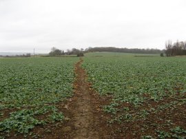
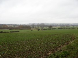
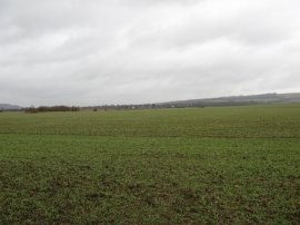
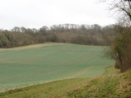
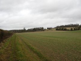
Where Gordon Close bends to the left the route continues ahead along a footpath that runs out to some open ground, although this looked as if it was soon going to be built upon. Crossing a track the route heads along a muddy path besides a small patch of woodland to take a footbridge over some railway lines. Passing between some houses the route then turns left along Cradlebridge Drive before bearing left to take a bridge, photo 4, that carries the Stour Valley Walk back over the M20 motorway. Once over the motorway the route joins a footpath that heads across open fields. Reaching a road the route turns right for a short distance before turning left along Blackwall Lane. At a junction the route continues ahead for a short distance further before taking a footpath that runs off to the left over the middle of a field, photo 5. This is followed across the field back to Blackwall Lane where the route once again heads along the road to the left. It was a very grey and overcast day, photo 6, with a brisk South Westerly wind however the wind direction did mean that it was particularly warm for the time of year.
 |
 |
 |
(7) Sheep |
(8) Field besides the River Stour |
(9) River Stour |
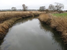
Just past the crest of a low hill the route bears to the right across a field and then continues alongside the farm buildings of Great Bromley Farm. Continuing ahead the route reaches Blackwall Farm where it turns left through the farm yard to cross a road and continue ahead over fields, photo 7, as the route makes its way down to the River Stour. In marked contrast to the first stage of this walk this was one of the few times today walk went near the river. Some of these fields were very damp and muddy, photo 8, and my boots were soon covered in mud. Reaching the River Stour, photo 9, the route heads down to the railway lines where it turns right for a short distance before bearing right across a patch of scrubby ground.
 |
 |
 |
(10) River Stour |
(11) Approaching Wye |
(12) Church Street, Wye |
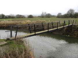
The route crosses back over the River Stour over a rather bouncy wooden bridge, photo 10, to continue across fields. In the distance I could see the hills of the North Downs and ahead of me the village of Wye, photo 11. After heading across a number of very muddy fields for about a mile the route reaches the edge of Wye. The mud in these fields was particularly sticky and they were very difficult and tiring to walk over. Entering Wye, the Stour Valley Walk turns down Long's Acre and then continues into Little Chequers. At the end of the road the route turns right along Bridge Street, linking up with the route of the North Downs Way, before turning left up Church Street, photo 12.
 |
 |
 |
(13) Church of St Gregory and St Martin, Wye |
(14) Heading towards Beech Wood, Wye |
(15) Approaching Warren Wood, Wye |
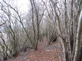
At the end of the road the route heads diagonally to the right through the churchyard of The Parish Church of St Gregory and St Martin, Wye, photo 13, and along a footpath that runs round past the buildings of Wye College. The route crosses a road and heads up Occupation Road to reach a broad track running alongside a field. The track starts heading uphill towards the Wye Downs and towards the end of the large field on the left hand side the route bears left across the field in the direction of a small radio mast. Leaving the field the route heads into a small patch of woodland continuing gently uphill to cross a road and continue ahead along the driveway that leads to the radio mast. The path passes the radio mast and head through some more trees for a short distance to cross another road and continues ahead to another large open field where the route turns right to run alongside the field edge, photo 14, before once again taking a path that runs diagonally across the field to the left towards some more woodland at Beech Wood. At this point I saw some long tail tits, the first I had seen while out walking for some months. The route cuts across the bottom of a valley that runs up to the right before ascending quite steeply up to the woodland. Reaching the top of the hill the Stour Valley Walk heads over a grassy field, photo 15, before turning left to take a path that runs through another patch of woodland, Warren Wood, on the top of the hill.
 |
 |
 |
(16) Field besides Warren Wood |
(17) Bridleway nr Eggarton Lane |
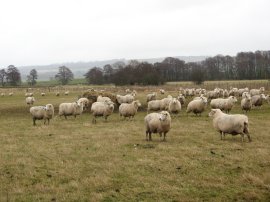
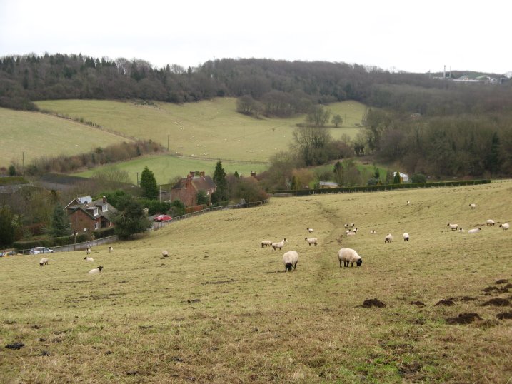
The path starts to descend and leaves the trees, following the edge of the woodland with a field to the right, photo 16. The route continues alongside this field until it reaches a sunken lane which the route crosses and then heads through trees as the route makes its way down towards some houses. Reaching the road at Crundale the route heads to right through the village and where the main road bends to the left continues ahead along another road. Where this road turns to the right the Stour Valley Walk continues ahead along a footpath into a field. The route turns to the left running alongside the edge of this field that slopes quite steeply up to the right before taking a hedge lined track that leads down to a road. At the road the route turns right then almost immediately left along a bridleway. The bridleway, photo 17, was lined with a hedge on the left and open fields to the right. Reaching the aptly named Bridleway Cottage the route continues along the driveway which runs down to reach the end of a road, Eggarton Lane. Just before the first house on the right of the lane the route turns right and heads diagonally uphill across a couple of fields to reach a patch of the trees where the route turns left running along close to the top of the hill. To my left there were extensive views across the Stour Valley. Reaching a stile route heads steeply downhill across a field, photo 18, which, when I went through, contained a flock of Black Headed Sheep. This leads down to reach some houses by Pope Street where the route turns right to continue along a driveway before taking a footpath off to the left that runs over the middle of a field. Once over the field the route passes through a gate and starts heading fairly steeply uphill towards some trees. The walk across the muddy fields on the approach to Wye had taken their toll on my legs and they, and particularly my left knee, where starting to feel a bit sore on this part of the walk.
 |
 |
 |
(19) Path besides Down Wood |
(20) Byway nr Chartham |
(21) Field nr Chartham |
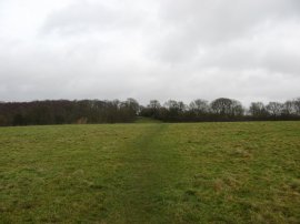
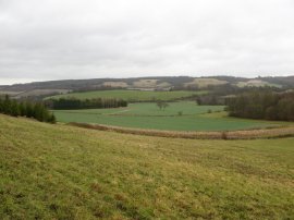
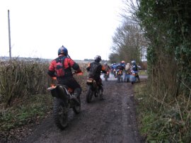
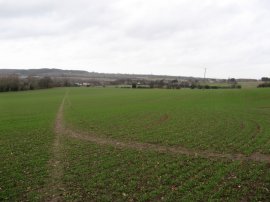
At the top of the hill the route enters some trees and turns left following a woodland path for a short distance before leaving the trees and taking another footpath that runs alongside the edge of some grassy fields before soon reaching another enclosed tree line track, running gently downhill along the edge of Down Wood. After about a third of a mile the route leaves this rather unattractive section of path through a kissing gate on the right and heads uphill over a small section of field towards a stile. The route then heads across several more grassy fields and small patches of woodland before turning right along what looked like a public byway. This view was leter confirmed when I was passed by a large number of motorcyclists making their way along the track, photo 20. From the path there were occasional views to my left across the valley towards Chilham Castle. After heading along the byway for at least a mile the route briefly joins Mystole Road before heading to the left across a large field, photo 21. Fortunately this field was nowhere near as muddy as some of the ones I had walked across earlier in the day.
 |
 |
 |
(22) The Green, Chartham |
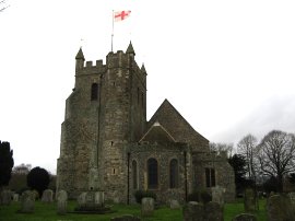
(23) St Mary's Church, Chartham |
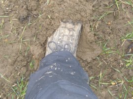
(24) Mud! |
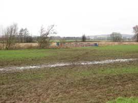
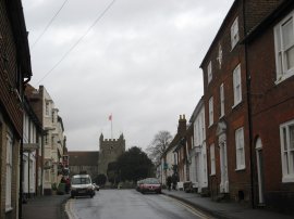
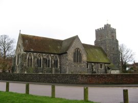
About two thirds of the way across the field the Stour Valley Walk turns to the right at a junction of footpaths to head down to join a road on the outskirts of Chartham. Here the route continues straight ahead before turning left to run alongside a hedge that follows the field edge. At the end of the field the route takes a footpath to the right, down beside a house to reach a road where the Stour Valley Path turns left to cross a bridge over the railway lines and then right to take a footpath that runs parallel to the tracks. Reaching a farm the route turns right to take a level crossing back over the railway lines then left along Parish Road in Chartham. The route runs down the road to The Green, photo 22, and takes a footpath that runs through the churchyard of St Mary's Church, photo 23. Leaving the churchyard the route crosses a road and enter the car park where I had parked my car at the start of the day. It was getting very gloomy as I approached Chartham and a number of photos that I took as I entered the village are too dark and blurry to use. The last two photos were ones I had taken earlier in the day, the photo of the Church of St Mary at Chartham in the morning when I had arrived there and photo 24 was taken crossing the muddy fields towards Wye.
Reaching Chartham I had walked a total distance of 15.0 miles, once again all along the Stour Valley Walk. This has been another enjoyable and quite hilly walk although some of the fields were very muddy and hard to walk over. There were a number of fine views over the Kent countryside although the grey overcast weather meant that these could not be seen in all it their glory. Hopefully the weather will be better when I return to the area along the North Down Way.
If you would like to comment on this walk you can do so here:
![]() Back to:Walk index page
Back to:Walk index page
| ©2012 Bertuchi.co.uk. Please contact me using the email button on the right if you have any questions or comments regarding the site. Any feedback and additional information about places of interest on the walks is always welcomed. All rights reserved. Please contact me if you want to use any of the images or information from the site. ENJOY YOUR WALKING |
|