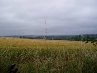
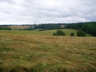
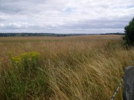
(1) Fields Nr West Hyde
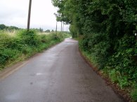
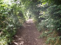
(2) Old Uxbridge Road, West Hyde
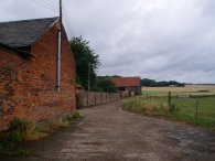
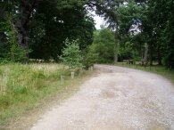
(3) Woodoaks Farm
OLD SHIRE LANE CIRCULAR WALK
|
|
|
|
(1) Fields Nr West Hyde |
(2) Old Uxbridge Road, West Hyde |
(3) Woodoaks Farm |
I did this walk on 9th July 2006. As seems to have been happening quite frequently just recently, this walk was a last minute change to the one I had intended to do however with the Victoria Line being shut it was easier to go somewhere I could drive to and being relatively close to home it fitted in better with my plans for the rest of the day. The Old Shire Lane Walk is a circular walk that runs just to the South of Chorleywood, nr the start of the Chiltern Hills on the Hertfordshire Buckinghamshire borders. The weather had been very wet as I drove round the M25 but had turned to drizzle by the time I started to walk and by the end had brightened up considerably.
I parked my car at the Northmoor Hill Wood nature reserve which is about half a mile off the route of the walk and walked down Tilehouse Lane, which is on the route of the South Bucks Way, to join the Old Shire Lane path where it crosses the road. The road was very quiet and I was only passed by a couple of cars as I was walking. Once I reached the start of the walk I turned right off the road and headed down a tree lined path that descended steeply to the valley of the River Colne. Photo 1 was taken looking across the fields to the left as I descended. At the foot of the hill the path crosses over the A412 and then follows the Old Uxbridge Road, photo 2, in a Northerly direction for a couple of miles as it runs roughly parallel with the current A412. This was a fairly uninspiring stretch of road walking with very little of interest to be seen. Although the lakes of the Colne Valley were very close by these remained out of sight at all times. The church of St Thomas at West Hyde had an interesting steeple although it was so densely surrounded by trees it proved impossible to photograph. The Old Uxbridge Road eventually joins the main A412 at Maple Cross for a short distance before the Old Shire Lane path leaves the road and heads up a bridleway towards Woodoaks Farm. Just before the end of the farm buildings in photo 3 the path turns left and heads uphill beside a field to a patch of woodland that runs alongside the M25 marked on the map as Ladywalk Wood.
 |
 |
 |
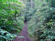
(4) Ladywalk Wood |
(5) Fields nr Heronsgate |
(6) Old Shire Lane |
The path leaves the Ladywalk Wood, photo 4, on a bridge over the M25. Once over the motorway the path runs on a footpath along the side of fields to Heronsgate. Photo 5 was taken looking back towards the M25 from the path with Bottom Wood to the right of the photo. In Heronsgate the path turns left into Heronsgate Road and then a short distance later turns left again into Bullsland Lane. At the end of the lane the path bears right along a path to join a track that heads South with Philipshill Woods on one side and fields on the other. It is this track that is the Old Shire Lane. This part of the walk is shared with the Chiltern Way and was very attractive to walk through as the sun made a brief appearance to shine through the leaves of the trees that lined the path, photo 6.
 |
 |
 |
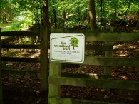
(7) Philipshill Woods |
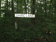
(8) Shire Lane |
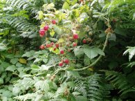
(9) Raspberries, soon to be eaten! |
The woodland beside the path is managed by the Woodland Trust and it was pleasing to see their signs, photo 7, saying that "Visitors are welcome to walk here" as I went past; far too often woodlands seems to be accompanied by "Private Keep out" signs. The Chiltern Way is left as the path turns left and then right to reach another stretch of road walking, this time along Shire Lane itself, photo 8. As perhaps can be deduced from the name the Shire Lane marks the boundary between the counties of Buckinghamshire and Hertfordshire. Shire Lane meant another stretch of road walking but once again the road was very quiet with little traffic.
As I was walking along the lane I spotted a large number of red berries in the hedgerow. At first I thought these were unripe blackberries but on closer inspection they proved to be raspberries - nicely washed by the earlier rain and in perfect condition to eat, photo 9. Blackberries seem to grow just about everywhere in the hedgerows but I don't recall ever coming across Raspberries before. They made a very tasty treat and had far more flavour than the ones I had brought the day before when shopping.
 |
 |
 |
(10) Fields Nr West Hyde |
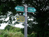
(11) Footpath signs |
(12) Northmoor Hill Wood |
The path continues for some distance along Shire Lane until just past the Dumb Bell Pub where the road turns sharp left the route of the Old Shire Lane Circular Walk continues straight ahead along a bridleway to rejoin another stretch of road for a short distance which leads down to a bridge that takes the path back over the M25. Here the path immediately leaves the road and takes a footpath to the right that runs between fields back to Tilehouse Lane. To the left of the path was a huge field of corn, photo 10 and as the path passes round the side of the field the route of the South Bucks Way is rejoined. Passing by the edge of Juniper Wood there were a couple of farmers shooting pigeons. I had heard the shotguns for some time before I reached them and I also noted the large flocks of pigeons passing over the fields and as I reached them their dog came running up with a pigeon in it's mouth. From the path there were good views across the River Colne Valley towards Harefield and further away towards Uxbridge.
While the Old Shire Lane Circular Walk is not signposted in its own right all the rights of way the route uses where very clearly signposted photo 11, and there was never any doubt at to where the path was. Once back at Tilehouse Lane I retraced my steps back along the road to the car at Northmoor Hill Wood nature reserve, photo 12.
The GPS made this walk 8.89 miles long. Although not a classic walk, there was a bit too much road walking for my liking, the route passed through some very pleasant scenery after I had crossed over the M25 from Maple Cross and finding the raspberries in the hedgerow was a real bonus.
![]() Back to:Walking index page
Back to:Walking index page
| ©2008 Bertuchi.co.uk. Please contact me if you have any questions or comments regarding the site. Additional information about places of interest on the walks is always welcomed. All rights reserved. Please contact me if you want to use any of the images or information from the site. Thank you. |
|