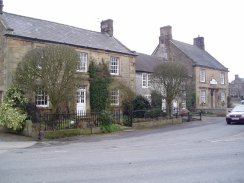
(1) Hartington Youth Hostel
(2) Hartington
PEAK DISTRICT
Circular from Hartington (2)
|
|
|
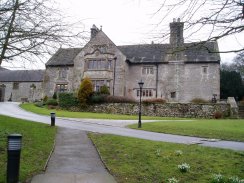
(1) Hartington Youth Hostel |
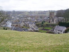
(2) Hartington |
I walked this circular walk from Hartington with Paul on Monday 20th March 2006.
We started the walk from Hartington Youth Hostel, photo 1, where we had stayed for the previous two nights. From the car park there was a nice view across the village of Hartington, photo 2, nestled at the foot of the hill.
 |
 |
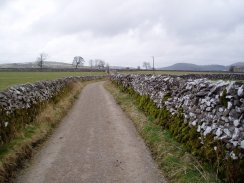
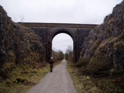
(3) Track from Hartington YHA |
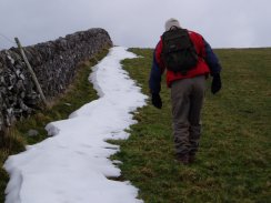
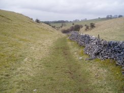
(4) Drystone Walls |
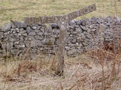
We took a track, photo 3, that heads off across the dales from almost directly opposite the hostel. A short distance further on we took a footpath off to the left that gradually climbed uphill across fields surrounded by dry stone walls. Once again it was a grey cloudy morning with a strong North Easterly wind blowing and there was still the remains of earlier snowfall besides the stone walls the line the fields, photo 4.
As we ascended there were good views back across Hartington towards the Valley of the River Dove that we had walked along two days earlier.
 |
 |
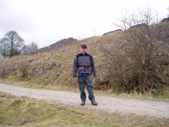
(5) Paul, Gipsy Bank |
(6) River Dove |
As we walked we were accompanied by the calls of skylarks which could be seen fluttering in the breeze overhead. We also saw a couple of curlews come flying close overhead, their distinctive long beaks clearly visible as they went past.
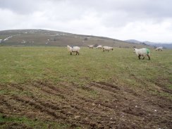
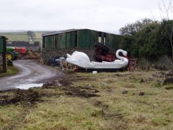
We continued across fields, photo 5, before joining another lane for a short distance. We then turned left, crossed a road and headed uphill across a field to the small and rather isolated village of Heathcote. We passed a number of interesting and old farm buildings before coming across the bizarre site of the swan boat, photo 6, sitting in a farmyard next to an overturned tractor. How it got there and why I guess we will never know!
 |
 |
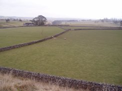
(7) View towards Long Dale |
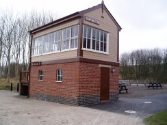
(8) Signal Box, Hartington Station |
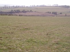
The route then followed a muddy farm track off to the right which wound its way between fields in a generally northerly direction towards the Tissington Trail just below the old Hartington Station. Again there were good views across the countryside and the line of trees on the horizon in photo 7 looked particularly impressive although this has not come out to good in the photo.
The Tissington trail was opened in 1971 and follows the route of the old Ashbourne to Buxton railway line. The old signal box has been preserved and the old rail points switches painted in bright colours, photo 8.
 |
 |
(9) Signal Box, Hartington Station |
(10) Paul, Tissington Trail |
An information board on the trail had a photo showing the signal box, photo 9 when the track was still in place. The platform, which had run alongside the signal box was level with the two small windows at the bottom of the signal box. The line had opened in 1899 and closed to regular passenger traffic in 1954. Following a quick look around the site of the station we headed down the trail in the direction of Ashbourne for a distance of about three miles.
 |
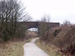 |
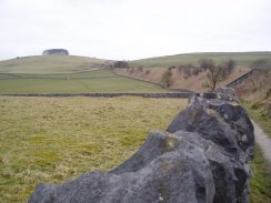
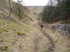
(11) Ilam Rock |
(12) River Dove |
Occasionally we passed old signs that indicated the gradient of the trail, photo 11. The good state of the path, photo 12, meant we were able to make much quicker progress than we had when walking across the muddy fields.
 |
 |
(13) Tissington Trail |
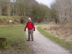
(14) Myself on theTissington Trail |
In some parts the trail was in cuttings which provided some shelter from the wind which was blowing very strongly across the trail from left to right, photo 13, although this rather restricted the views.
 |
 |
(15) Looking West towards Lees Barn |
(16) Tissington Trail |
In other places the trail ran up on embankments which although far colder than in the cuttings gave good views across the dales, photo 15. Eventually we turned off the Tissington Trail, photo 16, and after a very short stretch of walk along a road towards Lees Barn, turned left along a path that leads down towards Dovedale.
 |
 |
(17) Path towards Coldeaton Bridge |
(18) Path towards Coldeaton Bridge |
It was a gentle walk downhill, the valley sides gradually growing steeper as we descended down towards the River Dove, photo's 17 and 18.
 |
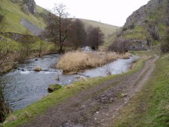 |
(19) Coldeaton Bridge |
(20) Dovedale nr Biggin Dale |
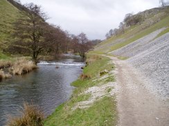
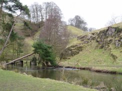
We reached the River Dove at Coldeaton Bridge, photo 19, directly opposite from where we had climbed down from Alstonefield the previous day. This time we turned and headed up Dovedale in the direction of Hartington and from this point on it was a relatively straight walk upstream alongside the River Dove. Photo 20 was taken just before Biggin Dale heads off to the right.
 |
 |
(21) Dovedale |
(22) Dovedale |
It was a pleasant walk up besides the river as the surrounding hillsides gradually became lower, photos 21 and 22.
 |
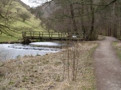
 |
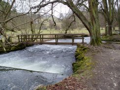
(23) Footbridge, River Dove |
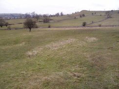
(24) Fields nr Hartington |
Near Beresford Cottage the path crosses over to the left hand bank of the river for a short stretch, photo 23 was taken looking back the way we had just come. The path goes through one last stretch of steep sided valley before the path leaves the course of the river and more open country to the South of Hartington is reached, photo 24. Hartington itself is just over the horizon. We headed gently uphill across the fields in a Northerly direction and in to Hartington. Once again these fields were quite boggy and muddy particularly around any gates or stiles which meant a few small detours to try and keep the boots clean.
 |
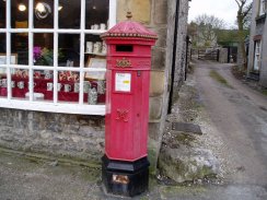 |
(25) Hartington |
(26) Letter box in Hartington |
Once Hartington was reached it was just a short walk through the town, photos 25 & 26 back to the Youth Hostel and the car ready for the drive back to London.
With this walk we had linked up the walks we had done on previous two days. They could almost form the start of a Peak District Chain Walk! Again it had been another very enjoybale walk with a good variety of scenery between the high moorland around around the Tissington Trail and the Dove valley.
![]() Back to:Walking index page
Back to:Walking index page
| ©2012 Bertuchi.co.uk. Please contact me using the email button on the right if you have any questions or comments regarding the site. Any feedback and additional information about places of interest on the walks is always welcomed. All rights reserved. Please contact me if you want to use any of the images or information from the site. ENJOY YOUR WALKING |
|