North Downs Way
Other Links >>> |
|
THE NORTH DOWNS WAY - PART 10
Shepherdswell to Canterbury
|
|
North Downs Way |
I did this walk on Sunday 9th November 2008. I drove down to Canterbury and then got the train from Canterbury East Station down to Shepherdswell, the single ticket cost £3.70. I had been going to park at the station car park but when I got there I found that even on Sundays the parking charge was £7 a day. I then tried another nearby pay and display car park which was a similar price and thus I decided to find a space in the back streets some distance away from the station where I could park for free. Having eventually found a suitable spot I then had to hurry to make sure I caught the train on time.
 |
 |
 |
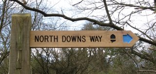
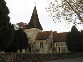
(1) North Down Way, nr Shepherdswell |
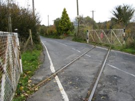
(2) East Kent Light Railway Line |
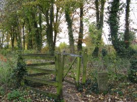
(3) Long Lane |
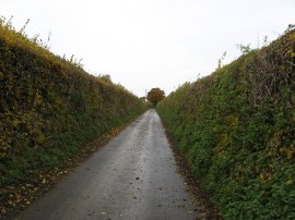
From Shepherdswell Station I followed the North Downs Way link route up a leaf covered footpath, across Eythorne Road, and then up Approach Road. At the end of Approach Road I continued along another footpath for a short distance to rejoin the route of the North Downs Way from where I had left it some two months earlier, photo 1. Back on the route of the North Downs Way the path heads downhill past some stables and out over fields before heading back down to the edge of Shepherdswell to once again cross over the Eythorne Road, close to where the tracks of the East Kent Light Railway cross the road, photo 2. The path then heads alongside a couple of fields down to reach Long Lane, photo 3. Here the route turns to the left, heading uphill along the quiet country lane.
 |
 |
 |
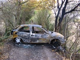
(4) Burnt out car |
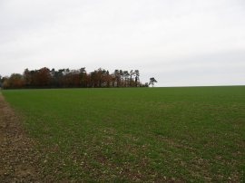
(5) North Downs Way nr Woolage |
(6) Heading towards Adisham Road |
After about half a mile Long Lane joins another road where the route turns briefly to the left to cross over the railway lines from Canterbury before leaving a road along a footpath that runs off to the right. This footpath soon joins a tree lined track that runs between fields which, when I went through, was partially blocked by a burnt out car, photo 4. The path then heads alongside the edge of a large field to join Nethersole Road. The route continue ahead along the road before taking a footpath that runs along the edge of the field on the right of the road towards the village of Woolage. The path skirts round the edge of the village green, where there was the remains of a Guy Fawkes night bonfire still smouldering away, and heads up to join a road that runs just in front of the trees that are on the horizon in photo 5. The North Downs Way heads briefly to the right along the road before heading through the trees and over another minor road to join a footpath that runs besides a field over to the village of Womenswold. The route heads across the road and heads up a track past some buildings and out into another large open field which is followed up to the busy B2046 Adisham Road, photo 6.
 |
 |
 |
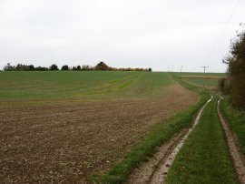
(7) Path over Barham Downs |
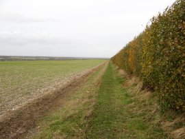
(8) Rapidly approaching rain clouds |
(9) Path over Barham Downs |
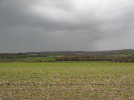
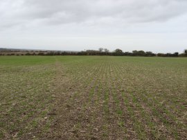
The day had started quite bright although the clouds had steadily become thicker and as I headed over the Barham Downs, photo 7, the weather began to steadily deteriorate. Looking over to my left as I walked alongside the wide open fields I could see a group of much darker clouds heading towards me from over the hilly ground on the other side of the A2, photo 8. Ahead of me I could still see a patch of sunny sky on the far horizon, but unfortunately this was not the direction the wind was blowing, which was coming strongly from the left. The wide open spaces were not the best area to be caught out in a downpour however soon the hills were disappearing under a cloud of rain and I was taking photo 9 I felt the first drops of rain starting to fall. By the time I had reached the hedge, which runs alongside a minor road, it was raining quite heavily, however the wind was blowing strongly enough to allow the hedge to act as a reasonable shelter against the rain. I put on my waterproof coat and decided to stop for my lunch break, nestled in the hedge. The worst of the rain had blown over by the time I had eaten and as I started to resume my journey I was joined by a runner, halfway through an 18 mile run. After stopping to chat for a while I continued on following the North Downs Way over the Barham Downs.
 |
 |
 |
(10) Higham Park |
(11) North Downs Way Milestone |
(12) St Mary Church, Patrixbourne |
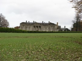
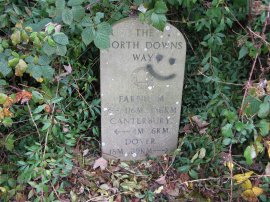
The rain had been sufficient to make the mud sticky and for the first time since the spring I found the damp earth sticking to my boots and before long it started raining heavily again. This time, rather than stopping to find shelter, I dug out my waterproof trousers and continued on across the damp fields. The route passes below Higham Park house, photo 10, and gradually makes its way down to run besides the A2 for about half a mile along a tree lined path that ran slightly above the road level. Being autumn the path was covered in fallen leaves and the trees also helped keep the rain, which was by now easing off again, at bay. Reaching the end of the trees the route turns to the right, away from the road, and heads down besides a field towards the village of Patrixbourne. As I was heading along the field edge I spotted another of the concrete North Downs Way milestones in the hedgerow, photo 11, which showed I had now walked 15 miles on from Dover. Reaching Patrixbourne the North Downs Way turns right along the road through the village passing the attractive St Mary Church, photo 12. The route follows the road through the village and then bears right up Hode Lane, a quiet stretch of tarmac running between fields. At a sharp left hand bend the North Downs Way continues ahead along a broad farm track past a small orchard and a patch of woodland and then between fields.
 |
 |
 |
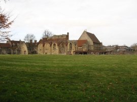
(13) St Augustines Abbey |
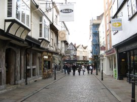
(14) Burgate, Canterbury |
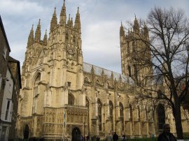
(15) Canterbury Cathedral |
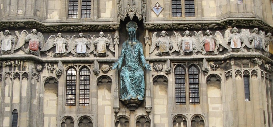
Shortly after passing an industrial area the route reaches the suburban fringes of Canterbury, joining the Pilgrims Way. The route heads downs between the houses following the road round to the right to cross over some railway lines and then following the Pilgrims Way to the left, continuing ahead where this becomes a surfaced footpath running behind houses and a playing field. At the end of the path the route turns right along a road, still called the Pilgrims Way, where I stopped and took off my muddy waterproof trousers prior to entering the town centre. Of course this was then the cue for another shower but fortunately it only lasted a couple of minutes. From here the path bears left into Spring Lane and then left again to join the A257 Longport where I linked up with part of the route of the Stour Valley Walk that I had walked earlier in the year. I headed down past the Canterbury Prison and round the side of St Augustines Abbey, photo 13. Leaving Longport I followed the road round into Monastery Street for just a few yards before turning left into Church Street. The route then heads across the busy A28 Lower Bridge Street and continues ahead into Burgate, photo 14, which I followed to the entrance of Canterbury Cathedral. Unlike the last time I had been here the grounds were open and I was able to enter a get a far better picture of the cathderal, photo 15.
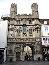 |
From Christ Church Gate, photo 16, I headed up the short distance up Mercery Lane to the High Street where I finished this stage of my walk along the North Downs Way. The GPS said that I had walked just 10 miles along the route on this stage
From the High Street it was just over half a mile back to where I had parked my car which made a total distance walked for the day of only 11 miles. Just as I reached the car I realised that for the next stage, the train from Wye will arrive at Canterbury West station and that I would have been better continuing my walk to there before heading back to the car as will now have to walk the wrong way down the North Downs Way to get to the point where I finished this time. It would have also added an extra mile or so to this rather short walk. Still just one more stage to go; the end is in sight!
If you would like to comment on this walk you can do so here:
![]() Back to:Walk index page
Back to:Walk index page
| ©2012 Bertuchi.co.uk. Please contact me using the email button on the right if you have any questions or comments regarding the site. Any feedback and additional information about places of interest on the walks is always welcomed. All rights reserved. Please contact me if you want to use any of the images or information from the site. ENJOY YOUR WALKING |
|