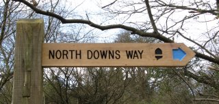
North Downs Way
Other Links >>> |
|
THE NORTH DOWNS WAY - PART 9
Folkestone to Shepherdswell
|
|
North Downs Way |
I did this walk on Friday 22nd September 2008. I still had quite a number of leave days to take before the end of the year and the train transfer times were considerably better than on a weekend for what was going to be quite a long walk between Folkestone and Shepherdswell. Driving down to Shepherdswell I arrived in good time for the 10:26 to Dover where I had a short wait for the connecting train over to Folkestone West station, arriving at 11:04.
 |
 |
 |
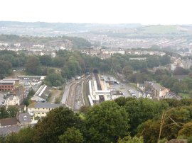
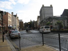
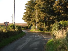
(1) Cherry Tree Avenue, Folkestone |
(2) Castle Hill |
(3) Channel Tunnel Rail Terminal |
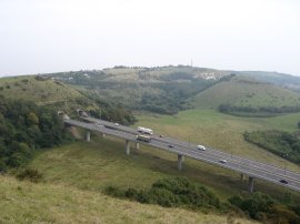
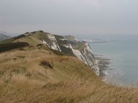
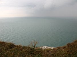
From Folkestone West station I set off along Cherry Tree Avenue, photo 1, retracing my steps for a mile and a quarter back over the A20 and up Castle Hill road to rejoin the route of the North Downs Way on the top of the Folkestone Downs, close to Castle Hill, photo 2. The route from the station is waymarked with signs saying "Follow the Kestrel to the Downs". Once back on the North Downs Way I continued along the edge of the downs past the earthworks on top of Castle Hill which are the remains of a Norman ringwork and bailey castle, probably built in the 1140's. The famous landmark is one of the largest and most complete ringwork and bailey castles in the South East of England and is a scheduled ancient monument. Below I past the entrance to the Channel Tunnel, photo 3, the station still quiet after the previous weeks fire although a limited service was back in operation through the tunnels. The weather was much gloomier than on last weeks walk and there was quite a strong breeze blowing over the top of the downs and on this occasion I could barley see the English Channel beyond Folkestone, let alone France.
 |
 |
 |
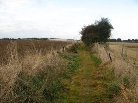
(4) Round Hill / Creteway Downs |
(5) Bees |
(6) Trig Point, top of Dover Hill |
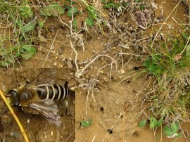
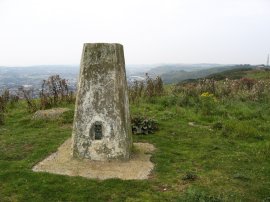
Passing round the edge of Castle Hill, the route runs parallel with the A20 before it heads off into the tunnels under Round Hill, photo 4. The North Downs Way follows the edge of the over Round Hill, descending slightly to cross over the A260 Canterbury Road, before heading up Crete Road East, the route ahead more or less following the skyline in photo 4. A short distance up Crete Road East the route takes a footpath that runs just inside from the road. Besides the path was a considerable stretch of earth that had been colonised by bees. There are actually a fair number visible in photo 5 (although not in the resized version). I had never spotted bees nesting like this before besides a path and spent some time watching their coming and going out of the soil. The path continues alongside the road over the Creteway Downs, crossing over a minor road and continuing up Dover Hill towards the trig point, photo 6, at a height of 170 metres. The trig point had the bracket number 11112 which got me wondering whether there was a 11111 anywhere.
 |
 |
 |
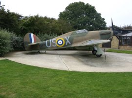
(7) Battle of Britain Memorial |
(8) Battle of Britain Memorial |
(9) Battle of Britain Memorial |
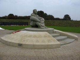
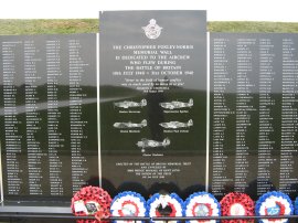
The route had steadily been heading closer to the coast and soon after the trig point the route crosses over the B2011, heads downs besides the Valiant Sailor pub and turns to the left to follow the path running along the edge of the cliff top. When I had been planning this and the previous walk I had half thought about finishing the stage from Wye here, rather than by Castle Hill, which would have made the two stages between Wye and Shepherdswell more even in length however I had been unsure about transport links. On my way past I noticed there was a bus stop more or less outside the pub although I am not sure how frequently they run. A short distance down the coast the North Downs Way passes the site of the Battle of Britain Memorial, photo 7-9. The idea of a National Memorial came from Wing Commander Geoffrey Page, who had been shot down and badly burned as a Hurricane pilot during the Battle. The Memorial, whose centrepiece is a sculpture of a seated airman looking out across the Strait of Dover, photo 7, was unveiled by Her Majesty Queen Elizabeth the Queen Mother in July 1993. The National Memorial site today also features replicas of a Hurricane and a Spitfire, photo 8, from the Battle, as well as the Christopher Foxley-Norris Memorial Wall (named in memory of a former Hurricane pilot who was first President of the Memorial Trust) which contains the names of all the airmen who fought in the Battle, photo 9. There is also a small visitor centre at the site.
 |
 |
 |
(10) The Warren, Folkestone |
(11) Acoustic Mirror |
(12) Flora Calcarea artwork |
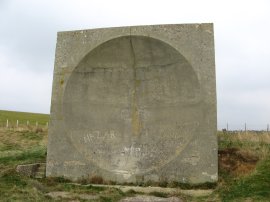
Just past the memorial the path goes down, and then back up, some steps around some houses. As I was following the path round a garden of one of the houses I came across a man who was mowing the footpath, with great difficulty, as he said his strimmer had broken and so was trying to use a lawnmower on the narrow and rather uneven path. A little further on from this I came across a dead snake which had unfortunately been caught and chopped into several pieces by the blades of the mower, two of the ends still wiggling away on the path. The path continues ahead over the top of downs above the Warren, photo 10. The route passes a cafe by Capel-Le-Ferne and then detours briefly inland to skirt another house. Here the route joins a paved track which soon becomes a gravel track as it heads back towards the edge of the cliffs. Just past here the North Downs Way passed a large concrete structure, photo 11, set on the cliff top, with a smooth hollowed out surface facing the coast. This is one of the concrete acoustic mirrors which were designed to focus the sounds of any incoming enemy aircraft to a listener in the days before radar made them redundant and aircraft were still slow enough to be heard before they were seen. I also passed plaque set into the ground describing the local flora and fauna, photo 12, part of a project called Flora Calcarea by artist Rob Kesseler for the chalk and channel way between Dover and Folkestone. Last time I had walked this stretch of path when walking the Saxon Shore Way I had spotted several of these but this time around this was the only one I noticed.
 |
 |
 |
(13) Samphire Hoe |
(14) Shakespeare Cliff |
(15) North Downs Way Milestone |
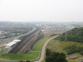
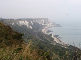
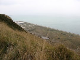
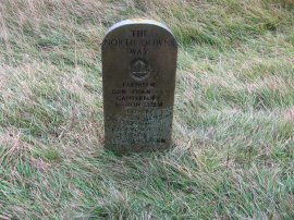
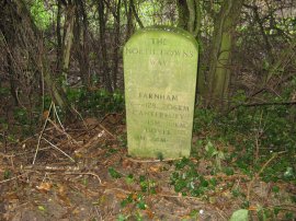
There followed a reasonably level stretch of walking as the path made its way over the cliffs above Samphire Hoe, photo 13. Samphire Hoe was constructed from the 4.9 million cubic metres of chalk marl dug to create the Channel Tunnel and is now a country park and far below me I could see a group of people taking a guided tour around the site. The cliffs between Dover and Folkestone had been heavily fortified during the second world war and I passed the remains of many old pillboxes and similar structures along the coast. As I had been heading towards Dover thicker clouds had steadily been building up and as I started descending down by Round Down it started raining quite heavily. I didn't really want to have to put my waterproofs on, it was reasonably warm and I knew I would soon get very hot and sticky wearing them, so I sheltered for some time behind one of the airshafts above the Shakespeare Rail Tunnel. The wind was blowing the rain sufficiently strongly to keep me dry until the rain started dripping off the slight overhang at the top of the airshaft. Admitting defeat, and not wanting to get soaked as on the previous walk I reluctantly dug my waterproof coat and trousers out of the rucksack and resumed my journey over Shakespeare Cliff towards Dover. Opposite where I had been sheltering was another of the North Downs Way Milestones, photo 15, this one stating that I had now walked 122 miles from Farnham and had just 2 miles to go to reach Dover. It also had additional mileages for London and Paris, although I'm not sure how you could walk there.
 |
 |
 |
(16) Rain over the Channel |
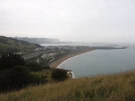
(17) View towards Dover Harbour |
(18) Knights Templar Church, Dover |
Photo 16 shows the worst of the rain cloud that I had been caught in as it passed out over the channel. Heading down over Shakespeare Cliff, Dover harbour gradually came into view, photo 17. The route joins a tarmac footpath that runs down to take a subway under the A20. From the subway the route heads up the Kings Ropewalk then along a grassy path that runs diagonally uphill underneath the Western Heights to join a road close to the remains of the Knights Templar church, photo 18, the site looking much more overgrown than when I had last gone past. Just before I reached the subway the rain had eased off enough for me to take my waterproof trousers off although my legs did get rather wet later on from the undergrowth as I headed up the path below the Western Heights.
 |
 |
 |
(19) The Drop Redoubt Fort |
(20) View over Dover Station |
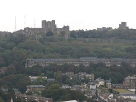
(21) Dover Castle |
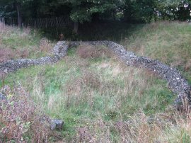
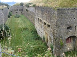
The route heads down Citadel Road for a short distance before turning left along Centre Road which soon runs into the North Military Road. Here the route crosses the road and takes a footpath that climbs up steeply besides the Drop Redoubt Fort, photo 19. The Drop Redoubt is one of the two forts on Western Heights, and is linked to the other, the Citadel, by a series of dry moats. The construction of the Redoubt was in two periods: the first being from 1804-1808 during the Napoleonic Wars, and the second from 1859-1864 following the recommendations of the 1859 Royal Commission. The North Downs Way heads around the side of the fort, the high path giving good views over the town of Dover, including the station, photo 20, where I had changed trains earlier in the day and across over to Dover Castle on the other side of town, photo 21.
 |
 |
 |
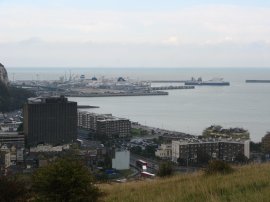
(22) Dover |
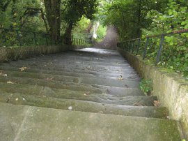
(23) St Martin's Steps |
(24) King Street, Dover |
The path continues round the fort with Dover Harbour coming into view, photo 22, before turning left and heading from the Western Heights down the 64 steps of the St Martin's Steps, photo 23, which were quite slippery after the rain. At the foot of the steps the route heads down Adrian Street, turns to the left to cross York Street at a pedestrian crossing and then continues down Queen Street before turning left into King Street in the centre of Dover, photo 24. Reaching this point meant that I had effectively walked the whole length of the North Downs Way between Farnham and Dover and here would be the end of the walk for those not walking both sections of the loop from Wye. Despite being the end of the route however, I did not notice any notice boards celebrating the fact like there had been at the start of the walk in Farnham. Given the bad weather earlier I had been considering finishing this section of the walk in Dover and taking the train back to Shepherdswell. I still had a fair distance to walk and my overall pace had been quite slow due the time spent sheltering from the rain and also stopping for something to eat in Dover however the sky was brightening up considerably and thus I decided to push on as originally planned and to try and walk at a faster pace so that I did not arrive at the car too late.
 |
 |
 |
(25) Approaching the A2 |
(26) Path nr Cane Wood |
(27) North Downs Way Milestone |
From King Street the route heads up Church Street, passing an attractive church and heading over an area of parkland to join a road where the route turns right before turning left up the busy Maison Dieu Road. Reaching a set of traffic lights the route then bears right, linking up with the route of the White Cliffs Country Trail and heads up Park Avenue and at the end crosses Connaught Road before taking a footpath that runs round the side of a church. The route of the North Downs Way was reasonable clear through town although there was one North Downs Way signpost pointing in completely the wrong direction on Church Street. The route turns to the left taking a sunken track, crossed by two low bridges which leads down to the Old Charlton Road. The North Downs Way crosses this and heads up a minor road towards Danes Court. It was quite a long slog up out of Dover along this section of lane that rises steadily uphill to eventually reach a byway, photo 25. On the way up the lane I passed a man out walking with a collection of 11 dogs of various shapes and sizes which provided a bit of interest as I plodded uphill. The route has now joined the course of a Roman Road and takes a relatively straight course ahead for the next couple of miles, only deviating off route to cross over the A2. On my copy of the Ordnance Survey Explorer map for the area the route is shown as heading to the A2 and then turning to the left to cross the road at the A256 junction however this section of path has now been closed and the route now takes a considerably longer route, turning to the right a fields length before the A2. A little further on the route turns left to head across the middle of this field and then right again along a footpath that runs besides the road up to cross the A2 on the road that runs to Guston. Looking ahead I could see Ramsgate in the distance lit up in the sun and slightly closer the towers of the Richborough power station. Once over the A2 it was back up besides the A2 on another footpath back to rejoin the original route of the path along the remains of the Roman Road, close to the A256 junction. I had been a bit annoyed by this unexpected diversion however my mood soon improved considerably as I headed across the open countryside in the afternoon sunshine. The route continues up the byway, often enclosed in a tunnel of hawthorn trees, before briefly joining the road in the hamlet of Pineham. Rejoining the byway the route heads over a couple of more fields, crosses another road and heads down past open fields towards Cane Wood, photo 26. The path briefly enters the edge of Cane Wood and I was surprised to see another of the randomly located North Downs Way milestones, photo 27, besides the path.
 |
 |
 |
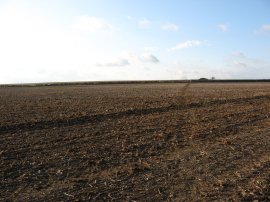
(28) Road Junction nr West Langdon |
(29) Farmland nr Ashley |
(30) Farmland nr Ashley |
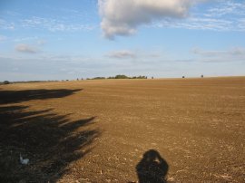
The route continues over farmland to join a road, heading across a road junction near the village of West Langdon, photo 28. Just past the junction the route of the White Cliffs Country Trail heads off to the right and a short distance further the North Downs Way takes a footpath that bears to the left over wide open fields, photo 29, heading towards the village of Ashley. The route follows the road round to the left through the village before taking a footpath off to the right that soon lead down into the grounds of Minacre Farm. Once again there were good views across the surrounding farmland in the later afternoon sunshine, photo 30. At the farm the North Downs Way heads off to the left along a farm track. At the end of the track the route then joins a road and turns right to cross over the A256 on the road bridge, the route once again deviating slightly from that as shown on my map which has the route of the North Downs Way heading more directly, and dangerously, across the road along a path that no longer exists. Once over the road the route turns to the right at a T junction before turning left to take a track that runs a short distance up to All Saints Church. The church served the Parish of Waldershare and the Waldershare Park Estate until 1980 when it was declared redundant however the church remains consecrated and is used occasionally for worship during the year. Looking at the church website there had in fact been a service just the day before I did this walk.
 |
 |
 |
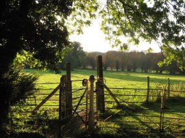
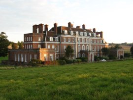
(32) Waldershare House |
(33) Field nr Waldershare House |
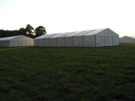
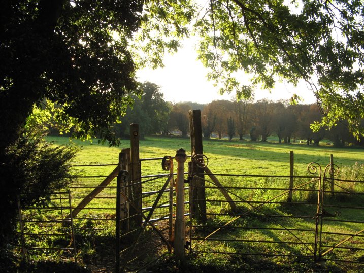
I took a couple of photo's of the church however it is surrounded by trees and they all came out very dark. I did however get a very nice photo looking across the parkland of Waldershare Park from the edge of the churchyard, photo 31. Leaving the churchyard the route heads across a small field and continues through a small circular plantation of trees known as Piddle Wood, before crossing another small section of field to join a driveway that runs through the grounds of the park. The North Downs Way then follows the driveway through the park, eventually turning to pass besides Waldershare House, photo 32, before bearing to the left over a patch of grassland in front of the house. The path continued along a rather indistinct path over the grassland before taking a black painted gate into a field. This field contained a considerable number of large white marquees and the direct route of the path worn in the grass headed straight into one, photo 33. The marquees had been erected in advance for the East Kent Ploughing Match which was taking place at the weekend.
 |
 |
 |
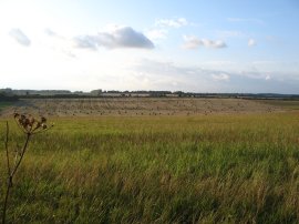
(34) Field nr Waldershare House |
(35) St Andrew's Church, Shepherdswell |
(36) Shepherds Well Station |
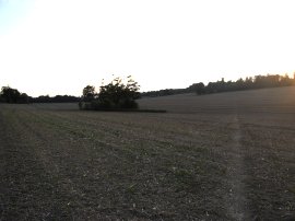
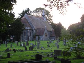
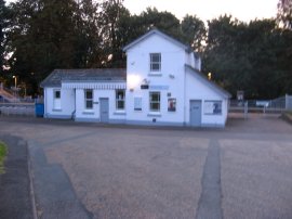
Having negotiated a course round the marquees the route heads to the corner of the field by some trees and then out over another larger open field, photo 34, heading over a shallow valley towards a small patch of woodland. A I walked across the filed the sun just dipping below the trees on the horizon. On my left I could see the tall structure of the Belvedere Tower. Leaving the woodland the route joins a road near Coldred for a short distance before taking a footpath that runs off to the left passed the buildings of Coldred Court Farm. Heading over a couple of stiles the route then turns to the right and heads over another large expanse of open fields towards the edge of the village of Shepherdswell. A number of the fields in this area had been recently ploughed and I was thankful that despite the recent rain the soil was still quite dry, I think it could be a very muddy and sticky passage in wetter weather. The North Downs Way leaves the fields and heads alongside St Andrew's Church, photo 35, down to join a road in the village of Shepherdswell. Here the route heads diagonally across the road before heading up a driveway that runs between houses. A short distance along this path I left the route of the North Downs Way, taking a footpath that ran off to the left heading downhill, past a playing field and onto a road that headed down to Shepherdswell Station, photo 36.
Outside the station there was a North Downs Way marker showing it as 1 mile to the North Downs Way, although the actual distance was under half a mile. Reaching the car I had walked a total of 18.9 miles of which 17.25 miles had been along the North Downs Way. I had walked the last 9 miles in three hours and arrived back at the car just before 7:00 pm. This had been a far more enjoyable days walk than I had been expecting. I knew from the Saxon Shore Way that the stretch of path between Folkestone and Dover was good walking but having left Dover I was also very impressed by the rolling chalk farmland the route passed through on the way to Shepherdswell which I had thought might be quite dull. Having got this stage of the walk completed I now just have to much shorter stretches to do to complete the entire path, both of which have the bonus of having direct train links between them which will cut the transfer times down between the finish and start points.
If you would like to comment on this walk you can do so here:
![]() Back to:Walk index page
Back to:Walk index page
| ©2012 Bertuchi.co.uk. Please contact me using the email button on the right if you have any questions or comments regarding the site. Any feedback and additional information about places of interest on the walks is always welcomed. All rights reserved. Please contact me if you want to use any of the images or information from the site. ENJOY YOUR WALKING |
|