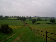
(1) Fields nr Redbourn
(2) Crossing the M1
(3) Route nr Flamsteadbury Farm
Other Links >>> |
|
THE HERTFORDSHIRE WAY - DAY 13
Redbourn to Great Gaddesden
The wettest day ever! Well there have probably been wetter days and I do remember a very rainy day up in the Lake District by Borrowdale about 15 years ago but seldom have I been out in such heavy or persistent rain. Not only did it rain heavily but the wind also picked up during the day and it became very cold too. I did this walk on Sunday 27th May and with true Bank Holiday weather it was absolutely pouring down with rain when I started and continued to rain without stopping for the next six hours. I parked in the village of Redbourn opposite All Saints Church where I had finished my last stage of the Hertfordshire Way.
|
|
|
|
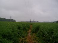
(1) Fields nr Redbourn |
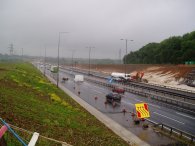
(2) Crossing the M1 |
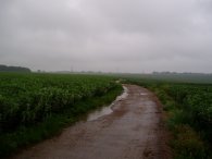
(3) Route nr Flamsteadbury Farm |
From the church the route heads through the churchyard, round past the church tower and out into fields. The path follows the field edge for a short distance before heading diagonally across a field, photo 1, to cross a bridge over the M1 motorway, photo 2. Once over the M1 the Hertfordshire Way continues up a driveway, past Flamsteadbury Farm, before turning right along a farm track, running between gently rolling fields, photo 3.
 |
 |
 |
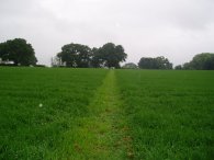
(4) Field nr Flamstead |
(5) Heading towards Flamstead |
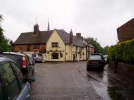
(6) Flamstead |
Reaching the end of the farm track at the corner of a road the Hertfordshire Way turns right along a tree lined bridleway. About half way along a field the route turns left to take footpath 48 over a field which is signposted "Flamstead ¾ mile", photo 4. Crossing the field the path turns right to follow a hedge round to a broad farm track that runs steeply downhill with the village of Flamstead ahead in the distance across the bottom of a dry valley, photo 5. Heading up the other side of the valley, where the farm track turns to the left the Hertfordshire Way continues ahead through a kissing gate through a scrubby bit of woodland to reach the outskirts of Flamstead. The route turns right along the road and continues on past the church and Three Blackbirds pub and along Chapel Lane, photo 6. Turning left into Friendless Lane the route then bears right at the next road junction, continuing on Friendless Lane before taking a farm track on the right. It was about at this point that the rain managed to find its way into my waterproof trousers, which having accidentally been washed with detergent just recently were no longer quite as waterproof as they could have been. My Paclite mac stayed dry all day though, it seemed quite flimsy when I brought it last year but it has actually proved to be quite robust given the use it has had.
 |
 |
 |
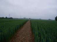
(7) Heading towards Markyate |
(8) Beechwood House |
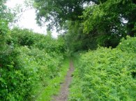
(9) Path towards Ballington Bottom |
The path crosses a number of small fields, running parallel with a line of electricity pylons away to the left. The Hertfordshire Way then enters an enormous open field, photo 7, the flint strewn muddy path over the field was damp enough for the mud to start sticking to my boots in great big clods, the first time this has happened for some months. Eventually the path reaches a hedge and continues ahead along a grassy track following the hedge round to the right before taking a short stretch of sunken line into the village of Markyate. The route turns right onto the road which is followed to a T junction where the route turns left and left again besides the fire station to take a road that runs through houses to the edge of the village. Level with the last house the Hertfordshire Way takes a footpath that runs off to the left behind houses. This is followed, at first going uphill and under some electricity pylons, for quite some distance besides a number of fields. This part of the walk was accompanied by the constant sound of banging, I presume from something like clay pigeon shooting. The area the sound covered was quite large and the noise quite intrusive. Reaching a road the Hertfordshire Way turns right and then follows the road down to its end where the route turns left along the driveway marked to Beechwood Home Farm, heading at first downhill on a gravel covered track. At a cross roads of tracks, just past the farm buildings, the Hertfordshire Way turns left down another gravely path, down past the side of Kennel Lodge. The track becomes a tarmac drive as it runs in front of Beechwood House school, photo 8. Whilst I was on this stretch of path I'm sure I saw a Hen Harrier flying low over the fields that were to my left, it was lower than me and looked grey from above with a conspicuous white rump, smaller and less "heavy" than a buzzard, but bigger than say a kestrel, I really can't think what else it could have been, very unusual. Continuing along the driveway the route runs past the edge of a sports field where the route turns right and passes through a patch of scrubby trees before continuing along the edge of the playing fields. The route of the public footpath at this point is slightly different to that marked on my map which appears to be routed diagonally across the playing field rather than around the edges as they Hertfordshire Way is signposted. At the end of the playing field the route passes through a kissing gate into a field that was being grazed by sheep, and heads down to reach a road. Here the Hertfordshire Way turns sharp right to take a tree lined track, signposted "Public Highway Ballington Bottom 2/3 mile", photo 9.
 |
 |
 |
(10) Fields nr Jockey End |
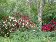
(11) Rhododendron's, Hoo Wood |
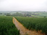
(12) Approaching Great Gaddesden |
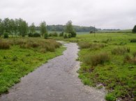
Leaving the track the Hertfordshire Way takes a footpath that runs off to the left over a field to reach the outskirts of Jockeys End. Passing through a small playground the route turns left along a road then a few hundred yards further on takes a footpath off to the right signposted Great Gaddesden 1 ½ miles. The path passes through a number of fields with thick grass, photo 10, which soaked my lower legs and boots, even more than the incessant rain. Reaching a patch of woodland, Hoo Wood, on the right the path starts heading gently downhill and then enters the woodland itself for a short distance. In the woodland there were a number of Rhododendron still in flower, photo 11. Leaving the woodland the path heads more steeply downhill over a field to reach the village of Great Gaddesden, photo 12.
 |
 |
 |
(13) River Gade, Great Gaddesden |
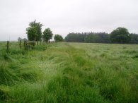
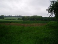
(14) Field, Great Gaddesden |
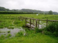
(15) St John the Baptist church |
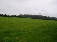
Crossing the road the route heads over a marshy area besides the river Gade, photo 13 as it makes it way up to the village. This marshy area was alive with flocks of swallows swooping low over the water. Reaching a road the route heads right, following the road round to the left through small housing estate to reach a footpath that leads uphill into a field, photo 14. This is where I finished my walk along the Hertfordshire Way for the day.
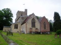
At this point I had done 9.86 miles, all along the Hertfordshire Way. From the field I headed down past the St John the Baptist church, photo 15, where I stopped under the lychgate to eat a quick sandwich out of the rain.
 |
 |
 |
(16) River Gade |
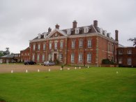
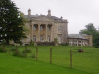
(17) Gaddesden Place |
(18) Greenlane Wood |
Leaving Great Gaddesden I then headed along side the marshy area besides the River Gade. Entering the field a sign had warned of the presence of a bull which I eventually came across as I took a little bridge back over the river, photo 16. The path then runs up to a house and onto a road. Across the road I joined up with the Chiltern Way and followed this uphill over fields past an imposing house at Gaddesden Place, photo 17, and then on past more fields to reach a farm track. Turning right to reach a road I turned right along the road to reach Briden's Camp before turning left onto a bridleway besides the Crown and Sepulchre pub. In Great Gaddesden the rain had turned to a much more pleasant drizzle however reaching the road it started pouring down again and I gave up taking any photos as I splashed my way steadily back towards the car in Redbourn. From the pub my route took me over fields towards Gaddesden Row where I turned right, then soon left, to take a footpath that lead down towards Long Wood where I joined a rather muddy tree lined bridleway. Passing Long wood I took another footpath off to the down that ran down the side of a field towards Greenlane Wood, photo 18. Heading round the wood I joined a footpath that ran uphill to reach a track that led down to a minor road. Crossing this I took a path that headed over fields back to join the farm track I had walked earlier close to Flamsteadbury Farm from where I retraced my steps back to Redbourn.
Reaching the car I had walked 16.2 miles for the day which was a fair distance given the weather conditions.
![]() Back to:Walk index page
Back to:Walk index page
| ©2012 Bertuchi.co.uk. Please contact me using the email button on the right if you have any questions or comments regarding the site. Any feedback and additional information about places of interest on the walks is always welcomed. All rights reserved. Please contact me if you want to use any of the images or information from the site. ENJOY YOUR WALKING |
|