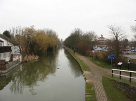
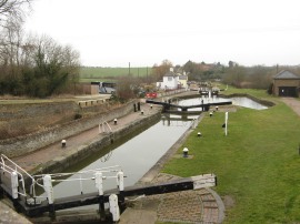
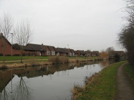
(1) Grand Union Canal, Leighton Buzzard
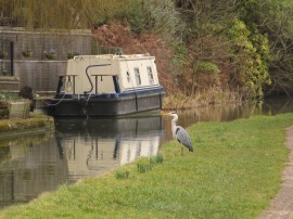
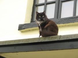
(2) Heron
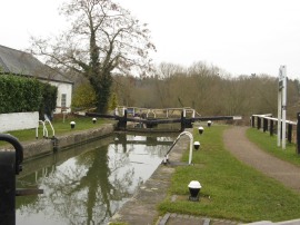
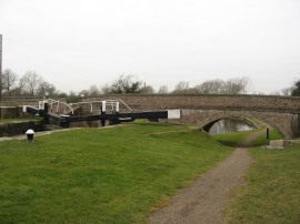
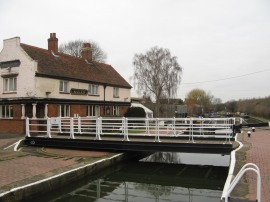
(3) Leighton Lock
Other Links >>> |
|
GRAND UNION CANAL - Part 10
Leighton Buzzard to Wolverton
I did this walk on Wednesday 29th February 2012. I had a rather slow journey up to Leighton Buzzard where I parked in the station car park which cost £6.90 for the day. I had spotted a Tesco's with a large car park right besides the canal in the centre of Leighton however you can never be sure if you will be spotted using such a car park for non shopping related parking and given the town centre nature of the car park I thought it better to be safer than sorry. The day started overcast and dull but was very mild for the time of year with only a light breeze.
|
|
|
|
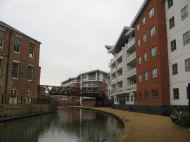
(1) Grand Union Canal, Leighton Buzzard |
(2) Heron |
(3) Leighton Lock |
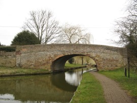
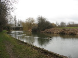
From the station in was then just 0.33 of a mile walk back down to rejoin the Grand Union Canal, photo 1, at the point where I had finished my last walk back in November. From this point the canal soon makes its way out of Leighton Buzzard, following the floodplain of the River Ouzel. I soon passed a Heron fishing besides the bank, photo 2. This was one of many I saw during the walk and I spent a fair bit of time trying to photograph one in flight as they took off when I went past although I didn't have much luck! In Leighton Buzzard the canal passed the brightly painted blue boats of Wyvern Shipping Company lined up along the canal bank and a short distance from the start I reached lock 27, which is Leighton Lock, photo 3.
 |
 |
 |
(4) Disused Swing Bridge, no 112 |
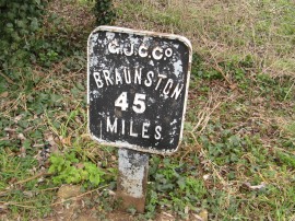
(5) Only 45 miles to go |
(6) Bridge 110 |
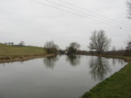
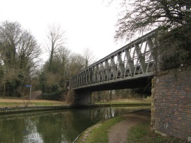
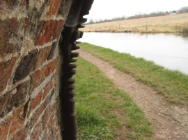
A little further on passed an old disused swing bridge, photo 4, on the bank besides the canal. As mentioned on other pages covering this walk the distance to Braunston is marked at each mile by a small metal plaque on the canal bank, photo 5, by the end of the day I was under 30 miles from Braunston. After1.3 miles from my start the route passes the Globe Inn and then bridge 111 which is where the route of the Greensand Ridge Walk leaves the canal. Just past bridge 110, photo 6, the towpath passes a winding hole, photo 7, and then curves round following the contours along the edge of the valley with the River Ouzel still running some distance away to the right.
 |
 |
 |
(7) Winding Hole nr Bridge 110 |
(8) The nearby train lines |
(9) Soulbury Three Locks |
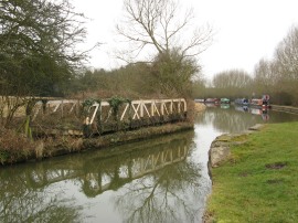
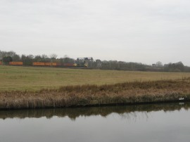
For a while the canal follows the route of the main rail lines up to Birmingham and there was a steady stream of rail traffic heading up and down the tracks, photo 8, which I myself would be taking on the way back form Wolverton. Reaching Bridge 107 the route changes to the opposite bank and heads down besides the Soulbury Three Locks, photo 9, which follow one another in quick succession close to the Grand Union Pub. On a British Waterways notice board there was a notice stating that there were water shortages on parts of the canal network and that travel should be only done in those areas where absolutely necessary, another sign of the really dry winter we have had.
 |
 |
 |
(10) Cat by the Grand Union Inn |
(11) View from bridge 106 |
(12) Stoke Hammond Lock |
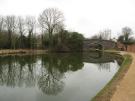
There was a cat sitting on a low roof outside the pub, photo 10, obviously a regular feature, as there were also a number of notices nearby asking people not to feed him and saying he had four bowls of food upstairs in the pub. By bridge 106 the towpath crosses back over to the opposite bank again, photo 11, as the canal gently winds its way between fields on a fairly picturesque section of path. Bridge 104, by Stoke Hammond Lock is a good example of one of the double arched bridges, photo 12, that were constructed when there were two locks built side by side to aid the passage of traffic.
 |
 |
 |
(13) Houses nr Fenny Stratford |
(14) Fenny Stratford and Swing Bridge |
(15) Bridges 90a and 90 |
Approaching Water Eaton the route passes the Willowbridge Marina and heads under the rather busy and noisy A4146 which is bridge 99a. Shortly after passing under Willow Bridge low rise housing started to become visible through the trees on the left of the canal marking the start of the built up area around Milton Keynes, photo 13. I stopped for a short break on a bench just before bridge 96 in Fenny Stratford where the housing started to encroach on both sides of the canal. Just past this bridge was a small marker stone saying it was 55 miles to the Thames. A short distance further the towpath passes under a rail bridge which carries the Marston Vale Line which runs between Bletchley and Bedford and reaches the rather unusual Fenny Stratford Lock which is lock number 22 and has a swing bridge across the middle of it, photo 14. 16. The towpath had been surfaced all the way between Leighton Buzzard and Fenny Stratford lock as it was quite pleasant to be off the hard tarmac and on the slightly softer, more muddy surface on the other side of the lock; although this interlude did not last that long. The Grand Union Canal follows a generally tree lined route past housing, open spaces and parkland, often accompanied by the noise of traffic from the nearby roads, the towpath passing under old brick bridges and newer concrete structures, photo 15, highlighting the different stages of development in the area. Bridge 90a carries the A421 across the canal and a short distance further on the path passes the entrance to the Milton Keynes Marina.
 |
 |
 |
(16) Suburban Milton Keynes |
(17) Where I stopped for lunch |
(18) Site of the Linford Wharf |
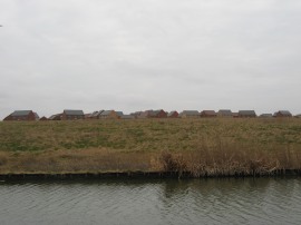
Photo 16 shows fairly typical Milton Keynes scenery with houses away on the left, the tree lined canal with parkland away to the right. For the next few miles there was not that much variation in the path and I plodded on through the towns. At one point I was just able to see the buildings that must form the centre of Milton Keynes away to the left but there was not that much to see of particular interest. A short distance after bridge 82 I passed the site of the start point for the Bedford and Milton Keynes Waterway. The proposed waterway will link the Grand Union Canal in Milton Keynes to the River Great Ouse in Bedford although the plans have been about for quite some time now with no real development actually taking place. Bridge 84 looked as if it had seen better days with a couple of quite big cracks running through the masonry and some bricks from the arch looking as if they were ready to fall off, in fact I was quite surprised it was still open in today's current health and safety climate. After 13.5 miles I stopped for my lunch break on a bench opposite the suburb of Pennyland, photo 17, where I soon had a couple of geese come up looking for any crumbs that might come there way. As I ate my sandwiches I wondered how different the area must have looked before all the new houses had been built. Continuing on along a newly laid gravel path the towpath reaches Linford Wharf, photo 18, where the short Newport Pagnell arm of the Canal used to leave the main canal although this closed way back in 1864, the site commemorated by a new information plaque. On this stretch some works had been undertaken on the canal bank and amongst the mud excavated from the canal where a number of very large freshwater shells.
 |
 |
 |
(19) Bridge 76a |
(20) New housing nr Stantonbury |
(21) Metal protecting the edge of the bridge |
From Linford Wharf the canal bends round to the west before heading under bridge 76a which is an old rail bridge, photo 19, that used to carry the Wolverton to Newport Pagnell Branch line. Passing bridge 76 the route joins a surfaced lane running past the Black Horse moorings at Stantonbury Wharf where the route links up briefly with that of the Swans Way and Midshires Way. Away to the left of the path more new houses were in the process of being constructed in the field just away from the canal, photo 20. However looking to the right I had finally reached the point where there were open views out across the surrounding countryside which made a pleasant change after the eight or so miles of the semi suburban sprawl of Milton Keynes. The edges of the old canal bridges were lined with metal rods and where these are still in place they often show signs of wear from the ropes that used to pull the barges, photo 21; the metal used to protect the much softer brickwork.
 |
 |
 |
(22) St Peters Church, Stantonbury |
(23) Grafton Street Aqueduct |
(24) Wolverton rail mural |
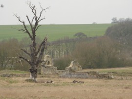
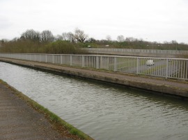
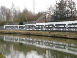
The canal passes the ruins of St Peters Church at Stantonbury away to the right, photo 22, as the canal gradually bends round to the left to end up travelling in an almost southerly direction for a while; the canal making the best use of the surrounding land. Away to the right, shortly after the ruined church, the canal passes a number of large lakes known as the Linford Lakes which are formed from old gravel pits. On this stretch I also spotted a way marker for the Ouse Valley Way although this was not marked on my map. This interlude of open countryside didn't last that long though and heading under bridge 74 the canal once again starts running through another area of housing as the path makes its way through New Bradwell. On the far side of the village the route crosses over the Grafton Street aqueduct, photo 23, which was opened in 1991 to carry the canal over the road. From the aqueduct the route bends its way round towards Wolverton, passing under the main rail lines where there was a big mural depicting the history of the railway, painted on the wall of the railway embankment, photo 24. The mural also said it was 72 miles to Birmingham although I'm not sure if that is an accurate distance or not.
 |
 |
 |
(25) Bates Bridge |
(26) Wolverton Park |
(27) Wolverton Station |
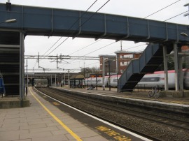
A short distance further on I finished this stage of my walk along the Grand Union Canal by bridge 70b, Bates Bridge, photo 25, which connects a couple of new housing developments on the site of the old rail works. At this point I had walked a further 17.5 miles along the Canal. The steps up to bridge 71 were closed so from bridge 70b I headed down past the new housing and along Wolverton Park Road, passing Wolverton Park, photo 26, which was once the home of Wolverton FC. This had one of the earliest covered stands in the country and a replica is sited in the park. I then headed to my right under the rail lines and right once again up Wolverton Road to the station, photo 27, where I got the train back to Leighton Buzzard, walking a total distance of 18.5 miles for the day. I had a 20 minute wait for the train and the ticket cost £6.70.
As usual I have uploaded the route of the walk which can be accessed here: Grand Canal Stage 10 Route.
This had been another good walk and I feel I have made good progress along the route, heading up into an area I have never walked before. I am definitely going to follow the tow path up to Braunston though for the time being I am probably be going to concentrate on the Chiltern Way which is my main walk for the year. It was also good to get the suburban areas around Milton Keynes out the way. For the next few miles there are far fewer stations on the route so I will have to look at buses or do shorter circular walks, or perhaps see if one of my walking colleagues will venture out that far! One odd thing about this walk was that all day I had an ache on the top of my right foot, I felt the first twinge as I got out of the car at Leighton Buzzard station and it only got worse throughout the day. By Wolverton this had got quite painful, enough that I kept having to stop, and I ended up completely undoing the laces on my boot. This helped a little bit my foot was still very sore. I have subsequently walked another 44 miles in the boots in the following two weeks without any problems! I'm still at rather a loss to explain this and what had happened while I was driving up.
If you would like to comment on this walk you can do so here:
![]() Back to:Walk index page
Back to:Walk index page
| ©2012 Bertuchi.co.uk. Please contact me using the email button on the right if you have any questions or comments regarding the site. Any feedback and additional information about places of interest on the walks is always welcomed. All rights reserved. Please contact me if you want to use any of the images or information from the site. ENJOY YOUR WALKING |
|