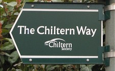
Chiltern Way
Other Links >>> |
|
CHILTERN WAY - Part 2
Coleshill to Sheepridge
|
|
Chiltern Way |
I did this on Easter Sunday, 8th April 2012. I drove to Coleshill where I once again parked up besides the village pond where we hand finished the last stage back in March. It was a cool grey day and there had been a fair bit of rain overnight, and on my way round to Coleshill, although it was dry by the time I set off and I would only encounter a few brief showers while I was out walking.
 |
 |
 |
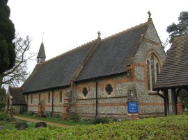
(1) All Saints Church, Coleshill |
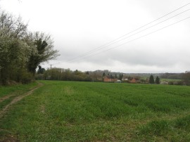
(2) Approaching Winchmore Hill |
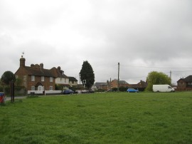
(3) The Common, Winchmore Hill |
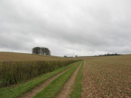
From the village the route takes a short stretch of footpath that heads down besides the church, photo 1. The Chiltern Way then crosses a minor road and heads down a stretch of gravel driveway between some attractive houses which soon leads past some old stables to join a field edge path. The footpath then heads gently downhill to pass through a small patch of woodland before joining another footpath running along the edge of a large open field. This path heads under some electricity pylons as the route makes its way over to the village of Winchmore Hill, photo 2. Leaving the fields I continued ahead along a track which leads past some houses and an industrial unit up to Whielden Lane, opposite the Primitive Methodist Chapel. Here the route heads to the left, the short distance up to the junction with Coleshill Lane with the Plough Pub on the left. The route then bears diagonally to the right across the large village common and playing field, photo 3.
 |
 |
 |
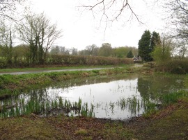
(4) Guardswater |
(5) Path from Horsemoor Lane |
(6) Path by Branches Wood |
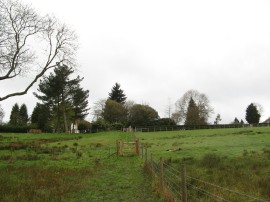
Reaching the end of the common the path heads through a kissing gate out along a fenced track running between paddocks. Like with some of the previous stage of the Chiltern Way the route is also sharing its course with that of the Chiltern Heritage Trail. This is a 52-mile circular walk through the Chiltern Hills created by Chiltern District Council in 2000, as part of their Millennium celebrations. The route then crosses a road by a small pond known as Guardswater, photo 4, where there was a very interesting board detailing the history of the small pond, before bearing to the left along a path running through a thin strip of woodland, photo 5. This track is followed gently downhill to a large area of trees where the route then bears to the left along a surfaced track lined by tall rhododendron bushes and at a bend in this track, photo 6, the Chiltern Way bears to the right along a path running through the trees.
 |
 |
 |
(7) Heading down to Penn Bottom |
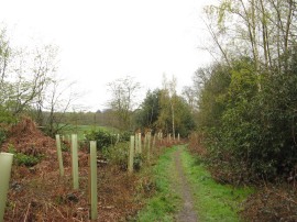
(8) Path from Noakes Lane |
(9) Path nr Penn |
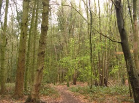
This soon leads to a field edge path that goes downhill round the edge of a field, photo 7, to join a road running along the bottom of a small valley. The route then crosses the road and joins a field edge path on the other side. This is followed round the short distance to Noakes Lane where the route continues ahead across the road to join a broad farm track heading gently uphill between fields, photo 8. This was a scenic spot and very popular area with dog walkers, I saw more people out on the path here than the rest of the walk combined. Shortly after passing through a field boundary the route bears to the left along a footpath that runs through the edge ofTwichels wood, leaving the bridleway which continues ahead around the edge of the wood. Leaving the trees the route heads to the left through a gate into a grassy paddock where there were still a few daffodils in bloom amongst the grass. This runs up to a road at the edge of Penn where the route turns briefly left and then right to join an enclosed stretch of footpath running down between houses and gardens. Passing a gate some far reaching views briefly opened up on the left, looking south over the surrounding countryside. Leaving the gardens behind the path heads downhill and round and area of trees before heading to the left uphill through three gates, photo 9 to reach a driveway where the path heads sharp left.
 |
 |
 |
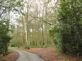
(10) Coppice Hoop |
(11) Start of the Berkshire Loop |
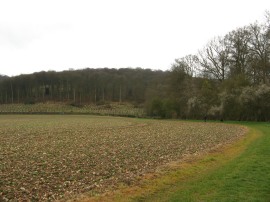
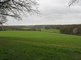
(12) View nr Coppice Hoop |
This driveway is then followed as it bends round to the right to join a section of path lined by a tall fir hedge that almost created a tunnel for the path to run through. This soon leads out into fields where the Chiltern Way bends round to the right before entering into another patch of trees. The route then heads across the top of a paddock and into another section of woodland at Coppice Hoop, photo 10. This stretch of path soon reaches a junction where the Chiltern Way forks to the right, the initials CW helpfully painted on a tree. Leaving the trees the route enters a field where immediately there is a sign indicating the start point of the Chiltern Way Berkshire Loop which heads off to the left, photo 11. This newest addition to the Chiltern Way was opened in October 2010 to mark the 10th anniversary of the path and I will be walking it once I have walked the main path and the Northern and Southern extensions. As it was I continued ahead, following the course of the original route across the bottom of the field as I wondered how long it would be before I was back at this point. The path continues ahead over fields with a golf visible away to the right and a very attractive valley snaking away off to the left, photo 12.
 |
 |
 |
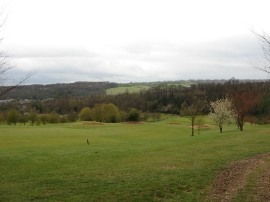
(13) Wycombe Heights Golf Course |
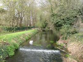
(14) River Wye, Loudwater |
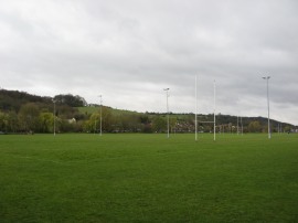
(15) Kings Mead playing fields |
The route heads down to Sniggs Wood where another short woodland interlude leads the route to a path running alongside the edge of the Wycombe Heights Golf Course, photo 13. The path snakes its way through the golf course, down towards the club houses before joining a path that runs alongside the entrance driveway. I had got caught in a short shower as I was heading through the golf course but by the time I was approaching the valley floor the weather had brightened up considerably. Reaching Rayners Avenue the route continues ahead towards a tall rail bridge across the road. Just before this is reached, at the junction with Robinson Road, the Chiltern Way bears half right into a patch of trees and then through a tunnel under the railway lines. Once under the railway a concrete track runs past houses and takes the route down to the main A40 road. Here the route heads to the left before crossing over the road into Frederick Place where the path crosses over the River Wye, photo 14, before turning to the right along a path running parallel to the river. The tarmac path is followed away from the river as it heads round to the left with an industrial estate to the left and a large number of rugby fields on away to the right on what is known as Kings Mead on the outskirts of High Wycombe.
 |
 |
 |
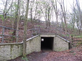
(16) Tunnel under the M40 motorway |
(17) The arrow points the way |
(18) Approaching Sheepridge Lane |
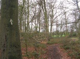
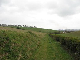
The route makes its way around the edge of playing fields before crossing a broad metal footbridge over a small stream. The route then heads across Kingsmead Road and continues ahead up Bridge Bank Close, the concrete track soon heading up into an area of trees. The path then heads steeply uphill through the Beech trees before taking a tunnel under the M40 motorway, photo 16. Leaving the long and dark tunnel, where every light had been ripped out, the route runs alongside the motorway for a short distance before joining a footpath on the left. This heads along the edge of a field with houses to the left into another patch of woodland, the path still running with houses to the left. At some point the route had been marked arrows painted on the trees, photo 17, which are a useful aid to navigation when there are none of the official footpaths markers present. Leaving the trees a fence lined stretch of footpath leads down to Heath End Road in Flackwell Heath where the route heads gently uphill to the right. The kissing gate just before the road was so narrow and badly designed that I had to remove my rucksack to get through it. Just past the junction with Spring Lane the Chiltern Way joins a footpath on the left that runs between a couple of houses and out onto a field edge path with wide open views across the surrounding countryside. Heath End Road was closed from its junction with Spring Lane due to a car accident however the policemen guarding the junciton let me through when we had determined on the map that the footpath I wanted was so near to the road junction. I hadn't actually been sure myself as I was navigating using the way marks rather than looking at the map and it is a credit to those looking after the path that I only needed to consult my map twice during the walk, and once was when I had managed to miss one of the large metal signs besides the path. As well as the good views ahead from the field down towards the Thames Valley there were also some Red Kites flying around over the field which made a pleasant sight to see. Continuing on along the field edge the footpath joins a track, photo 18, that runs down between fields to Sheepridge Lane where I headed to my right.
 |
(19) Crooked Billet, Sheepridge |
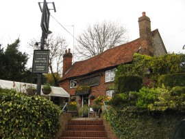
I then followed this road along to the Crooked Billet pub in the hamlet of Sheepridge, photo 19, where I finished my walk along the Chiltern Way for the day having walked a further 7.57 miles along the path. I still had plenty of energy at this point and did debate walking on a little further but the next parking space was quite some distance down the path and it would have made it a bit too much of a trip considering I would also have to walk the same distance back again.
As usual I have uploaded the route of the walk which can be accessed here: Chiltern Way Stage 2 Route.
I was able to devise a good circular route back to the car, avoiding the paths I had walked on, and eventually walked a total distance of 14.8 miles. It was good to have been back out in the Chilterns again and I was glad to get this stage completed and the crossing of the M40 motorway and busy area around High Wycombe out of the way. That said there were still some very scenic stretches of path on both the outwards and return legs of the walk.
If you would like to comment on this walk you can do so here:
![]() Back to:Walk index page
Back to:Walk index page
| ©2012 Bertuchi.co.uk. Please contact me using the email button on the right if you have any questions or comments regarding the site. Any feedback and additional information about places of interest on the walks is always welcomed. All rights reserved. Please contact me if you want to use any of the images or information from the site. ENJOY YOUR WALKING |
|