Chiltern Way
Other Links >>> |
|
CHILTERN WAY - Part 1
Hemel Hempstead to Coleshill
|
|
Chiltern Way |
I did this walk on Sunday 18th March 2012. I met up with Greg in Coleshill before driving over to Hemel Hempstead for the start of the walk. I had been going to park at the station, which had been free to park at on Sundays the last time I had been here, however there was now a £4 charge. I therefore headed the short distance over to Fishery Road where we parked at the roadside.
 |
 |
 |
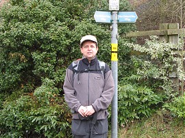
(1) The start of the walk |
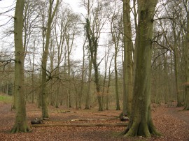
(2) Sheethanger Common |
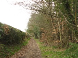
(3) Path from Longcroft Lane |
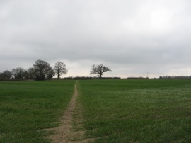
We then headed down the road, crossing over the Grand Union Canal, before heading to the right along the A4251 London Road. We followed the pavement under the bridges carrying the A41 and rail lines before crossing over the road to reach what was, for us, the start of Chiltern Way, photo 1. This heads along a footpath running besides the A41 before bending round through the trees of Roughdown Common. This leads up to Felden Lane where we headed to the left before joining a lane on the right that heads across the top of Sheethanger Common, photo 2. The route had been heading steadily uphill from the start and by this point we had probably already had more ascent than the previous weeks walk along the River Ver, not that we had actually ascended that far. We then joined another footpath on the right that headed across a couple of paddocks to reach Longcroft Lane. Here we headed to the right until the road heads sharp left where we joined a footpath that continued ahead across a field, photo 3.
 |
 |
 |
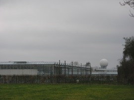
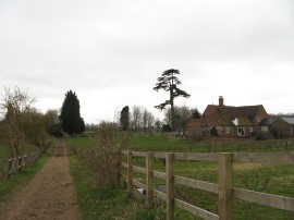
(4) Greenhouses and Radome nr Bovingdon |
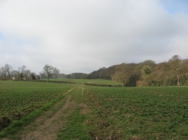
(5) A flinty field |
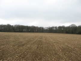
(6) Field nr Flaunden |
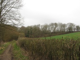
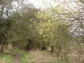
This footpath heads across a couple of fields before joining a footpath running alongside the edge of Bury Wood. A long stretch of field edge path is then followed as the Chiltern Way makes its way over to the village of Bovingdon, the village church briefly visible away to the right. Reaching the village the route heads to the right along Chipperfield Road for a few yards before heading to the left up Austins Meads where the Chiltern Way links up with the route of the Hertfordshire Way along a section of path I had walked back in June 2007. At the end of Austins Meads the route takes a footpath that runs between the houses and out into a field. The path then heads along the edge of a small field before bearing to the left to join a footpath that heads over fields up to Flaunden Lane. Near the start of this stretch of path the route passes close to some large greenhouses and in the distance behind them was could also see a radar type ball rising above the landscape, photo 4, which turned out to be the recently built Bovingdon Radome. Reaching Flaunden Lane the route heads to the right along the road before joining a footpath on the left that runs alongside a small patch of woodland. At the end of the third field the footpath then heads to the left, along the edge of one field and then over the middle of another larger field, photo 5, as the route heads up to Holly Hedge Lane which did indeed have neatly clipped holly hedges. Here we headed to the right for a short distance before joining a track on the right that leads down to a small stretch of woodland known as the Lower Plantation, the track at first running along the edge of the large field in photo 5 that we had just crossed. This field had been quite finely ploughed and showed how stony the soil was in the area. Reaching the end of the woodland interlude we continued ahead along a road, heading towards the village of Flaunden. Just before the village is reached the Chiltern Way joins a footpath on the left that heads along a field edge before bearing diagonally to the left across the next field, photo 6.
 |
 |
 |
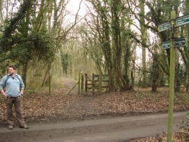
(7) Greg, Dawes Lane |
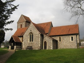
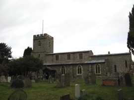
(8) Sarratt Church |
(9) View over the Chess Valley |
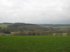
This leads over to another field edge path that runs down to another minor road. Here the route heads to the right, again just for a short distance, before joining another footpath on the left. This crosses a couple of fields before the path drops down some steps to join a road where we met a family coming the other way, one of quite a number of walkers we saw out the path during the day. The Chiltern Way heads to the left along the road before joining a footpath by Bragmans Farm. This soon leads to a farm track which the route follows to the left. This heads alongside Rosehall Wood and under some electricity pylons before a footpath is joined that heads diagonally across a couple of fields to Moor Lane. Continuing ahead across the road we followed the footpath into Dawes Wood and across Dawes Lane, photo 7, and up to a small road by an isolated house. The route heads past a small area of woodland, where there were some unusual sculptures amongst the trees, before joining a footpath on the right that heads out across the top of a field with views out over the Chess Valley opening up to the right. The path heads across the field towards Sarratt Church before turning sharp left along the bottom edge of the field. However first we continued ahead to have a look at the church, photo 8, and also have a quick look at the map to check that the path did indeed head sharp left, a dog leg which could have been avoided by heading more directly across the field. The signage was indeed correct, in fact this stage of the Chiltern Way was very well signposted and I think it would have been possible to navigate the days walk without the map or guidebook. When we stopped I had been surprised to see we had already walked over 7 miles, it really did seem like we had only just started. Heading along the edge of the field we soon joined a footpath that headed steeply down a grassy slope to the bottom of the Chess Valley, photo 9, near Sarratt Bottom.
 |
 |
 |
(10) River Chess |
(11) Turveylane Wood |
(12) Track leading to the rail lines |
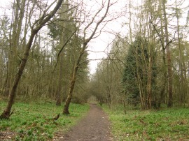
Here we crossed a bridge over the River Chess, photo 10, and continued ahead across the narrow valley floor in what was a very attractive setting. The path headed by some tall willow trees, just about ready to come into leaf before starting a long and gentle uphill climb along a broad path through the mixed woodland of Turveylane Wood, photo 11. Eventually the path heads off to the right, leaving the thin strip of woodland to curve round across a field before running through the edge of Wyburn Wood and alongside another field to reach a road. Here we headed to the right, following the road as it curves round to the left on the outskirts of Chenies. Soon a sigh pointed down a footpath on the left that heads alongside the edge of a cricket ground and besides a couple of fields to reach another minor road. Here we headed left and were soon waiting for a gap in the traffic to cross over the A 404 Amersham Road. On the other side of the road we joined a hedge lined track that heads downhill between fields and past a small area of trees to reach a tunnel under the embankment that carries the Metropolitan Line Underground services out to Amersham, photo 12.
 |
 |
 |
(13) Whitelands Wood |
(14) Path nr Newhouse Farm |
(15) Old Shire Lane |
Once through the tunnel the route begins heading gently uphill along a broad path running through Whitelands Wood, photo 13, and then Carpenters Wood. Close to the end of this patch of woodland we stopped for our lunch break on a pile of logs which made a handy seat. There were a few drops of rain while we were eating but despite the greyer than forecast weather I was really enjoying this walk through the rolling Chiltern countryside. From the woods we joined a farm track, photo 14, that heads down to Farm Road. This is followed down past houses to cross over Blacketts Wood Drive into Chalfont Lane. We were now walking through the edge of Chorleywood West, the road lined by a variety of fine houses. At the end of the lane we headed to the right along Shire Lane before continuing ahead along Old Shire Lane, photo 15, which soon becomes an unsurfaced track running with woodland to the right and fields away to the left. Old Shire Lane is one the route of the Shire Lane Circular Walk that I had walked back in July 2006.
 |
 |
 |
(16) St Giles Church |
(17) Chalfont St Giles |
(18) Path from Mill Lane |
Where Old Shire Lane heads sharply to the left we joined a footpath on the right that heads through an area of woodland. After a while the path bends to the left and heads uphill into open fields by Newlands Park. Away to the left we could see some of the buildings of the Chiltern Open Air Museum, which houses a collection of buildings from the Chilterns that would otherwise have been demolished or destroyed although we did not realise what these were at the time. The footpath leads to the entrance driveway to the museum and also the Buckinghamshire New University where we headed to the right the short distance down to Gorelands Lane. Crossing this, the Chiltern Way runs along a path that heads through the middle of a narrow strip of woodland which leads down to Chesham Lane. Crossing the road the footpath heads along the edge of a field before bearing to the left across another couple of fields. These lead on to an enclosed footpath running between houses which heads down to the A413 London Road. The Chiltern Way heads straight across the road, running between gardens down to the valley of the River Misbourne. The route crosses a small bridge over the dried up river where the route links up with that of the South Bucks Way as it skirts round St Giles Church, photo 16, before heading through an archway under a building into the High Street in the centre of Chalfont St Giles, photo 17. Crossing over the road the route then heads along a driveway which soon leads to an unsurfaced track lined by a thin strip of trees, the route still following that of the South Bucks Way. This leads on to another driveway and then Mill Lane where the route continues ahead. Where the lane bends round to the left the route continues ahead, once again running in a narrow band of trees, photo 18, that was in places little more than a thick hedge..
 |
 |
 |
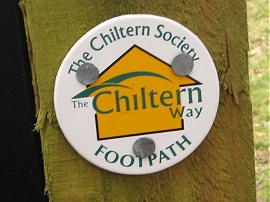
(19) Chiltern Way waymarker |
(20) Path leading up to Hill House Farm |
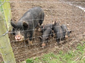
(21) Piglets |
Eventually a post on the left with one of the Chiltern Way waymarkers attached, photo 19, indicates the point the route leaves this path and begins heading uphill across fields, photo 20, towards Hill House Farm. We stopped for a short break on the way up, admiring the views back across the Misbourne Valley before joining a farm tack that skirts round the farm and back out to a field edge path that is followed up to Bottrells Lane. On the way we passed a small pigsty, photo 21, where the piglets all came running up to the fence to look at us.
 |
 |
 |
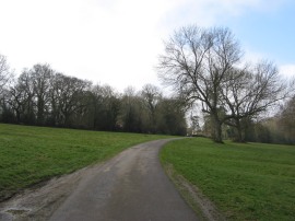
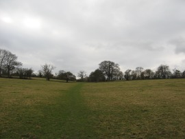
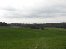
(22) Footpath leading to Coleshill |
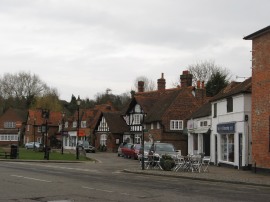
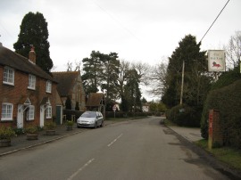
(23) End of Stage 1 in Coleshill |
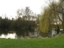
(24) Village Pond, Coleshill |
The route only briefly touches Bottrells Lane, heading to the right for a few yards before continuing ahead along a driveway leading to some far buildings. A short way down this driveway the Chiltern Way joins a footpath that continues ahead into a field. This stretch of footpath follows a fairly straight course across the fields, photo 22, for the best part of two miles up to the village of Coleshill which can just about be seen on a ridge in the distance. At times this footpath follows the field edge at other times in heads up and down across the middle of grassy fields, but all the time heading in roughly the same direction. The route cross Botton House Farm Lane and then continues ahead, passing close to Brentford Grange Farm to reach the A355 Amersham Road. Crossing this road the route heads up alongside a couple of more fields before skirting round the edge of Herts Wood, with its numerous keep out notices, to join an enclosed track that leads up to the Red Lion Pub and the village of Coleshill, photo 23, where we finished this stage of the walk, the car parked just a few yards down the road by the village pond, photo 24.
As usual I have uploaded the route of the walk which can be accessed here: Chiltern Way Stage 1 Route.
I had enjoyed finally getting started on walking the Chiltern Way and welcomed Greg's company as not only did it make the walk go a bit quicker it also meant I was able to get a much greater distance walked than if I had been doing a circular walk on my own; in the end we had walked 16.6 miles along the route and 16.9 miles altogether. After so much walking along the flat besides rivers and canals it was also very enjoyable to have the odd bit of ascent here and there rather than just a steady plod along flat ground.
If you would like to comment on this walk you can do so here:
![]() Back to:Main index page
Back to:Main index page
| ©2012 Bertuchi.co.uk. Please contact me using the email button on the right if you have any questions or comments regarding the site. Any feedback and additional information about places of interest on the walks is always welcomed. All rights reserved. Please contact me if you want to use any of the images or information from the site. ENJOY YOUR WALKING |
|