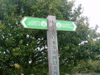
(1) Grand Union Canal
(2) Grand Union Canal
(3) Horsenden Hill
Other Links >>> |
|
CAPITAL RING STAGE 9
Greenford to South Kenton
I walked this, the ninth stage of the Capital Ring from Greenford to South Kenton on the 11th November 2006, immediately after walking stages 7 and 8.
|
|
|
|
(1) Grand Union Canal |
(2) Grand Union Canal |
(3) Horsenden Hill |
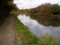
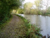
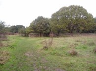
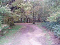
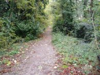
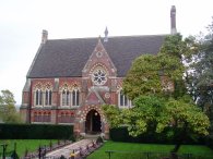
From the junction of Rockware Avenue and Greenford Road the Capital Ring takes a path that runs across open space, initially alongside the Greenford Road before turning round to the right to join the Paddington Arm of the Grand Union Canal, photo 1. The path runs along the canal towpath, photo 2, for about half a mile until Horsenden Lane North is reached. Here the route leaves the towpath, crosses the canal, and heads along the road for a short distance before taking a path that leads up round the side of Horsenden Hill, photo 3.
 |
 |
 |
(4) Horsenden Hill Trig Point |
(5) Capital Ring Waymarker |
(6) Horsenden Wood |
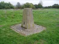
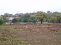
As the path climbs up the hill the views out over West London and beyond steadily increase. The path passes through a couple of gates and turns to the right and then right again up a flight of steps to reach the top of the hill, photo 4. The hill is the highest point in the borough of Ealing, 85 mts above sea level. In the past the hill has been settled by both Stone Age and Iron age people. According to a sign it is possible to see six counties and ten London Boroughs from the top. Amongst other buildings in the distance I could see the Post office tower and somewhat nearer Harrow on the Hill where the Capital Ring now heads, a Capital Ring finger board on top the hill, photo 5, showing it to be two and three quarters of a mile away. From the summit the path descends from the hill on a broad path through the oak trees of Horsenden Wood, photo 6, before making its way round to rejoin Horsenden Lane North.
 |
 |
 |
(7) Green Lane, Sudbury Hill |
(9) The Vaughan Library |
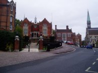
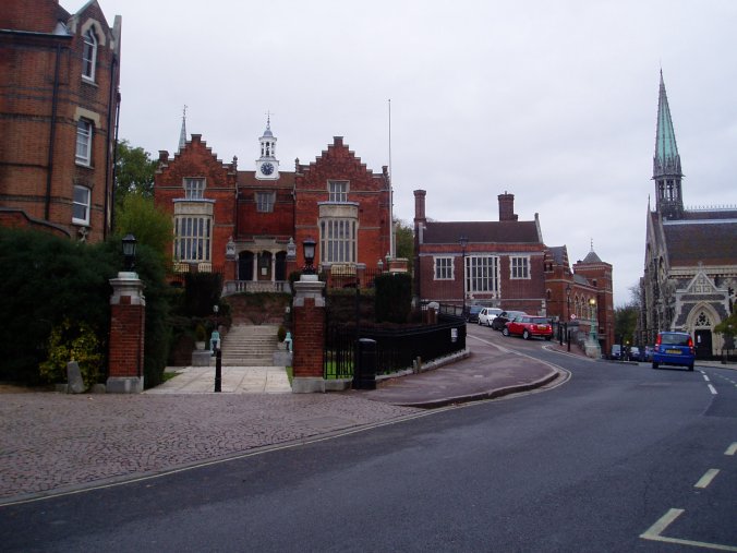
So far this, and the previous two stages of the walk, had managed to avoid any significant stretches of road walking but for the next mile of so much of the path was through residential areas. Turning right along Horsenden Lane North the route heads into Melville Avenue and then turns left into Whitton Avenue and right into Ridding Lane. At the end of the lane a track is taken which runs parallel with the tube lines to the Greenford Road by Sudbury Hill tube station. By Sudbury Hill Harrow rail station the path route of the path turns left into South Vale and at the end of the road heads up a track, photo 7, that leads steadily uphill to the A4005 Sudbury Hill. This runs into London Road past a number of fine old buildings in what is a very well to do area of London and on towards the buildings of Harrow School which are dotted about on either side of the road, photos 8 and 9.
 |
 |
(10) Harrow School playing fields |
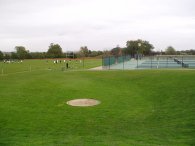
A little further on, after entering Peterborough Road the Capital Ring leaves the road and heads steeply down Footpath Lane to the Harrow School playing fields, photo 10, where a permissive path takes the Capital Ring over the playing fields to the A404 Watford Road. Passing through the playing fields there was a small diversion to the signed route of the path due to some works going on which can be seen in the foreground of photo 11. Inexplicably I headed the wrong way round the diversion and then had to retrace my steps back to join the right route. It was early afternoon and all across the playing fields teams were coming out for an afternoons sport.
 |
 |
(12) Northwick Park |
(13) South Kenton Station |
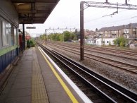
Leaving the playing fields the path crosses a stile to the very busy A404 where it took some time for a safe opportunity to cross. Once across the road the Capital Ring path heads down the rather dingy Duckers Lane to join a path that runs alongside the Northwick Park and St Mary's Hospitals towards Northwick Park itself, photo 12. Entering the park the path turns to the right to head past the pavilion before turning left close to the main entrance to the park to run up to Nathans Road and along to an underpass that leads to South Kenton Station, photo 13, where this stage of the Capital Ring ends.
The GPS made the length of this stage, 5.2 miles long, giving a total distance walked for the day of 13.6 miles. As ever on the Capital Ring the GPS gave significantly lower distance readings than that shown by the signposts, even with my detour round the Harrow playing fields. Once again the signposting for most of the stage was excellent with no real doubt about the route of the path.
![]() Back to:Walking index page
Back to:Walking index page
| ©2012 Bertuchi.co.uk. Please contact me using the email button on the right if you have any questions or comments regarding the site. Any feedback and additional information about places of interest on the walks is always welcomed. All rights reserved. Please contact me if you want to use any of the images or information from the site. ENJOY YOUR WALKING |
|