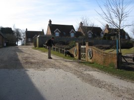
(1) Setting off from Dummer
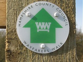
(2) Wayfarers Walk Waymark
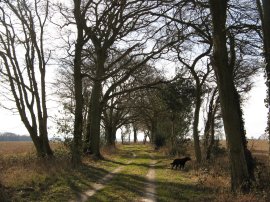
(3) Path nr Breach Farm
Other Links >>> |
|
WAYFARER'S WALK - Part 3
Dummer to Cheriton
Some three and half months after we had finished the previous stage of the Wayfarers Walk I met up with Anne to resume our walk. I had driven down the night before so we were able to make a reasonably early start from Dummer on a bright March morning, having earlier driven over to Cheriton which was to be the end point of this stage.
|
|
|
|
(1) Setting off from Dummer |
(2) Wayfarers Walk Waymark |
(3) Path nr Breach Farm |
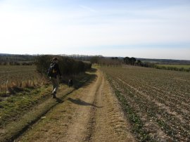
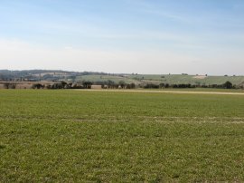
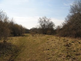
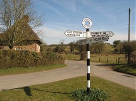
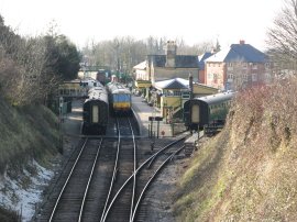
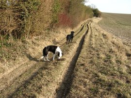
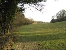
Dummer was considerably drier than when we had left it back in the autumn as we set off down the path in photo 1. This soon led out to a farm track that ran gently downhill between fields, eventually turning to the right to head towards the building of Dummer Grange where we were greeted by a large friendly dog. The route then heads down the driveway of the grange to reach a road where the route turns to the left for a short distance before joining another minor road on the right. Reaching the end of the road by Breach Farm we then joined a track that ran through a small patch of woodland before taking a footpath on the left. While it is probably necessary to have a map showing the route of the walk it is generally quite well way marked with a number of different signs including, more often not, the little green discs in photo 2. Leaving the trees the footpath we joined headed out between fields along a broad track, photo 3.
 |
 |
 |
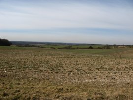
(4) View towards the South Downs |
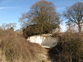
(5) Chalk Pit, nr Becket's Down |
(6) Chalk Pit, nr Becket's Down |
As the path began heading gently downhill over more open ground there were good views ahead towards the South Downs, photo 4. The track, photo 5, which is heading more or less due south, is followed for about a mile. On the way it passes an old chalk pit, photo 6, one of several in the area which used to be used to provide lime for the fields. It was really pleasant to be back out walking again in a part of the world I have not walked in before and in bright clear weather.
 |
 |
 |
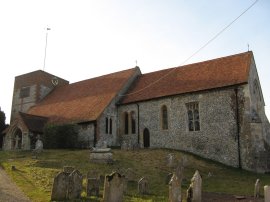
(7) St Peter's Church, Brown Candover |
(8) 28.5 miles walked |
(9) View back towards Totford |
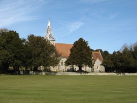
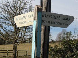
Reaching Lone Barn House the route passes the end of Gunners Lane and heads on along another track, Church Lane. This track is followed past Church Lane farm to the village of Brown Candover. Reaching the village by St Peter's Church, photo 7, the route crosses the village green before heading right along the B3046. A way marker besides the road showed that we had now walked 28.5 miles along the Wayfarers Way, photo 8. The road itself was very quiet and there was a small, clear stream running alongside the road. Leaving Brown Candover the route undertakes quite a dog leg, first heading up Bryces Lane and then continuing on ahead to Totford Farm. Here the route bears to the left leaving the floor of the valley to head uphill between fields to reach a road. Having ascended up between the fields the route then bears sharp left and head immediately back downhill along the road. Crossing over the B3046 the route joins a track that curves road some farm buildings and starts climbing back uphill on the other side of the valley from where there were good views over the paths we had just been walking, photo 9.
 |
 |
 |
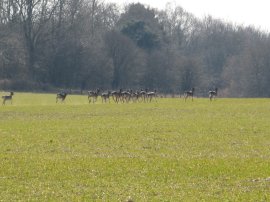
(10) Deer nr Lower Abbotstone Wood |
(11) Abbotstone Down |
(12) River at Abbotstone |
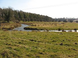
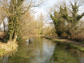
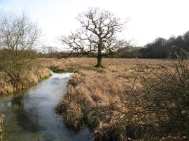
Just before a large building on the left the route joins a track on the right, Spybush Lane. This is followed uphill to a small patch of trees where the lane turns to the left, and then right again, to resume its course due South. As it passes the trees the Wayfarers Way is joined by the route of the Three Castles path. Continuing along Spybush Lane the route is followed alongside a large field on the left before passing through another small area of woodland. Heading out between two more fields, we saw a herd of deer, photo 10, cross the path in front of us. Leaving the fields the then path enters another area of woodland at Lower Abbotstone Wood before crossing back over the B3046 again. Continuing straight ahead the path passes a car park and heads over Abbotstone Down, photo 11. Leaving the trees the route heads alongside a field with trees to the right before the route heads out over open ground between fields as the Wayfarers Walk heads towards the hamlet of Abbotstone. Just before Abbotstone Farm is reached the route heads to the left along a track to reach the road in Abbotstone. Here the Wayfarers Way turns to the right along the road, crossing over a small river, photo 12, running along the bottom of the valley where I spotted a Little Egret.
 |
 |
 |
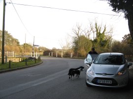
(13) Road Junction in Abbotstone |
(14) River Arle, New Arlesford |
(15) Fulling Mill, New Arlesford |
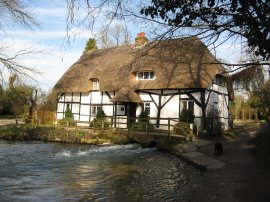
The road soon reaches a junction, photo 13, where the route continues ahead along a hedge lined track which ascends steadily uphill. Reaching what is almost the summit of the hill on Itchen Stoke Down the track reaches a junction where the Wayfarers Way heads to the left while the route of the Three Castles Way and the Oxdrove Way, which we had also been following for a while, head off on their own separate paths. The cross road of tracks made a good place to stop for lunch, with good views between the hedges in all directions. While we were eating there were a number of small butterflies flying about and I spent quite a while unsuccessfully trying to photograph them before we resumed our walk. The track soon reaches a minor road where, by chance we met someone Anne knew out walking her dog. Crossing the road the route joins another track heading downhill to reach the valley floor and cross back over the same river we had passed in Abbotstone where to our left the river was being used to irrigate a number of watercress beds. Reaching a junction, the route heads to the right along another track which heads rounds to Drove Lane, close to the outskirts of New Arlesford. On the track there were a number of travellers vans parked up, including one with a very strange piece of artwork outside comprised of a very large gold figure. Crossing the road the route heads alongside the right hand edge of a patch of open ground before heading past a house and turning to the right through a small patch of trees to reach the River Arle, photo 14. Crossing the river the route follows the path to the left along the riverbank, passing the Fulling Mill, photo 15, which is built across the river. The water was very clear and the river quite shallow and we were able to spot a number of trout swimming about as we went by.
 |
 |
 |
(16) Broad Street, New Arlesford |
(17) New Arlesford Station |
(18) Ladle Hill |
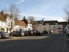
Not far past the mill the route joins a footpath that heads to the right that heads up to Ladywell Lane which is followed up to Mill Hill in New Arlesford. Here the route heads to the right up to Broad Street however we took a short break from the walk, heading a couple of doors down the road to Anne's mothers house where we were both staying. After a nice site down and a cup of tea we set back off to walk the final stretch of the days walk, this time accompanied by Anne's mothers dog Bonnie as well as Zuka. We followed the route through New Arlesford, heading up Broad Street, photo 16, crossing the main road and then continuing ahead along a footpath that heads down towards the railways lines from where we were able to catch a glimpse of New Arlesford Station, photo 17. Here the footpath bends to the left, running parallel with the train track so to reach Sun Lane. Here the route heads to the right, running downhill along the road which marks the edge of the town with houses on one side and fields on the other. At the end of the road the route heads to the right along Tichborne Down for a few yards, linking up with route of the St Swithuns Way, before joining a footpath on the left that heads up to cross over the A31, fortunately over a footbridge. Once over the road the route makes its way through the grounds of Arlesford Golf Course, heading generally diagonally to the right. Leaving the golf course the route heads between a couple of fields, through a very small patch of woodland and then along a hedge lined track to once again join the B3046. Turning left the Wayfarers Way follows the road for a short distance before joining a track on the left, Hinton Lane, photo 18, which heads gently uphill between a couple of large fields.
 |
 |
 |
(19) River Itchen, nr Cheriton |
(20) Field nr Cheriton |
(21) St Michael's church, Cheriton |
The route then heads to the right along a track that runs back downhill to the meet up with the B3046. Crossing the road the route continues ahead along a minor road for a few yards, to cross over the River Itchen, photo 19, where the dogs were able to have a little paddle in the stream. Once over the river the route heads to the left along a driveway that runs past some converted barns and a house to enter a long narrow field running parallel to the river, photo 20. The route continues ahead along a couple of similar fields, gradually heading away from the river to reach Hill Houses Lane on the edge of the village of Cheriton. Crossing over the road the route heads across a patch of open ground to head into the churchyard of St Michael's church, photo 21. Well this is the way we headed; on the map there was a little bit of confusion over the route as it was marked as heading off in two different directions over the open ground and it was one of the very few places of the entire walk that the path was not clearly signposted.
 |
(22) Bonnie and Zuka back at the car in Cheriton |
From the churchyard we turned right along the B3046 again as it headed through the village back to our parking place, photo 22.
Reaching the car we had walked a very decent 18.1 miles along the route. We also walked another 0.2 of a mile seeing if we could see where the other branch of the path across the open ground met the road and whether that route was way marked which it wasn't. This had been another good walk and even though I wrote the route description some months later I was amazed how clearly I could remember this walk. Definitely one of the best days out during 2010.
If you would like to comment on this walk you can do so here:
![]() Back to:Walk index page
Back to:Walk index page
| ©2012 Bertuchi.co.uk. Please contact me using the email button on the right if you have any questions or comments regarding the site. Any feedback and additional information about places of interest on the walks is always welcomed. All rights reserved. Please contact me if you want to use any of the images or information from the site. ENJOY YOUR WALKING |
|