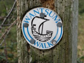
Wantsum Walk Waymark
Other Links >>> |
|
THE WANTSUM WALK - PART 1
Birchington on Sea - Reculver - Sarre
|
|
Wantsum Walk Waymark |
I did this walk on Monday 8th October 2007. I drove down from Walthamstow and parked in a side road close to Birchington on Sea station which marks the start of the Wantsum Walk. Most of the information I had been able to find out about the Wantsum Walk stated that it was an 8 mile walk along the coast between Birchington on Sea and Herne Bay however in addition to this on my Ordnance Survey map it showed a number of other paths marked as the Wantsum Walk running inland from the coastal section in a series of connected links and I intended to walk three of these today that lead off from the stretch of path that runs between Birchington on Sea and Reculver.
 |
 |
 |
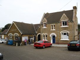
(1) Birchington on Sea station |
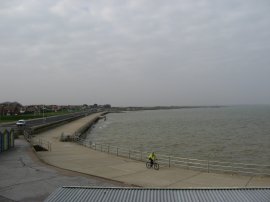
(2) Minnis Bay |
(3) Path above Minnis Bay |
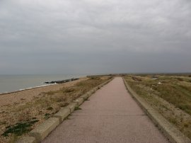
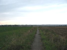
From the station, photo 1, I headed over the rail bridge and down Lyell Road. This soon runs into Grenham Road which then runs into Sea View Road which runs into Sea View Avenue, at the end of which the route reaches the seafront. The Wantsum Walk then turns left along the Parade as the route follows the road around the edge of Minnis Bay, photo 2. In the far distance on the horizon I could see the twin towers of the old church at Reculver which seemed a considerable distance away in the rather hazy weather conditons although a signpost said that it was only 3 ½ miles away. Reaching the end of the Parade the route heads along a path that runs ahead over the grassy surface of the cliff top, photo 3.
 |
 |
 |
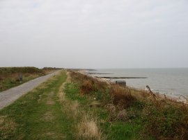
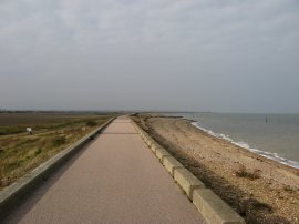
(4) Sea Wall Path nr Birchington |
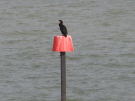
(5) Comorant |
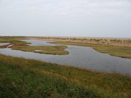
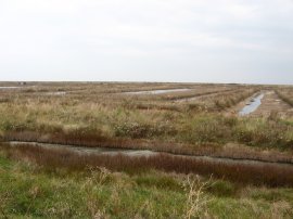
(6) Coastal Lagoon, nr Birchington |
After about a third of a mile the route joins the tarmac covered sea wall path that runs along the edge of the coast, photo 4 and for a few brief seconds the sun broke through the cloud, the only time it appeared all day. It was pleasant walking along the sea wall with farmland to my left and the sea gently lapping against the sea shore on my right and I made good time as I headed down towards Reculver. There were a number of stone groynes jutting out into the sea along the route and almost without exception the red marker poles at the end of the groynes were topped by a comorant, photo 5. About 2 ¾ miles along the coast the route reaches a little lagoon, photo 6, that had formed behind the shingle bank.
 |
 |
 |
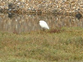
(7) Little Egret |
(8) Path besides the Wantsum River |
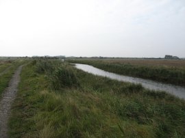
(9) Wantsum River |
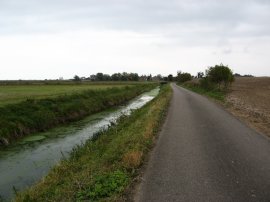
On the lagoon was a Little Egret and I finally managed to get a photo of one of these rather elusive birds, photo 7. I had spotted them on many occasions on my walks around the coast but in the past they had always taken flight whenever I stopped to get my camera out. Besides the lagoon I left the sea wall path and headed inland beside along a farm track, photo 8, that runs alongside the Wantsum River, photo 9.
 |
 |
 |
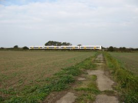
(10) Approaching the railway |
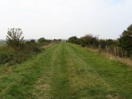
(11) Rushbourne sea wall |
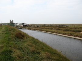
(12) Shellfish hatchery beds |
This track heads up to the railway lines, photo 10, that run down to Margate where the route of the Wantsum Walk turns right to follow a grassy embankment that runs alongside the railway, photo 11, although I deviated slightly off course at this point for a short distance. The Wantsum walk then follows the top of the embankment as it first turns to the right away from the railway lines and then left along the Rushbourne sea wall to head towards the church at Reculver. In the beds besides the sea wall, photo 12, I spotted two shellduck on the water although they soon flew off.
 |
 |
 |
(13) Reculver shellfish hatchery |
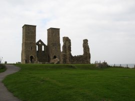
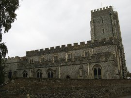
(14) St Mary's Church, Reculver |
(15) View towards Herne Bay |
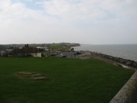
Passing the beds of a shellfish hatchery, photo 13, the route continues along the sea wall embankment into Reculver. Once at Reculver I went and had a quick look round the remains of the St Mary's Church, photo 14, and Roman fort before heading down to the visitors centre although unfortunately this was closed on Mondays and Tuesdays. Photo 15 was taken looking up the coast over the Reculver Country Park towards Herne Bay.
 |
 |
 |
(16) Sea Wall path nr Reculver |
(17) View towards Sarre |
(18) St Nicholas at Wade church |
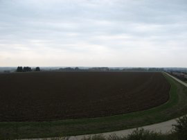
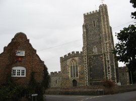
From Reculver I continued my walk along the Wantsum Walk this time heading back along the sea wall in the direction of Birchington and the Isle of Thanet, photo 16. It was a good day for bird spotting and whilst walking along the sea wall I saw several large flocks of Goldfinches, the most I had ever seen together. I continued back along the sea wall to the farm track I had turned up earlier which completed the first chain of the walk. I then headed back up the track to the railway lines but instead of turning right continued straight ahead across the tracks starting the second link of the walk. The route continues along the gravel farm track alongside the Wantsum River to join a concrete track that runs up to a road by some houses. Here the route bears left along Potten Street Road and then takes the first right to take a road bridge over the dual carriageway of the A299. From the top of the bridge there was a good view over the countryside I would soon be walking across, photo 17, when I made my to and from Sarre. The Wantsum Walk was reasonably well signed although there were a number of places where additional markers would be needed to enable the walk to be followed without the use of a map. Once over the A299 the route follows Court Road round to the village of St Nicholas at Wade. The route passes a church, photo 18, and heads on past two pubs which are directly opposite each other before turning right into Manor Road.
 |
 |
 |
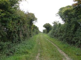
(19) Footpath from Manor Road |
(20) Footpath to Sarre |
(21) Kings Head pub, Sarre |
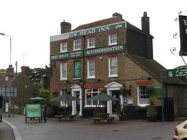
Where Manor Road turns to the left the Wantsum Walk path continues ahead along a footpath, photo 19, that initially runs down besides some playing fields before heading out across fields towards Sarre. Somewhat surprisingly this footpath, photo 20, was tarmaced all the way to Sarre. Leaving St Nicholas at Wade the route heads gently downhill to the end of a large field where the route splits into two. To the right the route continues on a loop of the Wantsum Walk that eventually heads back round to St Nicholas at Wade, ahead a spur takes the Wantsum Walk into the village of Sarre which was the direction I headed in, initially along a tree lined path then once again between open fields. Having reached Sarre I stopped for a quick sandwich outside the Kings Head pub before turning round and retracing my steps back to the split in the path where I turned left to start making way along a field side path back towards the A299.
 |
 |
 |
(22) Looking back to St Nicholas at Wade |
(23) Potten Street Road |
(24) St Nicholas at Wade church (again) |
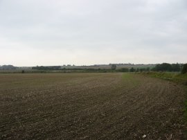
Photo 22 was taken looking back the way I had walked across the fields from St Nicholas at Wade. The route then continues alongside the field, past the Down Barton Farm, over wide open fields with few hedges and views stretching off for some distance in most directions. Reaching the A299 again the route turns left along a concrete farm track that leads to a bridge over the road. Crossing the road the route heads down a similar track on the other side of the dual carriageway before turning left along Potten Street Road, photo 23. A short distance along this road I completed my second chain of the Wantsum Walk as I re-joined the stretch of road I had walked along earlier that lead into St Nicholas at Wade. Reaching St Nicholas at Wade for the second time I then turned left besides the church down Shuart Lane, photo 24.
 |
 |
 |
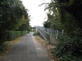
(25) Footbridge over the A299 |
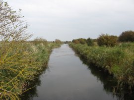
(26) River Lea |
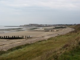
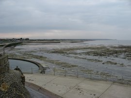
(27) Minnis Bay |
The route heads down Shuart Lane to take a footbridge back over the A299, photo 25, the fourth time I had crossed over this rather busy and noisy road before continuing on down Shuart Lane on the other side of the road. At the end of the road the Wantsum Walk takes a track that heads off to the left skirting some farm buildings. The path then heads along a hedge lined green lane, photo 26, which leads out to open fields and a path that runs down to cross the railway lines. After crossing the railway lines the route bears to the right along the top of a grassy embankment that runs between fields to rejoin the sea wall path that I had walked along at the start of the day. Reaching the sea wall I then turned right and began retracing my steps along the two miles back to where the car was parked in Birchington on Sea. The tide was much further out as I made my way back along the sea wall exposing much more of the sandy beach at Minnis Bay, photo 27.
 |
 |
 |
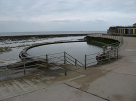
(28) Tidal Pool, Birchington on Sea |
(29) Minnis Bay |
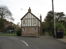
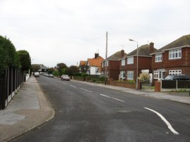
(30) Sea View Avenue, Birchington |
Back at Birchington on Sea I passed the small tidal bathing pool, photo 28, and headed up besides the low chalk cliffs besides Minnis Bay, photo 29, before turning to my right along Sea View Avenue, photo 30 to head along the roads to the car.
Reaching the car I had walked a total distance of 18.7 miles making this the longest walk of the year so far. It had been pleasant varied walking first along the coast and then inland. The only downside was the rather grey overcast weather that persisted throughout the day and the number of stretches of road walking, particularly the section between Potten Street Road and St Nicholas at Wade which had to be walked twice. Excluding any stretches of path walked twice the actual length of the Wantsum Way I walked was about 15 miles.
![]() Back to:Walk index page
Back to:Walk index page
| ©2012 Bertuchi.co.uk. Please contact me using the email button on the right if you have any questions or comments regarding the site. Any feedback and additional information about places of interest on the walks is always welcomed. All rights reserved. Please contact me if you want to use any of the images or information from the site. ENJOY YOUR WALKING |
|