THAMES DOWN LINK
Kingston to Boxhill
|
|
|
|
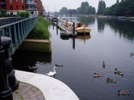
I walked the Thames Downs link path on the 29th June 2005. The path, as its name implies, links the river Thames with the North Downs. The Thames Downs link path runs from Kingston, where it is joined by both the Thames path itself and the London Loop, to Boxhill and Westhumble station where it meets up with the North Downs Way.
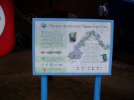
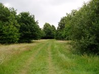
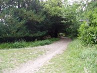
The first five miles of the path shares its route with the London Loop. At the start a small sign, (photo 1), gives details of the route ahead. I had not really enjoyed walking that stage of the London loop much and it did not seem that much better this time around so it was good to finally get onto a new path where the two routes split up and go there own ways by the A246, especially as the Thames Down link path immeadiatly headed across some quite pleasant open countryside.
Passing through houses near North Chessington I came around a corner and there was a red deer on the path just in front of me. I don't know who was more startled, me or the deer! Needless to say it skipped away farily promptly. I was very suprised to see a deer in such an urban area though. This stretch of the path also passes close to a line of electricity pylons and high up there were workmen in a cradle strung from the power cables which was quite fascinating too watch. I could also hear the sounds coming from Chessington World of Adventure that could just be seen some way in the distance.
 |
 |
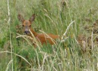 |
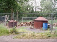
The path then makes its way through Horton Country Park and across Epsom Common where I came across the small charcoal working ,(photo 4). Just before the level crossing over the railway line near Ashstead I spotted another deer and this time was able to take a photograph without it running away, (photo 6). Believe it or not this is the first time ever that I have been able to take a close up picture of a deer. Usually they run off into the undergrowth before I am able to get my camera out and end up as little specks in the far distance, this one just stayed very still, watching closely.
When I reached Ashstead I took a litle detour off the route to go and buy some more water. It was a reasonably hot day and I had already drunk what I had taken with me. Both the Indian and Chinese restaurants on the main street looked very tempting but I stuck to buying a packet of crisps and another two litres of water.
 |
 |
 |
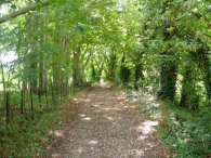
The path then continues along a variety of tracks, crosses the M25, and makesits way steadily over Mickleham Downs and down into the Mole Valley
There was a very heavy downpour of rain although as I was passing through a wooded area I was protected fom the worst of the rain. I eventually decided it was heavy enough to unpack my waterproof which was they key for the rain to stop. Within minutes it was sunny again and remained like that the rest of the day.
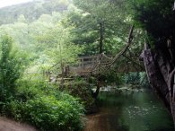
When I reached the A24 I took another short detour off the Thames Downs link path to walk down to the stepping stones over the river Mole before heading back to the path and making my way to the Boxhill and Westhumble station where the walk officially ends.
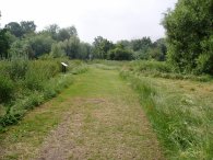
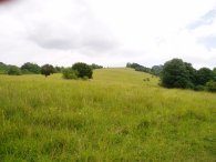
Although it was a pleasing to walk from the Thames to the North Downs, and after the first few miles there was not much road walking, a lot of the paths were along pretty featurless byways and bridleways enclosed by trees which prevented any real views and were rather uninteresting to walk along.
The GPS made this walk, including the short diversions I made, 16.3 miles long.
 |
 |
 |
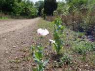
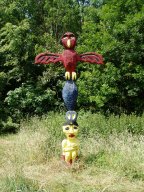
One thing about all these walks you never know what you are going to see. On this walk I came across the Totem Pole shown below stuck in a corner of field.
 |