(1) Kingsferry Bridge
(2) Kingsferry Bridge
(3) The Knauf Factory
Other Links >>> |
|
THE SAXON SHORE WAY - PART 4
The Sheppey Crossing to Oare Creek
I did this walk on Sunday 14th September 2008. Due to a variety of reasons, for this stage there was only Sally, Dave and myself out walking. I parked at the small car park besides the Oare Marshes nature reserve where Sally met me and we then drove over to meet Dave where we had finished the last stage of the walk along the Saxon Shore Way under the new Sheppey Crossing bridge. Both Dave and Sally had been running slightly late and it was about 10:30 when we set off from the cars.
|
|
|
|
(1) Kingsferry Bridge |
(2) Kingsferry Bridge |
(3) The Knauf Factory |
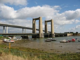
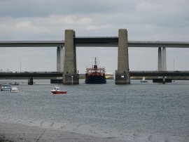
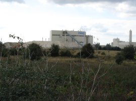
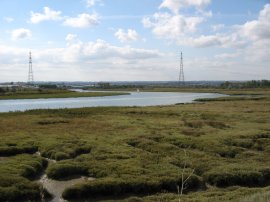
We headed along the road, passing underneath the new Sheppey Crossing and old Kingsferry Bridge, photo 1, before heading up to rejoin the path along the top of the fllood bank besides the Swale Estuary. As we set off Dave mentioned that the old bridge had been raised while he was waiting to let a ship pass and I replied that this was something I would have liked to have seen. Lo and behold a few minutes later I looked back down the estuary and the bridge had been raised again to allow another ship to pass, photo 2. After a short distance the route turns inland skirting the side of a large factory on the edge of the Swale, (although paying more attention to the bridge we all missed the turn off and continued ahead until the path reached a dead end at the factory jetty). The path then ran along a raised, tree lined embankment, descending to cross some old railway lines, before continuing on to reach a road. Here the route turns to the right along a broad brick surfaced road with the large Knauf drywall factory away to the right, photo 3. This remains a dominant structure on the skyline for some time. .
 |
 |
 |
(4) Swale Estuary nr Kemsley |
(5) Milton Creek |
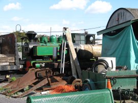
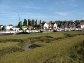
(6) Sittingbourne & Kemsley Light Railway |
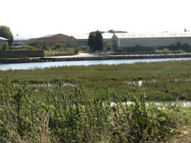
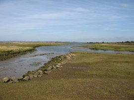
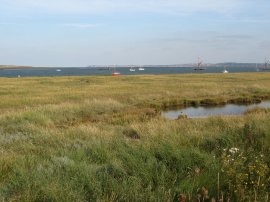
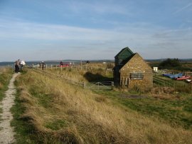
At a T junction the route heads past the gates of another factory and continues ahead along a short stretch of scrubby path to rejoin the flood bank alongside the Swale, photo 4. The path is then followed round to the entrance of Milton Creek, photo 5, which the Saxon Shore Way then follows as it gradually makes its way towards Sittingbourne. To the right of the path the route passes a number of industrial units and a large area of former landfill that has now been grassed over. A little further along the creek the route passes the Kemsley terminus of the Sittingbourne & Kemsley Light Railway. The Sittingbourne & Kemsley Light Railway is the preserved southern half of the former Bowater's Railway built to move the raw materials for paper making, and also the finished products, around the paper mill at Sittingbourne. The line which is built to a gauge of 2' 6" continues to use the steam engines and rolling stock that were supplied to operate the railway in its working life prior to preservation in 1969. Sittingbourne's Steam Railway was given notice to quit the land on which it operates at the beginning of 2008 when their landlords M-real decided to pull out of Sittingbourne including closing Sittingbourne paper mill. More details about the railway can be found at their website: Sittingbourne and Kemsley Light Railway. We stopped and had a quick look round the site, which also had some handy toilets and a small cafe, although this was shut when we went by.
 |
 |
 |
(7) Milton Creek |
(8) Castle Road, Sittingbourne |
(9) Mouth of Milton Creek |
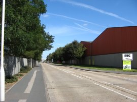
A short distance further along the creek we passed the point on the opposite bank where the route of the Saxon Shore Way rejoins Milton Creek after having negotiated its way through the outskirts of Sittingbourne, photo 7. Only a few yards across the water but exactly three miles along the path on foot. The landscape becomes ever more industrial as the path heads to Sittingbourne, a considerable part of the route being accompanied by the noise from a nearby Kart racing track which brought back memories of the River Lea path nr Rye House which also passes a well used kart track. Eventually the route leaves the edge of the creek, heading down a rather grotty short section path between litter strewn wire mesh fences to join a road where the route turns to the left along Gas Road and then left again into the busier Mill Way. This is followed ahead over a roundabout and round to the left to cross another roundabout where the route continues ahead into Eurolink Way, passing over another roundabout and at the end of the road, following the road round to the left into Castle Road, lined with industrial units. A little way down Castle Road the route of the Saxon Shore Way turns right, heading slightly uphill along Dolphin Road. I could not see any Saxon Shore Way marker at this junction, and it would be very easy to keep going straight on at this point, although there was a way marker at the other of the road where the route then turns to the left along Church Road. The path heads down Church Road, passing Central Park, before turning left down Stadium Road which takes the route down over a roundabout and on to the very short stretch of (another) Gas Road to rejoin the banks of Milton Creek. This is an area I know very well as Sittingbourne's Central Park ground has, for the last six seasons been the home of the football team I support, Maidstone United FC. In fact I had only been there the day before to watch Maidstone beat Tooting and Mitcham 2-1 in the 1st qualifying round of the 2008 FA cup. Back by Milton Creek the route turns to the left, passing a house and heading through a yard to the creek. The route then gradually heads out of the industrial areas and on over open country to the mouth of the creek, photo 9, to rejoin the Swale.
 |
 |
 |
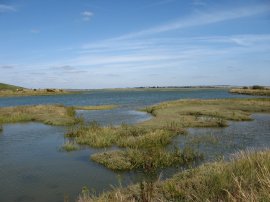
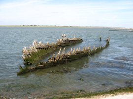
(10) Little Murston Nature Reseve |
(11) An abandoned boat |
(12) Path besides the Swale |
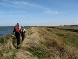
The route then follows the flood bank round to the right, passing the Little Murston Nature Reserve on the right, photo 10, and with Emley Island on the Isle of Sheppey still very close across the other side of the Swale. A little further down the path the route passes the remains of a couple of wooden boats, photo 11, gradually rotting away on the edge of the Swale. It was a fairly bright, sunny day however there was quite a strong wind blowing off the water and when we stopped for lunch we went and sat down on a patch of grass below the flood bank to get out of the breeze. Having eaten we then continued walking along the top of the flood bank down besides the Swale, photo 12.
 |
 |
 |
(13) Conyer Creek |
(14) Conyer |
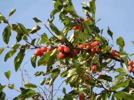
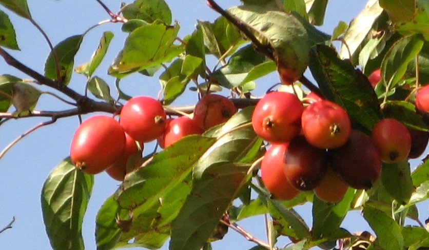
The path heads down to Conyer Creek, photo 13, where the route turns to the right and follows the creek inland up to the village of Conyer, photo 14. The creek is nowhere near as long as Milton Creek and we were soon making our way around the edges of the boatyard and moorings that are situated at the end of the creek. The route heads down the driveway to the boatyard and, reaching a road junction, turns to the left along the aptly named Conyer Road. The route passes by a number of wooden clad houses, which have good views across the creek, before heading past a barrier and taking a track that heads past the last few houses and begins heading back towards the Swale along a tree lined path. On the way the Saxon Shore Way passed a very unusual tree, photo 15. The tree was quite tall, maybe 15 or 20 feet and the bright red fruit appeared to be a mix of a cherry and plum, more elongated than a cherry but smaller than the plum. I had previously walked this stretch of the Saxon Shore Way back in early September 2005 and I remembered the tree from that walk, clicking the green text below the photo will display a larger version of the fruit; any ideas what it might be?
 |
 |
 |
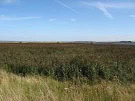
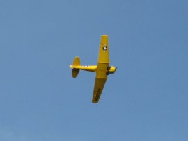
(16) Fields besides the Swale |
(17) Acrobatic plane |
(18) The Swale |
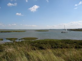
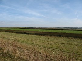
Having rejoined the path besides the Swale it was then a fairly straight walk along the flood wall to our destination point at the Oare Nature Reserve. This section of path was similar to that between the Sittingbourne and Conyer creeks with flat fields and marshland below the sea wall on the right lined with the occasional drainage ditch, the fields being grazed by sheep and the odd herd of cows, photo 16. Overhead there was a small yellow plane, photo 17, performing acrobatics, looping the loop and spinning up and down. To our left the Swale gradually widens until the higher ground of the Isle of Harty, photo 18. A few years ago I had done a circular walk on the Isle of Sheppey and I could clearly see a considerable part of the route I had taken along with the pub where I had stopped for lunch and the attractive Harty Church on top of the hillside on the other side of the Swale.
 |
 |
 |
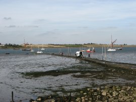
(19) Oare Marshes Nature Reserve |
(20) Oare Slipway |
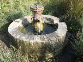
(21) Pump |
Ahead of us as we walked down the path we could see the town of Whitstable gradually growing larger on the horizon although it is going to be another days walk until we arrive there. A little further on we entered the Oare Marshes Nature Reserve. The reserve consists of over 81 hectares of grazing marsh with freshwater dykes, open water 'scrapes', seawall and saltmarsh on the mainland opposite the Isle of Sheppey. The reserve is of international importance for migratory, over wintering and breeding wetland birds. Suitable habitat is achieved through manipulation of water levels and livestock grazing and the reserve supports an exciting and diverse range of birds. A notice board besides the small car park and information centre, photo 19, listed 165 different species of bird that had been spotted there so far in 2008, and this figure had increased to 171 when we returned to walk the next leg of the Saxon Shore Way a month later. The land, which is known for its tranquil remoteness from nearby Faversham, was used from 1787 until 1916 for the manufacture of gunpowder and the remains of its jetty are still visible. The area by the car park was also the site of the Harty Ferry to Sheppey and is now a popular slipway, photo 20. Just inland from the slipway was a small pump, photo 21.
Reaching the car we had walked xx.x miles according to my GPS, although Dave's made it 16.9 miles! It had been very pleasant walking, even though it was just a group of three of us. We had been able to walk at a good, but not tiring, pace, and were able to stop at times that suited everyone. On the way back we stopped off for a quick drink at a pub in Oare before heading back to the other car at the Sheppey Crossing.
If you would like to comment on this walk you can do so here:
![]() Back to:Walk index page
Back to:Walk index page
| ©2012 Bertuchi.co.uk. Please contact me using the email button on the right if you have any questions or comments regarding the site. Any feedback and additional information about places of interest on the walks is always welcomed. All rights reserved. Please contact me if you want to use any of the images or information from the site. ENJOY YOUR WALKING |
|