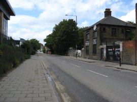
(1) View from the door
(2) Almshouses, Bakers Arms E10
(3) Lea Bridge Road
Other Links >>> |
|
WALTHAMSTOW TO STRATFORD - 1
Including a walk through the 2012 Olympic Site
I did this walk on Sunday 1st July, walking from my house down to Stratford, taking in the site of the 2012 Olympic Games on the way. From the 2nd July the Olympic games developers were taking control of the site and thus this was the last opportunity to walk the roads and footpaths of the area before they disappeared from public view. It will be very interesting to see what the area looks like once the games venues have been built and free access is once again possible, whenever that might be.
The layout of this page is slightly different to the rest of the site as I ended up taking loads of photos and thought I would let them describe the walk.
|
|
|
|
(1) View from the door |
(2) Almshouses, Bakers Arms E10 |
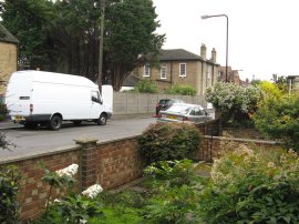
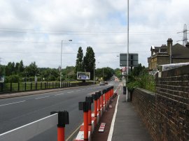
(3) Lea Bridge Road |
Firstly though I set off from home and photo 1 shows the view that greets me every time I leave the front door. I made my way down to the Bakers Arms and headed down the Lea Bridge Road. Photo 2 shows the Almhouses at the Bakers Arms and photo 3 was taken looking down the Lea Bridge Road towards Markhouse Road.
 |
 |
 |
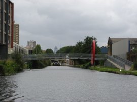
(4) Lea Bridge Railway Station |
(5) Lea Bridge Road |
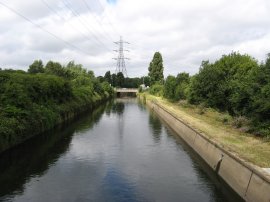
(6) Lea Flood Relief Channel |
Photo 4 was taken much further down the Lea Bridge Road and shows the site of the old Lea Bridge Railway Station which closed in 1985. The light brown strip running through the middle of the photo is the grass covered platform. Photo 5 is another view of the Lea Bridge Road from outside the old station entrance. Not far past the station I crossed the road and went into the Waterworks Nature Reserve which despite being so near home was a place I had never visited before. Photo 6 was taken looking back towards the Lea Bridge Road from a bridge in the nature reserve that crosses the Lea Flood Relief Channel.
 |
 |
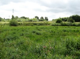 |
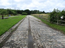
(7) Waterworks Nature Reserve |
(8) Waterworks Nature Reserve |
(9) Waterworks Nature Reserve |
The Waterworks Nature Reserve has been developed on the site of the Essex Filter Beds and were opened to the public in 2002. The cobbled path and metal rails in photo 7 show some evidence of the areas more functional past history. The old filter beds themselves have been turned into a variety of habitats, with some spaces of open water, photo 8, some with more reed cover and a couple almost completely filled in, as in photo 9. There is also a visitors centre and a number of bird hides at the site.
 |
 |
 |
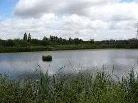
(10) Waterworks Nature Reserve |
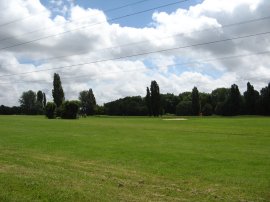
(11) Waterworks Golf Course |
(12) River Lea, Leyton |
Included on the site is a small 18 golf course and after having looked round the nature I reserve I headed round the side of the golf course, photo 11, and down towards the River Lea, photo 12.
 |
 |
 |
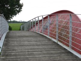
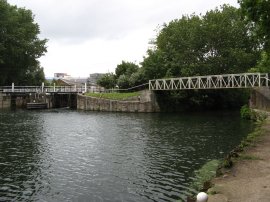
(13) Bridge over the River Lea |
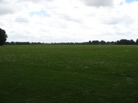
(14) Hackney Marshes |
(15) River Lea, from Hackney Marshes |
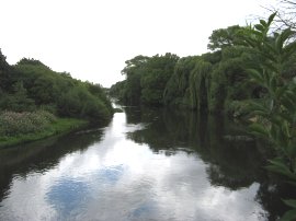
Crossing over the River Lea, photo 13, the path reaches Hackney Marshes, photo 14. There were a number of paths around the marshes but I followed one that kept as close as possible to the banks of the River Lea. Photo 15 shows the point where the River Lea and its flood relief channel join up.
 |
 |
 |
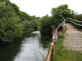
(16) Path besides the River Lea |
(17) White House Bridge |
(18) East Marsh |
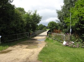
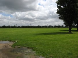
The initial stages of the path were along a tarmac track but the route soon joins a narrower footpath, photo 16, running close to the river although the river itself was often obscured by the dense undergrowth besides the path. After winding its way along the path for about half a mile the route re-joins the more open ground of Hackney Marshes besides the White House Bridge, photo 17. It was here that I encountered the first signs of the Olympic Site. Crossing over the bridge I headed into East Marsh, photo 18, which is to be inside the Olympic Park boundary.
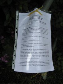 |
Attached to the bridge were various notices detailing the compulsory purchase order, photo 18a, the first of many that I would pass during the walk. In part the text reads "Notice is hereby given that the London Development Agency on 29 May 2007 made a general vesting declaration under section 4 of the Compulsory Purchase Act 1981 vesting the land described in the schedule to this notice in themselves on 2 July 2007. Situated besides the A12 I believe that the East Marsh site is to become a car park for the games.
 |
 |
 |
(19) River Lea |
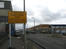
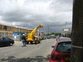
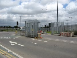
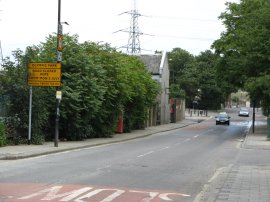
(20) Waterden Road |
(21) The gates arrive, Waterden Road |
Photo 19 was taken from the White House Bridge looking down the River Lea towards the A12. I then continued down the besides the trees on the right hand bank of the river to reach the A12 at the junction of Homerton Road and Ruckholt Road. Crossing under the road I continued ahead into Waterden Road. Close to the top of the road was a big yellow sign stating "Road closed here from Mon 2 July", photo 20, together with a couple of metal gateposts. A short distance further on I passed a crane that was slowly carrying one of the gates up the road, photo 21. I was not the only person out taken photo's at this time and a remarkably similar photo can be seen here.
 |
 |
 |
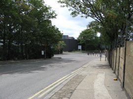
(22) Waterden Road |
(23) Celestial Evangelical World Crusaders Church Sign |
(24) Waterden Road |
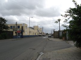
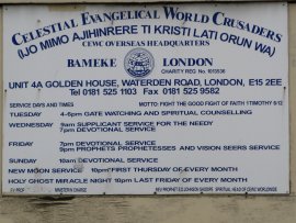
The industrial units and buildings of the area used to be home to a wide variety of different uses. Photo 22 was taken looking down Waterden Road, close to the entrance of the Hackney Wick Stadium. The stadium which opened in 1932 had a major makeover in 1994 but closed a few years later when the stadium owners went out of business. I hope the Olympic venues fare a bit better once the Olympics are finished. A little further down the road was a sign for the overseas headquarters of the Celestial Evangelical World Crusaders, photo 23, whose weekly order of services made for some interesting reading. Photo 24 is of another set of gates across the road. Immediately to the left of the gates is the currently redundant road that leads down to the new Stratford International Rail Station on the Channel Tunnel Rail Link a station which itself is also currently rather redundant. Whilst completed in 2006 is not due to open until 2009 at the earliest for commuter trains, its situation as a eurostar station rather comprised by the fact that it is only a few minutes travelling time from the new Eurostar terminal at St Pancras. Still, it shoudl see some use during the Olympic weeks in 2012!
 |
 |
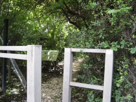 |
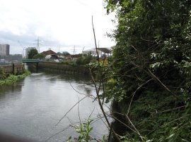
(25) Approaching White Post Lane |
(26) River Lea |
(27) Carpenters Road Wildlife Area |
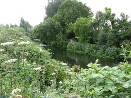
Photo 25 was taken from the bottom end of Waterden Road as it curves round to the right to join White Post Lane. I then turned left onto White Post Lane and headed down to the bridge over the River Lea. Photo 26 was taken looking downstream to the South with the Waterworks River heading off to the left. There used to be a path alongside the River Lea from White Post Lane into the Carpenters Road Wildlife Area but this had already been closed, photo 27 was taken looking through the fence towards the old notice board describing the area.
 |
 |
 |
(28) White Post Lane |
(29) Industrial Units, White Post Lane |
(30) White Post Lane |
I then retraced my steps back down White Post Lane down to the River Lea Navigation, passing a number of derelict industrial units on the way along with another notice announcing the imminent closure of the road, photo's 28 to 30. As I was walking down this stretch of road I was passed by a car which was being driven slowly down the road with the occupants holding a video camera out of the window.
 |
 |
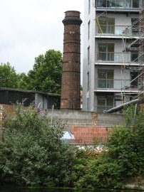 |
(31) River Lea Navigation |
(32) Hertford Union Canal |
(33) Old Factory Chimney, River Lea |
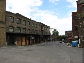
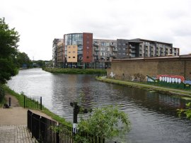
Photo 31 was taken looking South down the River Lea Navigation from close to White Post Lane. As I believe I had mentioned before when I walked the Lea Valley path there was a number of very inventive pieces of graffiti adorning the buildings around this area and an example can be seen on the opposite bank of the canal. Generally I feel that most graffiti is rather pointless vandalism but some of these, in my eyes at least, enhance the rather drab buildings and walls they have been painted on as much as a council funded mural or school art project might. Photo 32 was taken just a short distance further down the towpath looking along the Hertford Union Canal that links the River Lea Navigation with the Regents Canal. At the end of the canal the Swiss Re, or "Gherkin" building can just be made out on the horizon. Even before the planned Olympic Park developments there has been a considerable amount of new regeneration along side the river Lea, the old industrial building being steadily replaced by new housing developments all along the route of the canal. Photo 33 shows an old brick chimney looking rather isolated besides the new housing built up alongside.
 |
 |
 |
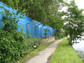
(34) Lea Navigation Towpath, Hackney |
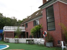
(35) Big Breakfast House |
(36) Way Marker, Old Ford Lock |
The River Lea Navigation runs along the edge of the Olympic Games site and in places the towpath was lined with the blue wooden fence, photo 34, that is steadily being erected around the site. By Old Ford Lock the canal towpath passes the Big Breakfast House, photo 35, although this is now a private dwelling. For younger readers the Big Breakfast was a Channel 4 television show that was hosted from the house between 1992 and 2002. Besides the house is a way marker for the Lea Valley Footpath and the Capital Ring, photo 36. Both these paths will be remaining open during the construction period of the Olympic venues and the it should be possible to view at least some of the developments taking place from the Capital Ring path as it follows the Greenway along the route of the Northern Outfall Sewer.
 |
 |
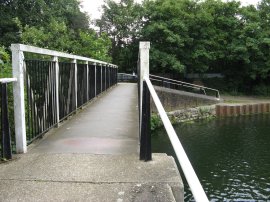 |
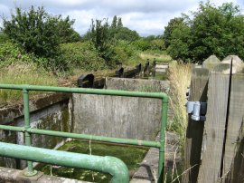
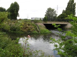
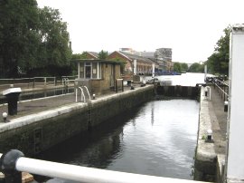
(37) Old Ford Lock |
(38) River Lea Navigation by Old Ford Lock |
(39) River Lea Navigation |
Photo 37 is of the Old Ford Lock itself and photo 38 was taken looking down the River Lea Navigation towards Limehouse. Immediately below the Old Ford Lock the towpath crosses a bridge, photo 39, as the River Lea, which I had been walking alongside when I passed through Hackney marshes, joins the River Lea Navigation from the left.
 |
 |
 |
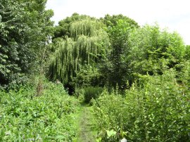
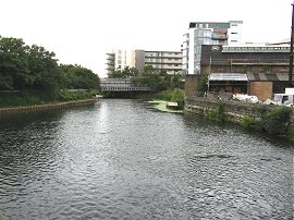
(40) Junction of the River Lea Navigation and Old River Lea |
(41) River Lea Information Board |
(42) Old River Lea by Pudding Mill River |
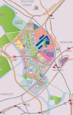
Having crossed the bridge photo 43 was taken looking back down the old River Lea towards the Old Ford Lock. I then continued along the path besides the Old River Lea. The area immediately to the right of the river is the proposed site of the main Olympic Stadium, needless to say this area will never again look like it does now. Despite the industry that has surrounded the area for years the back rivers has provided a small, green, wildlife rich oasis in the capital. Soon the Old River Lea reaches the junction with the City Mill River, photo 45, which also joins from the right. Having crossed over the bridge it was impossible to continue along the path besides the old River Lea which had been closed some time ago and thus I turned to my right to head down the City Mill River. Below is a map of the walk, a larger version of which can be seen by clicking on the green text under the photo on which I have added the photos numbers from some of the above photos at the locations the photos were taken.
 |
Given the number of photo's I have included I have split this walk over two pages, for part two of the walk click here: Part 2
![]() Back to:Walk index page
Back to:Walk index page
| ©2012 Bertuchi.co.uk. Please contact me using the email button on the right if you have any questions or comments regarding the site. Any feedback and additional information about places of interest on the walks is always welcomed. All rights reserved. Please contact me if you want to use any of the images or information from the site. ENJOY YOUR WALKING |
|