The Medway Valley Walk
Other Links >>> |
|
MEDWAY VALLEY WALK - Stage 1
Strood to Maidstone
|
|
The Medway Valley Walk |
I did this walk on Sunday 29th July 2012. I drove over to Strood and met up with Sara, who had taken the train from Maidstone, at the station.
 |
 |
 |
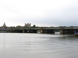
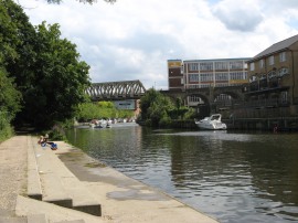
(1) Rochester Bridge |
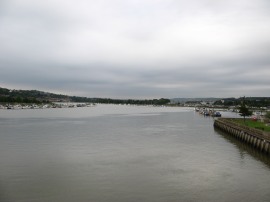
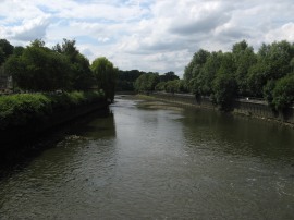
(2) River Medway, Rochester |
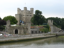
(3) Rochester castle |
From the station it was just a short walk down Canal Road alongside the Medway before crossing over the Rochester Bridge, photo 1, to reach the start point of the walk which is immediately at the end of the bridge. Crossing the river there were good views up the Medway towards the M2 rail bridge, photo 2 and over to Rochester castle, photo 3.
 |
 |
 |
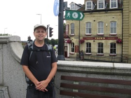
(4) Myself at the start |
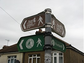
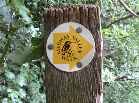
(5) Walk sign |
(6) Channel Tunnel Rail link |
After a quick photo stop at the start, photo 4, we set off along the path. This was an area I knew well as this short stretch of path was also part of the Saxon Shore Way and I had also walked most of this days walk with the walking group all be it in the other direction back in 2008. Also attached to the sign post at the start of the walk was a sign for the mysterious Rochester Centenary Walk, one of several we would see on the first couple of miles of this walk. I say mysterious because, along with the Canterbury and Maidstone Centenary Walks, I have been able to find out nothing whatsoever out about them. They are all marked as recreational trails on the OS maps, although the Maidstone Centenary Walk is no longer included on the latest OS Explorer map of the area. The Canterbury and Maidstone Walks were circular walks that were easy to follow from the map but because this area of the map is home to so many recreational trails in is impossible to determine exactly where the Rochester Walk starts and finishes as the route seems to have almost no part that was unique to its course. The last sign we saw, photo 5, was on the Woudlham Road, just north of the M2 motorway bridge, and I would be interested to hear from anyone with more information about the walk.
Anyway back to the Medway Valley Walk, we followed the path running along the Esplanade upstream alongside the river before joining a hedge lined stretch of path that heads up to a marina. Continuing on a more enclosed path heads by the left of the Marina before turning uphill to run behind houses up to the Woudlham Road. This stretch of path was quite over grown and we received the first of several nettle stings we were to get during the day. Reaching the road I popped into the Co-op for a sandwich, and Sara resisted by chocolate, before heading to the right down the road and under the bridge carrying the M2. Here we joined up with the route of the North Downs Way which we then followed for the next mile or so, following Nashden Farm Lane off to the left which runs down to the building by Nashenden Farm. At the farm the route turns to right and heads between some houses and over the Channel Tunnel Rail link, photo 6. as the path starts heading uphill onto the North Downs.
 |
 |
 |
(7) View over the Medway Valley |
(8) Path by Shoulder of Mutton Wood |
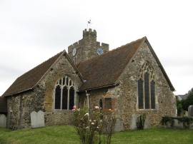
(9) All Saints Church, Wouldham |
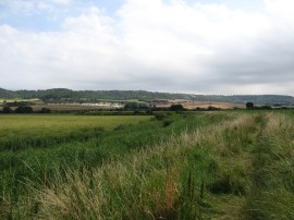
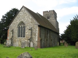
As the path ascends good views opened up over the river Medway, photo 7, as the route heads alongside fields on a chalky path continuing steadily uphill, alongside the Shoulder of Mutton Wood, photo 8. Reaching the trees that can be seen at the end of the field in photo 8 the Medway Valley path leaves the North Downs Way and heads downhill along a broad stony track to reach the Pilgrims Way. Crossing the road the path passes a very isolated post box and heads down School Lane into the village of Wouldham where we stopped for a short snack break at All Saints Church, photo 9, which is just a few yards off the route.
 |
 |
 |
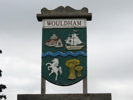
(10) Wouldham Village sign |
(11) Old Church Lane |
(12) River Medway |
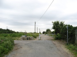
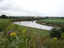
We then made out way through Wouldham, along the High Street, where we noticed there were three pubs which seemed a large number for the size of the village, and out along Hall Road. Where the road bends to the left the Medway Valley Walk continues ahead along Old Church Lane. This was once an area of considerable industrial activity but the factories have along been demolished and the road closed by a metal barrier, photo 11. Now the vacant land besides the path is rapidly becoming covered with shrubs and weeds, their flowers providing a bright splash of colour alongside the path, photo 12. We stopped and had a short chat with a dog walker who remembered the factories and also said that there were proposals to build houses on the site along with a bridge over the river to Halling so this area could once again be subject to great change.
 |
 |
 |
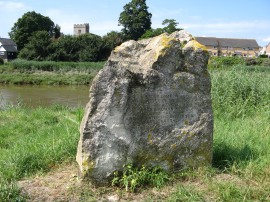
(13) Commemorative Stone |
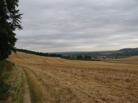
(14) View towards the North Downs |
(15) St Mary's church, Burham Court |
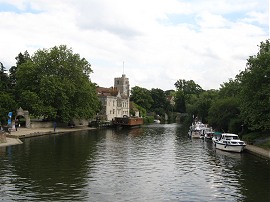
Shortly after rejoining a paved section of Old Church Road the route joins a footpath on the right which heads down to the river, the Medway Valley Walk doing a large dog leg as the footpath follows the riverside round to Burham Court. On the way the path passes a stone, photo 13, which commemorates the Battle of the Medway fought in AD43 between the native British tribes and the Romans although it is not known exactly where the battle took place. As the path curves back to Burham Court there were good views over to the North Downs across the fields in the distance. Reaching Burham Court by St Mary's church, photo 15, the route heads to the right, once again running along Old Church Lane.
 |
 |
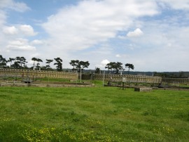 |
(16) Solar Power Station |
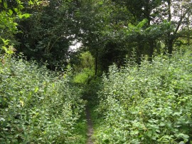
(17) Overgrown Path |
(18) Aylesford Sewage Treatment Works |
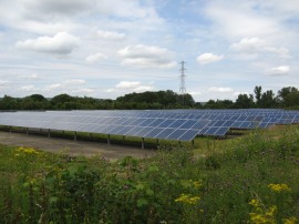
Where the road bends to the right the route heads diagonally to the right across a field before joining a path running through an area of trees which obscured a lot of the views on either side. This stretch of path is followed round to an area of solar panels, photo 16, before the route joins a footpath on the left running by an electricity sub station. This soon leads out to very overgrown section of path, with nettles and brambles encroaching from both sides, photo 17. There was a large pond nearby marked on the map although this remained hidden from view by the undergrowth as did another much larger area of solar panels. Reaching a sewage works, photo 18, the route joins a broad access track which leads up to the start of Aylesford High Street and the entrance to the Friars where there was an attractive thatched barn.
 |
 |
 |
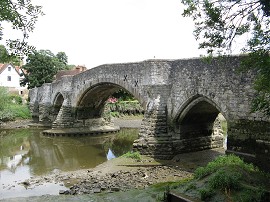
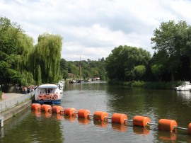
(19) Aylesford Bridge |
(20) River Medway, Aylesford |
(21) Route waymarker |
We then headed down the High Street through the village before crossing the Aylesford Bridge, photo 19, over the river Medway, photo 20. Once over the river we stopped for our lunch break at a bench besides the water. It had been close to high tide when we had set off from Strood but by now the tide was well on its way out and the level of the river dropped noticeably even in the short time we were eating. The route of the walk is partially way marked with metal signs and also the occasional small disc, photo 21, although it would be impossible to follow the route without a map as there are too many points where signage is lacking.
 |
 |
 |
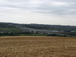
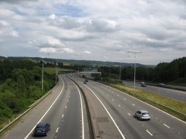
(22) Crossing over the M20 |
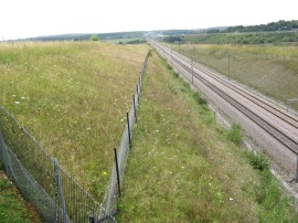
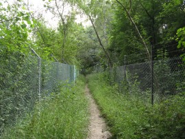
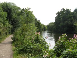
(23) Path alongside the railway |
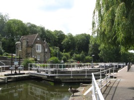
(24) Allington Lock |
Having eaten we then headed along the road which curves round to the road bridge over the river before joining a footpath on the right. This path follows the riverside past some new housing and out of the town before heading to the right to cross over the railway lines that run between Maidstone and Strood. The path heads alongside the railway lines for a short distance before continuing on along a field edge path that leads to a bridge over the M20 motorway, photo 22. Once over the motorway the route heads round to join another footpath running alongside the railway lines which are in a cutting to the left of the path. We followed this path, photo 23, for some distance up to Castle Road where we headed left down towards the entrance of the castle before joining a driveway on the left that doubles back the way we had come back down to the River Medway by Allington Lock, photo 24. This was the route as marked on my map, and in the guidebook for the walk that Sara had however looking at the most recent edition of the Explorer Map the route is now marked as taking a far more direct and shorter route from the motorway alongside the river up to the lock.
 |
 |
 |
(25) River Medway below Allington Lock |
(26) View upriver from Allington |
(27) Path along the Medway |
Allington Lock and sluice marks the end of the tidal section of the river, photo 25, and from there a surfaced path runs besides the river all the way into the centre of Maidstone. As we set off from the lock, photo 26, a pleasure boat setting off on its journey up to Maidstone and a little further upriver there were a number of interesting boats, mainly Dutch built barges, moored at the river bank, some with a little description of the history of the boats. Allington Castle could just be made out through the trees on the opposite bank and a little further on the path passes a small boatyard and Allington Marina.
 |
 |
 |
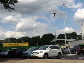
(28) Gallagher Stadium, Maidstone |
(29) Maidstone Rail Bridge |
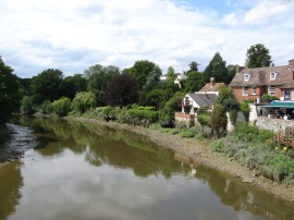
(30) River Medway, Maidstone |
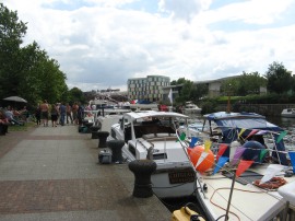
Just before the river reaches the town we made a quick detour up the bank besides the river to look into the grounds of the Gallagher Stadium, home of Maidstone United FC, photo 28. When I had last walked along this stretch of the river Medway when walking the Maidstone Centenary Walk this was just an open area of ground however it was now ready to hosts it's first competitive league match on 18th August 2012. It was exactly three PM when we passed the ground and three weeks from now I would be standing on the other side of the fence!
After boring Sara with such football related trivia we headed on along the towpath into the centre of Maidstone. Having passed under the two millennium footbridges that were built across the Medway the route heads under Medway Rail Bridge, photo 29, a classic Platt Truss girder bridge, before continuing through the centre of town. Here the river was lined by a number of boats and there was obviously some sort of gathering going one with their owners enjoying a beer or two on the towpath, photo 30.
 |
 |
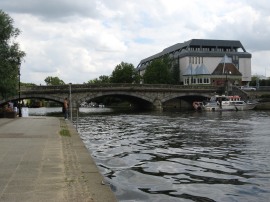
(31) Maidstone Bridge |
(32) View down to the Archbishops Palace, Maidstone |
Heading on we soon the reached the Maidstone Bridge, photo 31, which the Medway Valley Walk uses to cross over to the opposite bank of the river and photo 32 was taken looking upstream from the bridge towards the Archbishops Palace. Once over the river we finished this stage of the walk, heading the short distance up to Maidstone West Station where Sara had parked in the morning and for me to get the train back to Strood.
As always I had enjoyed this walk, with pleasant scenery and company and am looking forward to the next stage into Tonbridge, which unlike this stage will include a few miles of paths I have not walked before.
As usual I have uploaded the route of the walk which can be accessed here: Medway Valley Walk 1 route.
If you would like to comment on this walk you can do so here:
![]() Back to:Walk index page
Back to:Walk index page
| ©2012 Bertuchi.co.uk. Please contact me using the email button on the right if you have any questions or comments regarding the site. Any feedback and additional information about places of interest on the walks is always welcomed. All rights reserved. Please contact me if you want to use any of the images or information from the site. ENJOY YOUR WALKING |
|