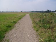
(1) London Loop nr Bexley
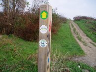
(2) London Loop Way marker
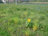
(3) Sunflower
LONDON LOOP STAGE 2
Bexley to Petts Wood
|
|
|
|
(1) London Loop nr Bexley |
(2) London Loop Way marker |
(3) Sunflower |
I did this walk on 17th September 2006. Regular visitors to the site will have noticed that the photos and descriptions for the early stages of the London Loop are fairly brief and I am gradually going to walk the stages again to provide a bit more detail for the pages.
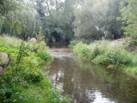
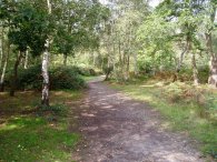
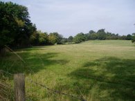
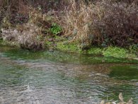
As ever, weekend engineering works on the tube and rail networks meant that it would have taken ages to get to the start of the stage by public transport so I drove down to Bexley and parked in the station car park. The station is just a few yards off the route of the London Loop and I walked down the station approach road to rejoin the path on a tarmac track that runs back down besides the station approach road, under the railway lines and onto a fenced footpath. This leads on past Bexley cricket club and onto the open space in photo 1. One thing that was immediately apparent was that this part of the London Loop path now has many more way markers, photo 2, than when I last walked it in December 2004. This part of the London Loop shares is route with the Cray Riverway which is also signposted. Crossing the open land the path passes under some electricity pylons and runs besides a small field which contained a lone sunflower, photo 3.
 |
 |
 |
(4) Path towards the River Cray |
(5) River Cray |
(6) Five Arch Bridge |
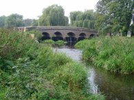
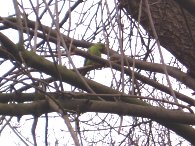
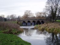
Reaching a road, the London Loop path immediately takes a footpath off to the left just after the first few houses. This footpath, photo 4, runs down to a bridge over the River Cray. Crossing the river the path turns right and runs alongside the river, photo 5, towards the five arch bridge, photo 6. This area has been colonised by Ring Necked Parakeets and although I did not see any this time I could still hear them calling from the treetops. The path continues along besides the River Cray passing through the Footscray Meadows nature reserve, crossing a bridge back over the river and carrying on to a road, close to All Saints church where I spotted a Green Woodpecker. A London Loop sign post shows it is 44 1/4 miles to Kingston Bridge along the London Loop and 7 1/2 miles along the Cray Riverway back to Crayford Marshes. The junction with the road marks the end of the Cray Riverway while the London Loop path continues to the left down Rectory Lane, crosses the A211 Sidcup Hill at the traffic lights and continues ahead along the A224 Cray Road before turning right up Suffolk Road a short distance up the road. This is the first of only two sections of this stage of the Loop where it passes through a built up area which is quite a remarkable feat given the generally built up nature of the area it is passing through.
 |
 |
 |
(7) Cray Wanderers FC ground |
(8) Sidcup Place |
(9) Sidcup Place |
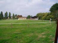
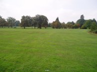
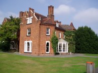
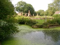
At the end of Suffolk Road the London Loop takes a footpath off to the left that leads to playing fields. The path skirts the edge of the playing fields along a tarmac path and takes a footpath off to the right at the end of a long hedge. This footpath runs past the ground of Cray Wanderers FC, photo 7, although it has been some years since their first team, who currently ground share with Bromley, have played there. The path then runs between allotments and garages and into the grounds of Sidcup Place where the path heads uphill across the open ground in photo 8 to the house itself at the top of the hill., photo 9. This building is now used as a pub and restaurant for anyone in need of refreshment. Another loop signpost here says we are now 10 3/4 miles from the Erith Riverside. Skirting the house to the left the Loop head up to the Chislehurst Road, opposite the St Mary and St Joesphs Catholic school and turns left along the road past the Queen Mary Hospital to cross the A20 Sidcup bypass through an underpass / bridge / underpass combination. Despite having walked this stage before I managed to turn the wrong way (right rather than left) when leaving the second underpass and I had to retrace my steps to rejoin the London Loop as it enters the grounds of Scadbury Park over a small wooden stile.
 |
 |
 |
(10) Scadbury Park |
(11) Little Wood, Sidcup |
(12) Old Manor House, Scadbury Park |
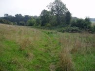
This section of the London Loop is not as clearly signposted as some of the previous sections however upon entering the park over the stile I turned immediately right, heading downhill on a muddy path between trees before taking the first path off to the left which continues downhill towards some open space in the distance, photo 10. The track in photo 10 heads into the trees at the back of photo which form part of Little Wood. The path takes a track through the woods, photo 11, that climbs gently uphill, pleasant walking although it was being used as a racetrack by a number teenage motorcyclists at the time. The country like appearance of the landscape in this area makes it hard to imagine the proximity of the London suburbia all around. After passing through Little Wood the route of the path heads on to the larger Park Wood, which also forms part of Scadbury Park. Near to the entrance of Park Wood, just a few seconds off the Loop path itself are the moated ruins of an old house, photo 12. Whilst the moat itself is original the "ruins" are a latter reconstruction of what might once have been on the site.
 |
 |
 |
(13) Park Wood, Sidcup |
(14) Petts Wood |
(15) Memorial, Petts Wood |
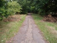
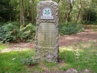
Passing through Park Wood the path turns right up a short flight of muddy steps besides an old oak tree with an enormous trunk before heading past the trees in photo 13. A little further on a path off to the left leads down to a lane that runs down to the A208. Crossing the road the path heads into Petts Wood, much of which is owned by the National Trust. It is very pleasant walking through the woodland, photo 14, and I stopped to eat my lunch besides a memorial stone that marks the donation of the land to the National trust. It was a very still day with hardly any breeze to rustle the tree tops, the silence only being broken by the sound of acorns falling from the trees which was happening in quite large numbers.
 |
 |
 |
(16) Eurostar Train |
(17) Petts Wood |
(18) Rail Lines, nr Petts Wood |
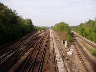
The path takes a fairly straight line through the wood down to a train line where the path turns right to run alongside the tracks at the bottom end of Petts Wood. As I was walking along I was passed by a very long eurostar train that went rushing by on its way over to the continent, photo 16. To the right of the path there was a mixture of woodland and trees, photo 17, before the London Loop turns left to climb up a footbridge over a larger number of rail lines. Descending down the other side the path climbs up another footbridge over a single rail line then continues on, crossing a street, to another footbridge over yet more train tracks , photo 18. To the left Petts Wood station is visible down the track and as the Loop path climbs down from the footbridge a London Loop link path leads off to the left and on to the station and the end of the walk.
The GPS made this stage of the London Loop only 7.25 miles long, which included my diversion when crossing the A20, by far the shortest stretch of the walk.
From Petts Wood I took the train to Hither Green and then a second train to Sidcup from where I then got a bus back to Bexley, the train being a fast one to Gillingham was not stopping at all the intermediate stations. Despite the two changes it only took about 45 minutes to complete the journey back to the car.
Below are some photo's I took when I first walked this section of the loop in December 2004. Click on the green text below to see larger versions of the photo's.
 |
 |
 |
(20) Five Arch Bridge |
![]() Back to:Walking index page
Back to:Walking index page
| ©2008 Bertuchi.co.uk. Please contact me if you have any questions or comments regarding the site. Additional information about places of interest on the walks is always welcomed. All rights reserved. Please contact me if you want to use any of the images or information from the site. Thank you. |
|